 Old Cumbria Gazetteer
 |
 |
|
| bridge, Low Wray | ||
| locality:- | Low Wray | |
| civil parish:- | Claife (formerly Lancashire) | |
| county:- | Cumbria | |
| locality type:- | bridge | |
| coordinates:- | NY37210125 | |
| 1Km square:- | NY3701 | |
| 10Km square:- | NY30 | |
| references:- | Listed Buildings 2010 |
|
|
|
||
 CGP67.jpg (taken 22.9.2017) 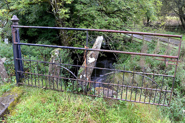 CGP68.jpg (taken 22.9.2017) |
||
|
|
||
| evidence:- | database:- Listed Buildings 2010 |
|
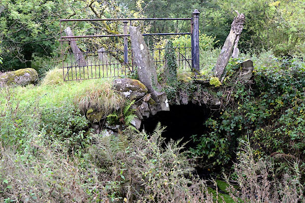
| source data:- | courtesy of English Heritage "BRIDGE APPROXIMATELY 30 METRES TO NORTH OF BARN AT LOW WRAY FARM / / / CLAIFE / SOUTH LAKELAND / CUMBRIA / II / 76755 / NY3721201253" |
|
| source data:- | courtesy of English Heritage "Bridge. Mid to late C19. Stone. Round arch formed of voussoirs, some projecting upwards approx lm at edges. No abutments or parapet. 2 fluted iron gate piers at crest. Design based on C17 packhorse bridges, e.g. Slater Bridge (see under Coniston). Property of the National Trust." |
|
|
|
||
 Lakes Guides menu.