 Old Cumbria Gazetteer
 |
 |
|
| High Wray, Claife | ||
| High Wray | ||
| civil parish:- | Claife (formerly Lancashire) | |
| county:- | Cumbria | |
| locality type:- | buildings | |
| locality type:- | locality | |
| coordinates:- | SD37289995 (etc) | |
| 1Km square:- | SD3799 | |
| 10Km square:- | SD39 | |
|
|
||
| evidence:- | old map:- OS County Series (Lan 2 15) placename:- High Wray placename:- Wray, High |
|
| source data:- | Maps, County Series maps of Great Britain, scales 6 and 25
inches to 1 mile, published by the Ordnance Survey, Southampton,
Hampshire, from about 1863 to 1948. |
|
|
|
||
| evidence:- | old map:- Jefferys 1770 (Wmd) placename:- High Wrays placename:- Wrays, High |
|
| source data:- | Map, 4 sheets, The County of Westmoreland, scale 1 inch to 1
mile, surveyed 1768, and engraved and published by Thomas
Jefferys, London, 1770.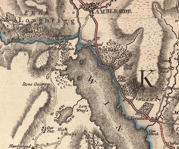 J5NY30SE.jpg "High Wrays" circle, labelled in italic lowercase text; settlement, farm, house, or hamlet? item:- National Library of Scotland : EME.s.47 Image © National Library of Scotland |
|
|
|
||
| evidence:- | old map:- Crosthwaite 1783-94 (Win/Ble) placename:- High Wray |
|
| source data:- | Map, uncoloured engraving, An Accurate Map of the Grand Lake of
Windermere, scale about 2 inches to 1 mile, by Peter
Crosthwaite, Keswick, Cumberland, 1783, version published 1819. CT9NY30Q.jpg "High Wray" circle and buildings, town or village item:- Armitt Library : 2008.14.102 Image © see bottom of page |
|
|
|
||
| evidence:- | old text:- Clarke 1787 placename:- High Wray |
|
| source data:- | Guide book, A Survey of the Lakes of Cumberland, Westmorland,
and Lancashire, written and published by James Clarke, Penrith,
Cumberland, and in London etc, 1787; published 1787-93. goto source goto sourcePage 146:- "... In the church-yard [Hawkshead] is a stone with the following inscription upon it:" "In memory of Banks Robinson, late of High-Wray, who departed this life 17th October 1782, in the 85th year of his age:" "Also Agness his wife, Who departed this life 23d June 1763, in the 55th year of her age." "In testimony of a dutiful regard for the best of parents, this stone was erected by their three children, John, Banks, and Ann." goto sourcePage 147:- ""Qui ont abandonne leur pays pour gagner leur pain avec industrie, mais imprimes d'une vive reconnaissance retient un penchant pour le place de leur naissance." "In English," ""Who have abandoned their country to get their bread with industry, but impressed with lively gratitude, they retain yet a regard for the place of their nativity."" |
|
|
|
||
| evidence:- | old map:- Clarke 1787 map (Windermere N) placename:- High Wray |
|
| source data:- | Map, A Map of the Northern Part of the Lake Winandermere and its
Environs, scale about 6.5 ins to 1 mile, by James Clarke,
engraved by Samuel John Neele, 352 Strand, published by James
Clarke, Penrith, Cumberland and in London etc, 1787. CLANY30Q.jpg "High-wray" item:- private collection : 10.10 Image © see bottom of page |
|
|
|
||
| evidence:- | probably old text:- Green 1810 placename:- High Kay placename:- Kay, High |
|
| source data:- | Set of prints, soft ground etchings, Sixty Studies from Nature,
by William Green, Ambleside, Westmorland, drawn 1808-10,
published 1810. goto source page 13:- "... on the Lancashire side [of Windermere lake] are High and Low Kay." |
|
|
|
||
| evidence:- | old map:- Ford 1839 map placename:- High Wray |
|
| source data:- | Map, uncoloured engraving, Map of the Lake District of
Cumberland, Westmoreland and Lancashire, scale about 3.5 miles
to 1 inch, published by Charles Thurnam, Carlisle, and by R
Groombridge, 5 Paternoster Row, London, 3rd edn 1843.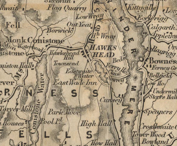 FD02SD39.jpg "Hh. Wray" item:- JandMN : 100.1 Image © see bottom of page |
|
|
|
||
| evidence:- | old map:- Garnett 1850s-60s H placename:- Wray |
|
| source data:- | Map of the English Lakes, in Cumberland, Westmorland and
Lancashire, scale about 3.5 miles to 1 inch, published by John
Garnett, Windermere, Westmorland, 1850s-60s.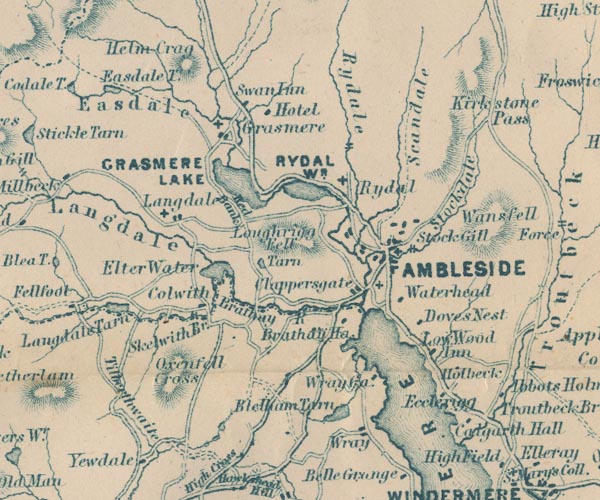 GAR2NY30.jpg "Wray" blocks, settlement item:- JandMN : 82.1 Image © see bottom of page |
|
|
|
||
| evidence:- | old map:- Prior 1874 map 1 placename:- High Wray |
|
| source data:- | Map, uncoloured engraving or lithograph? Winander Mere, scale
about 2.5 miles to 1 inch, published by John Garnett,
Windermere, Westmorland, 1874. click to enlarge click to enlargePI03M1.jpg "High Wray" block/s; building/s item:- private collection : 133.1 Image © see bottom of page |
|
|
|
||
| evidence:- | old map:- Post Office 1850s-1900s placename:- High Wray |
|
| source data:- | Post road maps, General Post Office Circulation Map for England
and Wales, for the General Post Office, London, 1850s-1900s. click to enlarge click to enlargePOF7Cm.jpg "High Wray" map date 1909 |
|
|
|
||
| :- |
images courtesy of the British Postal Museum and Hampshire CC Museums |
|
|
|
||
Lakes Guides menu.