Old Cumbria Gazetteer
 |
 |
|
||
| Trout Beck (5) | ||||
| runs into:- |  Windermere lake Windermere lake |
|||
|
|
||||
| Trout Beck | ||||
| locality:- | Troutbeck | |||
| civil parish:- | Lakes (formerly Westmorland) | |||
| county:- | Cumbria | |||
| locality type:- | river | |||
| 1Km square:- | NY4104 (etc) | |||
| 10Km square:- | NY40 | |||
|
|
||||
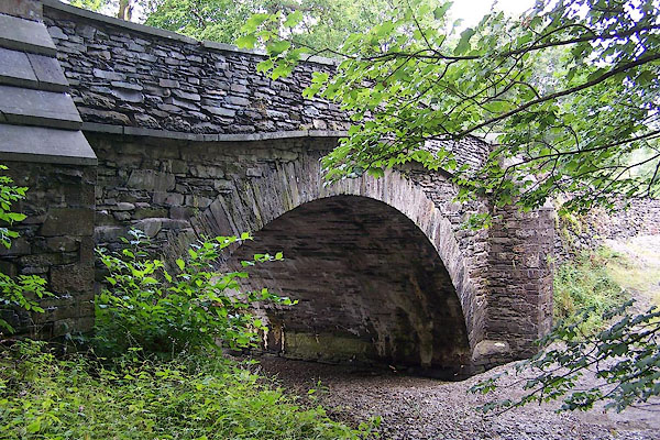
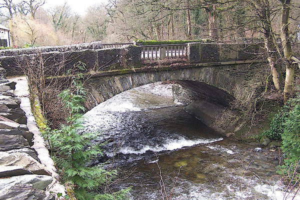
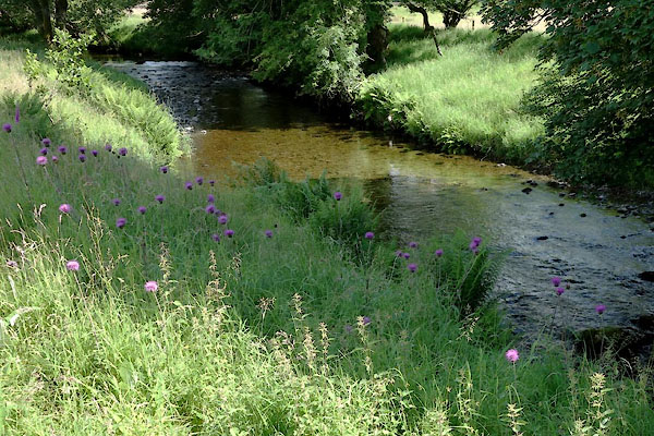 CDO26.jpg At Ing Bridge, (taken 9.7.2015) 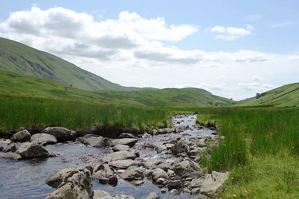 CDO48.jpg (taken 9.7.2015) |
||||
|
|
||||
| evidence:- | old map:- OS County Series (Wmd 19 16) placename:- Trout Beck |
|||
| source data:- | Maps, County Series maps of Great Britain, scales 6 and 25
inches to 1 mile, published by the Ordnance Survey, Southampton,
Hampshire, from about 1863 to 1948. OS County Series (Wmd 26 4) OS County Series (Wmd 26 8) OS County Series (Wmd 26 12) OS County Series (Wmd 26 15) OS County Series (Wmd 32 3) |
|||
|
|
||||
| evidence:- | old map:- Saxton 1579 |
|||
| source data:- | Map, hand coloured engraving, Westmorlandiae et Cumberlandiae Comitatus ie Westmorland
and Cumberland, scale about 5 miles to 1 inch, by Christopher Saxton, London, engraved
by Augustinus Ryther, 1576, published 1579-1645.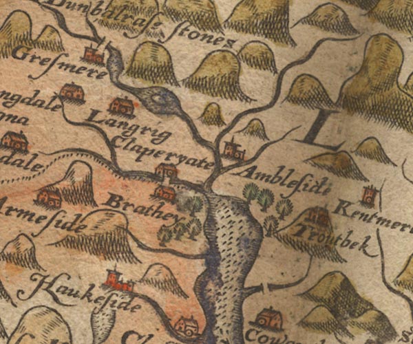 Sax9NY30.jpg item:- private collection : 2 Image © see bottom of page |
|||
|
|
||||
| evidence:- | old map:- Speed 1611 (Wmd) |
|||
| source data:- | Map, hand coloured engraving, The Countie Westmorland and
Kendale the Cheif Towne, scale about 2.5 miles to 1 inch, by
John Speed, 1610, published by George Humble, Popes Head Alley,
London, 1611-12.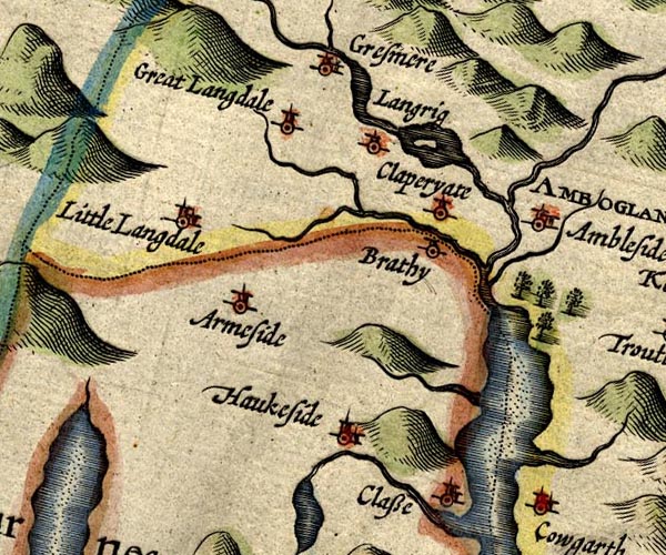 SP14NY30.jpg double line, into Windermere item:- Armitt Library : 2008.14.5 Image © see bottom of page |
|||
|
|
||||
| evidence:- | old map:- Jansson 1646 |
|||
| source data:- | Map, hand coloured engraving, Cumbria and Westmoria, ie
Cumberland and Westmorland, scale about 3.5 miles to 1 inch, by
John Jansson, Amsterdam, Netherlands, 1646.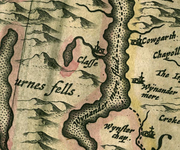 JAN3SD39.jpg Single wiggly line. item:- JandMN : 88 Image © see bottom of page |
|||
|
|
||||
| evidence:- | old map:- Ogilby 1675 (plate 96) |
|||
| source data:- | Road strip map, hand coloured engraving, the Road from Kendal to
Cockermouth, and the Road from Egremond to Carlisle, scale about
1 inch to 1 mile, by John Ogilby, London, 1675.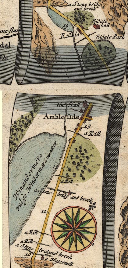 OG96m010.jpg In mile 10, Westmoreland. Road crosses:- "a Stone bridg and brook" no bridge drawn. item:- JandMN : 22 Image © see bottom of page |
|||
|
|
||||
| evidence:- | probably old map:- Morden 1695 (Wmd) |
|||
| source data:- | Map, hand coloured engraving, Westmorland, scale about 2.5 miles to 1 inch, by Robert
Morden, published by Abel Swale, the Unicorn, St Paul's Churchyard, Awnsham, and John
Churchill, the Black Swan, Paternoster Row, London, 1695.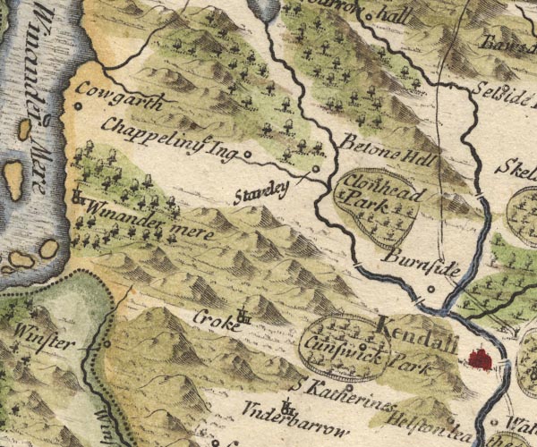 MD10SD49.jpg Running into Windermere, shown the wrong side of Calgarth. item:- JandMN : 24 Image © see bottom of page |
|||
|
|
||||
| evidence:- | old map:- Bowen 1720 (plate 260) |
|||
| source data:- | Road strip map, uncoloured engraving, pl.260, The Road from
Kendal to Cockermouth, scale about 2 miles to 1 inch, with
sections in Westmorland and Cumberland, published by Emanuel
Bowen, St Katherines, London, 1720.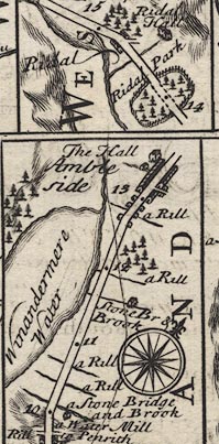 B260m10.jpg "a Stone Bridge and Brook" At 10 miles. item:- private collection : 1.260 Image © see bottom of page |
|||
|
|
||||
| evidence:- | old map:- Bowen and Kitchin 1760 |
|||
| source data:- | Map, hand coloured engraving, A New Map of the Counties of
Cumberland and Westmoreland Divided into their Respective Wards,
scale about 4 miles to 1 inch, by Emanuel Bowen and Thomas
Kitchin et al, published by T Bowles, Robert Sayer, and John
Bowles, London, 1760.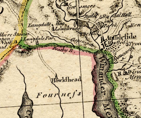 BO18SD29.jpg wiggly line, into Windermere item:- Armitt Library : 2008.14.10 Image © see bottom of page |
|||
|
|
||||
| evidence:- | old map:- Jefferys 1770 (Wmd) placename:- Trout Beck |
|||
| source data:- | Map, 4 sheets, The County of Westmoreland, scale 1 inch to 1
mile, surveyed 1768, and engraved and published by Thomas
Jefferys, London, 1770. J5NY40SW.jpg "Trout B." single or double wiggly line; river item:- National Library of Scotland : EME.s.47 Image © National Library of Scotland |
|||
|
|
||||
| evidence:- | old map:- Crosthwaite 1783-94 (Win/Ble) |
|||
| source data:- | Map, uncoloured engraving, An Accurate Map of the Grand Lake of
Windermere, scale about 2 inches to 1 mile, by Peter
Crosthwaite, Keswick, Cumberland, 1783, version published 1819. CT9SD39Z.jpg stream from Troutbeck Bridge to Windermere lake item:- Armitt Library : 2008.14.102 Image © see bottom of page |
|||
|
|
||||
| evidence:- | old map:- West 1784 map placename:- Troutbeck |
|||
| source data:- | Map, hand coloured engraving, A Map of the Lakes in Cumberland,
Westmorland and Lancashire, scale about 3.5 miles to 1 inch,
engraved by Paas, 53 Holborn, London, about 1784.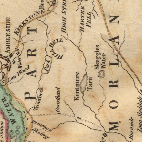 Ws02NY40.jpg item:- Armitt Library : A1221.1 Image © see bottom of page |
|||
|
|
||||
| evidence:- | old text:- Clarke 1787 placename:- Troutbeck item:- pacename, Troutbeck; trout |
|||
| source data:- | Guide book, A Survey of the Lakes of Cumberland, Westmorland,
and Lancashire, written and published by James Clarke, Penrith,
Cumberland, and in London etc, 1787; published 1787-93. goto source Page 134:- "..." "... Troutbeck-bridge, (see plate X.) ... The river that falls down here is called Troutbeck, probably from it being more plentifully stocked with trout than any other stream which runs into Winandermere. It gives name to a town near upon its banks, ..." |
|||
|
|
||||
| evidence:- | old map:- Clarke 1787 map (Windermere N) |
|||
| source data:- | Map, A Map of the Northern Part of the Lake Winandermere and its
Environs, scale about 6.5 ins to 1 mile, by James Clarke,
engraved by Samuel John Neele, 352 Strand, published by James
Clarke, Penrith, Cumberland and in London etc, 1787.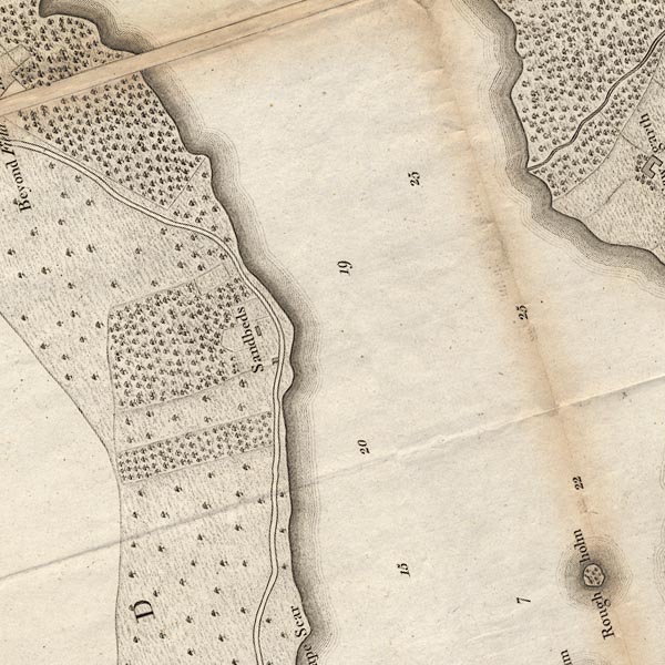 CLASD39Z.jpg item:- private collection : 10.10 Image © see bottom of page |
|||
|
|
||||
| evidence:- | old map:- Cary 1789 (edn 1805) |
|||
| source data:- | Map, uncoloured engraving, Westmoreland, scale about 2.5 miles
to 1 inch, by John Cary, London, 1789; edition 1805. CY24NY40.jpg river running into Windermere item:- JandMN : 129 Image © see bottom of page |
|||
|
|
||||
| evidence:- | old map:- Cooper 1808 |
|||
| source data:- | Map, hand coloured engraving, Westmoreland ie Westmorland, scale
about 9 miles to 1 inch, by H Cooper, 1808, published by R
Phillips, Bridge Street, Blackfriars, London, 1808. click to enlarge click to enlargeCOP4.jpg tapering wiggly line; river item:- Dove Cottage : 2007.38.53 Image © see bottom of page |
|||
|
|
||||
| evidence:- | old text:- Gents Mag |
|||
| source data:- | Magazine, The Gentleman's Magazine or Monthly Intelligencer or
Historical Chronicle, published by Edward Cave under the
pseudonym Sylvanus Urban, and by other publishers, London,
monthly from 1731 to 1922. goto source Gentleman's Magazine 1825 part 1 p.410 From the Compendium of County History:- "'In Calgarth's sole domain a mansion stands, ... Each flank is covered by a wooded hill, Near whose gay sides the silver Troutbeck flows, [ ] having left that source whence she arose, Impetuous rushing her rough rocks among, And in the lake's deep bosom glides along, Pleas'd to partake in her extended fame, She yields her tribute and becomes the [same].'" |
|||
|
|
||||
| evidence:- | descriptive text:- Ford 1839 (3rd edn 1843) |
|||
| source data:- | Guide book, A Description of Scenery in the Lake District, by
Rev William Ford, published by Charles Thurnam, Carlisle, by W
Edwards, 12 Ave Maria Lane, Charles Tilt, Fleet Street, William
Smith, 113 Fleet Street, London, by Currie and Bowman,
Newcastle, by Bancks and Co, Manchester, by Oliver and Boyd,
Edinburgh, and by Sinclair, Dumfries, 1839. goto source Page 31:- "..." "... Troutbeck, a mountain valley, distinguished by the Fells at its head ... This stream rises in High Street, flows over a very stony channel down to the park, whence it glides one while quietly, at another, chafing with foam, till it is lost in the silent depths of Windermere. ..." |
|||
|
|
||||
| evidence:- | old map:- Garnett 1850s-60s H |
|||
| source data:- | Map of the English Lakes, in Cumberland, Westmorland and
Lancashire, scale about 3.5 miles to 1 inch, published by John
Garnett, Windermere, Westmorland, 1850s-60s. GAR2NY40.jpg wiggly line, river item:- JandMN : 82.1 Image © see bottom of page |
|||
|
|
||||
| evidence:- | old text:- Martineau 1855 item:- trout |
|||
| source data:- | Guide book, A Complete Guide to the English Lakes, by Harriet
Martineau, published by John Garnett, Windermere, Westmorland,
and by Whittaker and Co, London, 1855; published 1855-76. goto source Page 35:- "... the stream,- the beck abounding in trout,- winds along the bottom, from the foot of High Street, to fall into the lake just by Calgarth." |
|||
|
|
||||
| evidence:- | old map:- Prior 1874 map 1 |
|||
| source data:- | Map, uncoloured engraving or lithograph? Winander Mere, scale
about 2.5 miles to 1 inch, published by John Garnett,
Windermere, Westmorland, 1874. click to enlarge click to enlargePI03M1.jpg tapering wiggly line item:- private collection : 133.1 Image © see bottom of page |
|||
|
|
||||
| evidence:- | old map:- Postlethwaite 1877 (3rd edn 1913) placename:- Troutbeck |
|||
| source data:- | Map, uncoloured engraving, Map of the Lake District Mining Field, Westmorland, Cumberland,
Lancashire, scale about 5 miles to 1 inch, by John Postlethwaite, published by W H
Moss and Sons, 13 Lowther Street, Whitehaven, Cumberland, 1877 edn 1913. PST2NY40.jpg "Troutbeck" wiggly line running into Windermere lake item:- JandMN : 162.2 Image © see bottom of page |
|||
|
|
||||
| evidence:- | old print:- Rose 1832-35 |
|||
| source data:- | Print, engraving, Valley of Troutbeck, Westmorland, by Thomas Allom, engraved by le
Petit, 1833. click to enlarge click to enlargeR161.jpg item:- JandMN : 66.28 Image © see bottom of page |
|||
|
|
||||
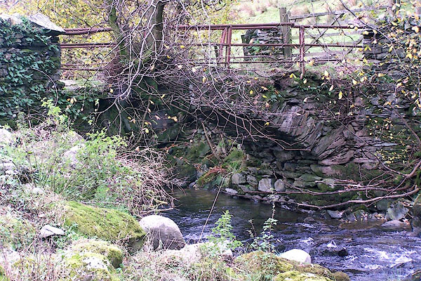
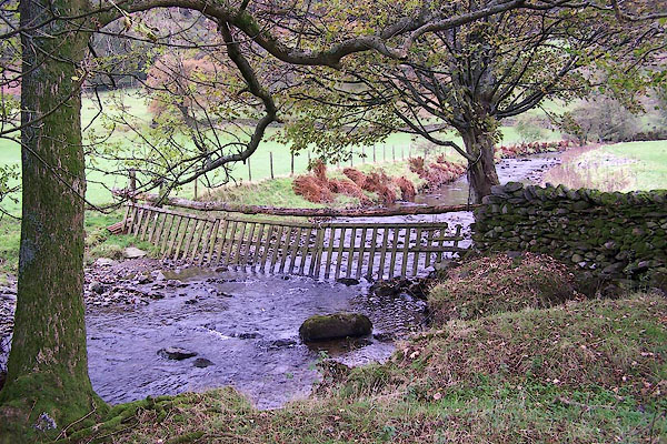 BMY44.jpg A little below Troutbeck Park farm. (taken 5.11.2006) |
||||
|
|
||||
| mapping:- | ||||
|
|
||||
| places:- |
|
|||
|
||||
|
||||
|
||||
|
||||
|
||||
|
||||
Lakes Guides menu.