 Old Cumbria Gazetteer
 |
 |
|
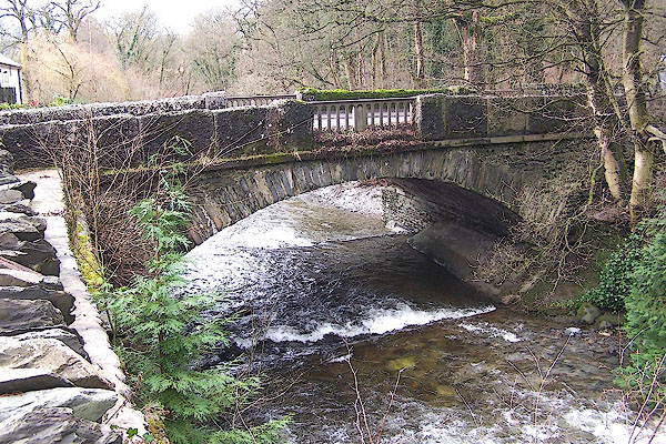
| Troutbeck Bridge, Troutbeck Bridge | ||
| Troutbeck Bridge | ||
| site name:- | Trout Beck (5) | |
| locality:- | Troutbeck Bridge | |
| civil parish:- | Windermere (formerly Westmorland) | |
| county:- | Cumbria | |
| locality type:- | bridge | |
| coordinates:- | NY40300034 | |
| 1Km square:- | NY4000 | |
| 10Km square:- | NY40 | |
|
|
||
 BLP77.jpg (taken 15.2.2006) 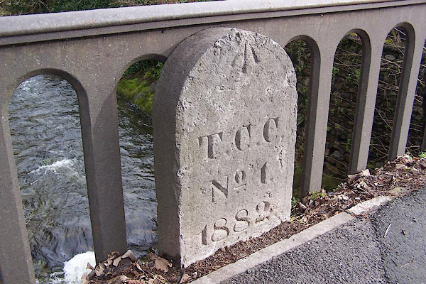 BLP78.jpg In east parapet:- "T.C.C. No.1. 1882" (taken 15.2.2006) |
||
|
|
||
| evidence:- | old map:- Saxton 1579 |
|
| source data:- | Map, hand coloured engraving, Westmorlandiae et Cumberlandiae Comitatus ie Westmorland
and Cumberland, scale about 5 miles to 1 inch, by Christopher Saxton, London, engraved
by Augustinus Ryther, 1576, published 1579-1645.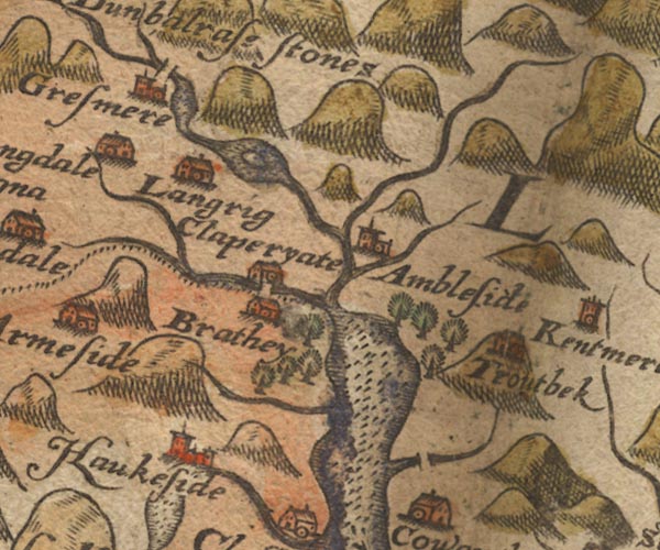 Sax9NY30.jpg Over Trout Beck. item:- private collection : 2 Image © see bottom of page |
|
|
|
||
| evidence:- | old map:- Ogilby 1675 (plate 96) |
|
| source data:- | Road strip map, hand coloured engraving, the Road from Kendal to
Cockermouth, and the Road from Egremond to Carlisle, scale about
1 inch to 1 mile, by John Ogilby, London, 1675.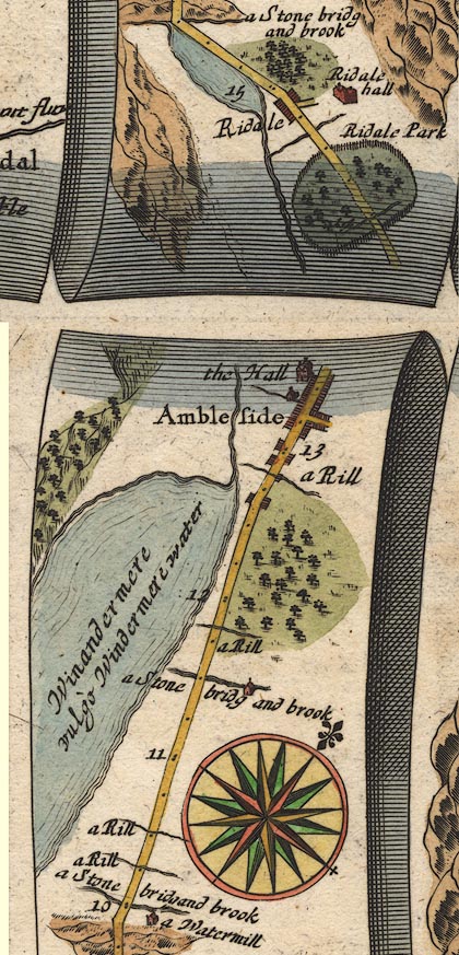 OG96m010.jpg In mile 10, Westmoreland. River crossed by:- "a Stone bridg and brook" no bridge drawn. item:- JandMN : 22 Image © see bottom of page |
|
|
|
||
| evidence:- | old map:- Morden 1695 (Cmd) |
|
| source data:- | Map, uncoloured engraving, Cumberland, scale about 4 miles to 1
inch, by Robert Morden, 1695, published by Abel Swale, the
Unicorn, St Paul's Churchyard, Awnsham, and John Churchill, the
Black Swan, Paternoster Row, London, 1695-1715.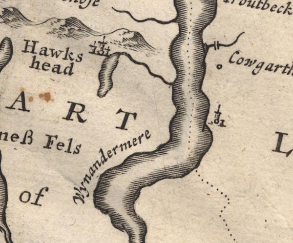 MD12SD39.jpg Double line over a stream. item:- JandMN : 90 Image © see bottom of page |
|
|
|
||
| evidence:- | old map:- Bowen and Kitchin 1760 |
|
| source data:- | Map, hand coloured engraving, A New Map of the Counties of
Cumberland and Westmoreland Divided into their Respective Wards,
scale about 4 miles to 1 inch, by Emanuel Bowen and Thomas
Kitchin et al, published by T Bowles, Robert Sayer, and John
Bowles, London, 1760.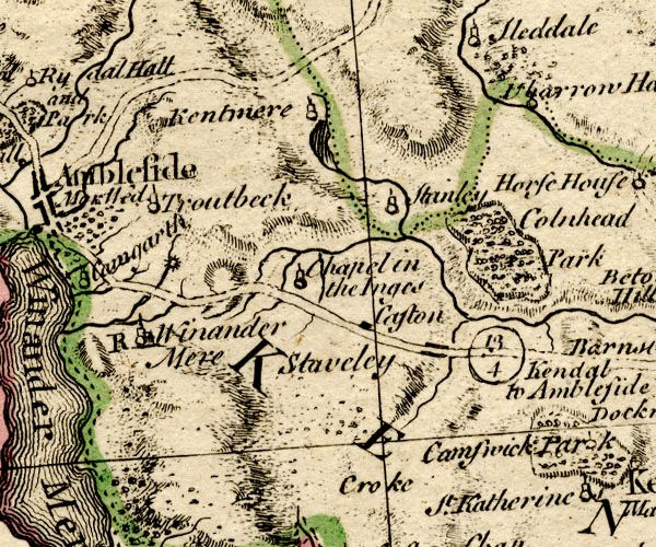 BO18SD39.jpg road across the Trout Beck item:- Armitt Library : 2008.14.10 Image © see bottom of page |
|
|
|
||
| evidence:- | old map:- Crosthwaite 1783-94 (Win/Ble) placename:- Troutbeck Bridge |
|
| source data:- | Map, uncoloured engraving, An Accurate Map of the Grand Lake of
Windermere, scale about 2 inches to 1 mile, by Peter
Crosthwaite, Keswick, Cumberland, 1783, version published 1819. CT9NY30V.jpg "Troutbeck Bridge" road crosses stream item:- Armitt Library : 2008.14.102 Image © see bottom of page |
|
|
|
||
| evidence:- | old map:- Clarke 1787 map (Windermere N) placename:- Troutbeck Bridge |
|
| source data:- | Map, A Map of the Northern Part of the Lake Winandermere and its
Environs, scale about 6.5 ins to 1 mile, by James Clarke,
engraved by Samuel John Neele, 352 Strand, published by James
Clarke, Penrith, Cumberland and in London etc, 1787. CLANY40A.jpg "Troutbeck Bridge" item:- private collection : 10.10 Image © see bottom of page |
|
|
|
||
| evidence:- | old map:- Cary 1789 (edn 1805) placename:- Troutbeck Bridge |
|
| source data:- | Map, uncoloured engraving, Westmoreland, scale about 2.5 miles
to 1 inch, by John Cary, London, 1789; edition 1805.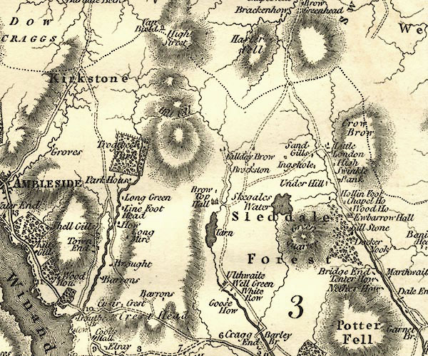 CY24NY40.jpg "Troutbeck Br" road across a stream; bridge over the Trout Beck item:- JandMN : 129 Image © see bottom of page |
|
|
|
||
| evidence:- | old map:- Otley 1818 |
|
| source data:- | Map, uncoloured engraving, The District of the Lakes,
Cumberland, Westmorland, and Lancashire, scale about 4 miles to
1 inch, by Jonathan Otley, 1818, engraved by J and G Menzies,
Edinburgh, Scotland, published by Jonathan Otley, Keswick,
Cumberland, et al, 1833.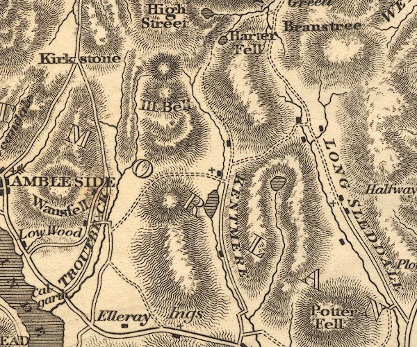 OT02NY40.jpg Implied by a road across the stream. item:- JandMN : 48.1 Image © see bottom of page |
|
|
|
||
| evidence:- | descriptive text:- Ford 1839 (3rd edn 1843) placename:- Troutbeck Bridge |
|
| source data:- | Guide book, A Description of Scenery in the Lake District, by
Rev William Ford, published by Charles Thurnam, Carlisle, by W
Edwards, 12 Ave Maria Lane, Charles Tilt, Fleet Street, William
Smith, 113 Fleet Street, London, by Currie and Bowman,
Newcastle, by Bancks and Co, Manchester, by Oliver and Boyd,
Edinburgh, and by Sinclair, Dumfries, 1839. goto source goto sourcePage 160:- "..." "Troutbeck Bridge crosses a rivulet, issuing from the high grounds on the right, and flowing down the deep and picturesque vale of Troutbeck. ..." |
|
|
|
||
| evidence:- | old map:- Garnett 1850s-60s H placename:- Troutbeck Bridge |
|
| source data:- | Map of the English Lakes, in Cumberland, Westmorland and
Lancashire, scale about 3.5 miles to 1 inch, published by John
Garnett, Windermere, Westmorland, 1850s-60s.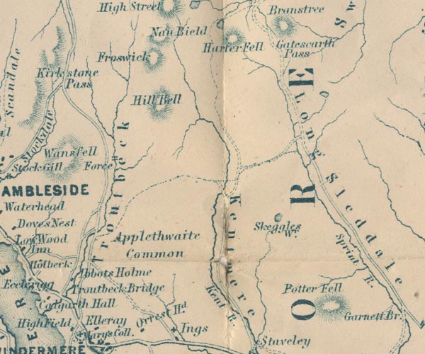 GAR2NY40.jpg "Troutbeck Bridge" no symbol, road crosses stream item:- JandMN : 82.1 Image © see bottom of page |
|
|
|
||
| hearsay:- |
According to the Ambleside Turnpike Trust records, 21480 carriages crossed the bridge
in 1885. |
|
|
|
||
Lakes Guides menu.