Old Cumbria Gazetteer
 |
 |
|
||
| Lodore, Borrowdale | ||||
| Lodore | ||||
| Lowdore | ||||
| civil parish:- | Borrowdale (formerly Cumberland) | |||
| county:- | Cumbria | |||
| locality type:- | locality | |||
| locality type:- | buildings | |||
| coordinates:- | NY26391889 (etc) | |||
| 1Km square:- | NY2618 | |||
| 10Km square:- | NY21 | |||
|
|
||||
| evidence:- | old map:- Donald 1774 (Cmd) placename:- Low Door |
|||
| source data:- | Map, hand coloured engraving, 3x2 sheets, The County of Cumberland, scale about 1
inch to 1 mile, by Thomas Donald, engraved and published by Joseph Hodskinson, 29
Arundel Street, Strand, London, 1774.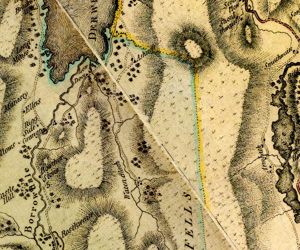 D4NY21NE.jpg "Low Door" block or blocks, labelled in lowercase; a hamlet or just a house item:- Carlisle Library : Map 2 Image © Carlisle Library |
|||
|
|
||||
| evidence:- | old map:- Cooke 1802 placename:- Low Dere |
|||
| source data:- | Map, The Lakes, Westmorland and Cumberland, scale about 8.5
miles to 1 inch, engravedby Neele and Son, published by
Sherwood, Jones and Co, Paternoster Road, London, 1824. click to enlarge click to enlargeGRA1Lk.jpg "Low Dere" blocks, italic lowercase text, village, hamlet, locality item:- Hampshire Museums : FA2000.62.5 Image © see bottom of page |
|||
|
|
||||
| evidence:- | old map:- Otley 1818 placename:- Lowdore |
|||
| source data:- | Map, uncoloured engraving, The District of the Lakes,
Cumberland, Westmorland, and Lancashire, scale about 4 miles to
1 inch, by Jonathan Otley, 1818, engraved by J and G Menzies,
Edinburgh, Scotland, published by Jonathan Otley, Keswick,
Cumberland, et al, 1833.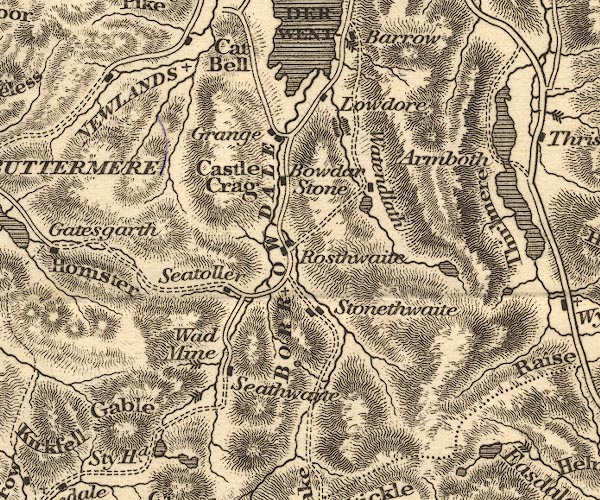 OT02NY21.jpg item:- JandMN : 48.1 Image © see bottom of page |
|||
|
|
||||
| evidence:- | :- Hullmandel 1826 |
|||
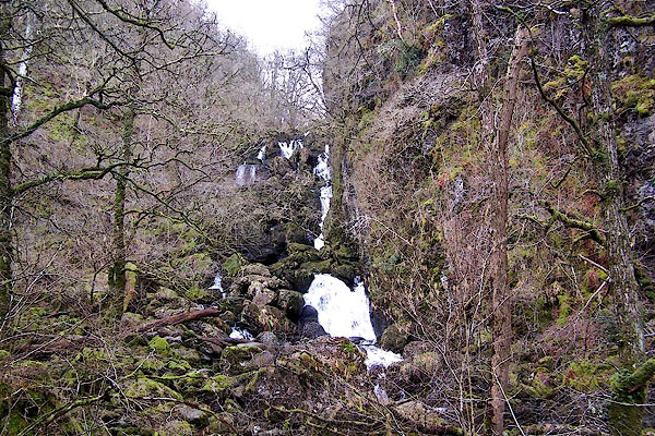
| source data:- | 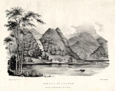 click to enlarge click to enlargeHUL107.jpg Print, uncoloured lithograph, The Fall of Lodore, from Derwent Water, Borrowdale, Cumberland, drawn by Miss I Cropper and Miss S Atkins, published by Charles Hullmandel, London, 1826. "Drawn on Stone by I.C & S.A. / Printed by C. Hullmandel. / THE FALL OF LODORE. / FROM DERWENT WATER." item:- Armitt Library : ALMA370.7 Image © see bottom of page |
|||
|
|
||||
| evidence:- | old map:- Ford 1839 map placename:- Low Dore |
|||
| source data:- | Map, uncoloured engraving, Map of the Lake District of
Cumberland, Westmoreland and Lancashire, scale about 3.5 miles
to 1 inch, published by Charles Thurnam, Carlisle, and by R
Groombridge, 5 Paternoster Row, London, 3rd edn 1843.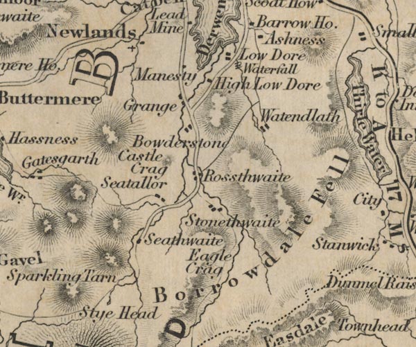 FD02NY21.jpg "Low Dore" item:- JandMN : 100.1 Image © see bottom of page |
|||
|
|
||||
| evidence:- | old drawing:- Aspland 1840s-60s placename:- Lowdore |
|||
| source data:- | Drawing, pencil, Lowdore, Borrowdale, Cumberland, by Theophilus Lindsey Aspland, 12
May 1853.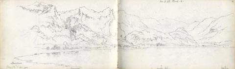 click to enlarge click to enlargeAS0377.jpg "Lowdore / May 12 & 14. 1853" "see p 42. Book 12." page number "61" item:- Armitt Library : 1958.390.77 Image © see bottom of page |
|||
|
|
||||
| evidence:- | old map:- Garnett 1850s-60s H placename:- Lowdore |
|||
| source data:- | Map of the English Lakes, in Cumberland, Westmorland and
Lancashire, scale about 3.5 miles to 1 inch, published by John
Garnett, Windermere, Westmorland, 1850s-60s.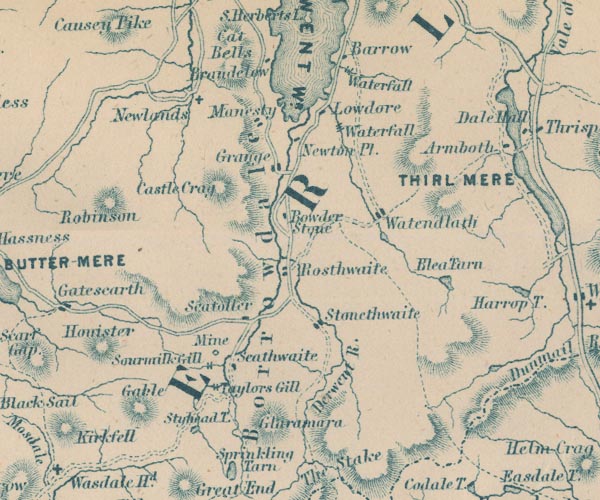 GAR2NY21.jpg "Lowdore" block, building item:- JandMN : 82.1 Image © see bottom of page |
|||
|
|
||||
| evidence:- | outline view:- Martineau 1855 placename:- Lowdore |
|||
| source data:- | Print, engraving, outline view, Mountains seen from Applethwaite near Keswick, drawn
by L Aspland, engraved by W Banks, Edinburgh, published by John Garnett, Windermere,
Westmorland, and by Whittaker and Co, London, 1855.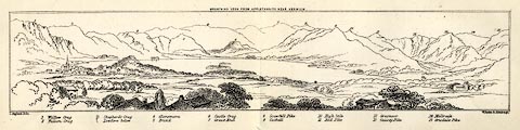 click to enlarge click to enlargeMNU114.jpg Folded in opposite p.93 in A Complete Guide to the English Lakes, by Harriet Martineau. "MOUNTAINS SEEN FROM APPLETHWAITE NEAR KESWICK." "L Aspland Delt. / W Banks Sc Edinr." The view is captioned, numbers referring to mountains in the image:- "1 Wallow Crag, 2 Falcon Crag, 3 Shepherd's Crag / Lowdore below, 4 Glaramara, 5 Brund, 6 Castle Crag, 7 Great End, 8 Scawfell Pike, 9 Catbell, 10, High Stile, 11 Red Pike, 12 Grasmoor, 13 Causey Pike, 14 Melbreak, 15 Grisdale Pike" item:- Armitt Library : A1159.14 Image © see bottom of page |
|||
|
|
||||
| evidence:- | old photograph:- Bell 1880s-1940s |
|||
| source data:- | Photograph, b/w, Derwent Water and Lodore, Borrowdale, Cumberland, by Herbert Bell,
Ambleside, Westmorland, 1890s?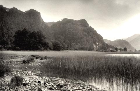 click to enlarge click to enlargeHB0288.jpg item:- Armitt Library : ALPS645 Image © see bottom of page |
|||
|
|
||||
| evidence:- | outline view:- Jenkinson 1875 placename:- Lodore |
|||
| source data:- | Print, lithograph, outline view, Panoramic Sketches from Skiddaw, Cumberland, by Edwin
A Pettitt, London, published by Edward Stanford, 55 Charing Cross, London, 1875. click to enlarge click to enlargeJk01E2.jpg "... Lodore ..." item:- JandMN : 28.8 Image © see bottom of page |
|||
|
|
||||
| places:- |
|
|||
|
||||
|
||||
|
||||
|
||||
|
||||
|
||||
|
||||
|
||||
|
||||
|
||||
|
||||
|
||||
|
||||
|
||||
|
||||
|
||||
 Lakes Guides menu.