 |
 |
   |
|
|
|
Lodore Bridge |
| site name:- |
Watendlath Beck |
| locality:- |
Lodore |
| civil parish:- |
Borrowdale (formerly Cumberland) |
| county:- |
Cumbria |
| locality type:- |
bridge |
| coordinates:- |
NY26461896 |
| 1Km square:- |
NY2618 |
| 10Km square:- |
NY21 |
|
|
| evidence:- |
old map:- OS County Series (Cmd 64 14)
placename:- Lowdore Bridge
|
| source data:- |
Maps, County Series maps of Great Britain, scales 6 and 25
inches to 1 mile, published by the Ordnance Survey, Southampton,
Hampshire, from about 1863 to 1948.
|
|
|
| evidence:- |
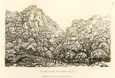
old print:- Green 1814 (plate 33)
|
| source data:- |
Print, uncoloured soft ground etching, Lowdore Waterfall, Borrowdale, Cumberland,
by William Green, Ambleside, Westmorland, 1814.
 click to enlarge click to enlarge
GN0933.jpg
Plate 33 in Sixty Small Prints.
printed at top right:- "33"
printed at bottom:- "LOWDORE WATER-FALL. / Published at Ambleside Augst. 1, 1814, by Wm. Green."
item:- Armitt Library : A6656.33
Image © see bottom of page
|
|
|
| evidence:- |
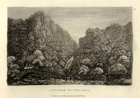
old print:- Green 1814 (plate 33)
|
| source data:- |
Print, tinted soft ground etching, Lowdore Waterfall, Borrowdale, Cumberland, by William
Green, Ambleside, Westmorland, 1814.
 click to enlarge click to enlarge
GN1033.jpg
Plate 33 in Sixty Small Prints.
printed at top right:- "33"
printed at bottom:- "LOWDORE WATER-FALL. / Published at Ambleside Augst. 1, 1814, by Wm. Green."
item:- Armitt Library : A6653.33
Image © see bottom of page
|
|
|
| evidence:- |
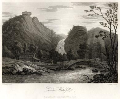
old print:- Farington 1816
|
| source data:- |
Print, uncoloured engraving and descriptive text, Lowdore Waterfall, Borrowdale, Cumberland,
drawn by Joseph Farington, engraved by J Landseer, published by T Cadell and W Davies,
Strand, London, 1816.
 click to enlarge click to enlarge
FA0420.jpg
printed, bottom left, right, centre "Drawn by J. Farington R.A. / Engraved by J. Landseer A.R.A. / Lowdore Waterfall. /
London Published Mar. 7, 1816, by T. Cadell &W. Davies, Strand."
item:- Armitt Library : A6666.20
Image © see bottom of page
|
|
|


 click to enlarge
 click to enlarge
 click to enlarge
 Lakes Guides menu.