Old Cumbria Gazetteer
 |
 |
|
||
| Leven, River | ||||
| civil parish:- | Colton (formerly Lancashire) | |||
| civil parish:- | Staveley-in-Cartmel (formerly Lancashire) | |||
| civil parish:- | Haverthwaite (formerly Lancashire) | |||
| civil parish:- | Egton with Newland (formerly Lancashire) | |||
| county:- | Cumbria | |||
| civil parish:- | Ulverston (formerly Lancashire) | |||
| civil parish:- | Lower Allithwaite (formerly Lancashire) | |||
| locality type:- | river | |||
| 1Km square:- | SD3483 (etc) | |||
| 10Km square:- | SD38 | |||
| 10Km square:- | SD37 | |||
|
|
||||
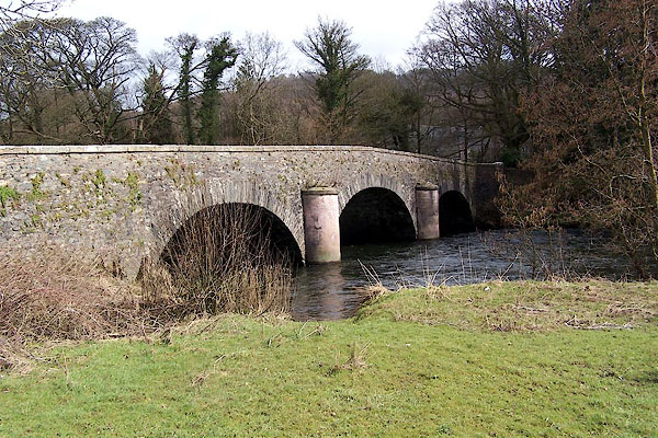
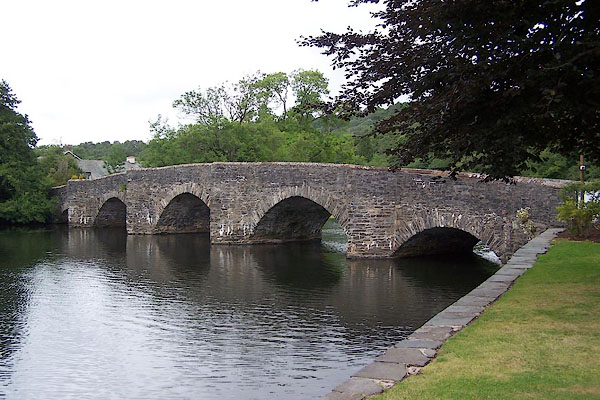
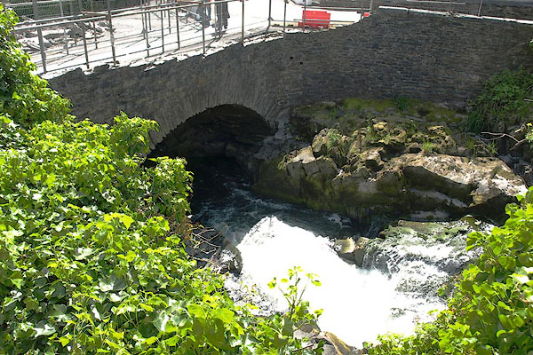
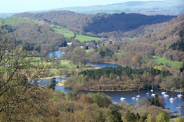 BLZ19.jpg From Gummers How. (taken 28.4.2006) 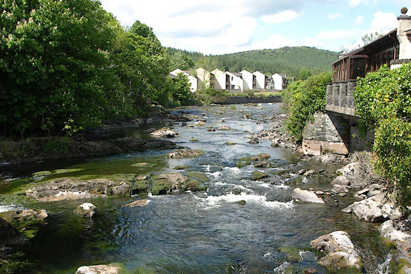 BSU77.jpg At Backbarrow Bridge, (taken 28.5.2010) |
||||
|
|
||||
| evidence:- | old map:- OS County Series (Lan 12) |
|||
| source data:- | Maps, County Series maps of Great Britain, scales 6 and 25
inches to 1 mile, published by the Ordnance Survey, Southampton,
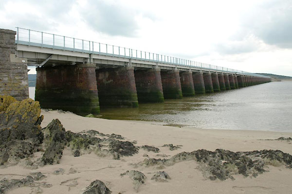
Hampshire, from about 1863 to 1948. "Spring Tides Flow to this Weir" |
|||
|
|
||||
| evidence:- | old map:- OS County Series (Lan 11) |
|||
| source data:- | Maps, County Series maps of Great Britain, scales 6 and 25
inches to 1 mile, published by the Ordnance Survey, Southampton,
Hampshire, from about 1863 to 1948. "Navigable to this point for Vessels of 7[5] Tons" at Greenodd (now on land) |
|||
|
|
||||
| evidence:- | old map:- Gough 1350s-60s placename:- Leven |
|||
| source data:- | Map, colour photozincograph copy, reduced size facsimile, Gough
Map of Britain, scale about 28.5 miles to 1 inch, published by
the Ordnance Survey, Southampton, Hampshire, 1875. click to enlarge click to enlargeGgh1Cm.jpg "leven" Flowing from lake Windermere to the sea. item:- JandMN : 33 Image © see bottom of page |
|||
|
|
||||
| evidence:- | old map:- Gough 1350s-60s placename:- Leven |
|||
| source data:- | Map, lithograph facsimile, Gough Map of Britain, 20 miles to 1
inch? published by the Ordnance Survey, Southampton, Hampshire,
1935. click to enlarge click to enlargeGgh2Cm.jpg "leven" Flowing from lake Windermere to the sea. item:- JandMN : 34 Image © see bottom of page |
|||
|
|
||||
| evidence:- | possibly old map:- Ptolemy 1540 |
|||
| source data:- | Map, copy, uncoloured lithograph? Anglia II Nova Tabula, New Map
of England, scale about 50 miles to 1 inch, data in the
Geographia by Claudius Ptolemy, engraved by Sebastian Munster,
Basle, Switzerland, 1540.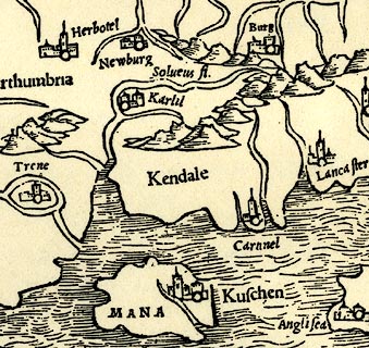 click to enlarge click to enlargePTY4Cm.jpg tapering wiggly double line; river item:- private collection : 131 Image © see bottom of page |
|||
|
|
||||
| evidence:- | probably old map:- Lloyd 1573 |
|||
| source data:- | Map, hand coloured copper plate engraving, Angliae Regni,
Kingdom of England, with Wales, scale about 24 miles to 1 inch, authored by Humphrey
Lloyd, Denbigh, Clwyd, drawn and engraved
by Abraham Ortelius, Netherlands, 1573. click to enlarge click to enlargeLld1Cm.jpg item:- Hampshire Museums : FA1998.69 Image © see bottom of page |
|||
|
|
||||
| evidence:- | old map:- Saxton 1579 |
|||
| source data:- | Map, hand coloured engraving, Westmorlandiae et Cumberlandiae Comitatus ie Westmorland
and Cumberland, scale about 5 miles to 1 inch, by Christopher Saxton, London, engraved
by Augustinus Ryther, 1576, published 1579-1645.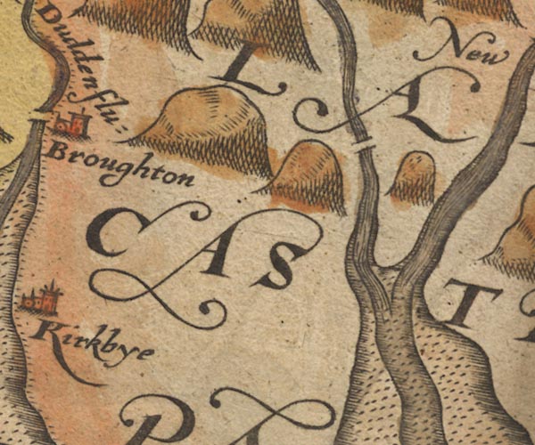 Sax9SD28.jpg item:- private collection : 2 Image © see bottom of page |
|||
|
|
||||
| evidence:- | old map:- Mercator 1595 (edn?) placename:- |
|||
| source data:- | Map, hand coloured engraving, Westmorlandia, Lancastria, Cestria
etc, ie Westmorland, Lancashire, Cheshire etc, scale about 10.5
miles to 1 inch, by Gerard Mercator, Duisberg, Germany, 1595,
edition 1613-16.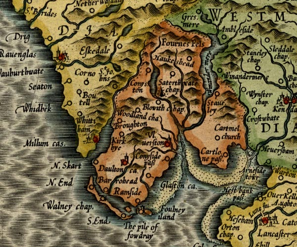 MER5LanA.jpg "" double line with stream lines; river, running into the sea item:- Armitt Library : 2008.14.3 Image © see bottom of page |
|||
|
|
||||
| evidence:- | old map:- Keer 1605 |
|||
| source data:- | Map, hand coloured engraving, Westmorland and Cumberland, scale
about 16 miles to 1 inch, probably by Pieter van den Keere, or
Peter Keer, about 1605 edition perhaps 1676. click to enlarge click to enlargeKER8.jpg "" double wiggly line, tapering to single; river item:- Dove Cottage : 2007.38.110 Image © see bottom of page |
|||
|
|
||||
| evidence:- | old map:- Speed 1611 (Cum/EW) |
|||
| source data:- | Map, hand coloured engraving, Kingdome of Great Britaine and
Ireland, scale about 36 miles to 1 inch, by John Speed, about
1610-11, published by Thomas Bassett, Fleet Street and Richard
Chiswell, St Paul's Churchyard, London, 1676? click to enlarge click to enlargeSPD6Cm.jpg tapering wiggly line item:- private collection : 85 Image © see bottom of page |
|||
|
|
||||
| evidence:- | old map:- Speed 1611 (Wmd) |
|||
| source data:- | Map, hand coloured engraving, The Countie Westmorland and
Kendale the Cheif Towne, scale about 2.5 miles to 1 inch, by
John Speed, 1610, published by George Humble, Popes Head Alley,
London, 1611-12.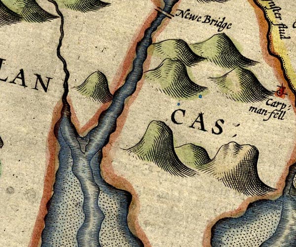 SP14SD38.jpg estuary, into the sea item:- Armitt Library : 2008.14.5 Image © see bottom of page |
|||
|
|
||||
| evidence:- | poem:- Drayton 1612/1622 text placename:- Levin placename:- Fosse |
|||
| source data:- | Poem, Poly Olbion, by Michael Drayton, published by published by
John Marriott, John Grismand and Thomas Dewe, and others?
London, part 1 1612, part 2 1622. goto source goto sourcepage 136:- "... Dudden first, then Levin, lastly Ken, Of three bright Naiades nam'd, ... ... ... Levin from the Fells, Besides her naturall source, with the abundance swells," goto sourcepage 137:- "Which those two mighty Meres, upon her either sidey Contribute by recourse, that out of very pride, Shee leaves her ancient name, and Fosse her selfe doth call, Till comming to the Sands, even almost at her fall, On them her ancient Style shee liberally bestowes." |
|||
|
|
||||
| evidence:- | old map:- Drayton 1612/1622 placename:- |
|||
| source data:- | Map, hand coloured engraving, Cumberlande and Westmorlande, by
Michael Drayton, probably engraved by William Hole, scale about
4 or 5 miles to 1 inch, published by John Mariott, John
Grismand, and Thomas Dewe, London, 1622.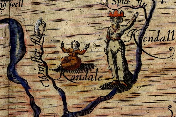 DRY523.jpg River. item:- JandMN : 168 Image © see bottom of page |
|||
|
|
||||
| evidence:- | old map:- Jansson 1646 |
|||
| source data:- | Map, hand coloured engraving, Cumbria and Westmoria, ie
Cumberland and Westmorland, scale about 3.5 miles to 1 inch, by
John Jansson, Amsterdam, Netherlands, 1646.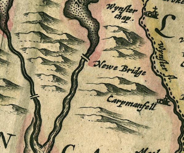 JAN3SD38.jpg Double wiggly line with stream lines. item:- JandMN : 88 Image © see bottom of page |
|||
|
|
||||
| evidence:- | old map:- Sanson 1679 |
|||
| source data:- | Map, hand coloured engraving, Ancien Royaume de Northumberland
aujourdhuy Provinces de Nort, ie the Ancient Kingdom of
Northumberland or the Northern Provinces, scale about 9.5 miles
to 1 inch, by Nicholas Sanson, Paris, France, 1679. click to enlarge click to enlargeSAN2Cm.jpg tapering wiggly line; river item:- Dove Cottage : 2007.38.15 Image © see bottom of page |
|||
|
|
||||
| evidence:- | old map:- Seller 1694 (Wmd) |
|||
| source data:- | Map, hand coloured engraving, Westmorland, scale about 8 miles
to 1 inch, by John Seller, 1694. click to enlarge click to enlargeSEL7.jpg item:- Dove Cottage : 2007.38.87 Image © see bottom of page |
|||
|
|
||||
| evidence:- | old map:- Morden 1695 (Cmd) |
|||
| source data:- | Map, uncoloured engraving, Cumberland, scale about 4 miles to 1
inch, by Robert Morden, 1695, published by Abel Swale, the
Unicorn, St Paul's Churchyard, Awnsham, and John Churchill, the
Black Swan, Paternoster Row, London, 1695-1715.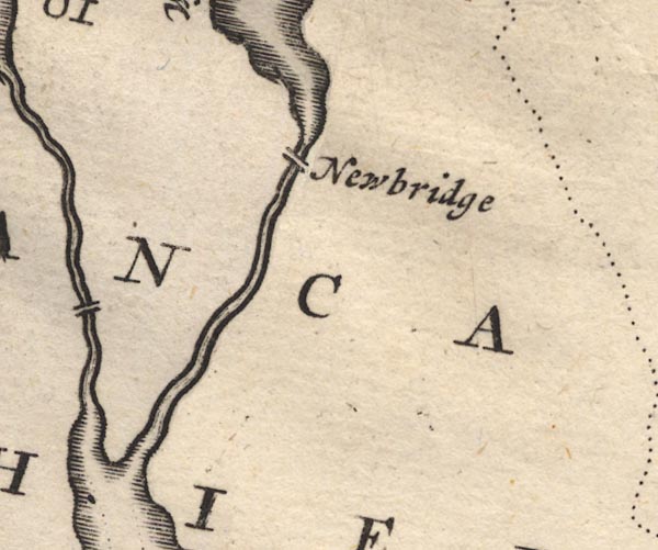 MD12SD38.jpg Double line from Windermere to the estuary. item:- JandMN : 90 Image © see bottom of page |
|||
|
|
||||
| evidence:- | old map:- Morden 1695 (Wmd) |
|||
| source data:- | Map, hand coloured engraving, Westmorland, scale about 2.5 miles to 1 inch, by Robert
Morden, published by Abel Swale, the Unicorn, St Paul's Churchyard, Awnsham, and John
Churchill, the Black Swan, Paternoster Row, London, 1695.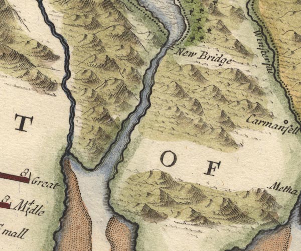 MD10SD38.jpg item:- JandMN : 24 Image © see bottom of page |
|||
|
|
||||
| evidence:- | old map:- Simpson 1746 map (Wmd) |
|||
| source data:- | Map, uncoloured engraving, Westmorland, scale about 8 miles to 1
inch, printed by R Walker, Fleet Lane, London, 1746.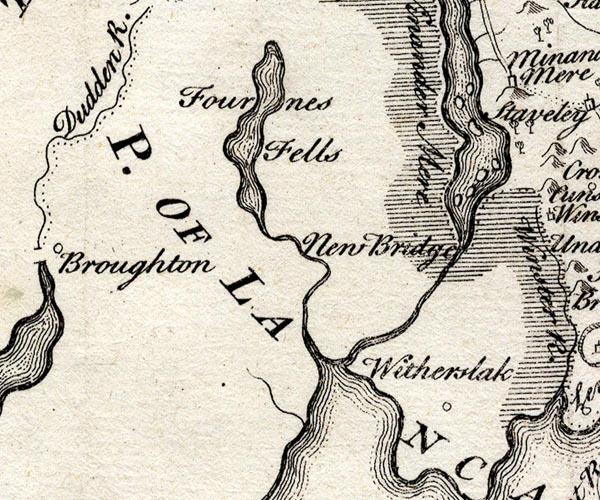 SMP2SDJ.jpg Wiggly line; from Windermere. item:- Dove Cottage : 2007.38.59 Image © see bottom of page |
|||
|
|
||||
| evidence:- | old map:- Bowen and Kitchin 1760 |
|||
| source data:- | Map, hand coloured engraving, A New Map of the Counties of
Cumberland and Westmoreland Divided into their Respective Wards,
scale about 4 miles to 1 inch, by Emanuel Bowen and Thomas
Kitchin et al, published by T Bowles, Robert Sayer, and John
Bowles, London, 1760.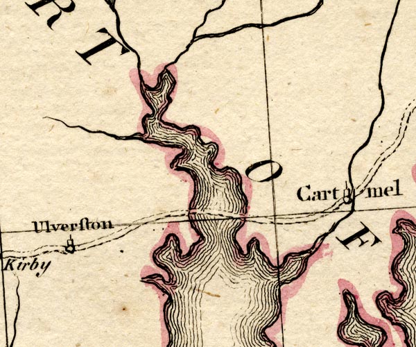 BO18SD27.jpg double line with stream lines, into the Leven Estuary item:- Armitt Library : 2008.14.10 Image © see bottom of page |
|||
|
|
||||
| evidence:- | old map:- Crosthwaite 1783-94 (Win/Ble) |
|||
| source data:- | Map, uncoloured engraving, An Accurate Map of the Grand Lake of
Windermere, scale about 2 inches to 1 mile, by Peter
Crosthwaite, Keswick, Cumberland, 1783, version published 1819.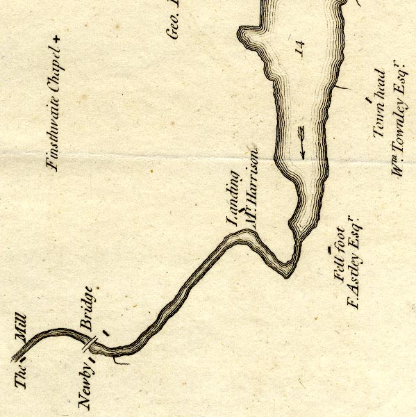 CT9SD38T.jpg double wiggly line with stream lines item:- Armitt Library : 2008.14.102 Image © see bottom of page |
|||
|
|
||||
| evidence:- | old map:- West 1784 map placename:- Leven, River |
|||
| source data:- | Map, hand coloured engraving, A Map of the Lakes in Cumberland,
Westmorland and Lancashire, scale about 3.5 miles to 1 inch,
engraved by Paas, 53 Holborn, London, about 1784.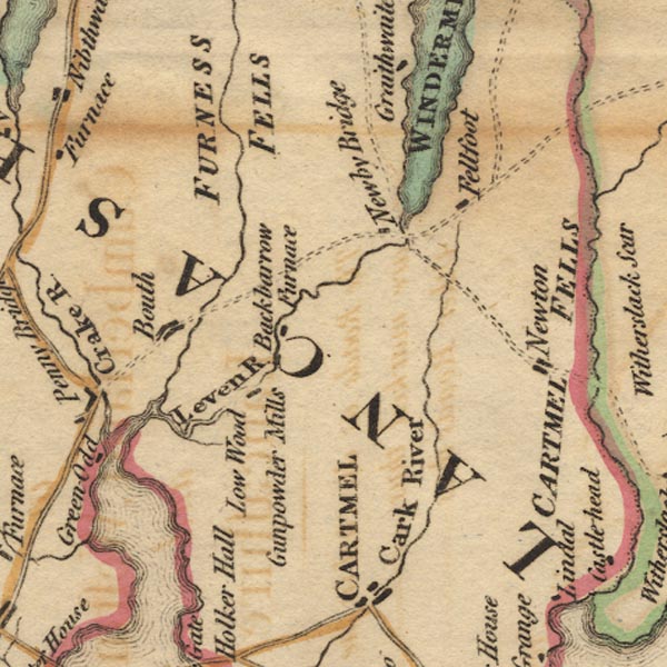 Ws02SD38.jpg "Leven R." item:- Armitt Library : A1221.1 Image © see bottom of page |
|||
|
|
||||
| evidence:- | old map:- Clarke 1787 map (Windermere S) |
|||
| source data:- | Map, A Map of the Southern Part of the Lake Winandermere and its
Environs, scale about 6.5 ins to 1 mile, by James Clarke,
engraved by Samuel John Neele, 352 Strand, published by James
Clarke, Penrith, Cumberland and in London etc, 1787.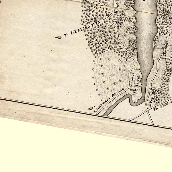 CLBSD38T.jpg item:- private collection : 10.11 Image © see bottom of page |
|||
|
|
||||
| evidence:- | road book:- Cary 1798 (2nd edn 1802) placename:- Leven, River |
|||
| source data:- | Road book, itineraries, Cary's New Itinerary, by John Cary, 181
Strand, London, 2nd edn 1802. goto source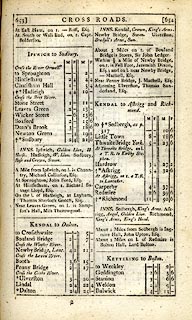 click to enlarge click to enlargeC38653.jpg page 653-654 "Cross the Leven River" item:- JandMN : 228.2 Image © see bottom of page |
|||
|
|
||||
| evidence:- | old map:- Skrine 1801 placename:- Leven River |
|||
| source data:- | Map, uncoloured engraving, rivers in Cumberland, Westmorland,
Lancashire and Cheshire, scale about 23 miles to 1 inch, by
Henry Skrine, published by P Elmsly, London, 1801.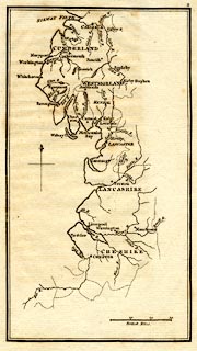 click to enlarge click to enlargeM076.jpg "Leven R." river item:- JandMN : 421 Image © see bottom of page |
|||
|
|
||||
| evidence:- | descriptive text:- Baker 1802 |
|||
| source data:- | Perspective road map with sections in Lancashire, Westmorland,
and Cumberland, by J Baker, London 1802. pp.25-26:- "... Cartmel ... between two bays of the sea, the one formed by the river Kenken, the other by the conflux of some smaller streams, there falling from the great Westmorland and Cumberland fells into the Irish sea. ..." |
|||
|
|
||||
| evidence:- | old map:- Cooke 1802 |
|||
| source data:- | Map, Lancashire, scale about 18 miles to 1 inch, by George
Cooke, 1802, bound in Gray's New Book of Roads, 1824, published
by Sherwood, Jones and Co, Paternoster Road, London, 1824.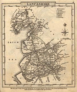 click to enlarge click to enlargeGRA1La.jpg tapering wiggly line; river item:- Hampshire Museums : FA2000.62.6 Image © see bottom of page |
|||
|
|
||||
| evidence:- | old map:- Laurie and Whittle 1806 placename:- Leven River |
|||
| source data:- | Road map, Completion of the Roads to the Lakes, scale about 10
miles to 1 inch, by Nathaniel Coltman? 1806, published by Robert
H Laurie, 53 Fleet Street, London, 1834. click to enlarge click to enlargeLw18.jpg "Leven R." river item:- private collection : 18.18 Image © see bottom of page |
|||
|
|
||||
| evidence:- | old map:- Otley 1818 placename:- Leven River |
|||
| source data:- | Map, uncoloured engraving, The District of the Lakes,
Cumberland, Westmorland, and Lancashire, scale about 4 miles to
1 inch, by Jonathan Otley, 1818, engraved by J and G Menzies,
Edinburgh, Scotland, published by Jonathan Otley, Keswick,
Cumberland, et al, 1833.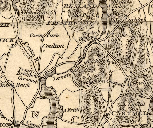 OT02SD38.jpg "Leven R." item:- JandMN : 48.1 Image © see bottom of page |
|||
|
|
||||
| evidence:- | descriptive text:- Otley 1823 (5th edn 1834) |
|||
| source data:- | Guide book, A Concise Description of the English Lakes, the
mountains in their vicinity, and the roads by which they may be
visited, with remarks on the mineralogy and geology of the
district, by Jonathan Otley, published by the author, Keswick,
Cumberland now Cumbria, by J Richardson, London, and by Arthur
Foster, Kirkby Lonsdale, Cumbria, 1823; published 1823-49,
latterly as the Descriptive Guide to the English Lakes. goto source Page 41:- "... leaving which [Windermere] ... is called the Leven, and joins the Crake from Coniston upon the sands below Penny Bridge." |
|||
|
|
||||
| evidence:- | old map:- Perrot 1823 |
|||
| source data:- | Map, hand coloured engraving, Cumberland and Westmoreland ie
Westmorland, scale about 38 miles to 1 inch, by Aristide Michel
Perrot, engraved by Migneret, 1823, published by Etienne Ledoux,
9 Rue Guenegaud, Paris, France, 1824-48. click to enlarge click to enlargePER2.jpg tapering wiggly line item:- Dove Cottage : 2007.38.45 Image © see bottom of page |
|||
|
|
||||
| evidence:- | descriptive text:- Ford 1839 (3rd edn 1843) |
|||
| source data:- | Guide book, A Description of Scenery in the Lake District, by
Rev William Ford, published by Charles Thurnam, Carlisle, by W
Edwards, 12 Ave Maria Lane, Charles Tilt, Fleet Street, William
Smith, 113 Fleet Street, London, by Currie and Bowman,
Newcastle, by Bancks and Co, Manchester, by Oliver and Boyd,
Edinburgh, and by Sinclair, Dumfries, 1839. goto source Page 27:- "... The Leven is a noble stream, and higher up above the bridge [Newby Bridge], gradually widens in sportive curves and charming little bays. ..." |
|||
|
|
||||
| evidence:- | old map:- Ford 1839 map placename:- Leven River |
|||
| source data:- | Map, uncoloured engraving, Map of the Lake District of
Cumberland, Westmoreland and Lancashire, scale about 3.5 miles
to 1 inch, published by Charles Thurnam, Carlisle, and by R
Groombridge, 5 Paternoster Row, London, 3rd edn 1843.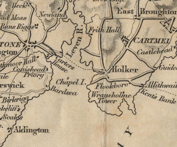 FD02SD37.jpg "Leven R." item:- JandMN : 100.1 Image © see bottom of page |
|||
|
|
||||
| evidence:- | old map:- Garnett 1850s-60s H placename:- Leven, River |
|||
| source data:- | Map of the English Lakes, in Cumberland, Westmorland and
Lancashire, scale about 3.5 miles to 1 inch, published by John
Garnett, Windermere, Westmorland, 1850s-60s.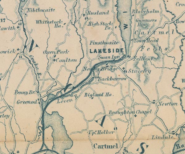 GAR2SD38.jpg "Leven R." double wiggly line, and estuary item:- JandMN : 82.1 Image © see bottom of page |
|||
|
|
||||
| evidence:- | old map:- Prior 1874 map 1 placename:- Leven River |
|||
| source data:- | Map, uncoloured engraving or lithograph? Winander Mere, scale
about 2.5 miles to 1 inch, published by John Garnett,
Windermere, Westmorland, 1874. click to enlarge click to enlargePI03M1.jpg "Leven R." double line with stream lines; river item:- private collection : 133.1 Image © see bottom of page |
|||
|
|
||||
| evidence:- | old print:- Bradley 1901 placename:- Leven, River |
|||
| source data:- | Print, uncoloured lithograph, On the River Leven, Haverthwaite, Lancashire, by Joseph
Pennell, published by Macmillan and Co, London, 1901.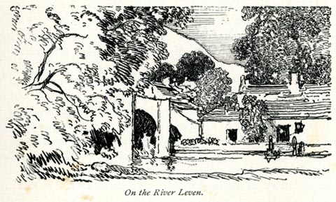 click to enlarge click to enlargeBRL140.jpg On page 179 of Highways and Byways in the Lake District, by A G Bradley. printed at bottom:- "On the River Leven." item:- JandMN : 464.40 Image © see bottom of page |
|||
|
|
||||
| evidence:- | old map:- Postlethwaite 1877 (3rd edn 1913) placename:- Leven, River |
|||
| source data:- | Map, uncoloured engraving, Map of the Lake District Mining Field, Westmorland, Cumberland,
Lancashire, scale about 5 miles to 1 inch, by John Postlethwaite, published by W H
Moss and Sons, 13 Lowther Street, Whitehaven, Cumberland, 1877 edn 1913.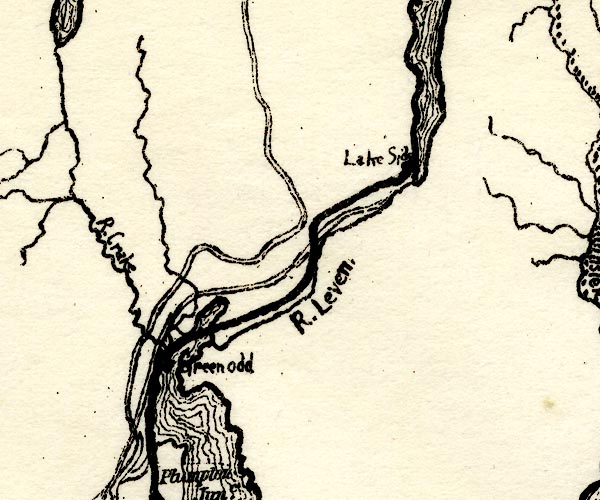 PST2SD38.jpg "R. Leven." wiggly line, running into Leven Estuary item:- JandMN : 162.2 Image © see bottom of page |
|||
|
|
||||
| evidence:- | old print:- Waugh 1860 |
|||
| source data:- | Print, engraving, Backbarrow Mills, Backbarrow, Haverthwaite, Lancashire, drawn by
T H Wilson, published by Alexander Ireland and Co, 22 Market Street, Manchester, 1860.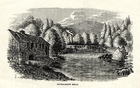 click to enlarge click to enlargeWU0118.jpg On p.47 of Over Sands to the Lakes, by Edwin Waugh. printed at bottom left:- "THW" printed at bottom:- "BACKBARROW MILLS." item:- Armitt Library : A1082.18 Image © see bottom of page |
|||
|
|
||||
| evidence:- | old print:- Garnett 1850s-60s F |
|||
| source data:- | Print, uncoloured engraving, Newby Bridge, Lancashire, engraved by William Banks and
Son, Edinburgh, published by John Garnett, Windermere, Westmorland, 1850s-60s?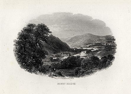 click to enlarge click to enlargeGAR713.jpg Found with Views of the English Lakes. The view is from the south showing the River Leven, and the bottom of Windermere, as well as the bridge and Swan Hotel. printed at bottom:- "W. Banks &Son, Edinr. / NEWBY BRIDGE." item:- JandMN : 165.13 Image © see bottom of page |
|||
|
|
||||
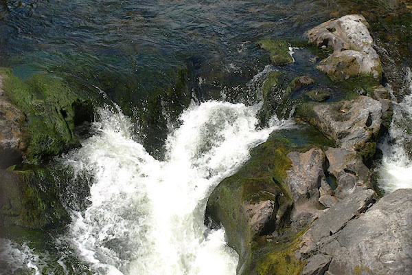 BSU76.jpg At Backbarrow Bridge, (taken 28.5.2010) |
||||
|
|
||||
| places:- |
|
|||
|
||||
|
||||
|
||||
|
||||
|
||||
|
||||
|
||||
|
||||
|
||||
|
||||
|
||||
|
||||
|
||||
Lakes Guides menu.