 Old Cumbria Gazetteer
 |
 |
|
| Greenodd Viaduct, Greenodd | ||
| Greenodd Viaduct | ||
| site name:- | Lakeside branch railway | |
| site name:- | Leven, River | |
| locality:- | Greenodd | |
| civil parish:- | Egton with Newland (formerly Lancashire) | |
| county:- | Cumbria | |
| locality type:- | railway viaduct | |
| locality type:- | viaduct | |
| coordinates:- | SD316825 (about) | |
| 1Km square:- | SD3182 | |
| 10Km square:- | SD38 | |
|
|
||
| evidence:- | old map:- OS County Series (Lan 11 8) placename:- Greenodd Viaduct |
|
| source data:- | Maps, County Series maps of Great Britain, scales 6 and 25
inches to 1 mile, published by the Ordnance Survey, Southampton,
Hampshire, from about 1863 to 1948. OS County Series (Lan 11 12) 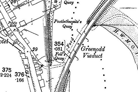 click to enlarge click to enlargeCSRY0155.jpg "Greenodd Viaduct" |
|
|
|
||
 Lakes Guides menu.