 Old Cumbria Gazetteer
 |
 |
|
| Leven Estuary | ||
| site name:- | Leven, River | |
| county:- | Cumbria | |
| locality type:- | estuary | |
| locality type:- | river estuary | |
| locality type:- | sea area | |
| coordinates:- | SD32107690 (etc etc) | |
| 1Km square:- | SD3276 | |
| 10Km square:- | SD37 | |
| 10Km square:- | SD38 | |
|
|
||
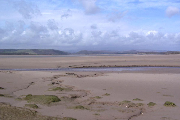 BLU50.jpg From Park Head. (taken 7.4.2006) 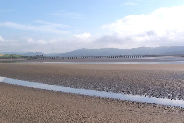 BMJ02.jpg Ulverston Sands, and railway viaduct. (taken 10.7.2006) |
||
|
|
||
| evidence:- | old map:- Saxton 1579 |
|
| source data:- | Map, hand coloured engraving, Westmorlandiae et Cumberlandiae Comitatus ie Westmorland
and Cumberland, scale about 5 miles to 1 inch, by Christopher Saxton, London, engraved
by Augustinus Ryther, 1576, published 1579-1645. Sax9SD27.jpg item:- private collection : 2 Image © see bottom of page |
|
|
|
||
| evidence:- | old map:- Mercator 1595 (edn?) placename:- |
|
| source data:- | Map, hand coloured engraving, Westmorlandia, Lancastria, Cestria
etc, ie Westmorland, Lancashire, Cheshire etc, scale about 10.5
miles to 1 inch, by Gerard Mercator, Duisberg, Germany, 1595,
edition 1613-16.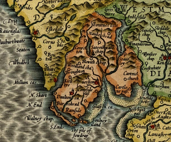 MER5LanA.jpg "" estuary item:- Armitt Library : 2008.14.3 Image © see bottom of page |
|
|
|
||
| evidence:- | old map:- Speed 1611 (Wmd) |
|
| source data:- | Map, hand coloured engraving, The Countie Westmorland and
Kendale the Cheif Towne, scale about 2.5 miles to 1 inch, by
John Speed, 1610, published by George Humble, Popes Head Alley,
London, 1611-12.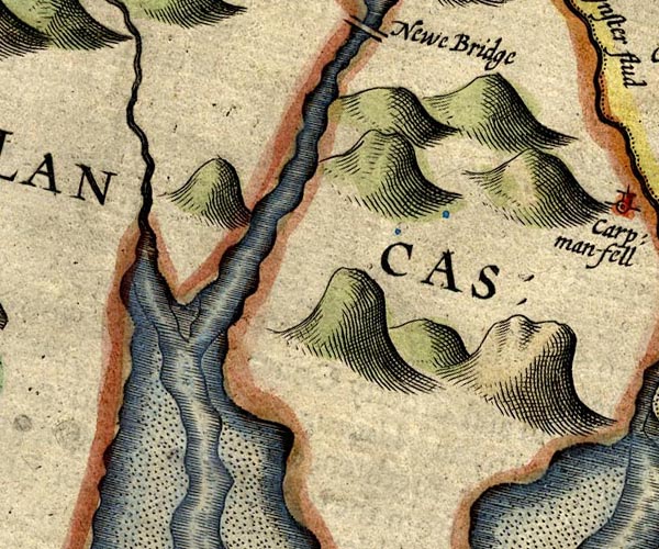 SP14SD38.jpg 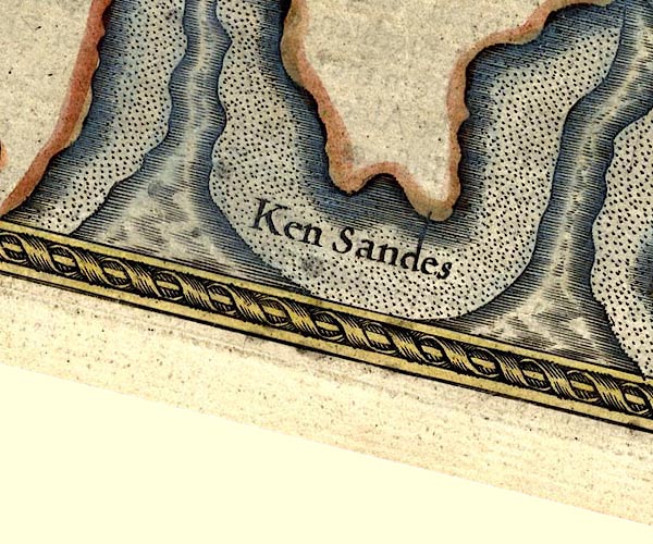 SP14SD37.jpg estuary item:- Armitt Library : 2008.14.5 Image © see bottom of page |
|
|
|
||
| evidence:- | old map:- Jansson 1646 |
|
| source data:- | Map, hand coloured engraving, Cumbria and Westmoria, ie
Cumberland and Westmorland, scale about 3.5 miles to 1 inch, by
John Jansson, Amsterdam, Netherlands, 1646.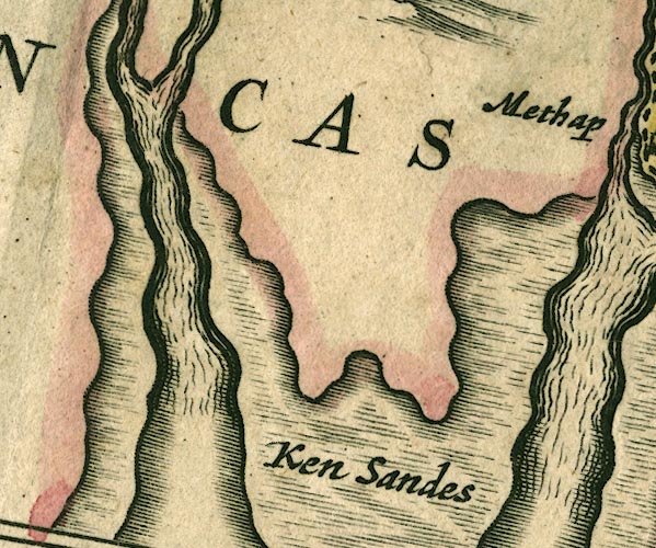 JAN3SD37.jpg item:- JandMN : 88 Image © see bottom of page |
|
|
|
||
| evidence:- | old map:- Sanson 1679 |
|
| source data:- | Map, hand coloured engraving, Ancien Royaume de Northumberland
aujourdhuy Provinces de Nort, ie the Ancient Kingdom of
Northumberland or the Northern Provinces, scale about 9.5 miles
to 1 inch, by Nicholas Sanson, Paris, France, 1679. click to enlarge click to enlargeSAN2Cm.jpg estuary item:- Dove Cottage : 2007.38.15 Image © see bottom of page |
|
|
|
||
| evidence:- | old map:- Seller 1694 (Wmd) |
|
| source data:- | Map, hand coloured engraving, Westmorland, scale about 8 miles
to 1 inch, by John Seller, 1694. click to enlarge click to enlargeSEL7.jpg estuary item:- Dove Cottage : 2007.38.87 Image © see bottom of page |
|
|
|
||
| evidence:- | old map:- Morden 1695 (Cmd) |
|
| source data:- | Map, uncoloured engraving, Cumberland, scale about 4 miles to 1
inch, by Robert Morden, 1695, published by Abel Swale, the
Unicorn, St Paul's Churchyard, Awnsham, and John Churchill, the
Black Swan, Paternoster Row, London, 1695-1715.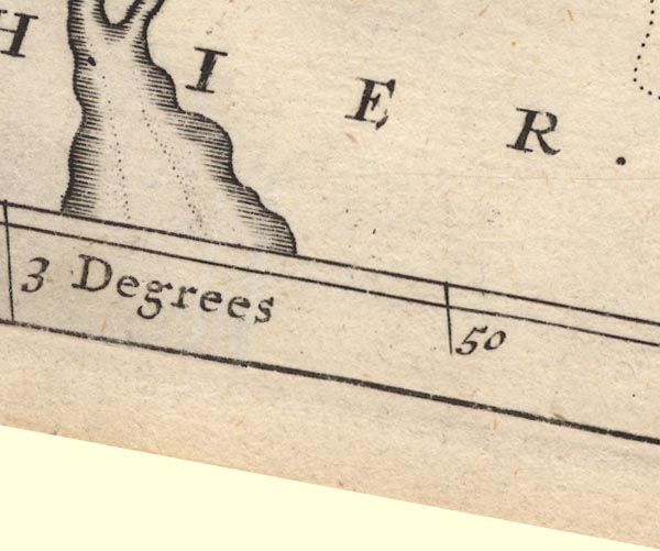 MD12SD37.jpg Foreshore sands outlined by dotted line. item:- JandMN : 90 Image © see bottom of page |
|
|
|
||
| evidence:- | old map:- Morden 1695 (Wmd) |
|
| source data:- | Map, hand coloured engraving, Westmorland, scale about 2.5 miles to 1 inch, by Robert
Morden, published by Abel Swale, the Unicorn, St Paul's Churchyard, Awnsham, and John
Churchill, the Black Swan, Paternoster Row, London, 1695.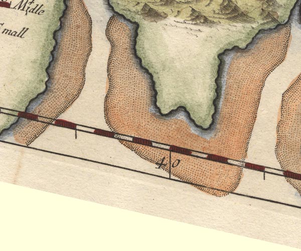 MD10SD37.jpg item:- JandMN : 24 Image © see bottom of page |
|
|
|
||
| evidence:- | old map:- Bowen and Kitchin 1760 |
|
| source data:- | Map, hand coloured engraving, A New Map of the Counties of
Cumberland and Westmoreland Divided into their Respective Wards,
scale about 4 miles to 1 inch, by Emanuel Bowen and Thomas
Kitchin et al, published by T Bowles, Robert Sayer, and John
Bowles, London, 1760.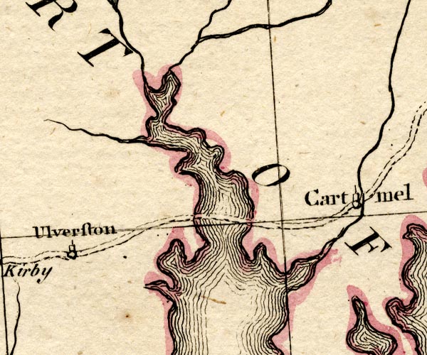 BO18SD27.jpg river mouth item:- Armitt Library : 2008.14.10 Image © see bottom of page |
|
|
|
||
| evidence:- | descriptive text:- West 1778 (11th edn 1821) placename:- Ulverston Bay |
|
| source data:- | Guide book, A Guide to the Lakes, by Thomas West, published by
William Pennington, Kendal, Cumbria once Westmorland, and in
London, 1778 to 1821. goto source goto sourcePage 34:- "... At the top of the hill [Great Head?] there opens a fine view of Furness. ... On the left, Ulverston-bay opens into the great bay, and is three miles over. The coast is deeply indented, and the peninsulas are beautifully fringed with wood. On the right, a bold bending rock presents a noble arched forehead; and a fine slope of inclosed grounds mixed with wood, leads the eye to Ulverston, the port and mart of Furness. ..." |
|
|
|
||
| evidence:- | old map:- West 1784 map |
|
| source data:- | Map, hand coloured engraving, A Map of the Lakes in Cumberland,
Westmorland and Lancashire, scale about 3.5 miles to 1 inch,
engraved by Paas, 53 Holborn, London, about 1784.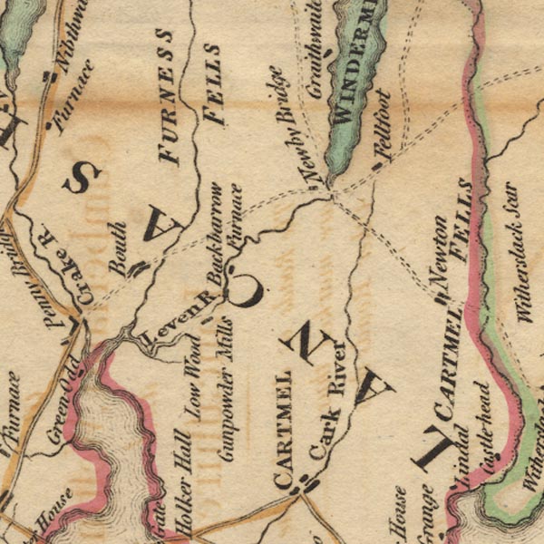 Ws02SD38.jpg 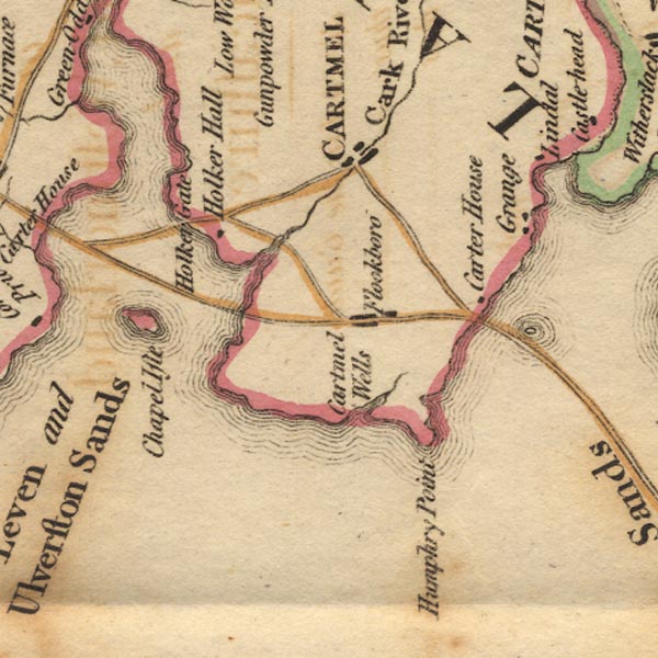 Ws02SD37.jpg item:- Armitt Library : A1221.1 Image © see bottom of page |
|
|
|
||
| evidence:- | old map:- Cooke 1802 placename:- Leven River |
|
| source data:- | Map, Lancashire, scale about 18 miles to 1 inch, by George
Cooke, 1802, bound in Gray's New Book of Roads, 1824, published
by Sherwood, Jones and Co, Paternoster Road, London, 1824.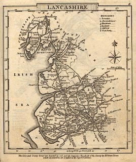 click to enlarge click to enlargeGRA1La.jpg "Leven R" estuary item:- Hampshire Museums : FA2000.62.6 Image © see bottom of page |
|
|
|
||
| evidence:- | old map:- Otley 1818 |
|
| source data:- | Map, uncoloured engraving, The District of the Lakes,
Cumberland, Westmorland, and Lancashire, scale about 4 miles to
1 inch, by Jonathan Otley, 1818, engraved by J and G Menzies,
Edinburgh, Scotland, published by Jonathan Otley, Keswick,
Cumberland, et al, 1833.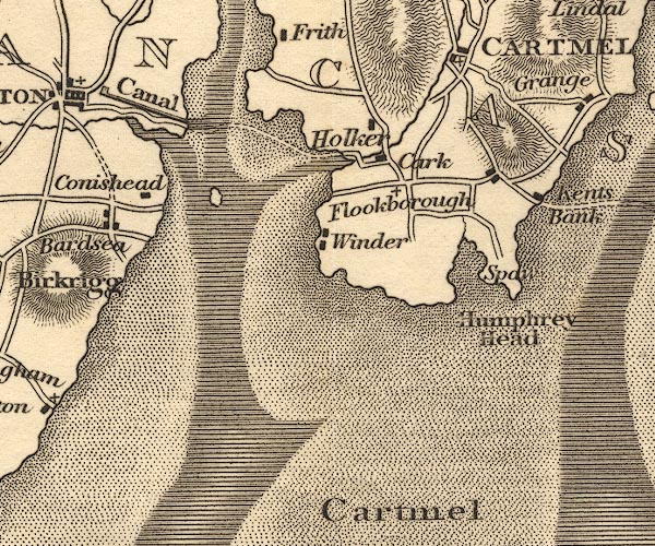 OT02SD37.jpg item:- JandMN : 48.1 Image © see bottom of page |
|
|
|
||
| evidence:- | old map:- Garnett 1850s-60s H |
|
| source data:- | Map of the English Lakes, in Cumberland, Westmorland and
Lancashire, scale about 3.5 miles to 1 inch, published by John
Garnett, Windermere, Westmorland, 1850s-60s. GAR2SD37.jpg area item:- JandMN : 82.1 Image © see bottom of page |
|
|
|
||
| evidence:- | old print:- Philip/Wilson 1890s |
|
| source data:- | Print, engraving, Leven Viaduct, published by George Philip and
Son, London, Philip, Son and Nephew, Liverpool, Lancashire, and
Titus Wilson, Kendal, Westmorland, about 1895. click to enlarge click to enlargePW1E04.jpg "LEVEN VIADUCT." item:- JandMN : 58.5 Image © see bottom of page |
|
|
|
||
| evidence:- | old print:- Barber 1873 |
|
| source data:- | Print, ?colour lithograph, Greenodd, published by The
Graphotyping Co, 7 Garrick Street and Simpkin, Marshall and Co,
Stationers' Hall Court, London, and by J Atkinson, King Street,
Ulverston, Cumberland, about 1873.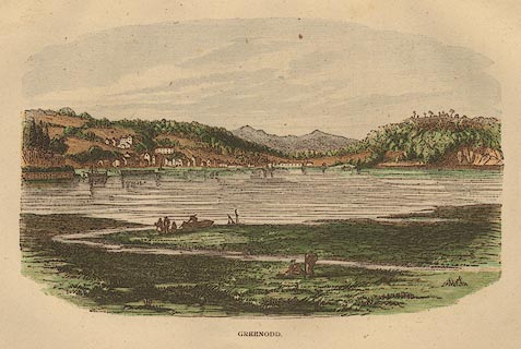 click to enlarge click to enlargeBB1E08.jpg Looking across the Leven Estuary to the village. "GREENODD" item:- JandMN : 69.9 Image © see bottom of page |
|
|
|
||
| evidence:- | old print:- Barber 1873 |
|
| source data:- | Print, ?colour lithograph, Head of Morecambe Bay from Leven
Viaduct, published by The Graphotyping Co, 7 Garrick Street and
Simpkin, Marshall and Co, Stationers' Hall Court, London, and by
J Atkinson, King Street, Ulverston, Cumberland, about 1873.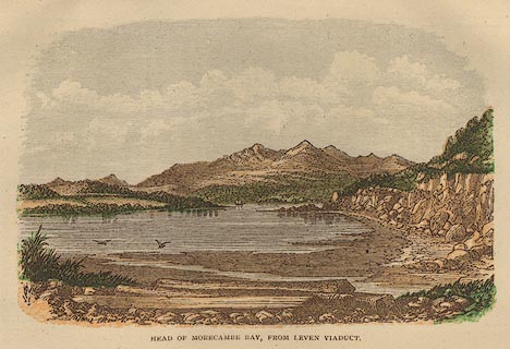 click to enlarge click to enlargeBB1E03.jpg "HEAD OF MORECAMBE BAY, FROM LEVEN VIADUCT" item:- JandMN : 69.4 Image © see bottom of page |
|
|
|
||
| evidence:- | old print:- Waugh 1860 |
|
| source data:- | Print, engraving, Greenodd, Egton with Newland, Lancashire, drawn by T H Wilson, engraved
by Swain, published by Alexander Ireland and Co, 22 Market Street, Manchester, 1860.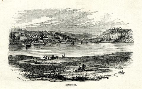 click to enlarge click to enlargeWU0117.jpg On p.45 of Over Sands to the Lakes, by Edwin Waugh. printed at bottom left, right, centre:- "WILSON [ ] / SWAIN SC. / GREENODD" item:- Armitt Library : A1082.17 Image © see bottom of page |
|
|
|
||
Lakes Guides menu.