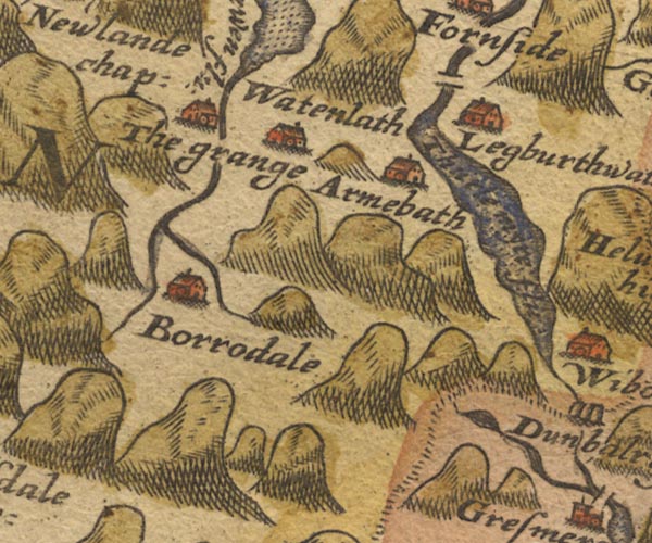
 Saxton 1576 NY21


|

|
|
|
gazetteer links places may or may not be labelled on the map |
||

|
-- Armboth House -- "Armebath" |
|
|
|
-- Borrowdale -- "Borrodale" |
|
|
|
-- Derwent, River -- "Darwen flu:" |
|
|
|
-- Easedale Tarn |
|
|
|
-- Grange -- "The grange" |
|
|
|
-- Legburthwaite -- "Legburthwate" |
|
|
|
-- Rosthwaite -- "Borrodale" |
|
|
|
-- Smaithwaite Bridge |
|
|
|
-- Stonethwaite Beck |
|
|
|
-- Thirlmere -- "Thurle myer flu" |
|
|
|
-- Watendlath -- "watenlath" |
|
|
civil parishes The area roughly includes parts of parishes:- St John's Castlerigg and Wythburn Buttermere Borrowdale Above Derwent Nether Wasdale Keswick Ennerdale and Kinniside Lakes |
||
|
|
||
|
|
Lakes Guides menu. | |