 Otley 1818 SD29


|

|
|
|
gazetteer links places may or may not be labelled on the map |
||

|
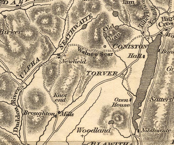
-- Beacon Tarn |
|
|
|
-- Broughton Mills |
|
|
|
-- Coniston Hall |
|
|
|
-- Coniston Water |
|
|
|
-- Goat's Water |
|
|
|
-- Knott, The |
|
|
|
-- Low Water |
|
|
|
-- Old Man of Coniston, The |
|
|
|
-- Oxen House |
|
|
|
-- Seathwaite Tarn |
|
|
|
-- Seathwaite -- "SEATHWAITE" --
"Newfield" |
|
|
|
-- Torver -- "TORVER" |
|
|
|
-- Walna Scar |
|
|
civil parishes The area roughly includes parts of parishes:- Blawith and Subberthwaite Torver Coniston Kirkby Ireleth Dunnerdale-with-Seathwaite Ulpha Colton Broughton West Eskdale |
||
|
|
||
|
|
Lakes Guides menu. | |