 Old Cumbria Gazetteer
 |
 |
|
| Beacon Tarn, Blawith and Subberthwaite | ||
| runs into:- |  Tarn Beck (4) Tarn Beck (4) |
|
|
|
||
| Beacon Tarn | ||
| locality:- | Blawith Fells | |
| civil parish:- | Blawith and Subberthwaite (formerly Lancashire) | |
| county:- | Cumbria | |
| locality type:- | tarn | |
| coordinates:- | SD27419004 (etc) | |
| 1Km square:- | SD2790 | |
| 10Km square:- | SD29 | |
| altitude:- | 535 feet | |
| altitude:- | 163m | |
|
|
||
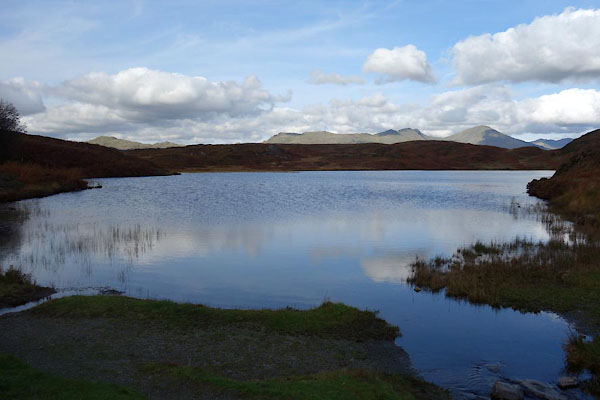
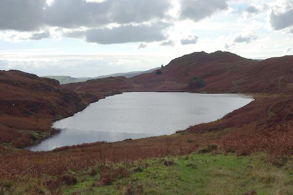 CGU10.jpg (taken 18.10.2017) 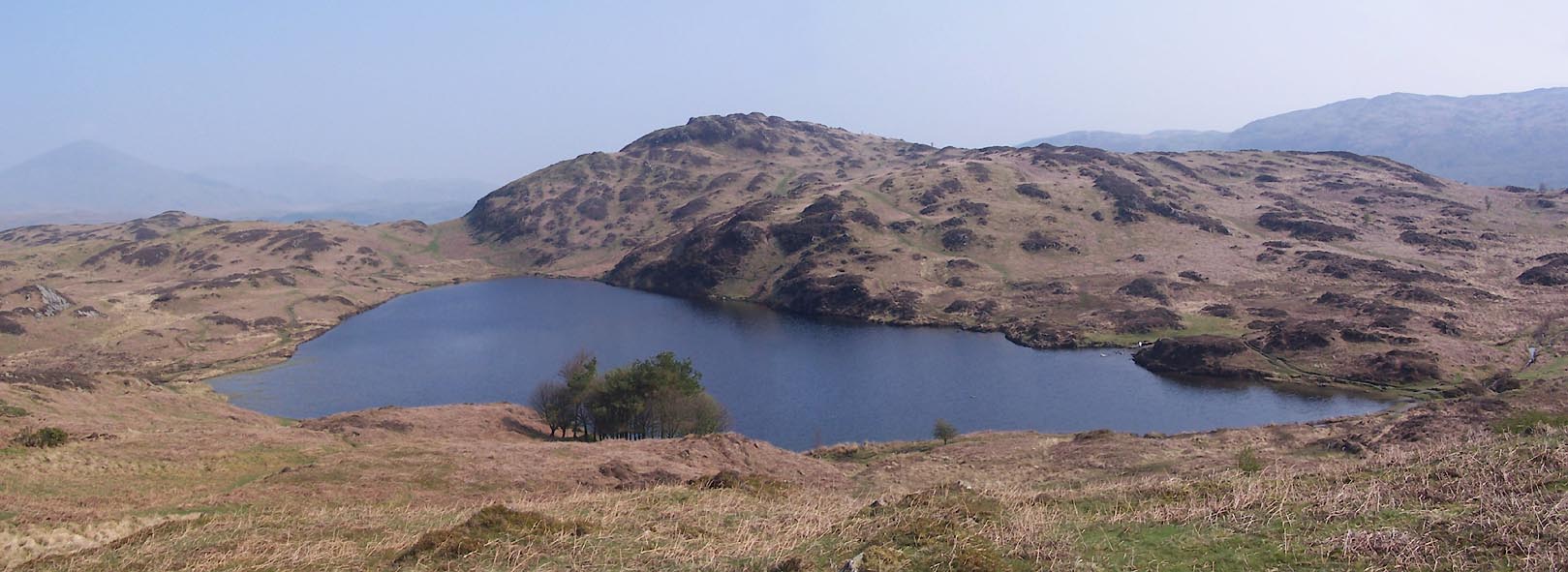 Click to enlarge BUI87.jpg (taken 19.4.2011) |
||
|
|
||
| evidence:- | old map:- OS County Series (Lan 7 7) placename:- Beacon Tarn |
|
| source data:- | Maps, County Series maps of Great Britain, scales 6 and 25
inches to 1 mile, published by the Ordnance Survey, Southampton,
Hampshire, from about 1863 to 1948. |
|
|
|
||
| evidence:- | old map:- Laurie and Whittle 1806 placename:- Beacon Tarn |
|
| source data:- | Road map, Completion of the Roads to the Lakes, scale about 10
miles to 1 inch, by Nathaniel Coltman? 1806, published by Robert
H Laurie, 53 Fleet Street, London, 1834. click to enlarge click to enlargeLw18.jpg "Beacon Tarn" lake item:- private collection : 18.18 Image © see bottom of page |
|
|
|
||
| evidence:- | old map:- Otley 1818 |
|
| source data:- | Map, uncoloured engraving, The District of the Lakes,
Cumberland, Westmorland, and Lancashire, scale about 4 miles to
1 inch, by Jonathan Otley, 1818, engraved by J and G Menzies,
Edinburgh, Scotland, published by Jonathan Otley, Keswick,
Cumberland, et al, 1833.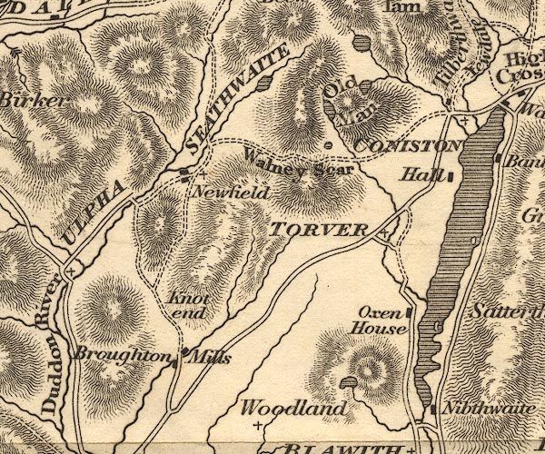 OT02SD29.jpg item:- JandMN : 48.1 Image © see bottom of page |
|
|
|
||
| evidence:- | descriptive text:- Otley 1823 (5th edn 1834) |
|
| source data:- | Guide book, A Concise Description of the English Lakes, the
mountains in their vicinity, and the roads by which they may be
visited, with remarks on the mineralogy and geology of the
district, by Jonathan Otley, published by the author, Keswick,
Cumberland now Cumbria, by J Richardson, London, and by Arthur
Foster, Kirkby Lonsdale, Cumbria, 1823; published 1823-49,
latterly as the Descriptive Guide to the English Lakes. goto source Page 36:- "... Beacon Tarn is a small one, near the foot of the lake [Coniston Water]." |
|
|
|
||
| evidence:- | old map:- Ford 1839 map |
|
| source data:- | Map, uncoloured engraving, Map of the Lake District of
Cumberland, Westmoreland and Lancashire, scale about 3.5 miles
to 1 inch, published by Charles Thurnam, Carlisle, and by R
Groombridge, 5 Paternoster Row, London, 3rd edn 1843.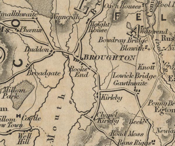 FD02SD28.jpg Outline with form lines. item:- JandMN : 100.1 Image © see bottom of page |
|
|
|
||
| evidence:- | old map:- Garnett 1850s-60s H placename:- Beacon Tarn |
|
| source data:- | Map of the English Lakes, in Cumberland, Westmorland and
Lancashire, scale about 3.5 miles to 1 inch, published by John
Garnett, Windermere, Westmorland, 1850s-60s.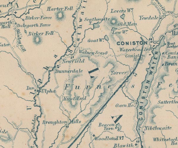 GAR2SD29.jpg "Beacon Tarn" outline with shore form lines, lake or tarn item:- JandMN : 82.1 Image © see bottom of page |
|
|
|
||
 CGU12.jpg (taken 18.10.2017) 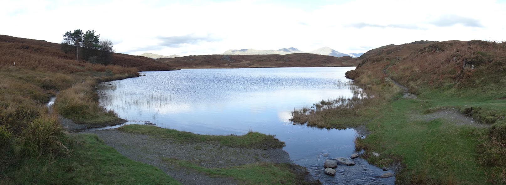 Click to enlarge CGU11.jpg (taken 18.10.2017) |
||
|
|
||
| hearsay:- |
Referred to as Trout Tarn by Arthur Ransome. |
|
|
|
||
Lakes Guides menu.