 Old Cumbria Gazetteer
 |
 |
|
| Goat's Water, Torver | ||
| runs into:- |  Torver Beck Torver Beck |
|
|
|
||
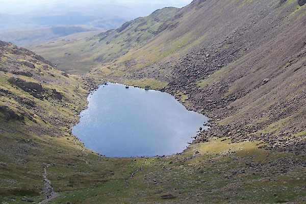
| Goat's Water | ||
| locality:- | Old Man of Coniston | |
| civil parish:- | Torver (formerly Lancashire) | |
| civil parish:- | Coniston (formerly Lancashire) | |
| county:- | Cumbria | |
| locality type:- | tarn | |
| coordinates:- | SD26619766 (etc) | |
| 1Km square:- | SD2697 | |
| 10Km square:- | SD29 | |
| altitude:- | 1650 feet | |
| altitude:- | 503m | |
|
|
||
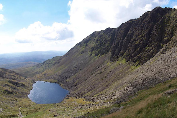 BTN42.jpg and Dow Crag. (taken 8.9.2010) 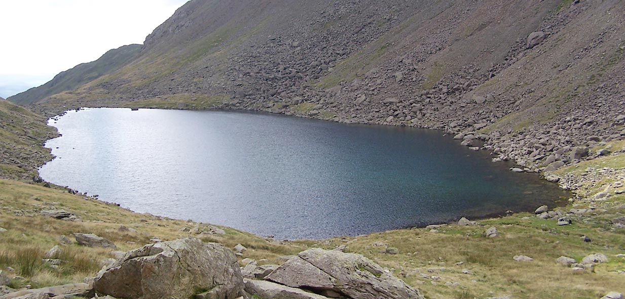 Click to enlarge BTN44.jpg (taken 8.9.2010) |
||
|
|
||
| evidence:- | old map:- West 1784 map placename:- Goats Tarn |
|
| source data:- | Map, hand coloured engraving, A Map of the Lakes in Cumberland,
Westmorland and Lancashire, scale about 3.5 miles to 1 inch,
engraved by Paas, 53 Holborn, London, about 1784.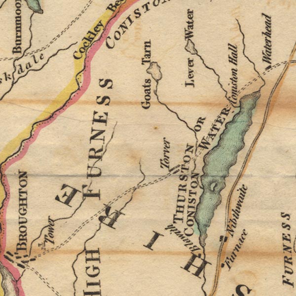 Ws02SD29.jpg item:- Armitt Library : A1221.1 Image © see bottom of page |
|
|
|
||
| evidence:- | old map:- Cooke 1802 placename:- Goats Tarn |
|
| source data:- | Map, The Lakes, Westmorland and Cumberland, scale about 8.5
miles to 1 inch, engravedby Neele and Son, published by
Sherwood, Jones and Co, Paternoster Road, London, 1824. click to enlarge click to enlargeGRA1Lk.jpg "Goats Tarn" outline with form lines; lake or tarn item:- Hampshire Museums : FA2000.62.5 Image © see bottom of page |
|
|
|
||
| evidence:- | old map:- Laurie and Whittle 1806 placename:- Goats Water |
|
| source data:- | Road map, Completion of the Roads to the Lakes, scale about 10
miles to 1 inch, by Nathaniel Coltman? 1806, published by Robert
H Laurie, 53 Fleet Street, London, 1834. click to enlarge click to enlargeLw18.jpg "Goats Water" lake item:- private collection : 18.18 Image © see bottom of page |
|
|
|
||
| evidence:- | old map:- Otley 1818 |
|
| source data:- | Map, uncoloured engraving, The District of the Lakes,
Cumberland, Westmorland, and Lancashire, scale about 4 miles to
1 inch, by Jonathan Otley, 1818, engraved by J and G Menzies,
Edinburgh, Scotland, published by Jonathan Otley, Keswick,
Cumberland, et al, 1833.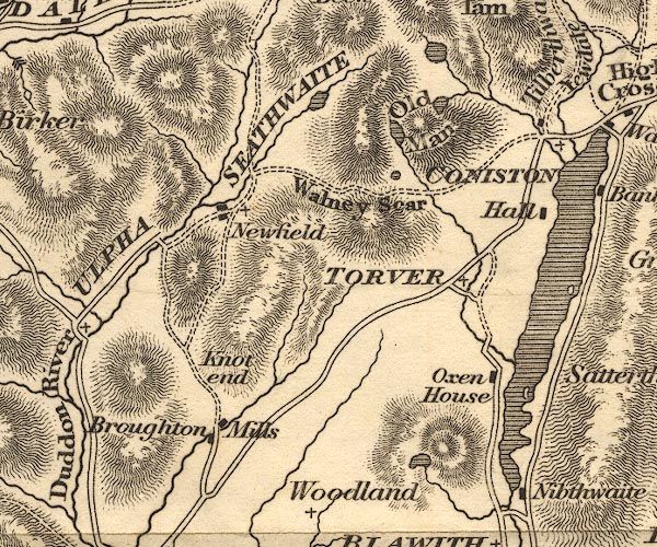 OT02SD29.jpg item:- JandMN : 48.1 Image © see bottom of page |
|
|
|
||
| evidence:- | descriptive text:- Otley 1823 (5th edn 1834) placename:- Gates Water placename:- Goats Water item:- trout; char; fishing |
|
| source data:- | Guide book, A Concise Description of the English Lakes, the
mountains in their vicinity, and the roads by which they may be
visited, with remarks on the mineralogy and geology of the
district, by Jonathan Otley, published by the author, Keswick,
Cumberland now Cumbria, by J Richardson, London, and by Arthur
Foster, Kirkby Lonsdale, Cumbria, 1823; published 1823-49,
latterly as the Descriptive Guide to the English Lakes. goto source Page 36:- "... Gates Water, (Goats Water) reposes between the Old Man's western side, and the foot of the precipitous Dow Crag; (Dove Crag.) Besides being in common with the other tarns stocked with trout, it also contains some char. Its stream forms the rivulet of Torver." |
|
|
|
||
| evidence:- | descriptive text:- Ford 1839 (3rd edn 1843) placename:- Goats Water |
|
| source data:- | Guide book, A Description of Scenery in the Lake District, by
Rev William Ford, published by Charles Thurnam, Carlisle, by W
Edwards, 12 Ave Maria Lane, Charles Tilt, Fleet Street, William
Smith, 113 Fleet Street, London, by Currie and Bowman,
Newcastle, by Bancks and Co, Manchester, by Oliver and Boyd,
Edinburgh, and by Sinclair, Dumfries, 1839. goto source Page 12:- "..." "... Goats Water, whose length is half a mile, and margin stony. ..." |
|
|
|
||
| evidence:- | old drawing:- Aspland 1840s-60s placename:- Goats Water |
|
| source data:- | Drawing, pencil, Goat's Water, Torver and Coniston, Lancashire, by Theophilus Lindsey
Aspland, 27 July 1852.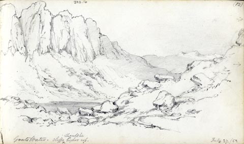 click to enlarge click to enlargeAS0316.jpg "Goats Water. cliffs should be higher up." page number "(12)" item:- Armitt Library : 1958.390.16 Image © see bottom of page |
|
|
|
||
| evidence:- | old map:- Garnett 1850s-60s H placename:- Goat Water |
|
| source data:- | Map of the English Lakes, in Cumberland, Westmorland and
Lancashire, scale about 3.5 miles to 1 inch, published by John
Garnett, Windermere, Westmorland, 1850s-60s.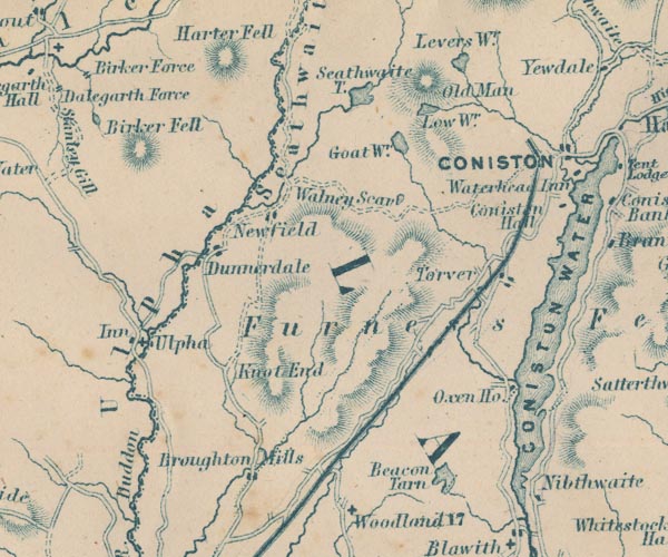 GAR2SD29.jpg "Goat Wr." outline with shore form lines, lake or tarn item:- JandMN : 82.1 Image © see bottom of page |
|
|
|
||
| evidence:- | old text:- Martineau 1855 placename:- Gait's Tarn item:- fox |
|
| source data:- | Guide book, A Complete Guide to the English Lakes, by Harriet
Martineau, published by John Garnett, Windermere, Westmorland,
and by Whittaker and Co, London, 1855; published 1855-76. goto source Page 168:- "... Where Dow Crag and the Old Man join, a dark and solemn tarn lies beneath the precipice, as he will see from above, whence it lies due west, far below. Round three sides of this Gait's Tarn, the rock is precipitous; and on the other, the crags are piled in grotesque fashion, and so as to afford,- as does much of this side of the mountain,- a great harbourage for foxes, against which the neighbouring population are for ever waging war. ..." |
|
|
|
||
| evidence:- | old photograph:- Marr 1916 placename:- Goatswater |
|
| source data:- | Photograph, halftone print, Goatswater, Coniston, Cumberland, 1916.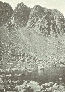 click to enlarge click to enlargeMA1228.jpg item:- JandMN : 173.36 Image © see bottom of page |
|
|
|
||
 BTN43.jpg (taken 8.9.2010) 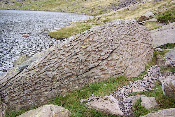 BTN45.jpg A stone by the tarn; what? (taken 8.9.2010) |
||
|
|
||
Lakes Guides menu.