 Old Cumbria Gazetteer
 |
 |
|
||||||||||||
| included in:- |
 road, Ambleside to Penrith road, Ambleside to Penrith |
|||||||||||||
| road, Ambleside to Kirkstone Pass | ||||||||||||||
| Ambleside to Kirkstone Pass | ||||||||||||||
| Kirkstone Pass to Ambleside | ||||||||||||||
| Kirkstone Road | ||||||||||||||
| civil parish:- | Lakes (formerly Westmorland) | |||||||||||||
| county:- | Cumbria | |||||||||||||
| locality type:- | route | |||||||||||||
| 10Km square:- | NY30 | |||||||||||||
| SummaryText:- | Commonly called The Struggle, this really applies to the last steep bit; the road lower down is the Kirkstone Road. | |||||||||||||
|
|
||||||||||||||
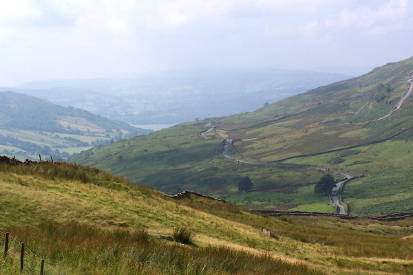 BJS66.jpg Looking down to lake Windermere. (taken 17.8.2005) |
||||||||||||||
|
|
||||||||||||||
| evidence:- | old map:- Morden 1695 (Wmd) |
|||||||||||||
| source data:- | Map, hand coloured engraving, Westmorland, scale about 2.5 miles to 1 inch, by Robert
Morden, published by Abel Swale, the Unicorn, St Paul's Churchyard, Awnsham, and John
Churchill, the Black Swan, Paternoster Row, London, 1695.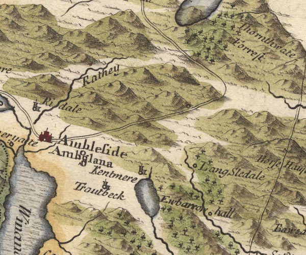 MD10NY40.jpg Double line. item:- JandMN : 24 Image © see bottom of page |
|||||||||||||
|
|
||||||||||||||
| evidence:- | old map:- Simpson 1746 map (Wmd) |
|||||||||||||
| source data:- | Map, uncoloured engraving, Westmorland, scale about 8 miles to 1
inch, printed by R Walker, Fleet Lane, London, 1746.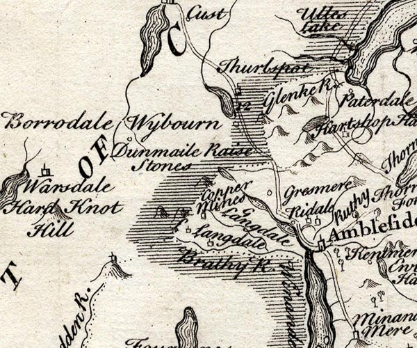 SMP2NYF.jpg Double line. item:- Dove Cottage : 2007.38.59 Image © see bottom of page |
|||||||||||||
|
|
||||||||||||||
| evidence:- | old map:- Bowen and Kitchin 1760 |
|||||||||||||
| source data:- | Map, hand coloured engraving, A New Map of the Counties of
Cumberland and Westmoreland Divided into their Respective Wards,
scale about 4 miles to 1 inch, by Emanuel Bowen and Thomas
Kitchin et al, published by T Bowles, Robert Sayer, and John
Bowles, London, 1760.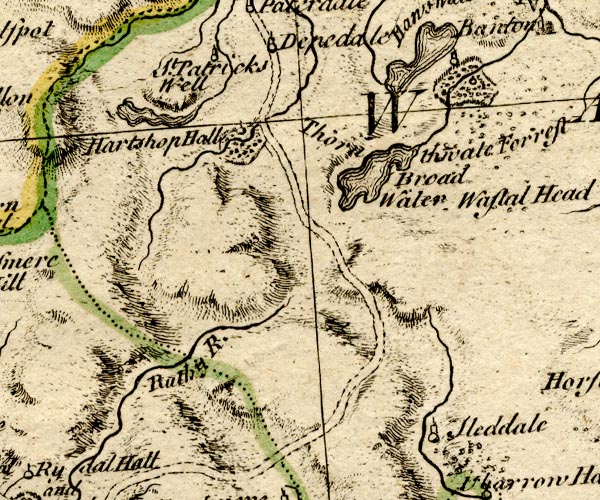 BO18NY30.jpg double line, dotted 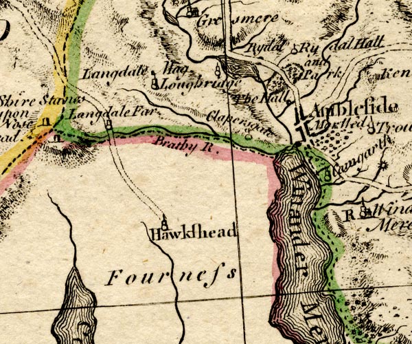 BO18SD29.jpg double line, dotted 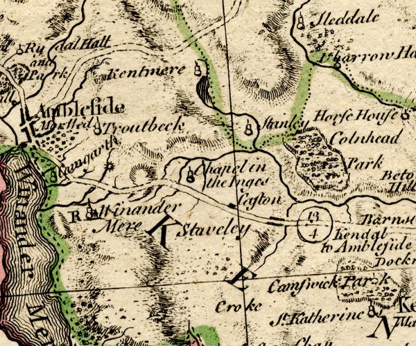 BO18SD39.jpg double line, dotted item:- Armitt Library : 2008.14.10 Image © see bottom of page |
|||||||||||||
|
|
||||||||||||||
| evidence:- | old map:- Jefferys 1770 (Wmd) |
|||||||||||||
| source data:- | Map, 4 sheets, The County of Westmoreland, scale 1 inch to 1
mile, surveyed 1768, and engraved and published by Thomas
Jefferys, London, 1770.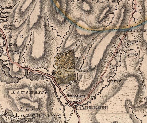 J5NY30NE.jpg 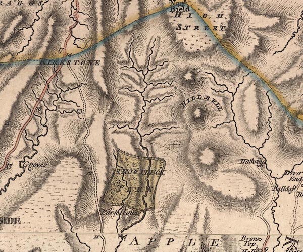 J5NY40NW.jpg double line; road, with mile numbers item:- National Library of Scotland : EME.s.47 Images © National Library of Scotland |
|||||||||||||
|
|
||||||||||||||
| evidence:- | descriptive text:- West 1778 (11th edn 1821) |
|||||||||||||
| source data:- | Guide book, A Guide to the Lakes, by Thomas West, published by
William Pennington, Kendal, Cumbria once Westmorland, and in
London, 1778 to 1821. goto source Page 162:- "... From the top of Kirkston to Ambleside the descent is quick. Some remarkable stones near the gorge of the pass are called Highcross. ..." |
|||||||||||||
|
|
||||||||||||||
| evidence:- | old text:- Clarke 1787 |
|||||||||||||
| source data:- | Guide book, A Survey of the Lakes of Cumberland, Westmorland,
and Lancashire, written and published by James Clarke, Penrith,
Cumberland, and in London etc, 1787; published 1787-93. goto source Page 153:- "..." "If the traveller wishes to return by way of Penrith, it may be done from Ambleside, the distance is 23 miles; two miles and three quarters of which, from Ambleside, is very steep, though carriages may travel upon it without much difficulty. Before we come to the top of Kirkstone, we see on the right hand, at a small distance, several cairns, ... [in Woundale]" |
|||||||||||||
|
|
||||||||||||||
| evidence:- | old map:- Clarke 1787 map (Windermere N) |
|||||||||||||
| source data:- | Map, A Map of the Northern Part of the Lake Winandermere and its
Environs, scale about 6.5 ins to 1 mile, by James Clarke,
engraved by Samuel John Neele, 352 Strand, published by James
Clarke, Penrith, Cumberland and in London etc, 1787.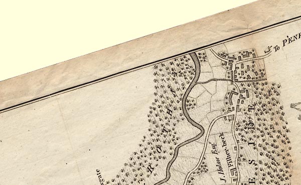 CLANY30S.jpg "To PENRITH" item:- private collection : 10.10 Image © see bottom of page |
|||||||||||||
|
|
||||||||||||||
| evidence:- | old text:- Green 1810 |
|||||||||||||
| source data:- | Set of prints, soft ground etchings, Sixty Studies from Nature,
by William Green, Ambleside, Westmorland, drawn 1808-10,
published 1810. goto source page 111:- "..." "The road to Ulls Water, from Ambleside, is wild and mountainous; the ascent from Ambleside is steep, with little variation, to the top of Kirkstone. ..." |
|||||||||||||
|
|
||||||||||||||
| evidence:- | old text:- Green 1814 |
|||||||||||||
| source data:- | Set of prints, soft ground etchings, Sixty Small Prints, with
text, A Description of a Series of Sixty Small Prints, by
William Green, Ambleside, Westmorland, 1814. goto source page 27:- "..." "The road to Ulls Water from Ambleside, which is by Brother Water, is wild and mountainous; the ascent from Ambleside is steep, with little variation to the top of Kirkstone. ..." |
|||||||||||||
|
|
||||||||||||||
| evidence:- | descriptive text:- Otley 1823 (5th edn 1834) item:- itinerary; road distances |
|||||||||||||
| source data:- | Guide book, A Concise Description of the English Lakes, the
mountains in their vicinity, and the roads by which they may be
visited, with remarks on the mineralogy and geology of the
district, by Jonathan Otley, published by the author, Keswick,
Cumberland now Cumbria, by J Richardson, London, and by Arthur
Foster, Kirkby Lonsdale, Cumbria, 1823; published 1823-49,
latterly as the Descriptive Guide to the English Lakes. goto source Page 106:- "AMBLESIDE TO ULLSWATER." "This is a very steep carriage road, rising 1300 feet above Ambleside, ... This hill has taken its name of Kirkstone from a detached mass of rock, standing at a" goto sourcePage 107:- "little distance from the road, and bearing some resemblance to the form of a house. ..."
|
|||||||||||||
|
|
||||||||||||||
| evidence:- | old map:- Ford 1839 map |
|||||||||||||
| source data:- | Map, uncoloured engraving, Map of the Lake District of
Cumberland, Westmoreland and Lancashire, scale about 3.5 miles
to 1 inch, published by Charles Thurnam, Carlisle, and by R
Groombridge, 5 Paternoster Row, London, 3rd edn 1843.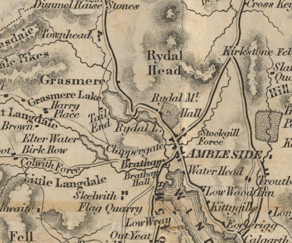 FD02NY30.jpg item:- JandMN : 100.1 Image © see bottom of page |
|||||||||||||
|
|
||||||||||||||
| evidence:- | old text:- Martineau 1855 |
|||||||||||||
| source data:- | Guide book, A Complete Guide to the English Lakes, by Harriet
Martineau, published by John Garnett, Windermere, Westmorland,
and by Whittaker and Co, London, 1855; published 1855-76. goto source Page 41:- "... at the top of the [Kirkstone] pass, ... he leaves the Troutbeck road to the left, and descends rapidly upon Ambleside, which is between three and four miles from the house [Kirkstone Inn]. On the left, is the valley or ravine of the Stock, whose waters are concealed by wood. The road runs along the slopes of the Scandale Fells. Below, Windermere opens more and more; and at length, the pretty little town of Ambleside appears, ..." |
|||||||||||||
|
|
||||||||||||||
| evidence:- | old print:- Goodwin 1887 (edn 1890) |
|||||||||||||
| source data:- | Print, etching? Kirkstone Pass, looking up The Struggle, Westmorland, by Harry Goodwin,
published by Swan Sonnenschein and Co, Paternoster Square, London, 1890.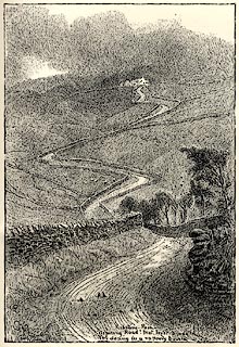 click to enlarge click to enlargePR1601.jpg Tipped in opposite p.160 of Through the Wordsworth Country, by William Knight. printed at lower centre:- "Kirkstone Pass / Aspiring road! that lov'st to hide / Thy daring in a vapoury bourn" item:- JandMN : 382.31 Image © see bottom of page |
|||||||||||||
|
|
||||||||||||||
| hearsay:- |
It was said:- |
|||||||||||||
| "He surely is an arrant ass Who pays to ride up Kirkstone Pass. He'll find in spite of all their talking, He'll have to walk, and pay for walking." |
||||||||||||||
|
|
||||||||||||||
| places:- | Ambleside Kirkstone Pass, Patterdale |
|||||||||||||
|
|
||||||||||||||
Lakes Guides menu.