Old Cumbria Gazetteer
 |
 |
|
||
| included in:- |
 road, Lancaster to Carlisle road, Lancaster to Carlisle |
|||
| road, Lancaster to Kendal E | ||||
| A6070 | ||||
| locality:- | Lancaster | |||
| county:- | Lancashire | |||
| civil parish:- | Burton-in-Kendal (formerly Westmorland) | |||
| civil parish:- | Holme (formerly Westmorland) | |||
| civil parish:- | Preston Patrick (formerly Westmorland) | |||
| civil parish:- | Preston Richard (formerly Westmorland) | |||
| civil parish:- | Stainton (formerly Westmorland) | |||
| civil parish:- | Natland (formerly Westmorland) | |||
| civil parish:- | Kendal (formerly Westmorland) | |||
| county:- | Cumbria | |||
| locality type:- | road route | |||
| 10Km square:- | SD46 | |||
| 10Km square:- | SD57 | |||
| 10Km square:- | SD58 | |||
| 10Km square:- | SD59 | |||
| SummaryText:- | the Easterly route through Burton | |||
|
|
||||
| evidence:- | old map:- OS County Series (Lan 19) |
|||
| source data:- | Maps, County Series maps of Great Britain, scales 6 and 25
inches to 1 mile, published by the Ordnance Survey, Southampton,
Hampshire, from about 1863 to 1948. "GARSTANG AND HERON SYKE TRUST" along road |
|||
|
|
||||
| evidence:- | old map:- Speed 1611 |
|||
| source data:- | Map, hand coloured engraving, The Countie Westmorland and
Kendale the Cheif Towne, scale about 2.5 miles to 1 inch, by
John Speed, 1610, published by George Humble, Popes Head Alley,
London, 1611-12.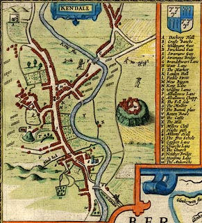 click to enlarge click to enlargeSP14Mk.jpg "Way to London" road, horseman galloping into town item:- Armitt Library : 2008.14.5 Image © see bottom of page |
|||
|
|
||||
| evidence:- | old map:- Ogilby 1675 |
|||
| source data:- | Road strip map, hand coloured engraving, continuation of the
Road from London to Carlisle, scale about 1 inch to 1 mile, by
John Ogilby, London, 1675.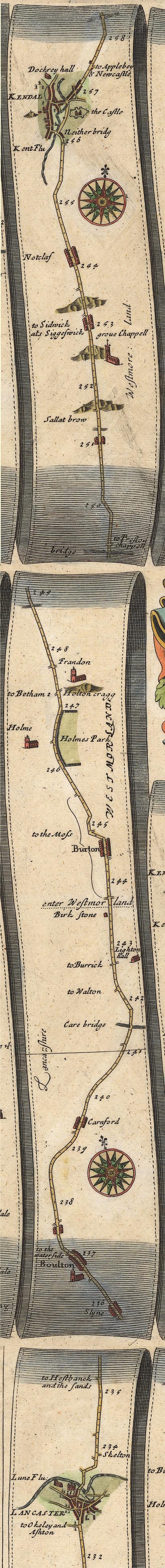 OG38LtoK.jpg item:- JandMN : 21 Image © see bottom of page |
|||
|
|
||||
| evidence:- | old map:- Morden 1695 (Wmd) |
|||
| source data:- | Map, hand coloured engraving, Westmorland, scale about 2.5 miles to 1 inch, by Robert
Morden, published by Abel Swale, the Unicorn, St Paul's Churchyard, Awnsham, and John
Churchill, the Black Swan, Paternoster Row, London, 1695.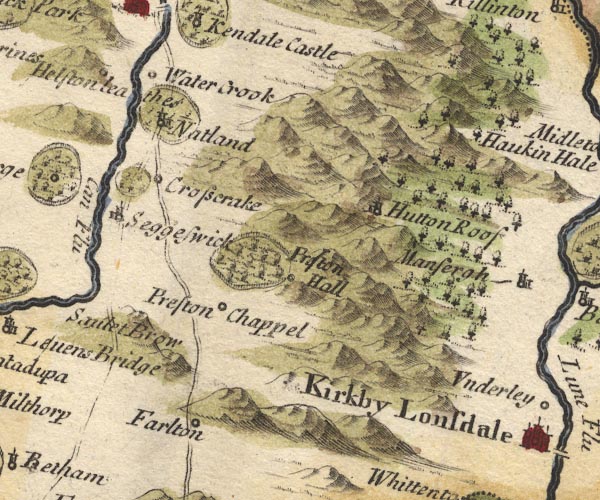 MD10SD58.jpg 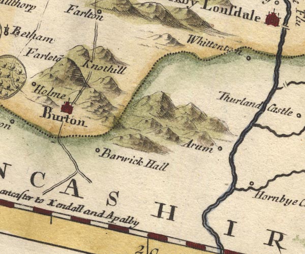 MD10SD57.jpg "From Lancaster to Kendall and Apalby" Double line, through Farleton. Double line, through Sedgwick, alternative route item:- JandMN : 24 Image © see bottom of page |
|||
|
|
||||
| evidence:- | descriptive text:- Fiennes 1698 |
|||
| source data:- | Travel book, manuscript record of Journeys through England
including parts of the Lake District, by Celia Fiennes, 1698. "Thence [Lancaster] I went to Kendall in Westmoreland over steepe stony hills all like rocks 6 miles to one Lady Middleton; ... had the advantage of going through her parke and saved the going round a bad stony passage; ...on to the road againe much of which was stony and steep far worse than the Peake in Darbyshire; ... thence to Kendall ten mile more, most of the way was in lanes when I was out of the stony hills, and then into inclosed lands; here in 6 mile to the town you have very good rich land enclosed, little round green hills flourishing with corn and grass as green and fresh being in the prime season in July; there is not much woods but ony the hedge rows round the grounds which looks very fine; in these Northern Countyes they have only the summer graine as barley oates peas beans and lentils noe wheate or rhye, for they are so cold and late in their yeare they cannot venture that sort of tillage, so have none but what they are supply'd out of other countys adjacent; the land seemes here in many places very fertile; ..." |
|||
|
|
||||
| evidence:- | old map:- Bowen 1720 (plate 93) |
|||
| source data:- | Strip maps, uncoloured engravings, road maps, The Road from
London to Carlisle, scale about 2 miles to 1 inch, with sections
in Lancashire and Westmorland, published by Emanuel Bowen, St
Katherines, London, 1720.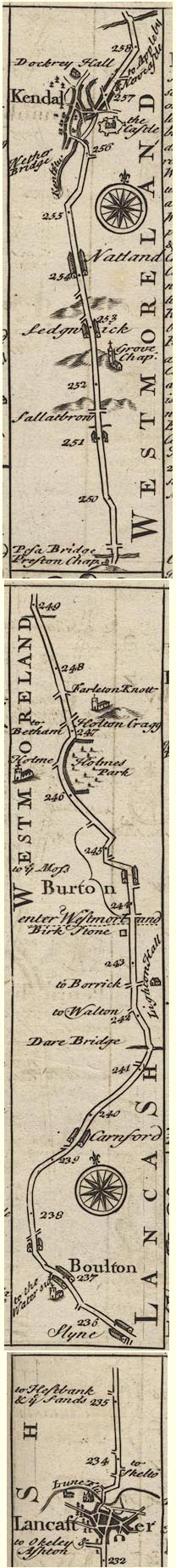 B093LtoK.jpg item:- Dove Cottage : 2007.38.100 Image © see bottom of page |
|||
|
|
||||
| evidence:- | old map:- Badeslade 1742 placename:- |
|||
| source data:- | Map, uncoloured engraving, A Map of Westmorland North from
London, scale about 10 miles to 1 inch, with descriptive text,
by Thomas Badeslade, London, engraved and published by William
Henry Toms, Union Court, Holborn, London, 1742. click to enlarge click to enlargeBD12.jpg "" double line, via Burton item:- Dove Cottage : 2007.38.62 Image © see bottom of page |
|||
|
|
||||
| evidence:- | old map:- Simpson 1746 map (Wmd) |
|||
| source data:- | Map, uncoloured engraving, Westmorland, scale about 8 miles to 1
inch, printed by R Walker, Fleet Lane, London, 1746. SMP2SDP.jpg  SMP2SDN.jpg "to Lancaster" Double line. item:- Dove Cottage : 2007.38.59 Image © see bottom of page |
|||
|
|
||||
| evidence:- | old map:- Bowen and Kitchin 1760 |
|||
| source data:- | Map, hand coloured engraving, A New Map of the Counties of
Cumberland and Westmoreland Divided into their Respective Wards,
scale about 4 miles to 1 inch, by Emanuel Bowen and Thomas
Kitchin et al, published by T Bowles, Robert Sayer, and John
Bowles, London, 1760.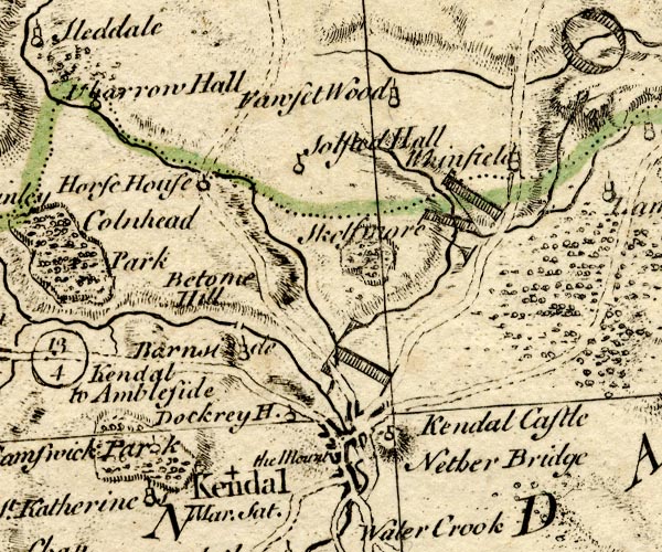 BO18SD49.jpg double line, solid 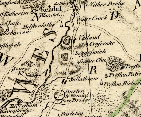 BO18SD48.jpg "Burton to Kendal 12 0" double line, solid, with a by road, road distance 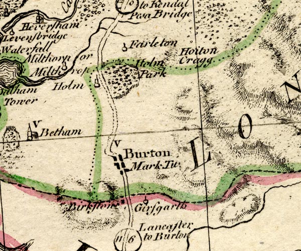 BO18SD47.jpg "Lancaster to Burton 11 6" double line, solid, road distance item:- Armitt Library : 2008.14.10 Image © see bottom of page |
|||
|
|
||||
| evidence:- | old map:- Kitchin 1767 (plate 40) |
|||
| source data:- | Road strip map, uncoloured engraving, The Road from London to
Carlisle, in Kitchin's Post Chaise Companion, by Thomas Kitchin,
published by Robert Sayer, 53 Fleet Street, John Bowles,
Cornhill, and Carington Bowles, St Paul's Church Yard, London,
1767. K040LtoK.jpg item:- Hampshire Museums : FA1999.138.40 Image © see bottom of page |
|||
|
|
||||
| evidence:- | old map:- Jefferys 1770 |
|||
| source data:- | Map, 4 sheets, The County of Westmoreland, scale 1 inch to 1
mile, surveyed 1768, and engraved and published by Thomas
Jefferys, London, 1770. J55191U.jpg road item:- National Library of Scotland : EME.s.47 Image © National Library of Scotland |
|||
|
|
||||
| evidence:- | old map:- Jefferys 1770 (Wmd) |
|||
| source data:- | Map, 4 sheets, The County of Westmoreland, scale 1 inch to 1
mile, surveyed 1768, and engraved and published by Thomas
Jefferys, London, 1770. J5SD59SW.jpg 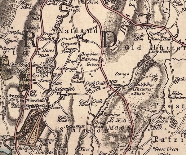 J5SD58NW.jpg 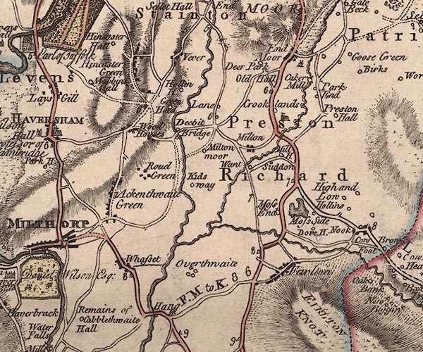 J5SD58SW.jpg 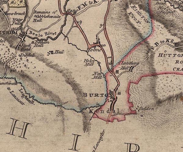 J5SD57NW.jpg "from Lancaster" double line; road, bold, main road, with mile numbers item:- National Library of Scotland : EME.s.47 Images © National Library of Scotland |
|||
|
|
||||
| evidence:- | descriptive text:- West 1778 (11th edn 1821) |
|||
| source data:- | Guide book, A Guide to the Lakes, by Thomas West, published by
William Pennington, Kendal, Cumbria once Westmorland, and in
London, 1778 to 1821. goto source Addendum; Mr Gray's Journal, 1769 Page 215:- "..." "Oct. 10. I proceeded by Burton to Lancaster, twenty-two miles; very good country, well inclosed and wooded, with some common interspersed. Passed at the foot of Farlton-knot, a high fell. Four miles north of Lancaster, on a rising ground, called Bolton ... we had a full view of Cartmel sands, with here and there a passenger riding over them (it being low water) the points of Furness shooting far into the sea, and lofty mountains, partly covered with clouds," goto sourcePage 216:- "extending north of them. Lancaster also appeared very conspicuous and fine; for its most distinguished features, the castle and church, mounted on a green eminence, were all that could be seen. ..." |
|||
|
|
||||
| evidence:- | old map:- Cary 1789 (edn 1805) |
|||
| source data:- | Map, uncoloured engraving, Westmoreland, scale about 2.5 miles
to 1 inch, by John Cary, London, 1789; edition 1805.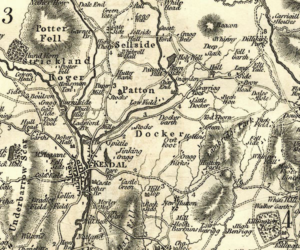 CY24SD59.jpg double line, bold light, numbered miles; main road, two routes 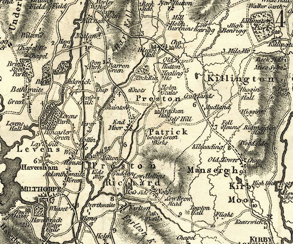 CY24SD58.jpg double line, bold light, numbered miles; main road; two routes 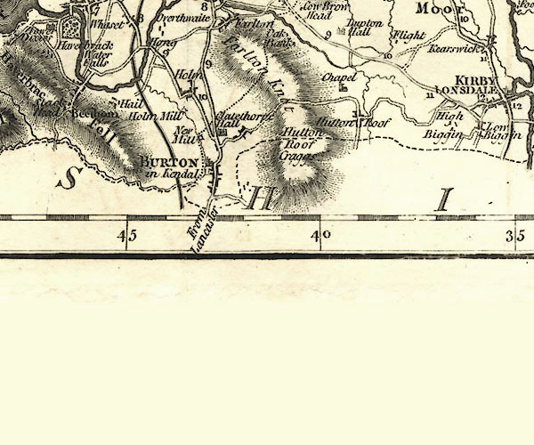 CY24SD57.jpg "From Lancaster" double line, bold light, numbered miles; main road; routes diverge north of Burton item:- JandMN : 129 Image © see bottom of page |
|||
|
|
||||
| evidence:- | road map:- Cary 1790 (Lan/edn 1792) |
|||
| source data:- | Road map, hand coloured engraving, Lancashire, scale about 18
miles to 1 inch, by John Cary, 181 Strand, London, 1790, edn
1792.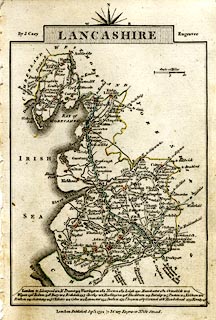 click to enlarge click to enlargeCY46.jpg "to Kendal" double line, with road distances from Lancaster item:- JandMN : 418 Image © see bottom of page |
|||
|
|
||||
| evidence:- | road map:- Cary 1790 (Wmd/edn 1792) |
|||
| source data:- | Road map, hand coloured engraving, Westmoreland, scale about
11.5 miles to 1 inch, by John Cary, 181 Strand, London, 1790,
edn 1792.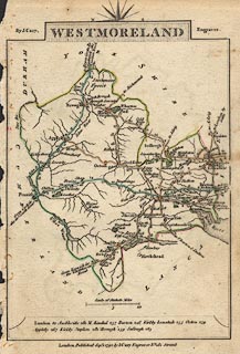 click to enlarge click to enlargeCY16.jpg "to Lancaster / London Rd." double line, with road distances from Kendal item:- JandMN : 44 Image © see bottom of page |
|||
|
|
||||
| evidence:- | road book:- Cary 1798 (2nd edn 1802) |
|||
| source data:- | Road book, itineraries, Cary's New Itinerary, by John Cary, 181
Strand, London, 2nd edn 1802. goto source click to enlarge click to enlargeC38267.jpg page 267-268 "LONDON, through Manchester and Carlisle, to Port Patrick" part of "Through Burton, on l. a T.R. to Milthorpe." alternative route through Burton "At Kendal ... on l. [T.Rs.] to Milthorpe, Ulverston, Winander Mere, and Ambleside." the Burton route joining at Kendal goto source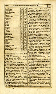 click to enlarge click to enlargeC38271.jpg page 271-272 "[PORT PATRICK to Northampton.]" part of reverse route goto source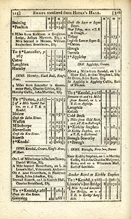 click to enlarge click to enlargeC38315.jpg page 315-316 "¾of a Mile beyond Burton, on r. a T.R. to Kendal." the main route off the Burton route goto source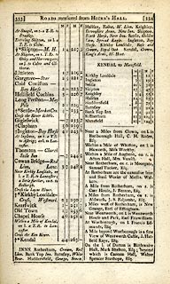 click to enlarge click to enlargeC38333.jpg page 333-334 "Within a Mile of Kendal [coming from Kirkby Lonsdale], on l. a T.R. to Lancaster." item:- JandMN : 228.1 Image © see bottom of page |
|||
|
|
||||
| evidence:- | old text:- Gents Mag item:- accident; mail coach |
|||
| source data:- | Magazine, The Gentleman's Magazine or Monthly Intelligencer or
Historical Chronicle, published by Edward Cave under the
pseudonym Sylvanus Urban, and by other publishers, London,
monthly from 1731 to 1922. goto source Gentleman's Magazine 1799 p.157 "Jan. 15. A shocking accident happened this evening at Carnforth, about 5 miles from Lancaster, As one of the stage coaches, generally termed the opposition coach, was proceeding to Kendal, the box on which the driver sat was by some means forced to one side rather suddenly; in consequence of which he fell to the ground, and the wheels instantly passing over his head occasioned his immediate death. He has left a widow and four small children." |
|||
|
|
||||
| evidence:- | old map:- Cooke 1802 |
|||
| source data:- | Map, Westmoreland ie Westmorland, scale about 12 miles to 1
inch, by George Cooke, 1802, published by Sherwood, Jones and
Co, Paternoster Road, London, 1824. click to enlarge click to enlargeGRA1Wd.jpg "to Lancaster London R." double line, feathered edges; post road? item:- Hampshire Museums : FA2000.62.4 Image © see bottom of page |
|||
|
|
||||
| evidence:- | old map:- Laurie and Whittle 1806 |
|||
| source data:- | Road map, Completion of the Roads to the Lakes, scale about 10
miles to 1 inch, by Nathaniel Coltman? 1806, published by Robert
H Laurie, 53 Fleet Street, London, 1834. click to enlarge click to enlargeLw18.jpg double line, light bold; 'Mail-Coach Roads (Direct)' item:- private collection : 18.18 Image © see bottom of page |
|||
|
|
||||
| evidence:- | old map:- Cooper 1808 |
|||
| source data:- | Map, hand coloured engraving, Westmoreland ie Westmorland, scale
about 9 miles to 1 inch, by H Cooper, 1808, published by R
Phillips, Bridge Street, Blackfriars, London, 1808. click to enlarge click to enlargeCOP4.jpg item:- Dove Cottage : 2007.38.53 Image © see bottom of page |
|||
|
|
||||
| evidence:- | old map:- Wallis 1810 (Wmd) |
|||
| source data:- | Road map, Westmoreland, scale about 19 miles to 1 inch, by James
Wallis, 77 Berwick Street, Soho, 1810, published by W Lewis,
Finch Lane, London, 1835? click to enlarge click to enlargeWAL5.jpg double line, hatched; 'Mail Coach Road', through Burton item:- JandMN : 63 Image © see bottom of page |
|||
|
|
||||
| evidence:- | old map:- Hall 1820 (Wmd) |
|||
| source data:- | Map, hand coloured engraving, Westmoreland ie Westmorland, scale
about 14.5 miles to 1 inch, by Sidney Hall, London, 1820,
published by Samuel Leigh, 18 Strand, London, 1820-31. click to enlarge click to enlargeHA18.jpg double line, solid; main road; through Burton; Burton, Preston Richard, Kendal item:- Armitt Library : 2008.14.58 Image © see bottom of page |
|||
|
|
||||
| evidence:- | old map:- Ford 1839 map |
|||
| source data:- | Map, uncoloured engraving, Map of the Lake District of
Cumberland, Westmoreland and Lancashire, scale about 3.5 miles
to 1 inch, published by Charles Thurnam, Carlisle, and by R
Groombridge, 5 Paternoster Row, London, 3rd edn 1843.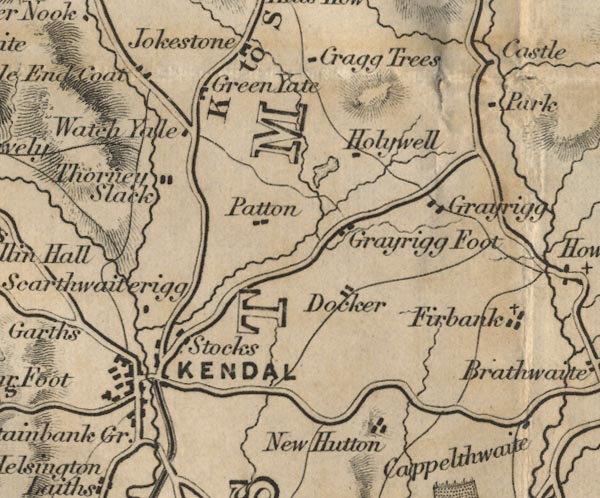 FD02SD59.jpg 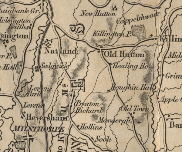 FD02SD58.jpg 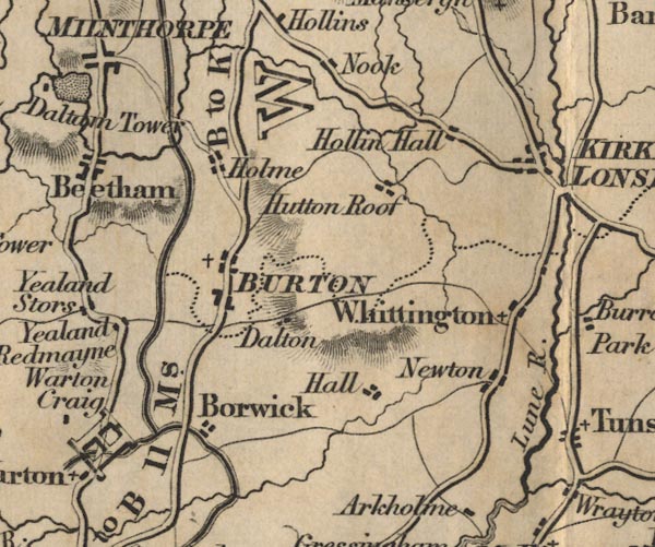 FD02SD57.jpg "B to K 11 Ms." "L to B 11 Ms." Distances from Burton.  FD02SD56.jpg  FD02SD46.jpg item:- JandMN : 100.1 Image © see bottom of page |
|||
|
|
||||
| evidence:- | old map:- Garnett 1850s-60s H |
|||
| source data:- | Map of the English Lakes, in Cumberland, Westmorland and
Lancashire, scale about 3.5 miles to 1 inch, published by John
Garnett, Windermere, Westmorland, 1850s-60s. GAR2SD59.jpg double line, bold light, major road  GAR2SD58.jpg  GAR2SD57.jpg  GAR2SD46.jpg item:- JandMN : 82.1 Image © see bottom of page |
|||
|
|
||||
| evidence:- | gradient diagram:- Gall and Inglis 1890s-1900s (Roads) |
|||
| source data:- | Contour Road Book of England, Northern Division, by Harry R G Inglis, published by
Gall and Inglis, 25 Paternoster Square, London and Edinburgh, 1898.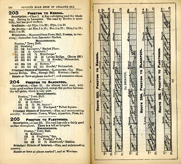 click to enlarge click to enlargeIG5203.jpg Itinerary, with gradient diagram, route 203, Preston to Kendal, Lancashire and Westmorland, 1898. item:- JandMN : 763.24 Image © see bottom of page |
|||
|
|
||||
| evidence:- | old text:- Harper 1907 item:- milestone |
|||
| source data:- | HP01p094.txt Page 94:- "... in a choice of routes to Kendal, by Milnthorpe or by Burton-in-Kendal, we take the second, past the "Longlands" inn; where traces of an older road to Kendal are to be found. A mile onward, a considerable stretch of it, on the left hand of the present highway, exists as a deserted lane, very narrow here and there, and overgrown with grass. In general, however, farmers have gradually abolished it and added it to their pastures, and even this surviving stretch is in process of being similarly swallowed and digested. Portions of it are not without their romantic aspects: as where a huge granite crag, called from time immemorial "the Buckstone," stands in the hedgerow and recalls the trials of travellers in a bygone age, when roads were little better than winding tracks and sign-posts did not exist. They went, those palpitating travellers, as directed, "past the Buckstone," standing for centuries as sure a landmark as anything in this countryside. And now it is forgotten, except by the farming and field-folk and those whose business or pleasure is in the byways and hedges. ..." HP01p097.txt Page 97:- "... Burton-in-Kendal; but before you reach that decayed town the old road is cut off and a modern lane leads on the right into the highway, past Dalton Park, through whose grounds the old road ran its winding way. Still, a few yards within the Park wall, may be seen, amid the trees, a rude milestone, bearing nothing by way of inscription save the figure "10." This, if you please, was the curt way of informing travellers that they were ten miles from Lancaster. It is obvious that old-time wayfarers had to bring some native understanding with them." "..." HP01p098.txt Page 98:- "..." "On the night of April 30th, 1812, some evil-disposed persons placed no fewer than eleven gates across the road between Lancaster and Burton-in-Kendal, with intent to upset the mail; which indeed only narrowly escaped. These scoundrels were never caught." HP01p102.txt Page 102:- "..." 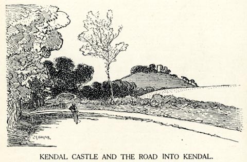 click to enlarge click to enlargeHP0106.jpg "KENDAL CASTLE AND THE ROAD INTO KENDAL." item:- JandMN : 1055.7 Image © see bottom of page |
|||
|
|
||||
 Act of Parliament Act of Parliament |
||||
|
|
||||
| places:- | Lancaster, Lancashire Slyne, Lancashire Carnforth, Lancashire Heron Syke, Burton-in-Kendal Burton-in-Kendal Farleton, Beetham Stainton Natland Kendal |
|||
|
|
||||
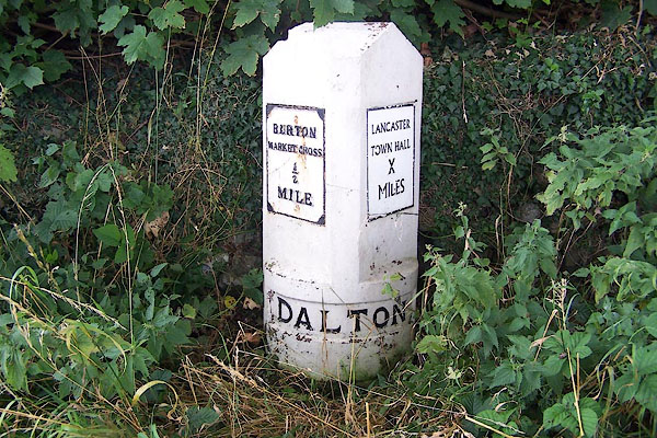
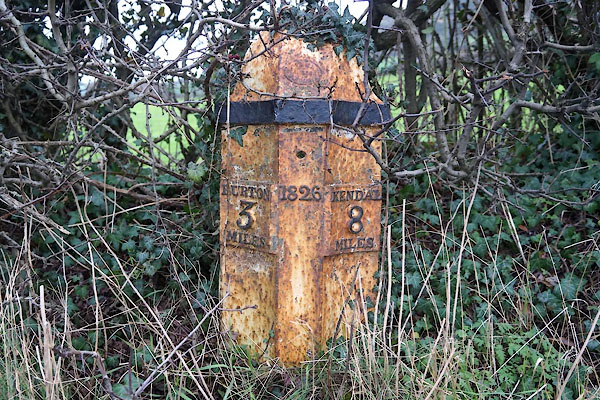
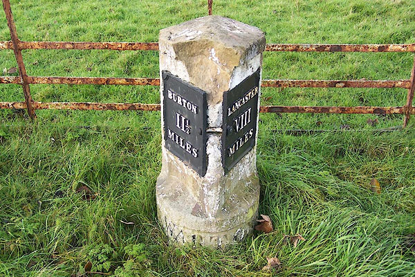
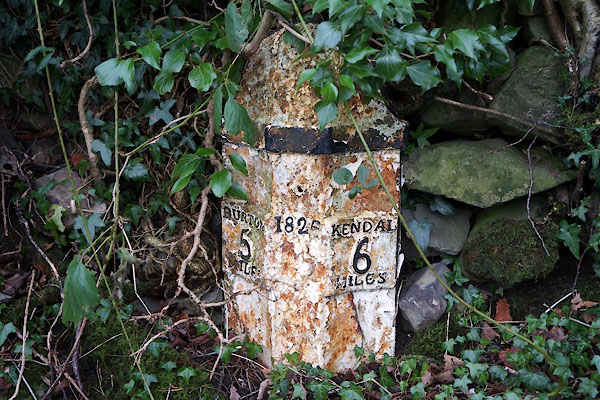
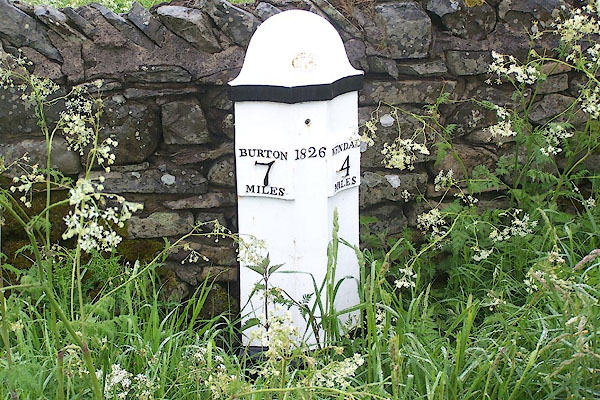
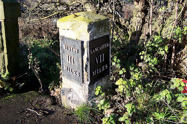
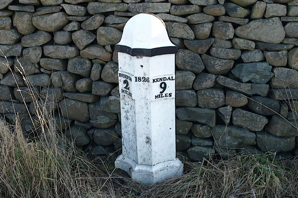
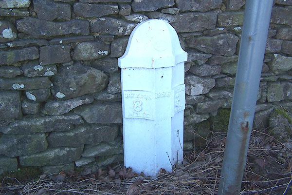
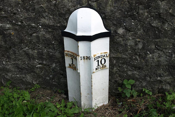
| milestones:- | Milestones in order. on A6 in Lancashire, A6070 to Farleton, A65 toKendal milestone, Lancashire (3) milestone, Lancashire milestone, Lancashire (2) milestone, Burton-in-Kendal milestone, Burton-in-Kendal (2) milestone, Burton-in-Kendal (3) milestone, Holme (4) milestone, Farleton milestone, Preston Patrick (2) milestone, Preston Richard (3) milestone, Preston Richard (2) milestone, Stainton milestone, Natland milestone, Kendal (10) milestone, Kendal (4) milestone, Kendal (3) |
|||
|
|
||||
| places:- |
|
|||
|
||||
|
||||
|
||||
|
||||
|
||||
|
||||
|
||||
|
||||
|
||||
|
||||
|
||||
|
||||
|
||||
|
||||
|
||||
|
||||
Lakes Guides menu.