 Old Cumbria Gazetteer
 |
 |
|
| milestone, Farleton | ||
| site name:- | road, Lancaster to Kendal E | |
| locality:- | Farleton | |
| civil parish:- | Beetham (formerly Westmorland) | |
| county:- | Cumbria | |
| locality type:- | milestone | |
| coordinates:- | SD53378128 | |
| 1Km square:- | SD5381 | |
| 10Km square:- | SD58 | |
| references:- | OS 2000s Explorer |
|
|
|
||
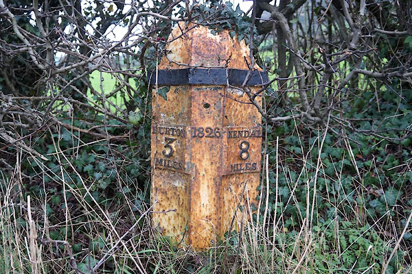 CEM31.jpg Cast iron:- "BURTON / 3 / MILES" "1826" "KENDAL / 8 / MILES" (taken 1.1.2016) |
||
|
|
||
| evidence:- | old map:- Jefferys 1770 (Wmd) |
|
| source data:- | Map, 4 sheets, The County of Westmoreland, scale 1 inch to 1
mile, surveyed 1768, and engraved and published by Thomas
Jefferys, London, 1770.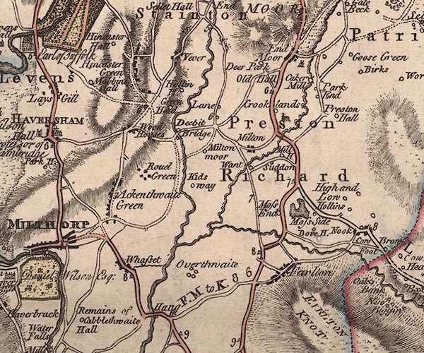 J5SD58SW.jpg "8" milestone marked by road item:- National Library of Scotland : EME.s.47 Image © National Library of Scotland |
|
|
|
||
| evidence:- | database:- Listed Buildings 2010 |
|
| source data:- | courtesy of English Heritage "MILEPOST 80 METRES SOUTH OF ENTRANCE TO GREEN CLOSE / / A6070 / BEETHAM / SOUTH LAKELAND / CUMBRIA / II / 76561 / SD5337381284" |
|
| source data:- | courtesy of English Heritage "Milepost. Dated 1826. Cast-iron. Half-hexagonal with fluted faces and domed top. Painted black and white. Marked:" "BURTON / 3 / MILES" "on North side and" "KENDAL / 8 / MILES" "on South side" "One of series of similar milestones and boundary stones on Heronsyke Turnpike Road, the building of which was supervised by John McAdam." |
|
|
|
||
 Lakes Guides menu.