 Jansson 1646 SD48


|

|
|
|
gazetteer links places may or may not be labelled on the map |
||

|
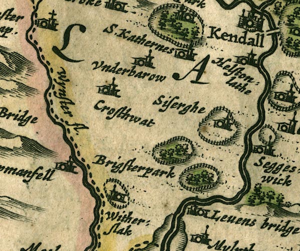
-- Brigsteer Park -- "Brigsterpark" |
|
|
|
-- Cartmel Fell -- "Carpmanfell" |
|
|
|
-- Crosthwaite -- "Crosthwat" |
|
|
|
-- Helsington Laithes -- "Helstonlathe" |
|
|
|
-- Kent, River |
|
|
|
-- Levens Bridge -- "[Levens bridge]" |
|
|
|
-- Levens Hall -- "Levens bridge" |
|
|
|
-- Levens Park |
|
|
|
-- Sizergh Castle -- "Siserghe" |
|
|
|
-- St Catherine's Church -- "S. Kathernes" |
|
|
|
-- Underbarrow -- "Underbarow" |
|
|
|
-- Winster, River -- "Wynster fl." |
|
|
|
-- Witherslack Hall -- "Witherslak" |
|
|
civil parishes The area roughly includes parts of parishes:- Broughton East Staveley-in-Cartmel Underbarrow and Bradleyfield Heversham Witherslack Beetham Meathop and Ulpha Milnthorpe Cartmel Fell Crosthwaite and Lyth Levens Helsington Upper Allithwaite Grange-over-Sands |
||
|
|
||
|
|
Lakes Guides menu. | |