 Garnett 1850s-60s SD46


|

|
|
|
gazetteer links places may or may not be labelled on the map |
||

|
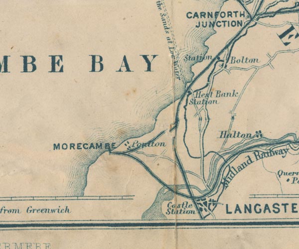
-- Bolton-le-SandsBolton-le-Sands -- "Bolton" |
|
|
|
-- Lancaster and Carlisle Railway -- "Lancaster & Carlisle
Railway" -- "Lancaster & Carlisle Railway" |
|
|
|
-- Lancaster Canal |
|
|
|
-- Lancaster Castle Station -- "Castle Station" |
|
|
|
-- Lune, River -- "R. Lune" -- "R. Lune" --
"R. Lune" |
|
|
|
-- Morecambe Bay -- "MORECAMBE BAY" -- "MORECAMBE
BAY" |
|
|
|
-- North Western Railway -- "Midland Railway" |
|
|
|
-- Lancaster to Kendal |
|
|
|
-- Lancaster Sands Road -- "Road across the Sands at Low
Water" |
|
|
civil parishes The area roughly includes parts of parishes:- Lower Allithwaite Lower Holker |
||
|
|
||
|
|
Lakes Guides menu. | |