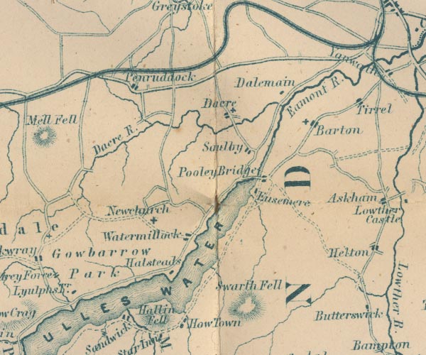
 Garnett 1850s-60s NY42


|

|
|
|
gazetteer links places may or may not be labelled on the map |
||

|
-- All Saints Church -- "Newchurch" |
|
|
|
-- Barton -- "Barton" |
|
|
|
-- Cockermouth, Keswick and Penrith Railway |
|
|
|
-- Dacre Beck -- "Dacre R." |
|
|
|
-- Dacre -- "Dacre" |
|
|
|
-- Dalemain -- "Dalemain" |
|
|
|
-- Eamont, River -- "R. Eamont" -- "Eamont
R." |
|
|
|
-- Eusemere -- "Eusemere" |
|
|
|
-- Gowbarrow Park -- "Gowbarrow Park" |
|
|
|
-- Hallin Fell -- "Hallin Fell" |
|
|
|
-- Hallsteads -- "Halsteads" |
|
|
|
-- Penruddock -- "Penruddock" |
|
|
|
-- Pooley Bridge -- "Pooley Bridge" |
|
|
|
-- Soulby -- "Soulby" |
|
|
|
-- St Andrew's Church |
|
|
|
-- St Michael's Church |
|
|
|
-- Swarth Fell -- "Swarth Fell" |
|
|
|
-- Ullswater -- "ULLES WATER" |
|
|
|
-- Watermillock -- "Watermillock" |
|
|
civil parishes The area roughly includes parts of parishes:- Sockbridge and Tirril Penrith Martindale Bampton Barton Askham Catterlen Mungrisdale Greystoke Hutton Dacre Matterdale |
||
|
|
||
|
|
Lakes Guides menu. | |