 Old Cumbria Gazetteer
 |
 |
|
| Eusemere, Barton | ||
| Eusemere | ||
| Eusemerehill | ||
| locality:- | Pooley Bridge | |
| civil parish:- | Barton (formerly Westmorland) | |
| county:- | Cumbria | |
| locality type:- | buildings | |
| coordinates:- | NY46952414 | |
| 1Km square:- | NY4624 | |
| 10Km square:- | NY42 | |
|
|
||
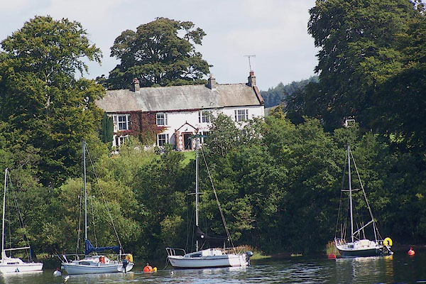 BNZ68.jpg (taken 24.8.2007) 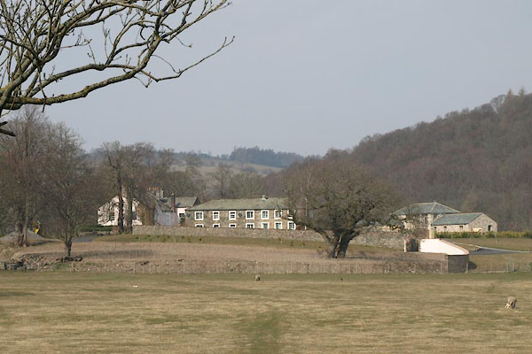 BYB94.jpg (taken 10.4.2013) |
||
|
|
||
| evidence:- | old map:- OS County Series (Wmd 7 6) placename:- Eusemerehill |
|
| source data:- | Maps, County Series maps of Great Britain, scales 6 and 25
inches to 1 mile, published by the Ordnance Survey, Southampton,
Hampshire, from about 1863 to 1948. |
|
|
|
||
| evidence:- | old map:- Crosthwaite 1783-94 (Ull) placename:- Euse Mere Hill |
|
| source data:- | Map, uncoloured engraving, Accurate Map of the Beautiful Lake of
Ullswater, scale about 3 inches to 1 mile, by Peter Crosthwaite,
Keswick, Cumberland, 1783, version published 1800.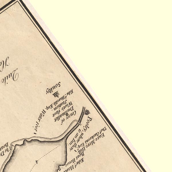 CT5NY42S.jpg "Euse Mere Hill / Thos. Clarkson's Esqr." item:- Armitt Library : 1959.191.7 Image © see bottom of page |
|
|
|
||
| evidence:- | old map:- Clarke 1787 map (Ullswater) placename:- Ouzemire |
|
| source data:- | Map, A Map of the Lake Ullswater and its Environs, scale about
6.5 ins to 1 mile, by James Clarke, engraved by S J Neele, 352
Strand, published by James Clarke, Penrith, Cumberland and in
London etc, 1787.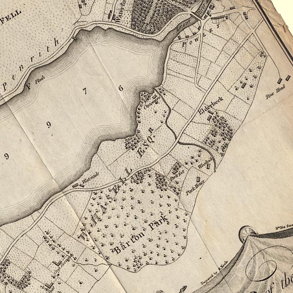 CL4NY42R.jpg "Ouzemire" item:- private collection : 10.4 Image © see bottom of page |
|
|
|
||
| evidence:- | old map:- Otley 1818 placename:- Eusemere |
|
| source data:- | Map, uncoloured engraving, The District of the Lakes,
Cumberland, Westmorland, and Lancashire, scale about 4 miles to
1 inch, by Jonathan Otley, 1818, engraved by J and G Menzies,
Edinburgh, Scotland, published by Jonathan Otley, Keswick,
Cumberland, et al, 1833.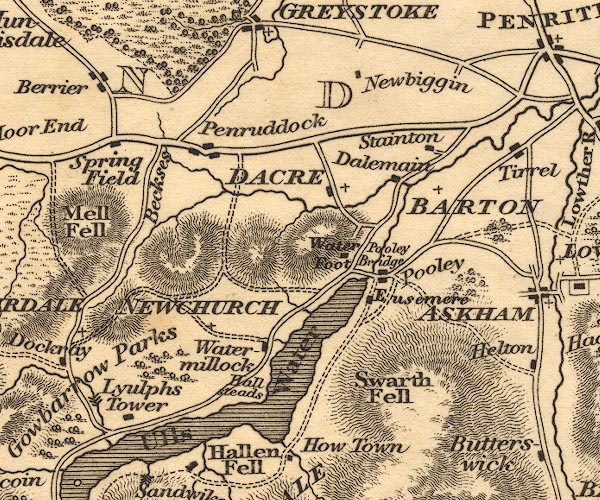 OT02NY42.jpg item:- JandMN : 48.1 Image © see bottom of page |
|
|
|
||
| evidence:- | old map:- Garnett 1850s-60s H placename:- Eusemere |
|
| source data:- | Map of the English Lakes, in Cumberland, Westmorland and
Lancashire, scale about 3.5 miles to 1 inch, published by John
Garnett, Windermere, Westmorland, 1850s-60s.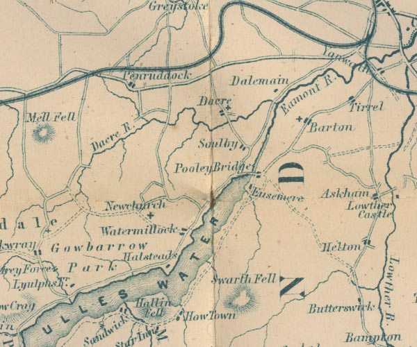 GAR2NY42.jpg "Eusemere" block, building item:- JandMN : 82.1 Image © see bottom of page |
|
|
|
||
| evidence:- | old photograph:- Bell 1880s-1940s |
|
| source data:- | Photograph, black and white, Eusemere, Pooley Bridge, Barton, Westmorland, by Herbert
Bell, Ambleside, Westmorland, 1890s.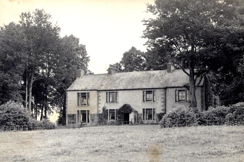 click to enlarge click to enlargeHB0531.jpg item:- Armitt Library : ALPS194 Image © see bottom of page |
|
|
|
||
| evidence:- | old photograph:- Bell 1880s-1940s |
|
| source data:- | Photograph, black and white, Eusemere, Pooley Bridge, Barton, Westmorland, by Herbert
Bell, Ambleside, Westmorland, 1890s.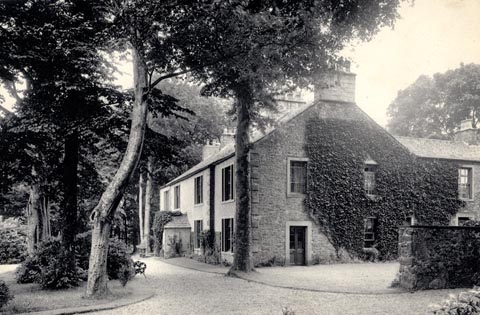 click to enlarge click to enlargeHB0537.jpg item:- Armitt Library : 1958.5145 Image © see bottom of page |
|
|
|
||
| evidence:- | old photograph:- Bell 1880s-1940s |
|
| source data:- | Photograph, b/w, Eusemere, Barton, Westmorland, by Herbert Bell, Ambleside, Westmorland,
1890s?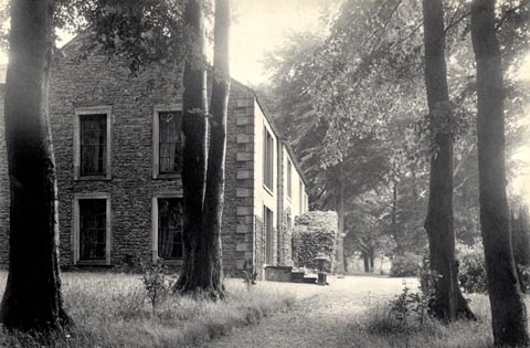 click to enlarge click to enlargeHB0302.jpg item:- Armitt Library : ALPS661 Image © see bottom of page |
|
|
|
||
| hearsay:- |
Thomas Clarkson was a campaigner against the slave trade. His wife was a friend of
Dorothy Wordsworth, and his portait hangs in Dove Cottage. |
|
|
|
||
| personal | ||
| person:- | : Clarkson, Thomas |
|
| place:- | home | |
|
|
||
 Lakes Guides menu.