Old Cumbria Gazetteer
 |
 |
|
||
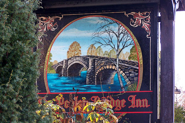
| Pooley Bridge, Barton | ||||
| Pooley Bridge | ||||
| Poolah | ||||
| civil parish:- | Barton (formerly Westmorland) | |||
| county:- | Cumbria | |||
| locality type:- | locality | |||
| locality type:- | buildings | |||
| locality type:- | market town (?) | |||
| coordinates:- | NY47082444 (etc) | |||
| 1Km square:- | NY4724 | |||
| 10Km square:- | NY42 | |||
|
|
||||
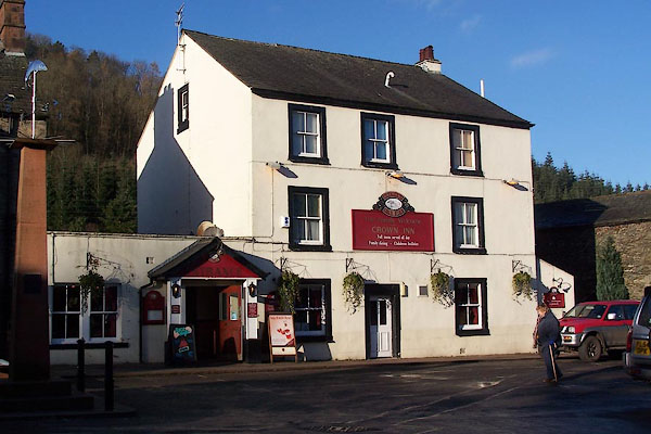
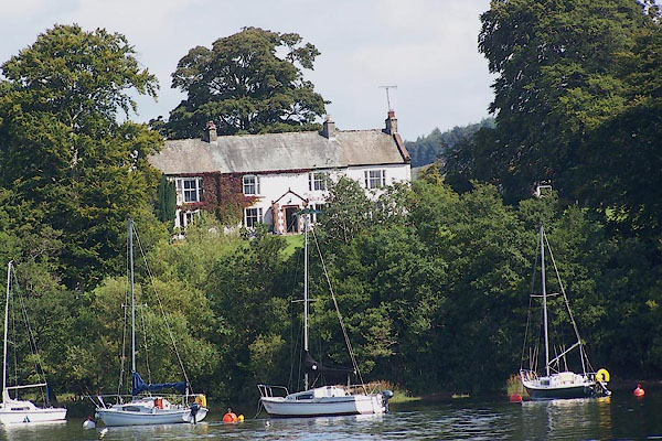
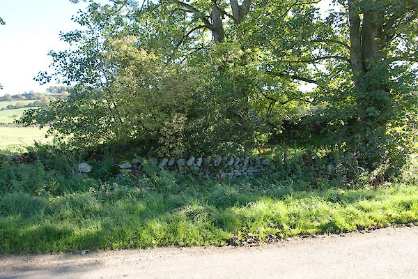
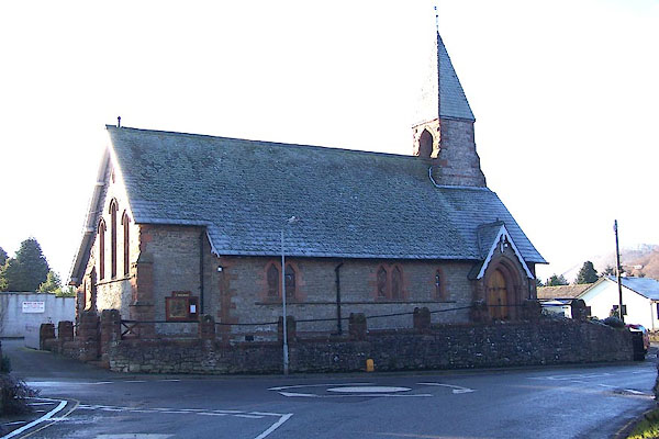
 BTR79.jpg (taken 20.10.2010) |
||||
|
|
||||
| evidence:- | old map:- OS County Series (Wmd 7 6) placename:- Pooleybridge |
|||
| source data:- | Maps, County Series maps of Great Britain, scales 6 and 25
inches to 1 mile, published by the Ordnance Survey, Southampton,
Hampshire, from about 1863 to 1948. |
|||
|
|
||||
| evidence:- | old map:- Saxton 1579 placename:- Pole |
|||
| source data:- | Map, hand coloured engraving, Westmorlandiae et Cumberlandiae Comitatus ie Westmorland
and Cumberland, scale about 5 miles to 1 inch, by Christopher Saxton, London, engraved
by Augustinus Ryther, 1576, published 1579-1645.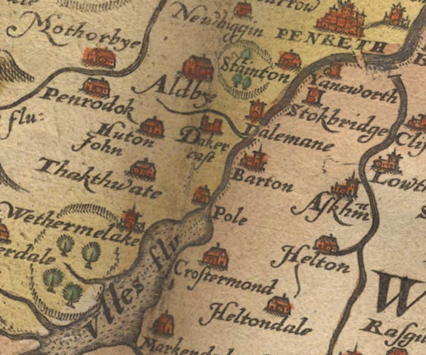 Sax9NY42.jpg Building, symbol for a hamlet, which may or may not have a nucleus. "Pole" On the wrong side of the river? item:- private collection : 2 Image © see bottom of page |
|||
|
|
||||
| evidence:- | old map:- Mercator 1595 (edn?) placename:- Pole |
|||
| source data:- | Map, hand coloured engraving, Northumbria, Cumberlandia, et
Dunelmensis Episcopatus, ie Northumberland, Cumberland and
Durham etc, scale about 6.5 miles to 1 inch, by Gerard Mercator,
Duisberg, Germany, about 1595.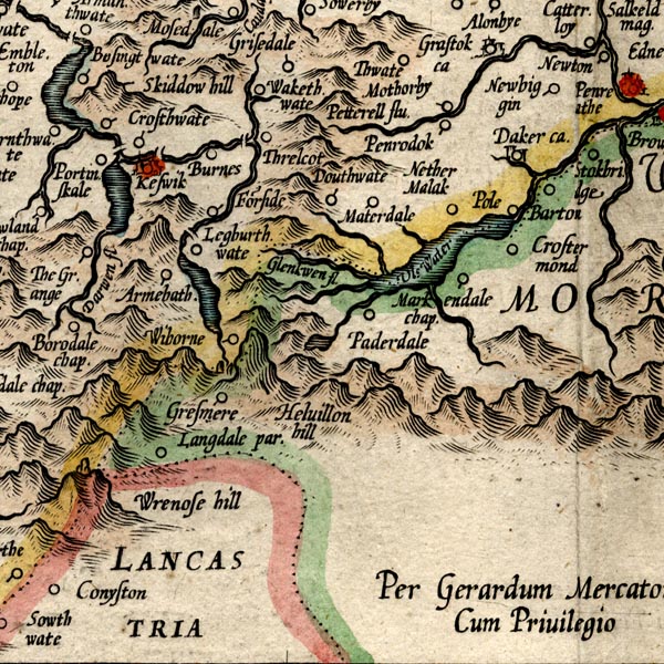 MER8CumF.jpg "Pole" circle, plotted in Cumberland not Westmorland item:- JandMN : 169 Image © see bottom of page |
|||
|
|
||||
| evidence:- | possibly old map:- Keer 1605 placename:- Iole |
|||
| source data:- | Map, hand coloured engraving, Westmorland and Cumberland, scale
about 16 miles to 1 inch, probably by Pieter van den Keere, or
Peter Keer, about 1605 edition perhaps 1676. click to enlarge click to enlargeKER8.jpg "Iole" dot, circle and tower; village item:- Dove Cottage : 2007.38.110 Image © see bottom of page |
|||
|
|
||||
| evidence:- | old map:- Speed 1611 (Cmd) placename:- Pole |
|||
| source data:- | Map, hand coloured engraving, Cumberland and the Ancient Citie
Carlile Described, scale about 4 miles to 1 inch, by John Speed,
1610, published by J Sudbury and George Humble, Popes Head
Alley, London, 1611-12. SP11NY42.jpg "Pole" circle, tower; on the wrong side of the river item:- private collection : 16 Image © see bottom of page |
|||
|
|
||||
| evidence:- | old map:- Speed 1611 (Wmd) placename:- Pole |
|||
| source data:- | Map, hand coloured engraving, The Countie Westmorland and
Kendale the Cheif Towne, scale about 2.5 miles to 1 inch, by
John Speed, 1610, published by George Humble, Popes Head Alley,
London, 1611-12. SP14NY42.jpg "Pole" circle, building and tower item:- Armitt Library : 2008.14.5 Image © see bottom of page |
|||
|
|
||||
| evidence:- | old map:- Jenner 1643 placename:- Pole |
|||
| source data:- | Tables of distances with a maps, Westmerland, scale about 16
miles to 1 inch, and Cumberland, scale about 21 miles to 1 inch,
published by Thomas Jenner, London, 1643; published 1643-80. JEN4Sq.jpg "Pole" circle |
|||
|
|
||||
| evidence:- | old map:- Jansson 1646 placename:- Pole |
|||
| source data:- | Map, hand coloured engraving, Cumbria and Westmoria, ie
Cumberland and Westmorland, scale about 3.5 miles to 1 inch, by
John Jansson, Amsterdam, Netherlands, 1646.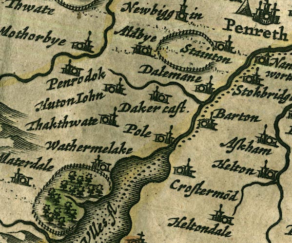 JAN3NY42.jpg "Pole" Buildings and tower. item:- JandMN : 88 Image © see bottom of page |
|||
|
|
||||
| evidence:- | hearth tax returns:- Hearth Tax 1670 placename:- Powley in Barton Parish |
|||
| source data:- | Records, hearth tax returns, exchequer duplicates, Westmorland,
1670. "Powley in Barton Parish" |
|||
|
|
||||
| evidence:- | old map:- Morden 1695 (Cmd) placename:- Pole |
|||
| source data:- | Map, uncoloured engraving, Cumberland, scale about 4 miles to 1
inch, by Robert Morden, 1695, published by Abel Swale, the
Unicorn, St Paul's Churchyard, Awnsham, and John Churchill, the
Black Swan, Paternoster Row, London, 1695-1715.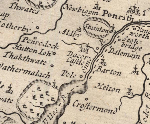 MD12NY42.jpg "Pole" Circle. item:- JandMN : 90 Image © see bottom of page |
|||
|
|
||||
| evidence:- | old map:- Morden 1695 (Wmd) placename:- Pooley |
|||
| source data:- | Map, hand coloured engraving, Westmorland, scale about 2.5 miles to 1 inch, by Robert
Morden, published by Abel Swale, the Unicorn, St Paul's Churchyard, Awnsham, and John
Churchill, the Black Swan, Paternoster Row, London, 1695.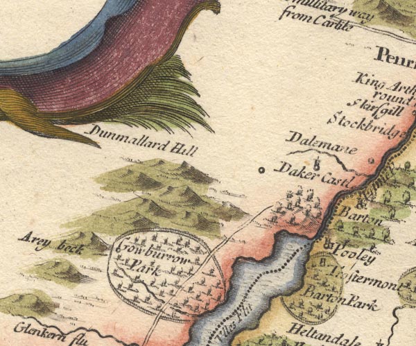 MD10NY42.jpg "Pooley" Circle, building and tower. item:- JandMN : 24 Image © see bottom of page |
|||
|
|
||||
| evidence:- | old map:- Badeslade 1742 placename:- Pooley |
|||
| source data:- | Map, uncoloured engraving, A Map of Westmorland North from
London, scale about 10 miles to 1 inch, with descriptive text,
by Thomas Badeslade, London, engraved and published by William
Henry Toms, Union Court, Holborn, London, 1742. click to enlarge click to enlargeBD12.jpg "Pooley" circle, italic lowercase text; village, hamlet or locality item:- Dove Cottage : 2007.38.62 Image © see bottom of page |
|||
|
|
||||
| evidence:- | old map:- Simpson 1746 map (Wmd) placename:- Pooley |
|||
| source data:- | Map, uncoloured engraving, Westmorland, scale about 8 miles to 1
inch, printed by R Walker, Fleet Lane, London, 1746.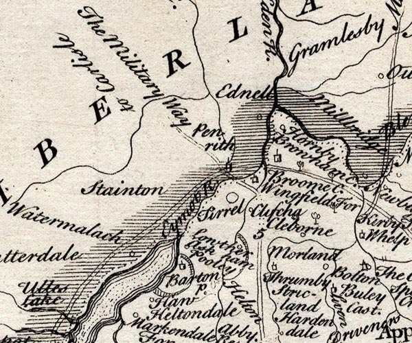 SMP2NYL.jpg "Pooley" Circle. item:- Dove Cottage : 2007.38.59 Image © see bottom of page |
|||
|
|
||||
| evidence:- | old map:- Bowen and Kitchin 1760 placename:- Powley placename:- Pooley |
|||
| source data:- | Map, hand coloured engraving, A New Map of the Counties of
Cumberland and Westmoreland Divided into their Respective Wards,
scale about 4 miles to 1 inch, by Emanuel Bowen and Thomas
Kitchin et al, published by T Bowles, Robert Sayer, and John
Bowles, London, 1760.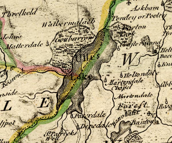 BO18NY31.jpg "Powley or Pooley" circle, tower item:- Armitt Library : 2008.14.10 Image © see bottom of page |
|||
|
|
||||
| evidence:- | old map:- Jefferys 1770 (Wmd) placename:- Pooley |
|||
| source data:- | Map, 4 sheets, The County of Westmoreland, scale 1 inch to 1
mile, surveyed 1768, and engraved and published by Thomas
Jefferys, London, 1770.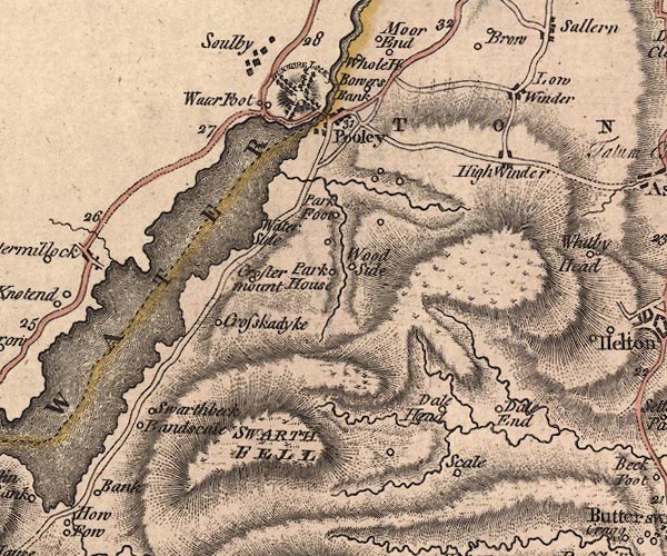 J5NY42SE.jpg "Pooley" blocks, labelled in upright lowercase text; settlement; town? item:- National Library of Scotland : EME.s.47 Image © National Library of Scotland |
|||
|
|
||||
| evidence:- | old map:- Donald 1774 (Cmd) placename:- Pooly Bridge |
|||
| source data:- | Map, hand coloured engraving, 3x2 sheets, The County of Cumberland, scale about 1
inch to 1 mile, by Thomas Donald, engraved and published by Joseph Hodskinson, 29
Arundel Street, Strand, London, 1774. D4NY42SE.jpg "Pooly Bridge" block or blocks, labelled in lowercase; a hamlet or just a house item:- Carlisle Library : Map 2 Image © Carlisle Library |
|||
|
|
||||
| evidence:- | old map:- Crosthwaite 1783-94 (Ull) placename:- Pooley |
|||
| source data:- | Map, uncoloured engraving, Accurate Map of the Beautiful Lake of
Ullswater, scale about 3 inches to 1 mile, by Peter Crosthwaite,
Keswick, Cumberland, 1783, version published 1800. CT5NY42S.jpg "Pooley, where there is an Inn" item:- Armitt Library : 1959.191.7 Image © see bottom of page |
|||
|
|
||||
| evidence:- | old text:- Clarke 1787 placename:- Powley placename:- Poolah item:- boat; rowing boat |
|||
| source data:- | Guide book, A Survey of the Lakes of Cumberland, Westmorland,
and Lancashire, written and published by James Clarke, Penrith,
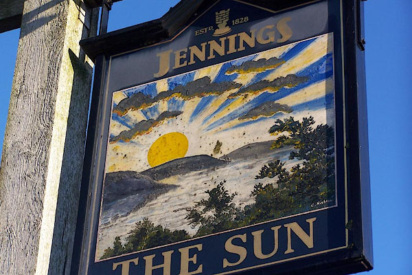
Cumberland, and in London etc, 1787; published 1787-93. goto source goto sourcePage 25:- "... to the little village of Powley, or, as it is pronounced Poolah. As the beauties of the Lake can no otherwise be seen to perfection, we must here embark for that delightful expedition: this we may do either in one of the boats kept by Edward Richardson, at the sign of the Sun, or in that with which the Earl of Surrey politely gives leave to his keeper to accommodate any gentleman who desires it. Richardson's boats are neat and in good repair, but his Lordship's is truly worthy its noble owner. ..." "As there is little or no convenience for dining at Powley, I would advise those who visit Ulswater to take some refreshment with them; but they may be supplied with liquors at Powley, wine excepted. ..." |
|||
|
|
||||
| evidence:- | old text:- Clarke 1787 placename:- Powley item:- fishing |
|||
| source data:- | Guide book, A Survey of the Lakes of Cumberland, Westmorland,
and Lancashire, written and published by James Clarke, Penrith,
Cumberland, and in London etc, 1787; published 1787-93. goto source Page 39:- "..." "We now return to the little village of Powley, which appears by the cross which stands there to have been formerly a market town; the cross is now in ruin, though it was, in A.D. 1679, repaired by the Earl of Sussex. From the bridge, which takes its name from this village, is the most beautiful view of some parts of the Lake; Dun-Mallard in particular rises in a most picturesque manner, and exhibits to the view the almost inaccessible avenue which leads to its summit." "If now we desire to take the fish of this Lake in perfection, we must adjourn to Edward Richardson's, whom I mentioned before. Edward himself is a real curiosity; he is blind, but an excellent guide to any of the adjacent places, and a sensible, intelligent man. I shall not here enlarge upon the cookery of our fish; I only shall add, their flavour is far the finest when dressed as soon as taken, and is still improved by the plain manner of dressing; I mean roasting them, (wrapped up in wet paper,) among wood ashes: the reader may laugh if he pleases at my cookery, but if he will try it he will find it far exceed his expectations." |
|||
|
|
||||
| evidence:- | old map:- Clarke 1787 map (Ullswater) placename:- Powley |
|||
| source data:- | Map, A Map of the Lake Ullswater and its Environs, scale about
6.5 ins to 1 mile, by James Clarke, engraved by S J Neele, 352
Strand, published by James Clarke, Penrith, Cumberland and in
London etc, 1787. CL4NY42R.jpg "POWLEY" item:- private collection : 10.4 Image © see bottom of page |
|||
|
|
||||
| evidence:- | old map:- Cary 1789 (edn 1805) placename:- Pooley |
|||
| source data:- | Map, uncoloured engraving, Westmoreland, scale about 2.5 miles
to 1 inch, by John Cary, London, 1789; edition 1805. CY24NY42.jpg "Pooley" block/s, labelled in italic lowercase; house, or hamlet item:- JandMN : 129 Image © see bottom of page |
|||
|
|
||||
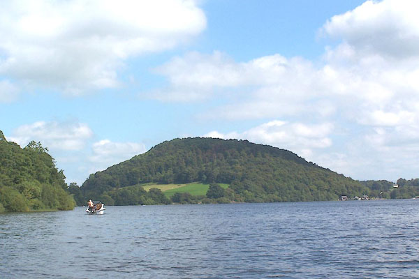
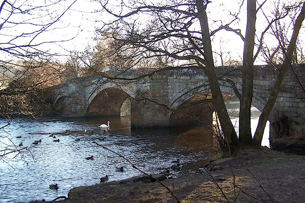
| evidence:- | old text:- Farington 1816 placename:- Pooley item:- placename, Dunmallard |
|||
| source data:- | Descriptive text:- "THE VILLAGE OF POOLEY, part of which appears in the fore-ground of this engraving,
is pleasantly situated at the foot of Ulswater; having, besides the embellishments
of wood and water, a great accession of beauty from Dunmallard Hill, (so called from
the great resort of wild fowl thither from the lake,) which lies on the opposite side
of the water. With this hill the village is connected by a handsome stone bridge,
erected about fifty years since, and from this bridge it is that the present view
has been taken." "..." item:- Armitt Library : A6666.2 Image © see bottom of page |
|||
|
|
||||
| evidence:- | old map:- Otley 1818 placename:- Pooley |
|||
| source data:- | Map, uncoloured engraving, The District of the Lakes,
Cumberland, Westmorland, and Lancashire, scale about 4 miles to
1 inch, by Jonathan Otley, 1818, engraved by J and G Menzies,
Edinburgh, Scotland, published by Jonathan Otley, Keswick,
Cumberland, et al, 1833. OT02NY42.jpg item:- JandMN : 48.1 Image © see bottom of page |
|||
|
|
||||
| evidence:- | descriptive text:- Otley 1823 (5th edn 1834) item:- boat; fishing; post horse; horse |
|||
| source data:- | Guide book, A Concise Description of the English Lakes, the
mountains in their vicinity, and the roads by which they may be
visited, with remarks on the mineralogy and geology of the
district, by Jonathan Otley, published by the author, Keswick,
Cumberland now Cumbria, by J Richardson, London, and by Arthur
Foster, Kirkby Lonsdale, Cumbria, 1823; published 1823-49,
latterly as the Descriptive Guide to the English Lakes. goto source Page 112:- "POOLEY BRIDGE is a desirable station for the lovers of angling; or to take a boat for viewing the scenery of Ullswater." "..." goto sourcePage 137:- "... the want of post-horses at Pooley Bridge is sometimes felt as an inconvenience." |
|||
|
|
||||
| evidence:- | old map:- Ford 1839 map placename:- Pooley Bridge |
|||
| source data:- | Map, uncoloured engraving, Map of the Lake District of
Cumberland, Westmoreland and Lancashire, scale about 3.5 miles
to 1 inch, published by Charles Thurnam, Carlisle, and by R
Groombridge, 5 Paternoster Row, London, 3rd edn 1843. FD02NY42.jpg "Pooley Bridge" item:- JandMN : 100.1 Image © see bottom of page |
|||
|
|
||||
| evidence:- | old map:- Garnett 1850s-60s H placename:- Pooley Bridge |
|||
| source data:- | Map of the English Lakes, in Cumberland, Westmorland and
Lancashire, scale about 3.5 miles to 1 inch, published by John
Garnett, Windermere, Westmorland, 1850s-60s.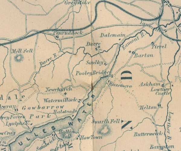 GAR2NY42.jpg "Pooley Bridge" blocks, settlement item:- JandMN : 82.1 Image © see bottom of page |
|||
|
|
||||
| evidence:- | old photograph:- Ullswater Steamers 1900s (edn 1903) placename:- Pooley Bridge |
|||
| source data:- | Photograph, bw halftone, Pooley Bridge, Barton, Westmorland, published in a guide
book by the Ullswater Steam Navigation Co, Penrith, Cumberland, 1903.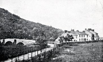 click to enlarge click to enlargeUN121.jpg printed, bottom "POOLEY BRIDGE" item:- JandMN : 1023.21 Image © see bottom of page |
|||
|
|
||||
| evidence:- | market notes:- placename:- |
|||
| source data:- | www.history.ac.uk/cmh/gaz/gazweb2.htmPalmer's Index No.93:: Public Record Office | |||
|
|
||||
| evidence:- | old map:- Post Office 1850s-1900s placename:- Pooley Bridge |
|||
| source data:- | Post road maps, General Post Office Circulation Map for England
and Wales, for the General Post Office, London, 1850s-1900s. click to enlarge click to enlargePOF7Cm.jpg "Pooley Bridge" map date 1909 |
|||
|
|
||||
| evidence:- | old map:- Post Office 1850s-1900s placename:- Pooley Bridge |
|||
| source data:- | Post road maps, General Post Office Circulation Map for England
and Wales, for the General Post Office, London, 1850s-1900s. click to enlarge click to enlargePF10Cm.jpg "Pooley Bridge" map date 1892 |
|||
|
|
||||
| evidence:- | old map:- Post Office 1850s-1900s placename:- Pooley Bridge |
|||
| source data:- | Post road maps, General Post Office Circulation Map for England
and Wales, for the General Post Office, London, 1850s-1900s. click to enlarge click to enlargePOF2Cm.jpg "Pooley Bridge" map date 1890 |
|||
|
|
||||
| :- |
images courtesy of the British Postal Museum and Hampshire CC Museums |
|||
|
|
||||
| evidence:- | old painting:- |
|||
| source data:- | Painting, watercolour, View Looking to the Bridge on the River Going to Ullswater,
Pooley Bridge, Barton, Westmorland, by Paul Sandby, 1760s-70s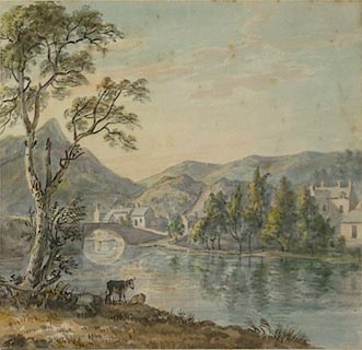 click to enlarge click to enlargePR0812.jpg Summertime; view of a wide gently flowing river from the nearside bank with two cattle at the water's edge beside a blasted oak tree which frames composition to left. Beyond, the river is panned by a stone bridge, a small village speading along the riverbank, partially screened by a stand of trees. Barren fells rise beyond. inscribed at on mount:- "P. Sandby View looking to the Bridge on the river going out of Ullswater" item:- Tullie House Museum : 1905.10A.3 Image © Tullie House Museum |
|||
|
|
||||
| date:- | 1216 |
|||
| period:- | 13th century | |||
| item:- | charter; market charter |
|||
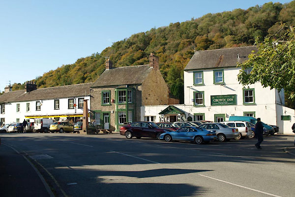
| Market for Barton probably held at Pooley Bridge, charter granted 1216, and a fair
on 3rd Monday in September. |
||||
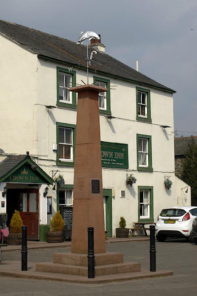
| There was a fish market in The Square in front of the Crown Inn. |
||||
|
|
||||
| places:- |
|
|||
|
||||
|
||||
|
||||
|
||||
|
||||
|
||||
|
||||
|
||||
|
||||
|
||||
|
||||
|
||||
|
||||
|
||||
|
||||
|
||||
|
||||
|
||||
|
||||
|
||||
|
||||
|
||||
Lakes Guides menu.