 Garnett 1850s-60s NY00


|

|
|
|
gazetteer links places may or may not be labelled on the map |
||

|
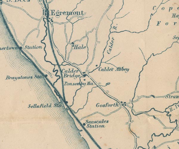
-- Braystones Station -- "Braystones Sta" |
|
|
|
-- Calder Abbey -- "Calder Abbey" |
|
|
|
-- Calder Bridge -- "Calder Bridge" |
|
|
|
-- Calder, River -- "Calder R." |
|
|
|
-- Egremont and Sellafield branch railway |
|
|
|
-- Gosforth -- "Gosforth" |
|
|
|
-- Hale -- "Hale" |
|
|
|
-- lake, Ponsonby |
|
|
|
-- Ponsonby Old Hall -- "Ponsonby Hall" |
|
|
|
-- Seascale Station -- "Seascales Station" |
|
|
|
-- Sellafield Station -- "Sellafield Sta" |
|
|
|
-- Whitehaven and Furness Junction Railway -- "Whitehaven &
Furness Junction Raily." |
|
|
civil parishes The area roughly includes parts of parishes:- Drigg and Carleton Irton with Santon Seascale Ponsonby Gosforth Haile St Bridget Beckermet Lowside Quarter Ennerdale and Kinniside Egremont St John Beckermet |
||
|
|
||
|
|
Lakes Guides menu. | |