 Old Cumbria Gazetteer
 |
 |
|
| Sellafield Station, St Bridget Beckermet | ||
| Sellafield Station | ||
| site name:- | Whitehaven and Furness Junction Railway | |
| locality:- | Sellafield | |
| civil parish:- | St Bridget Beckermet (formerly Cumberland) | |
| county:- | Cumbria | |
| locality type:- | railway station | |
| coordinates:- | NY02080341 | |
| 1Km square:- | NY0203 | |
| 10Km square:- | NY00 | |
| SummaryText:- | Opened 1849. | |
|
|
||
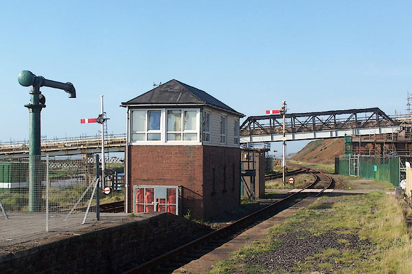
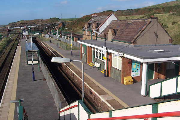 BMV97.jpg (taken 13.10.2006) 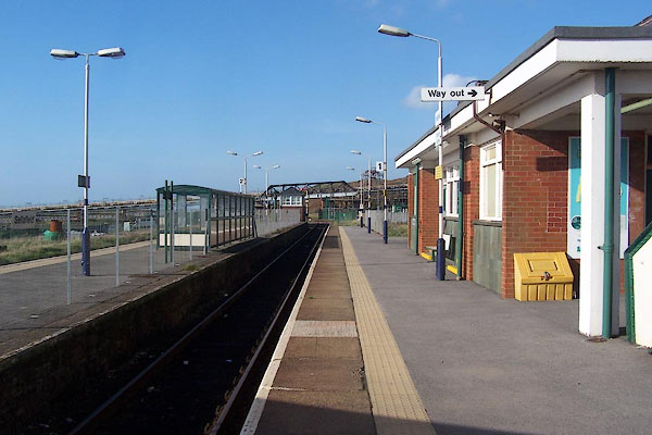 BMV93.jpg (taken 13.10.2006) |
||
|
|
||
| evidence:- | old map:- OS County Series (Cmd 77 8) placename:- Sellafield Station item:- railway signal; railway milepost |
|
| source data:- | Maps, County Series maps of Great Britain, scales 6 and 25
inches to 1 mile, published by the Ordnance Survey, Southampton,
Hampshire, from about 1863 to 1948.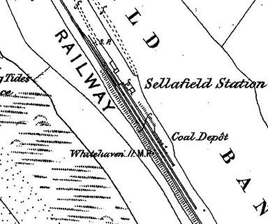 click to enlarge click to enlargeCSRY0103.jpg "Sellafield Station / Coal Depot / S.P. / Whitehaven 11 M.P." |
|
|
|
||
| evidence:- | old map:- Garnett 1850s-60s H placename:- Sellafield Station |
|
| source data:- | Map of the English Lakes, in Cumberland, Westmorland and
Lancashire, scale about 3.5 miles to 1 inch, published by John
Garnett, Windermere, Westmorland, 1850s-60s.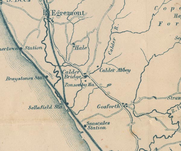 GAR2NY00.jpg "Sellafield Sta" dot by railway item:- JandMN : 82.1 Image © see bottom of page |
|
|
|
||
| evidence:- | old map:- Post Office 1850s-1900s placename:- Sellafield Station |
|
| source data:- | Post road maps, General Post Office Circulation Map for England
and Wales, for the General Post Office, London, 1850s-1900s. click to enlarge click to enlargePOF7Cm.jpg "Sellafield Sta." map date 1909 |
|
|
|
||
| evidence:- | old map:- Post Office 1850s-1900s placename:- Sellafield Station |
|
| source data:- | Post road maps, General Post Office Circulation Map for England
and Wales, for the General Post Office, London, 1850s-1900s. click to enlarge click to enlargePF10Cm.jpg "Sellafield Sta." map date 1892 |
|
|
|
||
| evidence:- | old map:- Post Office 1850s-1900s placename:- Sellafield Station |
|
| source data:- | Post road maps, General Post Office Circulation Map for England
and Wales, for the General Post Office, London, 1850s-1900s. click to enlarge click to enlargePOF2Cm.jpg "Sellafield Sta." map date 1890 |
|
|
|
||
| evidence:- | old map:- Post Office 1850s-1900s placename:- Sellafield Station |
|
| source data:- | Post road maps, General Post Office Circulation Map for England
and Wales, for the General Post Office, London, 1850s-1900s. click to enlarge click to enlargePOF8Cm.jpg "Sellafield Stn." map date 1873 |
|
|
|
||
| :- |
images courtesy of the British Postal Museum and Hampshire CC Museums |
|
|
|
||
 BMV94.jpg View N; signal box and water crane. (taken 13.10.2006) 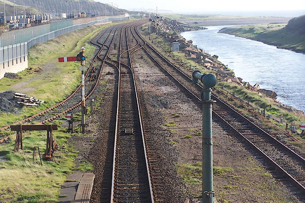 BMV96.jpg View S. (taken 13.10.2006) |
||
|
|
||
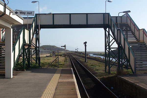 BMV95.jpg Passenger footbridge. (taken 13.10.2006)  CGH51.jpg Water crane. (taken 28.7.2017) 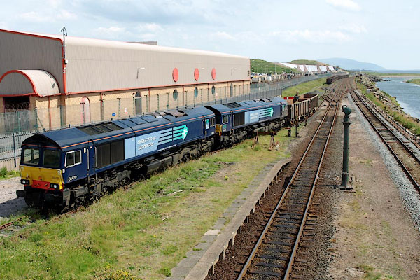 BQW93.jpg Diesel locomotives and waggons:- "DIRECT RAIL / SERVICES" (taken 25.6.2009) 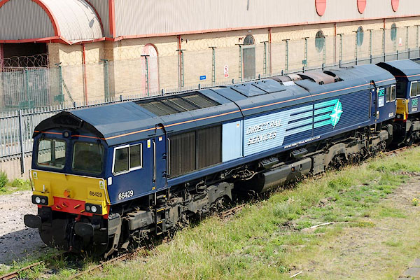 BQW94.jpg Diesel locomotive:- "DIRECT RAIL / SERVICES" (taken 25.6.2009) |
||
|
|
||
| Paley and Austin series | ||
| person:- | architect : Austin, Hubert J |
|
| person:- | architect : Paley, Henry A |
|
| date:- | 1885 |
|
| New buildings, perhaps. |
||
|
|
||
 Lakes Guides menu.