 Old Cumbria Gazetteer
 |
 |
|
| Hale | ||
| imagined | ||
| civil parish:- | Haile (formerly Cumberland) (?) | |
| county:- | Cumberland | |
| locality type:- | buildings | |
| 1Km square:- | NY0508 (?) | |
| 10Km square:- | NY00 | |
| references:- | Morden 1695 |
|
|
|
||
| evidence:- | old map:- Morden 1695 (Cmd) placename:- Hale |
|
| source data:- | Map, uncoloured engraving, Cumberland, scale about 4 miles to 1
inch, by Robert Morden, 1695, published by Abel Swale, the
Unicorn, St Paul's Churchyard, Awnsham, and John Churchill, the
Black Swan, Paternoster Row, London, 1695-1715.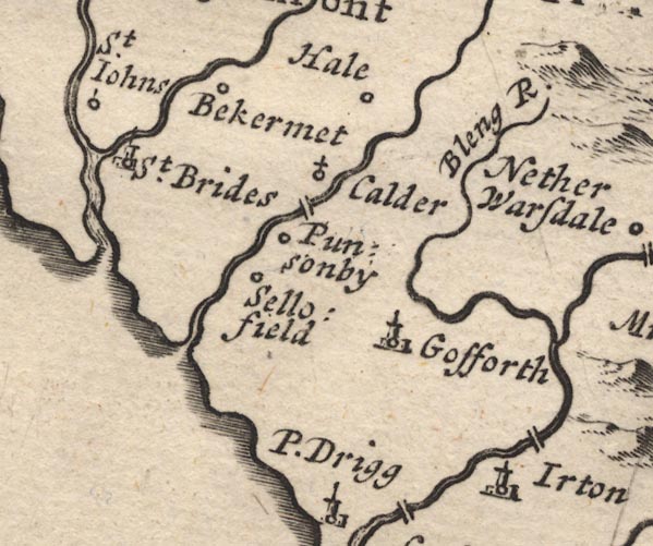 MD12NY00.jpg "Hale" Circle, at the east of the label. item:- JandMN : 90 Image © see bottom of page |
|
|
|
||
| evidence:- | old map:- Post Office 1850s-1900s placename:- Hale |
|
| source data:- | Post road maps, General Post Office Circulation Map for England
and Wales, for the General Post Office, London, 1850s-1900s. click to enlarge click to enlargePOF7Cm.jpg "Hale" map date 1909 |
|
|
|
||
| :- |
images courtesy of the British Postal Museum and Hampshire CC Museums |
|
|
|
||
 Lakes Guides menu.