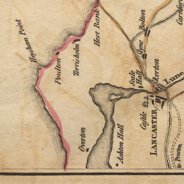
 West 1784 map SD45


|

|
|
|
gazetteer links places may or may not be labelled on the map |
||

|
-- Ashton Hall (?) |
|
|
|
-- Bolton-le-Sands |
|
|
|
-- Heysham Point (?) |
|
|
|
-- Heysham |
|
|
|
-- Lancaster Canal |
|
|
|
-- Lancaster Castle -- "Castle" |
|
|
|
-- Lune Estuary |
|
|
|
-- Overton |
|
|
|
-- Poulton |
|
|
|
-- Scale Hall |
|
|
|
-- Slyne |
|
|
|
-- St Mary's Church |
|
|
|
-- Torrisholme |
|
|
counties The area includes parts of counties:- Lancashire |
||
|
|
||
|
|
Lakes Guides menu. | |