 Speed 1611 (Wmd) SD48


|

|
|
|
gazetteer links places may or may not be labelled on the map |
||

|
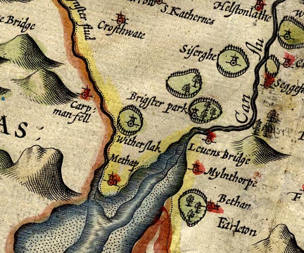
-- Beetham Park |
|
|
|
-- Beetham -- "Bethan" |
|
|
|
-- Brigsteer Park |
|
|
|
-- Brigsteer |
|
|
|
-- Cartmel Fell -- "Carp: man-fell" |
|
|
|
-- Kent Estuary |
|
|
|
-- Kent, River -- "Can flu" |
|
|
|
-- Levens Bridge -- "Levens Bridge" |
|
|
|
-- Levens Park -- "Brigster park" |
|
|
|
-- Meathop -- "Methop" |
|
|
|
-- Milnthorpe -- "Mylnthorpe" |
|
|
|
|
|
|
|
-- Sizergh Castle -- "Siserghe" |
|
|
|
-- Winster, River -- "Wynster flud" |
|
|
|
-- Witherslack Hall |
|
|
|
-- Witherslack -- "Witherslack" |
|
|
civil parishes The area roughly includes parts of parishes:- Broughton East Staveley-in-Cartmel Underbarrow and Bradleyfield Heversham Witherslack Beetham Meathop and Ulpha Milnthorpe Cartmel Fell Crosthwaite and Lyth Levens Helsington Upper Allithwaite Grange-over-Sands |
||
|
|
||
|
|
Lakes Guides menu. | |