 Old Cumbria Gazetteer
 |
 |
|
| Kent Estuary | ||
| runs into:- |  Irish Sea Irish Sea |
|
|
|
||
| civil parish:- | Lower Allithwaite (formerly Lancashire) | |
| civil parish:- | Grange-over-Sands (formerly Lancashire) | |
| civil parish:- | Arnside (formerly Westmorland) | |
| county:- | Cumbria | |
| locality type:- | estuary | |
| locality type:- | river estuary | |
| locality type:- | sea area | |
| 1Km square:- | SD4377 (etc) | |
| 10Km square:- | SD47 | |
|
|
||
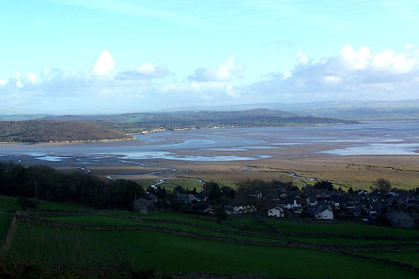 BJZ72.jpg From Hampsfell. (taken 9.11.2005) 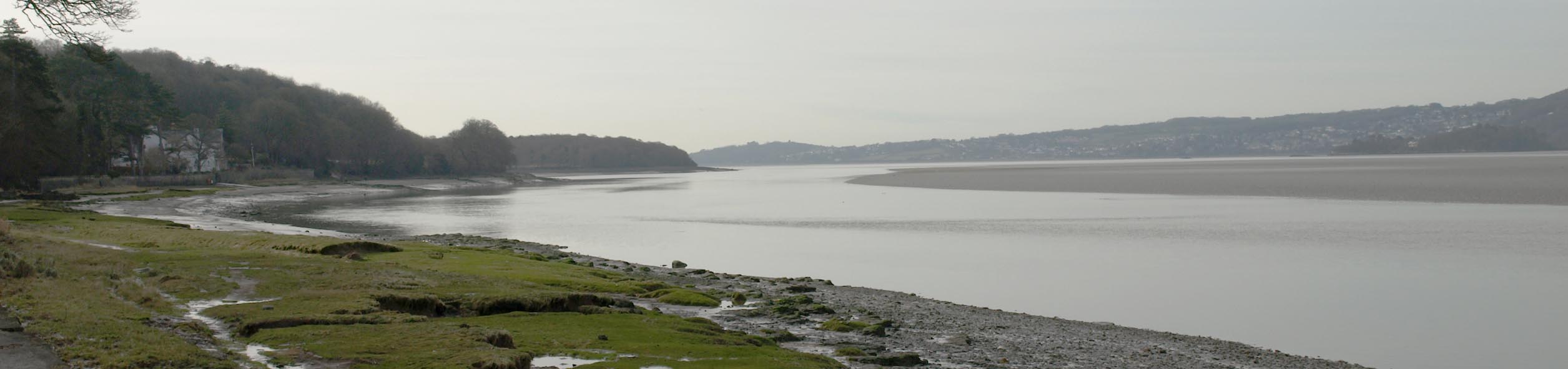 Click to enlarge BTZ82.jpg From Arnside. (taken 8.2.2011) |
||
|
|
||
| evidence:- | old map:- Saxton 1579 |
|
| source data:- | Map, hand coloured engraving, Westmorlandiae et Cumberlandiae Comitatus ie Westmorland
and Cumberland, scale about 5 miles to 1 inch, by Christopher Saxton, London, engraved
by Augustinus Ryther, 1576, published 1579-1645.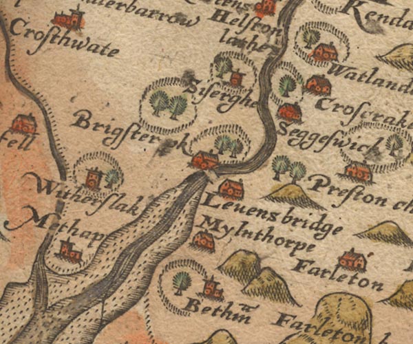 Sax9SD48.jpg 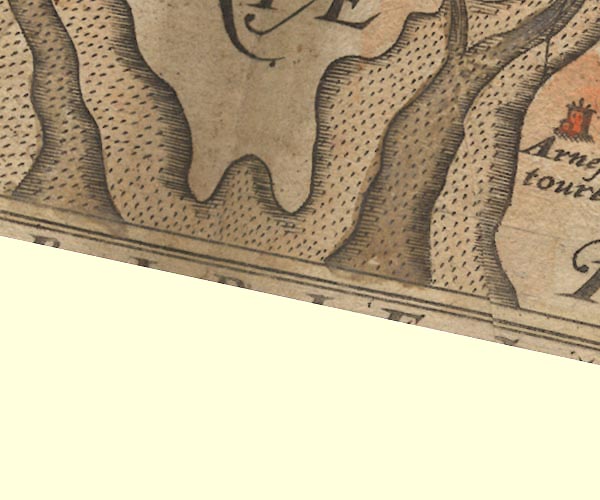 Sax9SD37.jpg item:- private collection : 2 Image © see bottom of page |
|
|
|
||
| evidence:- | old map:- Mercator 1595 (edn?) placename:- |
|
| source data:- | Map, hand coloured engraving, Westmorlandia, Lancastria, Cestria
etc, ie Westmorland, Lancashire, Cheshire etc, scale about 10.5
miles to 1 inch, by Gerard Mercator, Duisberg, Germany, 1595,
edition 1613-16.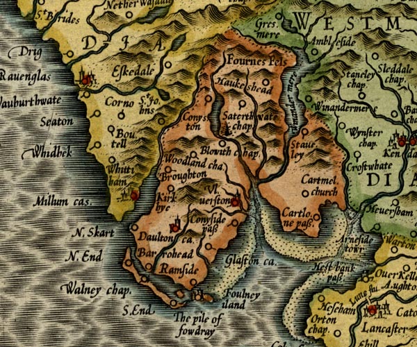 MER5LanA.jpg "" estuary item:- Armitt Library : 2008.14.3 Image © see bottom of page |
|
|
|
||
| evidence:- | old map:- Speed 1611 (Cum/EW) |
|
| source data:- | Map, hand coloured engraving, Kingdome of Great Britaine and
Ireland, scale about 36 miles to 1 inch, by John Speed, about
1610-11, published by Thomas Bassett, Fleet Street and Richard
Chiswell, St Paul's Churchyard, London, 1676? click to enlarge click to enlargeSPD6Cm.jpg estuary item:- private collection : 85 Image © see bottom of page |
|
|
|
||
| evidence:- | old map:- Speed 1611 (Wmd) |
|
| source data:- | Map, hand coloured engraving, The Countie Westmorland and
Kendale the Cheif Towne, scale about 2.5 miles to 1 inch, by
John Speed, 1610, published by George Humble, Popes Head Alley,
London, 1611-12. SP14SD48.jpg  SP14SD47.jpg estuary item:- Armitt Library : 2008.14.5 Image © see bottom of page |
|
|
|
||
| evidence:- | old map:- Jansson 1646 |
|
| source data:- | Map, hand coloured engraving, Cumbria and Westmoria, ie
Cumberland and Westmorland, scale about 3.5 miles to 1 inch, by
John Jansson, Amsterdam, Netherlands, 1646. JAN3SD47.jpg item:- JandMN : 88 Image © see bottom of page |
|
|
|
||
| evidence:- | old map:- Sanson 1679 |
|
| source data:- | Map, hand coloured engraving, Ancien Royaume de Northumberland
aujourdhuy Provinces de Nort, ie the Ancient Kingdom of
Northumberland or the Northern Provinces, scale about 9.5 miles
to 1 inch, by Nicholas Sanson, Paris, France, 1679. click to enlarge click to enlargeSAN2Cm.jpg estuary item:- Dove Cottage : 2007.38.15 Image © see bottom of page |
|
|
|
||
| evidence:- | old map:- Seller 1694 (Wmd) |
|
| source data:- | Map, hand coloured engraving, Westmorland, scale about 8 miles
to 1 inch, by John Seller, 1694. click to enlarge click to enlargeSEL7.jpg estuary item:- Dove Cottage : 2007.38.87 Image © see bottom of page |
|
|
|
||
| evidence:- | old map:- Morden 1695 (Wmd) |
|
| source data:- | Map, hand coloured engraving, Westmorland, scale about 2.5 miles to 1 inch, by Robert
Morden, published by Abel Swale, the Unicorn, St Paul's Churchyard, Awnsham, and John
Churchill, the Black Swan, Paternoster Row, London, 1695.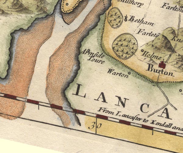 MD10SD47.jpg item:- JandMN : 24 Image © see bottom of page |
|
|
|
||
| evidence:- | old map:- Badeslade 1742 placename:- Can River placename:- Kent River |
|
| source data:- | Map, uncoloured engraving, A Map of Westmorland North from
London, scale about 10 miles to 1 inch, with descriptive text,
by Thomas Badeslade, London, engraved and published by William
Henry Toms, Union Court, Holborn, London, 1742. click to enlarge click to enlargeBD12.jpg "Can or Kent R" tapering wiggly line and estuary item:- Dove Cottage : 2007.38.62 Image © see bottom of page |
|
|
|
||
| evidence:- | old map:- Simpson 1746 map (Wmd) placename:- Camn River placename:- Kent River |
|
| source data:- | Map, uncoloured engraving, Westmorland, scale about 8 miles to 1
inch, printed by R Walker, Fleet Lane, London, 1746.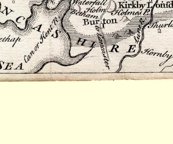 SMP2SDN.jpg "Camn or Kent R." Coast line with form lines. item:- Dove Cottage : 2007.38.59 Image © see bottom of page |
|
|
|
||
| evidence:- | old map:- Bowen and Kitchin 1760 |
|
| source data:- | Map, hand coloured engraving, A New Map of the Counties of
Cumberland and Westmoreland Divided into their Respective Wards,
scale about 4 miles to 1 inch, by Emanuel Bowen and Thomas
Kitchin et al, published by T Bowles, Robert Sayer, and John
Bowles, London, 1760.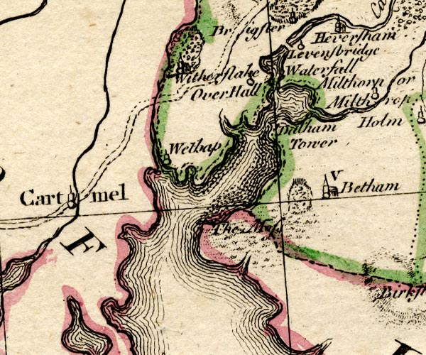 BO18SD37.jpg river mouth item:- Armitt Library : 2008.14.10 Image © see bottom of page |
|
|
|
||
| evidence:- | old map:- Jefferys 1770 (Wmd) |
|
| source data:- | Map, 4 sheets, The County of Westmoreland, scale 1 inch to 1
mile, surveyed 1768, and engraved and published by Thomas
Jefferys, London, 1770.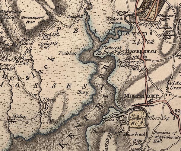 J5SD48SE.jpg "KENT RIVER" 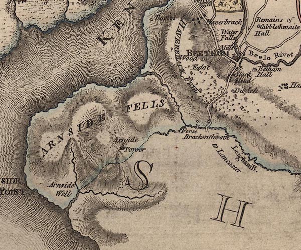 J5SD47NE.jpg 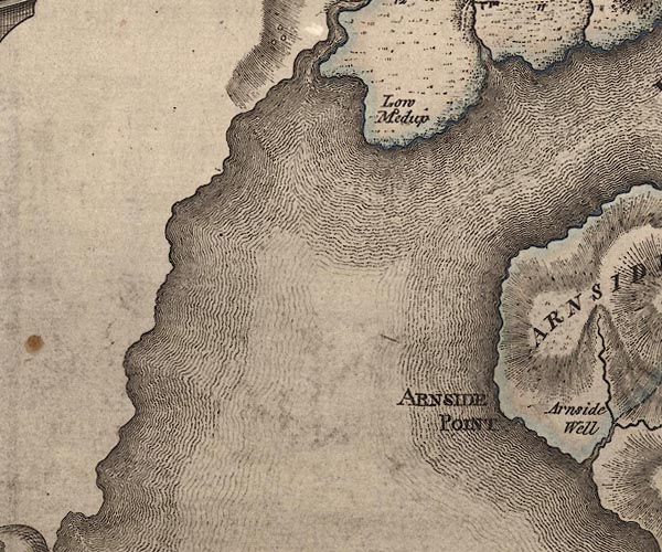 J5SD47NW.jpg estuary item:- National Library of Scotland : EME.s.47 Images © National Library of Scotland |
|
|
|
||
| evidence:- | old text:- Mackenzie 1776 placename:- |
|
| source data:- | Charts, and sailing directions, Nautical Descriptions of the
West Coast of Great Britain, Bristol Channel to Cape Wrath, by
Murdoch Mackenzie, published London, 1776. goto source Page 18:- "... ..." "KENT River." "The River Kent, between Sunderland and the Piel-of-Foudray, is very dangerous, and not to be attempted by any stranger, except in necessity; as there are neither buoys, perches, or distinct land-marks to point out the channels to one that is not particularly acquainted. When a vessel is forced into this Bay, the only channels to be pursued are, either Furness, or Grange; the former on the west side of Cartmel-wharfs Bank, which dries about low-water only, the other on the E. side of it: at four hours of flood, a vessel, that draws ten or twelve feet, will have sufficient water over Cartmel-wharfs, near the channel. These channels often discover themselves, by the appearance of the water in them; a good look-out is therefore necessary here." |
|
|
|
||
| evidence:- | descriptive text:- West 1778 (11th edn 1821) |
|
| source data:- | Guide book, A Guide to the Lakes, by Thomas West, published by
William Pennington, Kendal, Cumbria once Westmorland, and in
London, 1778 to 1821. goto source Page 28:- "... [crossing Lancaster Sands] The Cartmel coast, now as you advance, becomes more pleasing. Betwixt that and Silverdale-nab (a mountain of naked grey rock) is a great break in the coast, and through the opening the river Kent rolls its waters to join the tide. In the mouth of the aestuary are two beautiful conical isles, clothed with wood and sweet verdure. As you advance toward them they seem to change their position, and hence often vary their appearance. At the same time a grand view opens of the Westmorland mountains, tumbled about in a most surprising manner. ..." |
|
|
|
||
| evidence:- | old map:- West 1784 map |
|
| source data:- | Map, hand coloured engraving, A Map of the Lakes in Cumberland,
Westmorland and Lancashire, scale about 3.5 miles to 1 inch,
engraved by Paas, 53 Holborn, London, about 1784.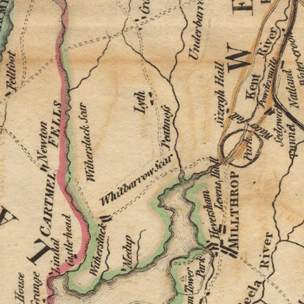 Ws02SD48.jpg 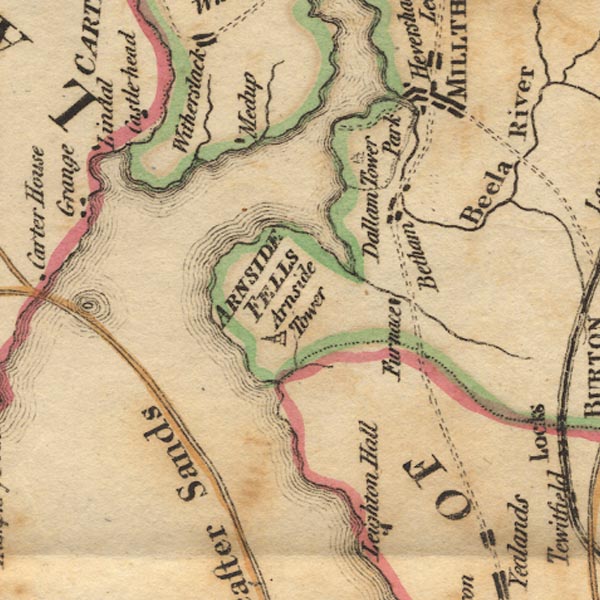 Ws02SD47.jpg 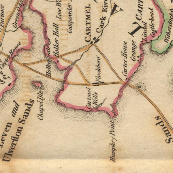 Ws02SD37.jpg item:- Armitt Library : A1221.1 Image © see bottom of page |
|
|
|
||
| evidence:- | old map:- Cary 1789 (edn 1805) placename:- Kent River |
|
| source data:- | Map, uncoloured engraving, Westmoreland, scale about 2.5 miles
to 1 inch, by John Cary, London, 1789; edition 1805.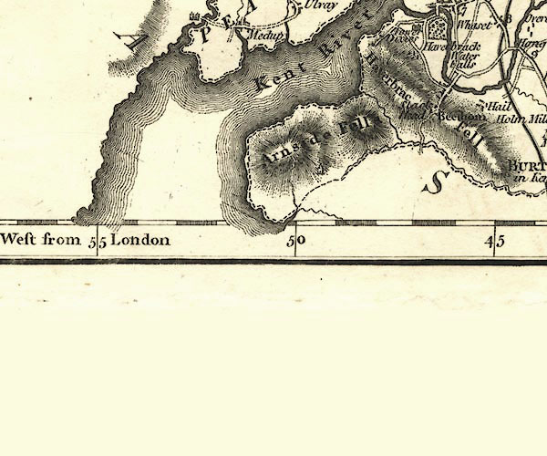 CY24SD47.jpg "Kent River" river estuary item:- JandMN : 129 Image © see bottom of page |
|
|
|
||
| evidence:- | old map:- Cooke 1802 placename:- Kent River |
|
| source data:- | Map, Westmoreland ie Westmorland, scale about 12 miles to 1
inch, by George Cooke, 1802, published by Sherwood, Jones and
Co, Paternoster Road, London, 1824. click to enlarge click to enlargeGRA1Wd.jpg "Kent River" estuary item:- Hampshire Museums : FA2000.62.4 Image © see bottom of page |
|
|
|
||
| evidence:- | old map:- Cooke 1802 placename:- Ken River |
|
| source data:- | Map, Lancashire, scale about 18 miles to 1 inch, by George
Cooke, 1802, bound in Gray's New Book of Roads, 1824, published
by Sherwood, Jones and Co, Paternoster Road, London, 1824. click to enlarge click to enlargeGRA1La.jpg "Ken R" estuary item:- Hampshire Museums : FA2000.62.6 Image © see bottom of page |
|
|
|
||
| evidence:- | old map:- Cooper 1808 placename:- Ken River |
|
| source data:- | Map, hand coloured engraving, Westmoreland ie Westmorland, scale
about 9 miles to 1 inch, by H Cooper, 1808, published by R
Phillips, Bridge Street, Blackfriars, London, 1808. click to enlarge click to enlargeCOP4.jpg "Ken R." estuary item:- Dove Cottage : 2007.38.53 Image © see bottom of page |
|
|
|
||
| evidence:- | old map:- Otley 1818 |
|
| source data:- | Map, uncoloured engraving, The District of the Lakes,
Cumberland, Westmorland, and Lancashire, scale about 4 miles to
1 inch, by Jonathan Otley, 1818, engraved by J and G Menzies,
Edinburgh, Scotland, published by Jonathan Otley, Keswick,
Cumberland, et al, 1833. OT02SD47.jpg item:- JandMN : 48.1 Image © see bottom of page |
|
|
|
||
| evidence:- | old map:- Hall 1820 (Wmd) placename:- Kent River |
|
| source data:- | Map, hand coloured engraving, Westmoreland ie Westmorland, scale
about 14.5 miles to 1 inch, by Sidney Hall, London, 1820,
published by Samuel Leigh, 18 Strand, London, 1820-31. click to enlarge click to enlargeHA18.jpg "Kent R." estuary item:- Armitt Library : 2008.14.58 Image © see bottom of page |
|
|
|
||
| evidence:- | old map:- Garnett 1850s-60s H |
|
| source data:- | Map of the English Lakes, in Cumberland, Westmorland and
Lancashire, scale about 3.5 miles to 1 inch, published by John
Garnett, Windermere, Westmorland, 1850s-60s.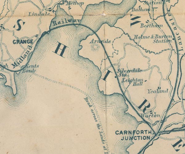 GAR2SD47.jpg area item:- JandMN : 82.1 Image © see bottom of page |
|
|
|
||
| evidence:- | old print:- Waugh 1860 |
|
| source data:- | Print, engraving, Kent Viaduct, the Ulverstone and Lancaster Railway over the River
Kent, Arnside, Lancashire, drawn by T H Wilson, engraved by Swain, published by Alexander
Ireland and Co, 22 Market Street, Manchester, 1860.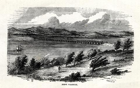 click to enlarge click to enlargeWU0102.jpg On p.10 of Over Sands to the Lakes, by Edwin Waugh. printed at bottom left:- "THW" printed at bottom right, centre:- "SWAIN Sc / KENT VIADUCT" item:- Armitt Library : A1082.2 Image © see bottom of page |
|
|
|
||
| evidence:- | old print:- Rose 1832-35 |
|
| source data:- | Print, uncoloured engraving, Scout Scar, near Kendal, Westmorland, by Thomas Allom,
engraved by T H Shepherd, 1835.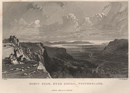 click to enlarge click to enlargeR369.jpg item:- JandMN : 66.37 Image © see bottom of page |
|
|
|
||
Lakes Guides menu.