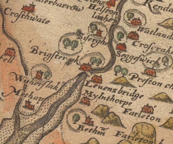
 Saxton 1576 SD48


|

|
|
|
gazetteer links places may or may not be labelled on the map |
||

|
-- Beetham -- "Betham" |
|
|
|
-- Beetham Park |
|
|
|
-- Brigsteer Park -- "Brigster p~k" |
|
|
|
-- Crosscrake -- "Croscrake" |
|
|
|
-- Kent Estuary |
|
|
|
-- Kent, River |
|
|
|
-- Lancaster Sands |
|
|
|
-- Levens Bridge -- "Levens bridge" |
|
|
|
-- Levens Park |
|
|
|
-- Meathop -- "Methap" |
|
|
|
-- Milnthorpe -- "Mylnthorpe" |
|
|
|
-- Milnthorpe Sands |
|
|
|
-- Natland -- "Watlande" |
|
|
|
-- Natland Park |
|
|
|
-- |
|
|
|
-- Sedgwick -- "Seggeswick" |
|
|
|
-- Sizergh Castle -- "Siserghe" |
|
|
|
-- Witherslack Hall -- "Witherslak" |
|
|
civil parishes The area roughly includes parts of parishes:- Broughton East Staveley-in-Cartmel Underbarrow and Bradleyfield Heversham Witherslack Beetham Meathop and Ulpha Milnthorpe Cartmel Fell Crosthwaite and Lyth Levens Helsington Upper Allithwaite Grange-over-Sands |
||
|
|
||
|
|
Lakes Guides menu. | |