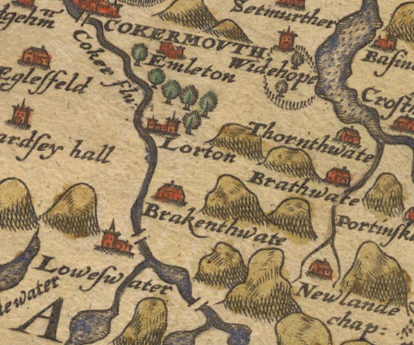
 Saxton 1576 NY12


|

|
|
|
gazetteer links places may or may not be labelled on the map |
||

|
-- Bassenthwaite Lake |
|
|
|
-- Brackenthwaite -- "Brakenthwate" |
|
|
|
-- Braithwaite -- "Brathwate" |
|
|
|
-- Cocker, River -- "Coker flu:" |
|
|
|
-- Crummock Water -- "Loweswater" |
|
|
|
-- Dub Beck |
|
|
|
-- Embleton -- "Emleton" |
|
|
|
-- |
|
|
|
-- High Lorton -- "Lorton" |
|
|
|
-- Keskadale Beck |
|
|
|
-- Low Lorton -- "Lorton" |
|
|
|
-- Loweswater -- "Loweswater" |
|
|
|
-- Newlands -- "Newlande chap:" |
|
|
|
-- Park Beck |
|
|
|
-- Scale Bridge |
|
|
|
-- Scalehill Bridge |
|
|
|
-- Thornthwaite -- "Thornthwate" |
|
|
|
-- Wythop Hall -- "Widehope" |
|
|
civil parishes The area roughly includes parts of parishes:- Buttermere Above Derwent Loweswater Lorton Dean Lamplugh Cockermouth Blindbothel Embleton Wythop Brigham |
||
|
|
||
|
|
Lakes Guides menu. | |