 Otley 1818 SD49


|

|
|
|
gazetteer links places may or may not be labelled on the map |
||

|
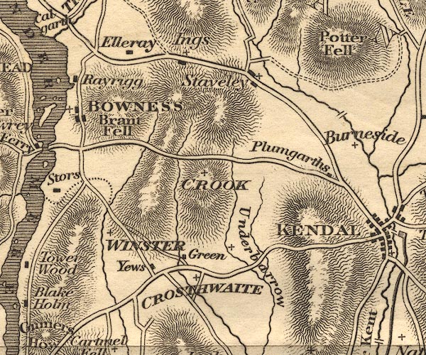
-- Bowness-on-Windermere -- "BOWNESS" |
|
|
|
-- Bowston Bridge |
|
|
|
-- Brant Fell |
|
|
|
-- Crook -- "CROOK" |
|
|
|
-- Crosthwaite -- "CROSTHWAITE" |
|
|
|
-- Dodds Howe |
|
|
|
-- Elleray |
|
|
|
-- Ings |
|
|
|
-- Low Yews |
|
|
|
-- Plumgarths |
|
|
|
-- Potter Fell |
|
|
|
-- Rayrigg Hall |
|
|
|
-- Staveley |
|
|
|
-- Underbarrow |
|
|
|
-- Winster -- "WINSTER" |
|
|
civil parishes The area roughly includes parts of parishes:- Crosthwaite and Lyth Cartmel Fell Helsington Strickland Ketel Windermere Underbarrow and Bradleyfield Hugill Strickland Roger Over Staveley Nether Staveley Crook |
||
|
|
||
|
|
Lakes Guides menu. | |