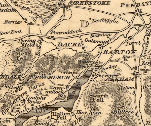
 Otley 1818 NY42


|

|
|
|
gazetteer links places may or may not be labelled on the map |
||

|
-- Barton -- "BARTON" |
|
|
|
-- Beckces |
|
|
|
-- Dacre -- "DACRE" |
|
|
|
-- Dalemain |
|
|
|
-- Eusemere |
|
|
|
-- Hallsteads -- "Hall[steads]" |
|
|
|
-- Lyulph's Tower |
|
|
|
-- Newbiggin |
|
|
|
-- Newchurch -- "NEWCHURCH" |
|
|
|
-- Penruddock |
|
|
|
-- Pooley Bridge |
|
|
|
-- Pooley Bridge |
|
|
|
-- Stainton |
|
|
|
-- Swarth Fell |
|
|
|
-- Ullswater |
|
|
|
-- Waterfoot |
|
|
|
-- Watermillock |
|
|
civil parishes The area roughly includes parts of parishes:- Sockbridge and Tirril Penrith Martindale Bampton Barton Askham Catterlen Mungrisdale Greystoke Hutton Dacre Matterdale |
||
|
|
||
|
|
Lakes Guides menu. | |