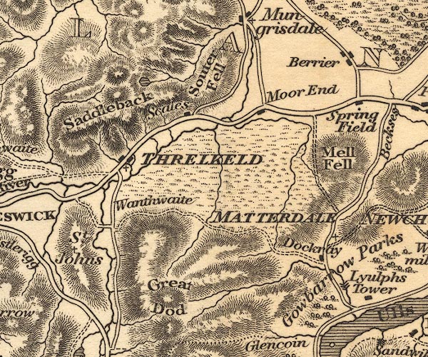
 Otley 1818 NY32


|

|
|
|
gazetteer links places may or may not be labelled on the map |
||

|
-- Aira Beck |
|
|
|
-- Aira Force |
|
|
|
-- Berrier |
|
|
|
-- Dacre Beck |
|
|
|
-- Dockray |
|
|
|
-- Gowbarrow Park |
|
|
|
-- Great Dodd |
|
|
|
-- Great Mell Fell |
|
|
|
-- Matterdale -- "MATTERDALE [NEWCHURCH]" |
|
|
|
-- Moorend |
|
|
|
-- Saddleback |
|
|
|
-- Scales Tarn |
|
|
|
-- Scales |
|
|
|
-- Souther Fell |
|
|
|
-- Springfield |
|
|
|
-- St John's Beck |
|
|
|
-- Threlkeld -- "THRELKELD" |
|
|
|
-- Wanthwaite |
|
|
civil parishes The area roughly includes parts of parishes:- St John's Castlerigg and Wythburn Matterdale Hutton Mungrisdale Threlkeld |
||
|
|
||
|
|
Lakes Guides menu. | |