 England West Coast sheet XI

|

|
|
|
map type:- Hydrographic Office 1850s onwards |
|
|
|
Charts, Irish Sea, Solway Firth, etc, published by the
Hydrographic Office.
No detail description of a continuing supply of charts is attempted. Do note that the Admiralty charts have a force in maritime law quite unlike the status of OS land maps. |
||
|
(example Carlisle Library (39))
|
||
| map feature:- | compass rose & up is N & magnetic deviation & lat and long scales & sea plain & depth soundings & depth contours & tidal flows & sandbanks & foreshore sands & coast line & lighthouses & coast views & leading lines & sea marks & rivers & relief & hill hachuring & county & settlements & railways | |
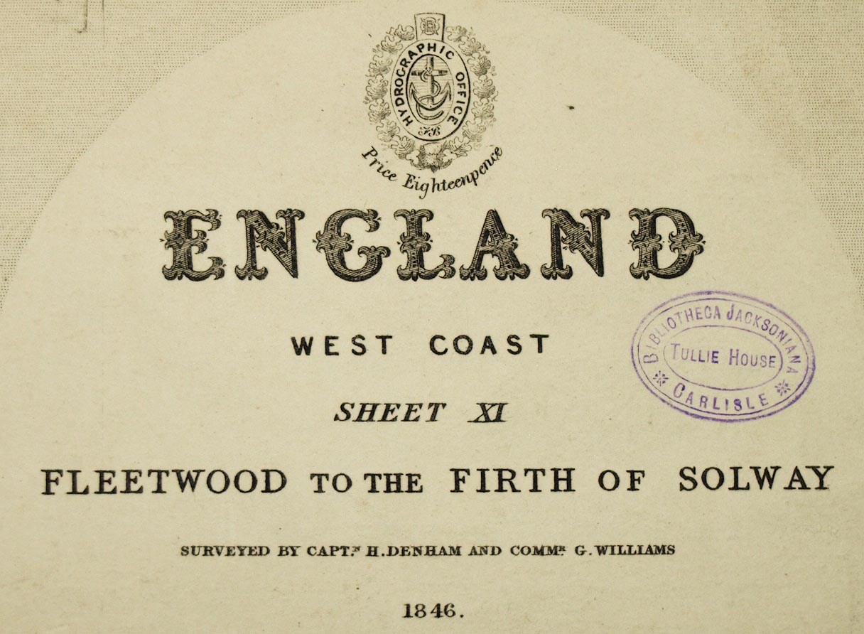
| inscription:- |
printed upper right
ENGLAND / WEST COAST / SHEET XI / FLEETWOOD TO THE FIRTH OF SOLWAY / SURVEYED BY CAPTN. H. DENHAM AND COMMR. G. WILLIAMS. / 1846 |
|
| inscription:- |
printed bottom
Published according to Act of Parliament at the Hydrogaphic Office of the Admiralty Augt. 9th. 1850. / ... / Corrections to 1858. |
|
| inscription:- |
printed bottom right
J. & C. Walker Sculpt. |
|
| wxh, map:- | 488x617mm | |
| scale:- | 1 to 150000 ? (1 to 149476 from 0.5d latitude = 372.2 mm) | |
| sources:- |
Carlisle Library Maps JandMN Collection |
|
| items seen (illustrated items in bold):- | ||

|
Carlisle Library : Map 93 -- chart -- England West Coast sheet XI -- Fleetwood to the Firth of Solway | |
|
|
Carlisle Library : Map 94 -- chart -- England West Coast sheet XII -- Firth of Solway | |
|
|
JandMN (185) -- chart -- Firth of Solway | |
|
|
private collection (216) -- chart (1826) -- Burrow Head to Liverpool | |
|
|
private collection (217) -- chart (1979) -- East Cost of Ireland with the Irish Sea ... | |
|
|
private collection (218) -- chart (2013) -- Saint Bees Head to Silloth | |