Old Cumbria Gazetteer
 |
 |
|
||
| road, Cockermouth to Maryport | ||||
| Cockermouth to Maryport | ||||
| Maryport to Cockermouth | ||||
| A594 | ||||
| civil parish:- | Cockermouth (formerly Cumberland) | |||
| civil parish:- | Papcastle (formerly Cumberland) | |||
| civil parish:- | Bridekirk (formerly Cumberland) | |||
| civil parish:- | Broughton Moor (formerly Cumberland) | |||
| civil parish:- | Dearham (formerly Cumberland) | |||
| civil parish:- | Maryport (formerly Cumberland) | |||
| county:- | Cumbria | |||
| locality type:- | route | |||
| 10Km square:- | NY13 | |||
| 10Km square:- | NY03 | |||
|
|
||||
| evidence:- | old map:- Donald 1774 (Cmd) |
|||
| source data:- | Map, hand coloured engraving, 3x2 sheets, The County of Cumberland, scale about 1
inch to 1 mile, by Thomas Donald, engraved and published by Joseph Hodskinson, 29
Arundel Street, Strand, London, 1774.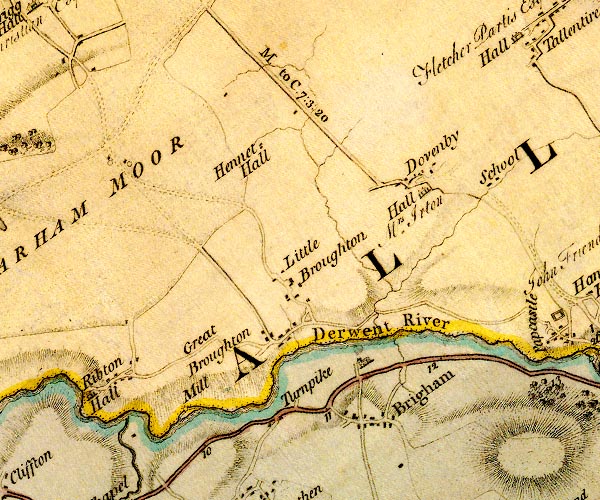 D4NY03SE.jpg "M. to C. 7:3:20" miles.furlongs.poles; Maryport to Cockermouth item:- Carlisle Library : Map 2 Image © Carlisle Library |
|||
|
|
||||
| evidence:- | road book:- Cary 1798 (2nd edn 1802) |
|||
| source data:- | Road book, itineraries, Cary's New Itinerary, by John Cary, 181
Strand, London, 2nd edn 1802. goto source goto source click to enlarge click to enlargeC38319.jpg page 319-320 item:- JandMN : 228.1 Image © see bottom of page |
|||
|
|
||||
| evidence:- | old map:- Hall 1820 (Cmd) |
|||
| source data:- | Map, hand coloured engraving, Cumberland, scale about 21 miles
to 1 inch, engraved by Sidney Hall, published by S Leigh, 18
Strand, London, 1820-31. click to enlarge click to enlargeHA14.jpg single line, solid; minor road; Cockermouth, Dovenby, Maryport item:- JandMN : 91 Image © see bottom of page |
|||
|
|
||||
| evidence:- | old strip map:- Smith 1826 (Roads/Cum) |
|||
| source data:- | Strip map, pp.88-90, including To Kendal by Halifax and Settle, continued to Keswick
etc, published by Charles Smith and Son, 172 Strand, London, 1st edn 1826.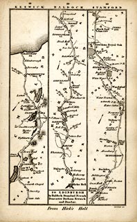 click to enlarge click to enlargeSM22M4.jpg Through Ambleside, Westmorland; then Keswick, Cockermouth to Maryport, Cumberland; and other routes. Included in Smith's Pocket New Companion to the Roads of England and Wales. printed at p.86:- "TO KENDAL / by Halifax & Settle / continued to Keswick &c." item:- private collection : 269.4 Image © see bottom of page |
|||
|
|
||||
| evidence:- | old map:- Ford 1839 map |
|||
| source data:- | Map, uncoloured engraving, Map of the Lake District of
Cumberland, Westmoreland and Lancashire, scale about 3.5 miles
to 1 inch, published by Charles Thurnam, Carlisle, and by R
Groombridge, 5 Paternoster Row, London, 3rd edn 1843.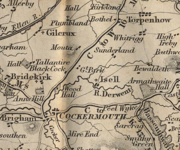 FD02NY13.jpg 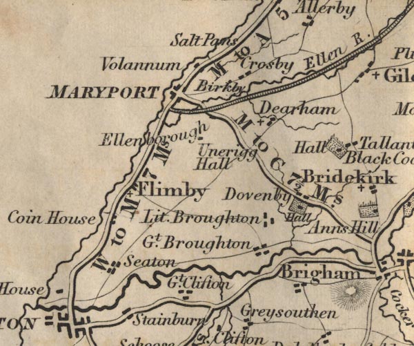 FD02NY03.jpg "M to C 7½Ms." item:- JandMN : 100.1 Image © see bottom of page |
|||
|
|
||||
| evidence:- | old map:- Bell 1892 |
|||
| source data:- | Map, colour lithograph, Road Map of Cumberland, by George Joseph
Bell, scale about 2.5 miles to 1 inch, printed by Charles
Thurnam and Sons, Carlisle, Cumberland, 1892.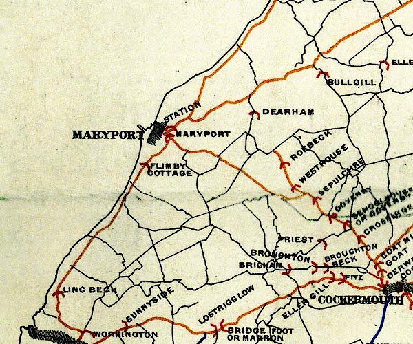 BEL9NY03.jpg 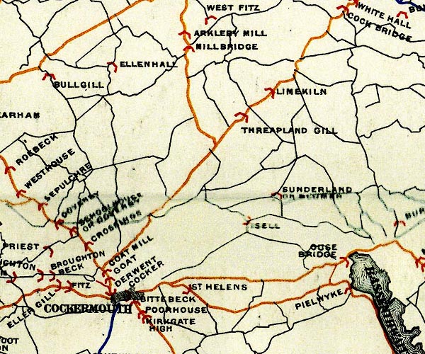 BEL9NY13.jpg orange - disturnpiked 'main road' under section 13 of the Highways Act 1878 since 1 September 1883 Road map of Cumberland showing County Bridges item:- Carlisle Library : Map 38 Images © Carlisle Library |
|||
|
|
||||
| evidence:- | old strip map:- CTC 1911 (Roads) |
|||
| source data:- | Page 110 of Cyclists' Touring Club British Road Book new series vol.6, edited by F
B Sandford, published by Thomas Nelson and Sons, London etc, 1911.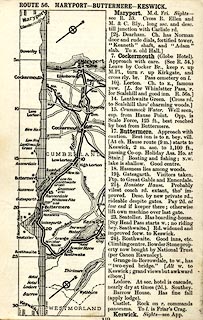 click to enlarge click to enlargeCTC2B0.jpg Strip road map, route 56, Maryport Buttermere Keswick, scale roughly 5 miles to 1 inch. Together with an itinerary and gradient diagram. item:- JandMN : 491.110 Image © see bottom of page |
|||
|
|
||||
| evidence:- | old strip map:- Geographia 1925 |
|||
| source data:- | Road book, with road strip maps and gradient diagrams, Premier Road Book of Great
Britain, by Alexander Gross and F Waite-Browne, published by Geographia, 55 Fleet
Street, London, about 1925?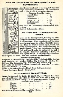 click to enlarge click to enlargeGE1103.jpg "251. - MARYPORT TO COCKERMOUTH AND BUTTERMERE." item:- Hampshire Museums : B1990.161.4 Image © see bottom of page |
|||
|
|
||||
 Act of Parliament Act of Parliament |
||||
|
|
||||
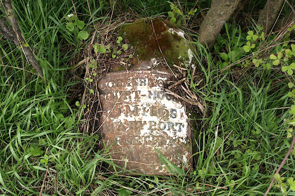
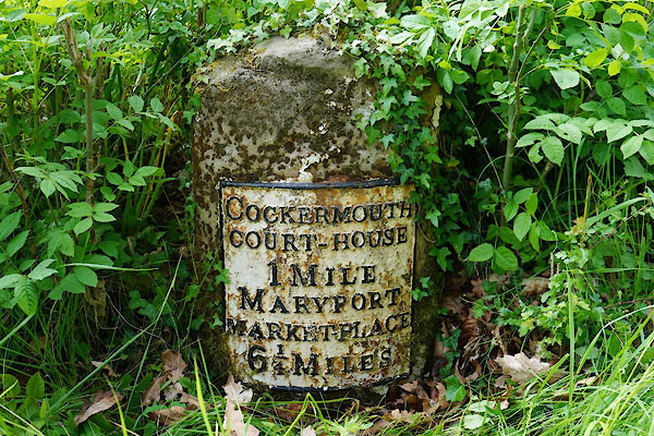
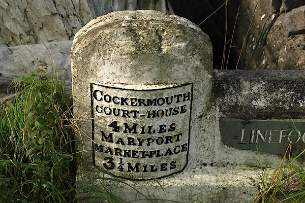
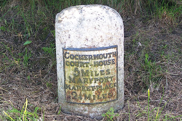
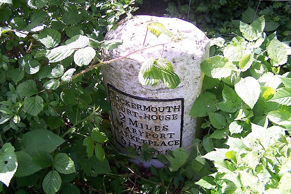
| places:- | Cockermouth Dovenby, Bridekirk Dearham Maryport |
|||
|
|
||||
| places:- |
|
|||
|
||||
|
||||
|
||||
|
||||
|
||||
|
||||
Lakes Guides menu.