Old Cumbria Gazetteer
 |
 |
|
||
| Ravenstonedale | ||||
| Russendal | ||||
| civil parish:- | Ravenstonedale (formerly Westmorland) | |||
| county:- | Cumbria | |||
| locality type:- | locality | |||
| locality type:- | buildings | |||
| locality type:- | selected place | |||
| coordinates:- | NY72300392 (etc) | |||
| 1Km square:- | NY7203 | |||
| 10Km square:- | NY70 | |||
| latitude; longitude:- | 2d 25.6m W; 54d 25.8m N | |||
|
|
||||
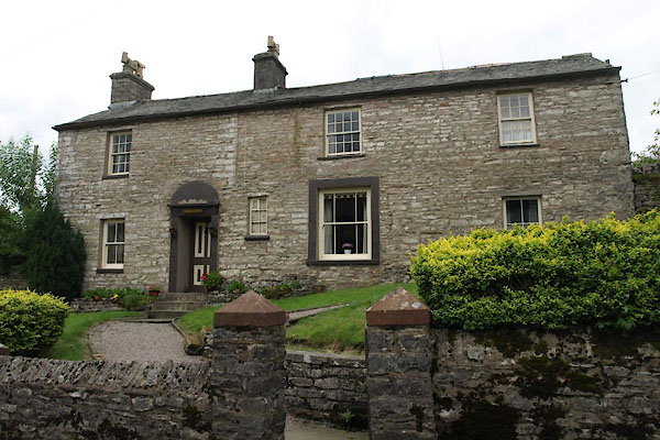
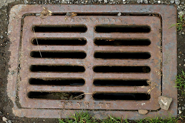
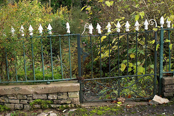
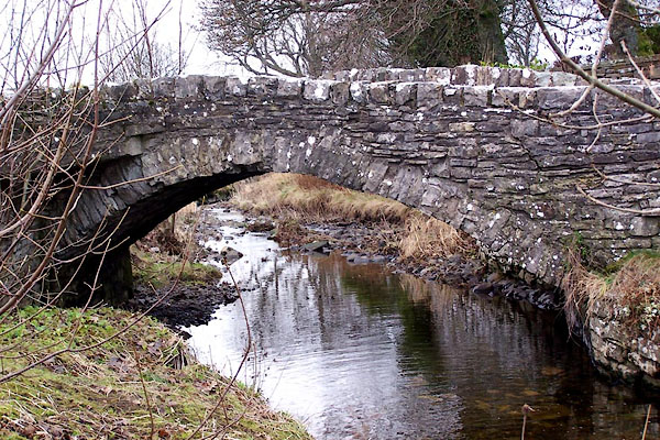
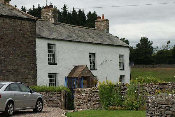
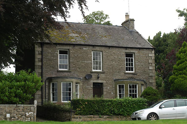
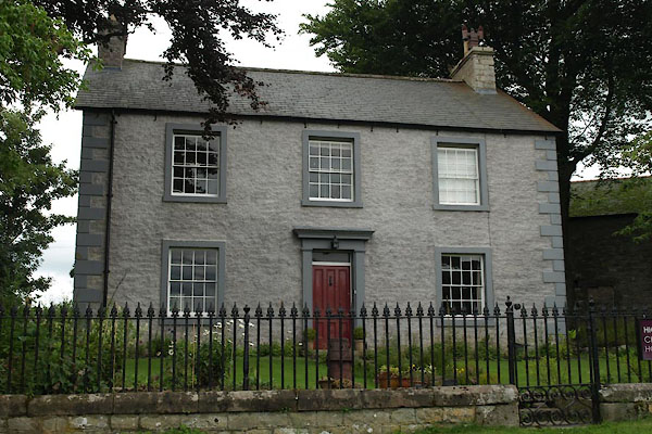
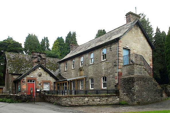
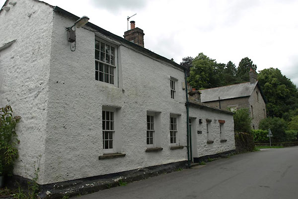
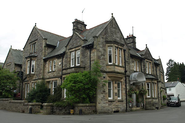
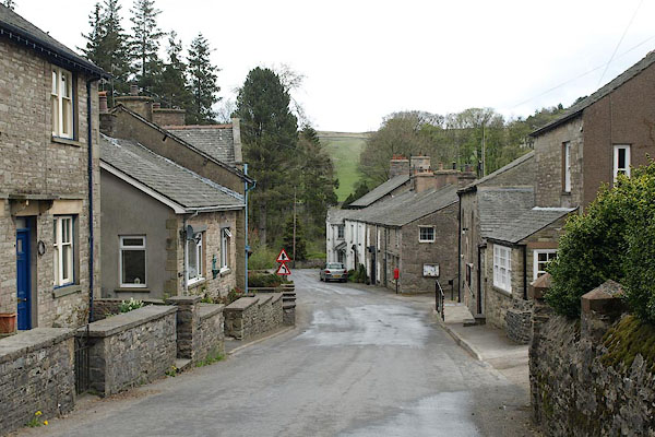 BSP52.jpg (taken 30.4.2010) 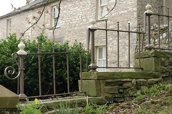 BSP53.jpg Railings, (taken 30.4.2010) |
||||
|
|
||||
| evidence:- | old map:- OS County Series (Wmd 29 12) placename:- Ravenstonedale |
|||
| source data:- | Maps, County Series maps of Great Britain, scales 6 and 25
inches to 1 mile, published by the Ordnance Survey, Southampton,
Hampshire, from about 1863 to 1948. |
|||
|
|
||||
| evidence:- | old map:- Saxton 1579 placename:- Ravingstangdale |
|||
| source data:- | Map, hand coloured engraving, Westmorlandiae et Cumberlandiae Comitatus ie Westmorland
and Cumberland, scale about 5 miles to 1 inch, by Christopher Saxton, London, engraved
by Augustinus Ryther, 1576, published 1579-1645.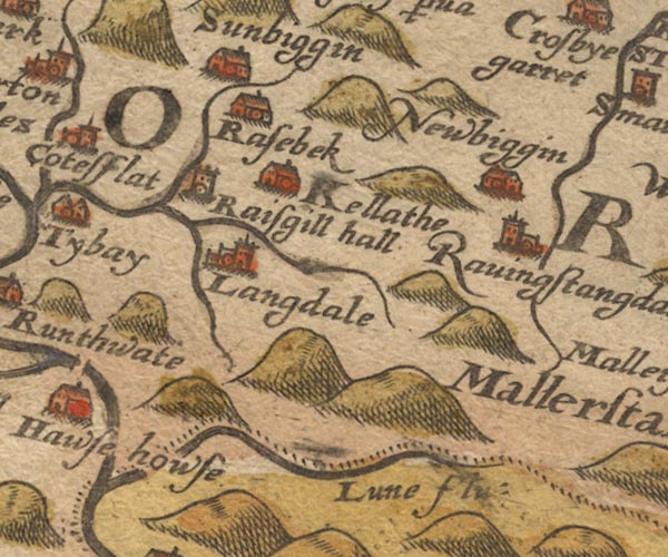 Sax9NY60.jpg Church, symbol for a parish or village, with a parish church. "Ravingstangdale" item:- private collection : 2 Image © see bottom of page |
|||
|
|
||||
| evidence:- | old map:- Mercator 1595 (edn?) placename:- Ravingstandale |
|||
| source data:- | Map, hand coloured engraving, Westmorlandia, Lancastria, Cestria
etc, ie Westmorland, Lancashire, Cheshire etc, scale about 10.5
miles to 1 inch, by Gerard Mercator, Duisberg, Germany, 1595,
edition 1613-16. MER5WmdA.jpg "Ravingstandale" circle item:- Armitt Library : 2008.14.3 Image © see bottom of page |
|||
|
|
||||
| evidence:- | old map:- Speed 1611 (Wmd) placename:- Ravingstangdale |
|||
| source data:- | Map, hand coloured engraving, The Countie Westmorland and
Kendale the Cheif Towne, scale about 2.5 miles to 1 inch, by
John Speed, 1610, published by George Humble, Popes Head Alley,
London, 1611-12.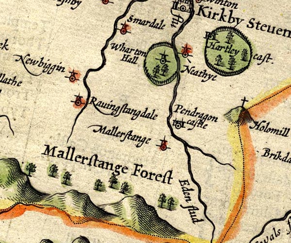 SP14NY70.jpg "Ravingstangdale" circle, tower item:- Armitt Library : 2008.14.5 Image © see bottom of page |
|||
|
|
||||
| evidence:- | old map:- Jansson 1646 placename:- Ravingstangdale |
|||
| source data:- | Map, hand coloured engraving, Cumbria and Westmoria, ie
Cumberland and Westmorland, scale about 3.5 miles to 1 inch, by
John Jansson, Amsterdam, Netherlands, 1646.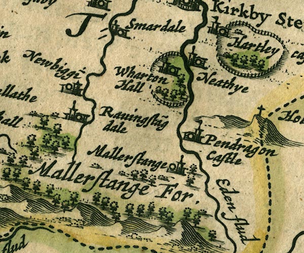 JAN3NY70.jpg "Ravingsta~gdale" Buildings and tower. item:- JandMN : 88 Image © see bottom of page |
|||
|
|
||||
| evidence:- | hearth tax returns:- Hearth Tax 1675 placename:- Ravenstonedale |
|||
| source data:- | Records, hearth tax survey returns, Westmorland, 1674/75. "Ravenstonedale" |
|||
|
|
||||
| evidence:- | hearth tax returns:- Hearth Tax 1670 placename:- Town Angle |
|||
| source data:- | Records, hearth tax returns, exchequer duplicates, Westmorland,
1670. "Town Angle" in "Ravenstone Daill" |
|||
|
|
||||
| evidence:- | old map:- Morden 1695 (Wmd) placename:- Ravingstondale placename:- Russendale |
|||
| source data:- | Map, hand coloured engraving, Westmorland, scale about 2.5 miles to 1 inch, by Robert
Morden, published by Abel Swale, the Unicorn, St Paul's Churchyard, Awnsham, and John
Churchill, the Black Swan, Paternoster Row, London, 1695.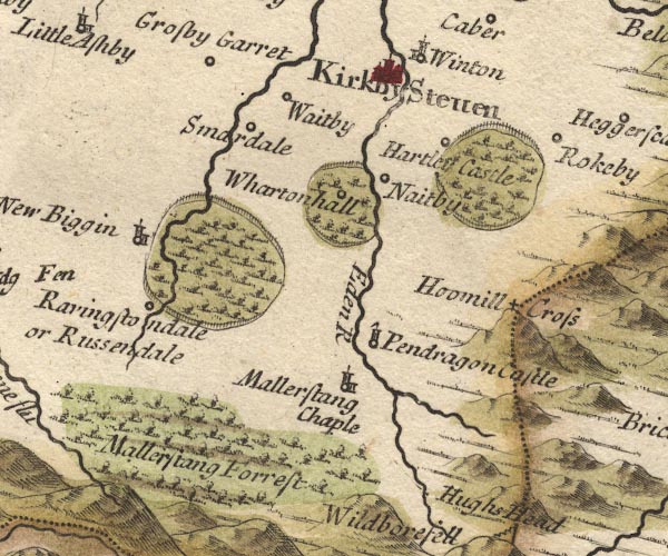 MD10NY70.jpg "Ravingstondale or Russendale" Circle. item:- JandMN : 24 Image © see bottom of page |
|||
|
|
||||
| evidence:- | old map:- Badeslade 1742 placename:- Russendale |
|||
| source data:- | Map, uncoloured engraving, A Map of Westmorland North from
London, scale about 10 miles to 1 inch, with descriptive text,
by Thomas Badeslade, London, engraved and published by William
Henry Toms, Union Court, Holborn, London, 1742. click to enlarge click to enlargeBD12.jpg "Russendale" circle, italic lowercase text; village, hamlet or locality item:- Dove Cottage : 2007.38.62 Image © see bottom of page |
|||
|
|
||||
| evidence:- | perhaps descriptive text:- Simpson 1746 placename:- Rissendale |
|||
| source data:- | Atlas, three volumes of maps and descriptive text published as
'The Agreeable Historian, or the Compleat English Traveller
...', by Samuel Simpson, 1746. goto source goto sourcePage 1020:- "..." "... the Lone or Lune, which rising near Mallerstrand Forest, not far from Rissendale, ..." |
|||
|
|
||||
| evidence:- | old map:- Simpson 1746 map (Wmd) placename:- Russendale |
|||
| source data:- | Map, uncoloured engraving, Westmorland, scale about 8 miles to 1
inch, printed by R Walker, Fleet Lane, London, 1746.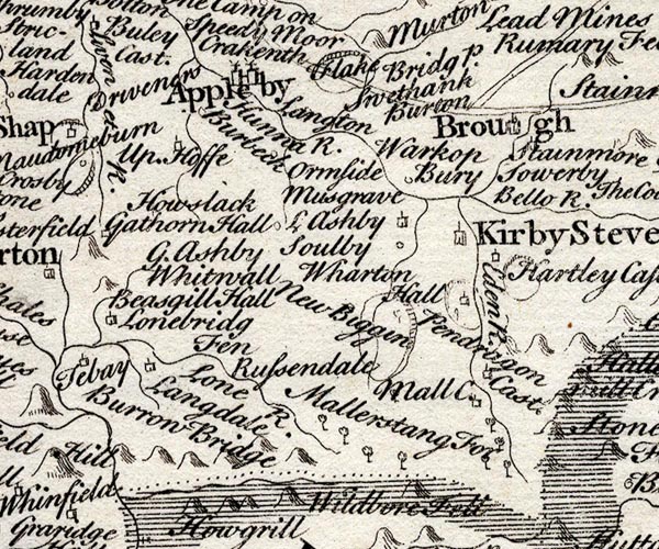 SMP2NYQ.jpg "Russendale" item:- Dove Cottage : 2007.38.59 Image © see bottom of page |
|||
|
|
||||
| evidence:- | old map:- Bowen and Kitchin 1760 placename:- Ravingstone placename:- Rissendale |
|||
| source data:- | Map, hand coloured engraving, A New Map of the Counties of
Cumberland and Westmoreland Divided into their Respective Wards,
scale about 4 miles to 1 inch, by Emanuel Bowen and Thomas
Kitchin et al, published by T Bowles, Robert Sayer, and John
Bowles, London, 1760.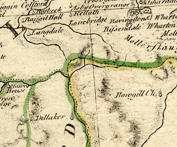 BO18NY60.jpg "Ravingstone [or] Rissendale" circle, tower item:- Armitt Library : 2008.14.10 Image © see bottom of page |
|||
|
|
||||
| evidence:- | old map:- Jefferys 1770 (Wmd) |
|||
| source data:- | Map, 4 sheets, The County of Westmoreland, scale 1 inch to 1
mile, surveyed 1768, and engraved and published by Thomas
Jefferys, London, 1770. J5NY70SW.jpg "Town" blocks, labelled in italic lowercase text; settlement, village?; in Ravenstonedale valley item:- National Library of Scotland : EME.s.47 Image © National Library of Scotland |
|||
|
|
||||
| evidence:- | old text:- Pennant 1773 placename:- Ravenstondale item:- standard bearer; Battle of Solway Moss |
|||
| source data:- | Book, A Tour from Downing to Alston Moor, 1773, by Thomas
Pennant, published by Edward Harding, 98 Pall Mall, London, 1801. goto source Pennant's Tour 1773, page 123 "... Ravenston-dale, a parish which had the honour of giving birth to the late pious, benevolent, learned and humane Divine the Reverend Dr. George Fothergil, under whom I had the happiness of four years tuition at Queen's College, Oxford. He was of a respectable family in this dale, and reckoned among his ancestors Sir William Fothergil, standard-bearer to Sir Thomas Wharton at the battle of Solway Moss." |
|||
|
|
||||
| evidence:- | descriptive text:- West 1778 (11th edn 1821) |
|||
| source data:- | Guide book, A Guide to the Lakes, by Thomas West, published by
William Pennington, Kendal, Cumbria once Westmorland, and in
London, 1778 to 1821. goto source Tour to the Caves in the West Riding of Yorkshire, late 18th century Page 243:- "..." "... The Roman road is easily traced from Ribchester ... to Overborough; afterwards the Roman road goes through Casterton and Middleton, and, as some think, by Borrow-bridge and Orton, to Apulby. Others, and perhaps from better reasons, are of opinion, the road went by Sedbergh, or Sedburgh, [2] over Blewcaster, along Ravenstonedale-street, and through Kirkby-Stephen, to Brough or Burgh." "[2] ... Street is derived from the Latin word stratum, or military road, or causeway. ..." |
|||
|
|
||||
| evidence:- | old text:- Camden 1789 (Gough Additions) placename:- Ravenstondale placename:- Rissendale |
|||
| source data:- | Book, Britannia, or A Chorographical Description of the Flourishing Kingdoms of England,
Scotland, and Ireland, by William Camden, 1586, translated from the 1607 Latin edition
by Richard Gough, published London, 1789. goto source Page 155:- "..." "The river Lune rising a little above Ravenstondale, or Rissendale, ..." |
|||
|
|
||||
| evidence:- | old map:- Cary 1789 (edn 1805) |
|||
| source data:- | Map, uncoloured engraving, Westmoreland, scale about 2.5 miles
to 1 inch, by John Cary, London, 1789; edition 1805. CY24NY70.jpg "Town" block/s, labelled in italic lowercase; house, or hamlet item:- JandMN : 129 Image © see bottom of page |
|||
|
|
||||
| evidence:- | old text:- Capper 1808 placename:- Ravenstonedale item:- population |
|||
| source data:- | Gazetteer, A Topographical Dictionary of the United Kingdom,
compiled by Benjamin Pitts Capper, published by Richard
Phillips, Bridge Street, Blackfriars, London, 1808; published
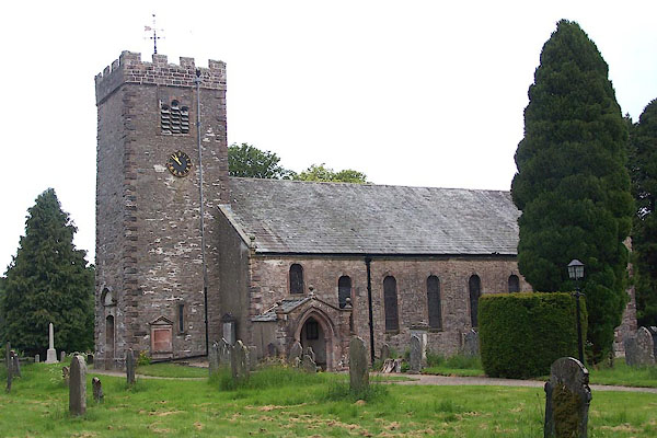
1808-29. goto source "..." "RAVENSTONEDALE, a parish in East ward, Westmoreland, 5 miles from Kirby Stephen, and 260 from London; containing 224 houses and 1138 inhabitants. The church is a small but neat structure rebuilt in 1744, and has a square tower containing three bells. There is a handsome meeting house, for Calvinistic dissenters, whose minister has established a Sunday school. The grammar-school was rebuilt in 1758, and was originally well endowed. Many of the men, women, and children are employed, during the winter, in knitting worsted stockings for the market at Kendal. ... The church is a perpetual curacy, in the patronage of the earl of Lonsdale, who is lord of the manor. - Monthly Magazine, 1801." "..." |
|||
|
|
||||
| evidence:- | old map:- Cooper 1808 placename:- Ravenstonedale |
|||
| source data:- | Map, hand coloured engraving, Westmoreland ie Westmorland, scale
about 9 miles to 1 inch, by H Cooper, 1808, published by R
Phillips, Bridge Street, Blackfriars, London, 1808. click to enlarge click to enlargeCOP4.jpg "Ravenstonedale" area item:- Dove Cottage : 2007.38.53 Image © see bottom of page |
|||
|
|
||||
| evidence:- | old text:- Gents Mag item:- tenancy |
|||
| source data:- | Magazine, The Gentleman's Magazine or Monthly Intelligencer or
Historical Chronicle, published by Edward Cave under the
pseudonym Sylvanus Urban, and by other publishers, London,
monthly from 1731 to 1922. goto source Gentleman's Magazine 1825 part 1 p.516 "Compendium of County History. - Westmorland." "One of the customs at RAVENSTONEDALE is very peculiar. If any tenant being of the age sixteen die, not having a child born in wedlock, and without a will attested by at least 4 tenants of the manor, his estate escheats to the lord. The Earl of Lonsdale offered to enfranchise the tenants, but such was their attachment to ancient customs as to refuse the offer." |
|||
|
|
||||
| evidence:- | old directory:- Parson and White 1829 item:- Bowderdale Angle; Fellend Angle; Newbiggin Angle; Town Angle |
|||
| source data:- | Book, History, Directory, and Gazetteer, of the Counties of
Cumberland and Westmorland, with that Part of the Lake District
in Lancashire, forming the Lordships of Furness and Cartmel, by
William Parson and William White, published by W White and Co,
44 Hunslet Lane, Leeds, Yorkshire, 1829. Ravenstonedale is listed under four separate angles - Bowderdale Angle, Fellend Angle, Newbiggin Angle, and Town Angle. |
|||
|
|
||||
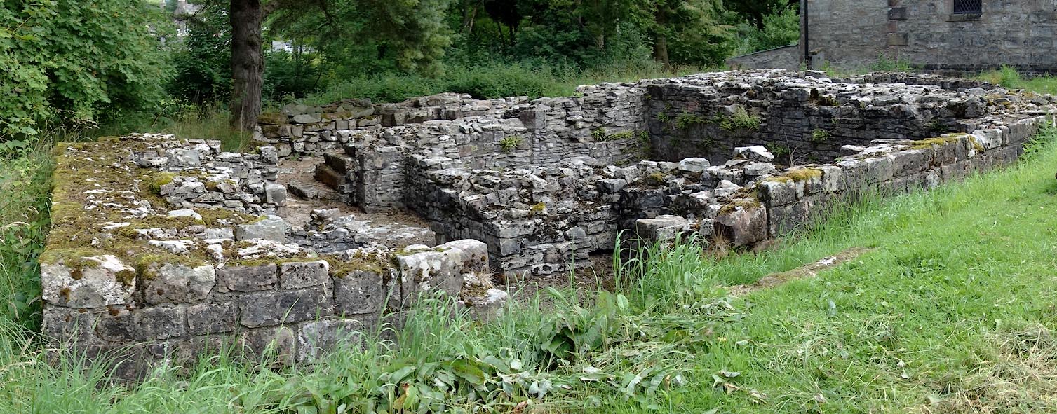
| evidence:- | site plan:- Historical Monuments 1936 |
|||
| source data:- | Site plan, uncoloured lithograph, Ravenstonedale Mediaeval Foundations North of the
Church, Ravenstonedale, Westmorland, scale about 1 to 600, published by Royal Commission
on Historical Monuments England, London, 1936.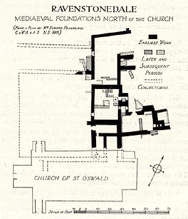 click to enlarge click to enlargeHMW118.jpg On p.198 of the Inventory of the Historical Monuments in Westmorland. printed, top "RAVENSTONEDALE / MEDIAEVAL FOUNDATIONS NORTH OF THE CHURCH" RCHME no. Wmd, Ravenstonedale 2 item:- Armitt Library : A745.119 Image © see bottom of page |
|||
|
|
||||
| evidence:- | site plan:- Historical Monuments 1936 |
|||
| source data:- | Site plan, uncoloured lithograph, Dyke at Ravenstonedale, Westmorland, scale about
1 to 21000, about 2.5 inches to 1 mile, published by Royal Commission on Historical
Monuments England, London, 1936.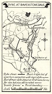 click to enlarge click to enlargeHMW119.jpg On p.200 of the Inventory of the Historical Monuments in Westmorland. printed, top "DYKE AT RAVENSTONEDALE" RCHME no. Wmd, Ravenstonedale 33 item:- Armitt Library : A745.120 Image © see bottom of page |
|||
|
|
||||
| evidence:- | old map:- Post Office 1850s-1900s placename:- Ravenstonedale |
|||
| source data:- | Post road maps, General Post Office Circulation Map for England
and Wales, for the General Post Office, London, 1850s-1900s. click to enlarge click to enlargePOF7Cm.jpg "Ravenstonedale" map date 1909 |
|||
|
|
||||
| evidence:- | old map:- Post Office 1850s-1900s placename:- Ravenstonedale |
|||
| source data:- | Post road maps, General Post Office Circulation Map for England
and Wales, for the General Post Office, London, 1850s-1900s. click to enlarge click to enlargePF10Cm.jpg "Ravenstonedale" map date 1892 |
|||
|
|
||||
| evidence:- | old map:- Post Office 1850s-1900s placename:- Ravenstonedale |
|||
| source data:- | Post road maps, General Post Office Circulation Map for England
and Wales, for the General Post Office, London, 1850s-1900s. click to enlarge click to enlargePOF2Cm.jpg "Ravenstonedale" map date 1890 |
|||
|
|
||||
| :- |
images courtesy of the British Postal Museum and Hampshire CC Museums |
|||
|
|
||||
| notes:- |
Piped water came to the village in 1890. A tap was installed in a small building on
Main Street. |
|||
|
|
||||
| :- |
William Whellan:- |
|||
| "Ravenstonedale parish comprises only one manor and township, though, for the convenience
of collecting rates, &c., it is divided into four angles or parts, called respectively
Town, Bowderdale, Fell-End, and Newbiggin Angles." |
||||
| Whellan, William: 1860: History and Topography of the Counties of Cumberland and Westmoreland:
Whellan, W and Co (Pontefract, Yorkshire) & Whittaker and Co (London) &Galt and Co
(Manchester, Greater Manchester) |
||||
| At least one old boundary stone uses the word 'angle'. |
||||
|
|
||||
| places:- |
|
|||
|
||||
|
||||
|
||||
|
||||
|
||||
|
||||
|
||||
|
||||
|
||||
|
||||
|
||||
|
||||
|
||||
|
||||
|
||||
|
||||
|
||||
|
||||
|
||||
|
||||
|
||||
|
||||
|
||||
|
||||
|
||||
|
||||
|
||||
|
||||
|
||||
|
||||
|
||||
|
||||
|
||||
|
||||
|
||||
|
||||
|
||||
|
||||
|
||||
|
||||
|
||||
|
||||
Lakes Guides menu.