Old Cumbria Gazetteer
 |
 |
|
||
| Eamont Bridge | ||||
| Yamon Bridge | ||||
| civil parish:- | Yanwath and Eamont Bridge (formerly Westmorland) | |||
| county:- | Cumbria | |||
| locality type:- | locality | |||
| locality type:- | buildings | |||
| coordinates:- | NY52242868 (etc) | |||
| 1Km square:- | NY5228 | |||
| 10Km square:- | NY52 | |||
|
|
||||
| evidence:- | old map:- OS County Series (Wmd 3 12) placename:- Eamontbridge |
|||
| source data:- | Maps, County Series maps of Great Britain, scales 6 and 25
inches to 1 mile, published by the Ordnance Survey, Southampton,
Hampshire, from about 1863 to 1948. OS County Series (Cmd 59 5) |
|||
|
|
||||
| evidence:- | hearth tax returns:- Hearth Tax 1675 placename:- Bridge, The |
|||
| source data:- | Records, hearth tax survey returns, Westmorland, 1674/75. "The bridge" in "Yainwath and Bridge" |
|||
|
|
||||
| evidence:- | hearth tax returns:- Hearth Tax 1670 placename:- Emond Bridge |
|||
| source data:- | Records, hearth tax returns, exchequer duplicates, Westmorland,
1670. "Emond Bridge" |
|||
|
|
||||
| evidence:- | old map:- Ogilby 1675 (plate 38) placename:- Emonbridge |
|||
| source data:- | Road strip map, hand coloured engraving, continuation of the
Road from London to Carlisle, scale about 1 inch to 1 mile, by
John Ogilby, London, 1675.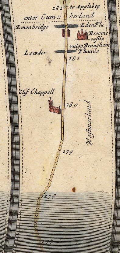 OG38m277.jpg In mile 281, Westmorland. "Emonbridge" Houses drawn each side of the road. item:- JandMN : 21 Image © see bottom of page |
|||
|
|
||||
| evidence:- | old map:- Morden 1695 (Wmd) placename:- Emot |
|||
| source data:- | Map, hand coloured engraving, Westmorland, scale about 2.5 miles to 1 inch, by Robert
Morden, published by Abel Swale, the Unicorn, St Paul's Churchyard, Awnsham, and John
Churchill, the Black Swan, Paternoster Row, London, 1695.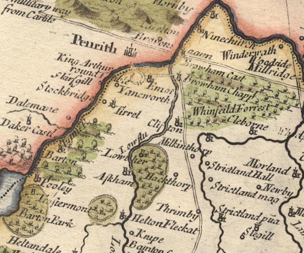 MD10NY52.jpg "Emot" Circle, building and tower. item:- JandMN : 24 Image © see bottom of page |
|||
|
|
||||
| evidence:- | descriptive text:- Defoe 1724-26 placename:- Louther Bridge |
|||
| source data:- | Tour through England and Wales, by Daniel Defoe, published in
parts, London, 1724-26. "... the great road leads to the left-hand to Perith, in going to which we first pass the Eden, at a very good stone bridge call'd Louther Bridge, and then the Elnot over another." |
|||
|
|
||||
| evidence:- | old text:- Gents Mag item:- rebellion, 1745; 1745 Rebellion; inn, Eamont Bridge |
|||
| source data:- | Magazine, The Gentleman's Magazine or Monthly Intelligencer or
Historical Chronicle, published by Edward Cave under the
pseudonym Sylvanus Urban, and by other publishers, London,
monthly from 1731 to 1922. goto source goto sourceGentleman's Magazine 1746 p.62 "..." "Dec. 14 [1745]. The D. of Perth with about 110 men, the vanguard of the rebels, ... about noon they proceeded on their march as far as Eamont Bridge, intending for Penrith that night, but perceiving that beacon on fire, they enquir'd at a public house the reason; the landlady told them it was to raise the country, and added, 'Gentlemen, I desire you for God's sake to go back, because all the hedges from here to Penrith are lin'd.' They follow'd her advice, and returned to Shap. ..." |
|||
|
|
||||
| evidence:- | old map:- Bowen and Kitchin 1760 placename:- Emon Bridge |
|||
| source data:- | Map, hand coloured engraving, A New Map of the Counties of
Cumberland and Westmoreland Divided into their Respective Wards,
scale about 4 miles to 1 inch, by Emanuel Bowen and Thomas
Kitchin et al, published by T Bowles, Robert Sayer, and John
Bowles, London, 1760.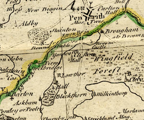 BO18NY42.jpg blocks, on road item:- Armitt Library : 2008.14.10 Image © see bottom of page |
|||
|
|
||||
| evidence:- | old map:- Jefferys 1770 (Wmd) placename:- Eamont Bridge |
|||
| source data:- | Map, 4 sheets, The County of Westmoreland, scale 1 inch to 1
mile, surveyed 1768, and engraved and published by Thomas
Jefferys, London, 1770.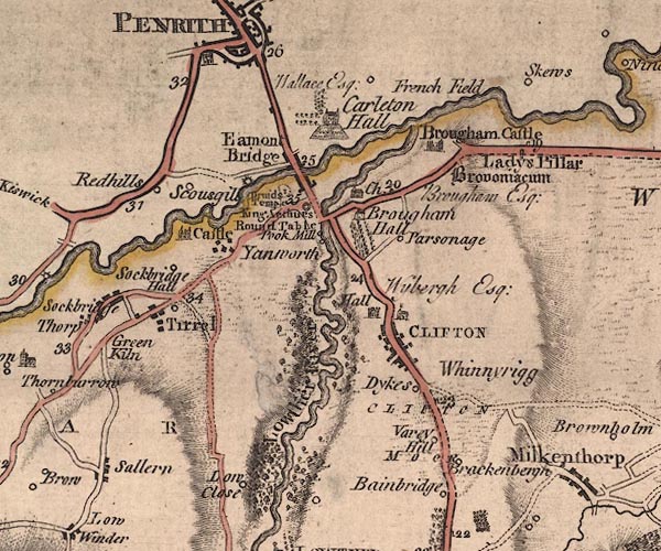 J5NY52NW.jpg "Eamont Bridge" blocks, labelled in upright lowercase text; settlement; town? item:- National Library of Scotland : EME.s.47 Image © National Library of Scotland |
|||
|
|
||||
| evidence:- | old map:- Donald 1774 (Cmd) placename:- Eamont Bridge |
|||
| source data:- | Map, hand coloured engraving, 3x2 sheets, The County of Cumberland, scale about 1
inch to 1 mile, by Thomas Donald, engraved and published by Joseph Hodskinson, 29
Arundel Street, Strand, London, 1774.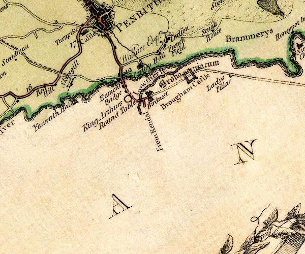 D4NY52NW.jpg "Eamont Bridge" block or blocks, labelled in lowercase; a hamlet or just a house item:- Carlisle Library : Map 2 Image © Carlisle Library |
|||
|
|
||||
| evidence:- | old text:- Clarke 1787 placename:- Emont Bridge item:- dyes |
|||
| source data:- | Guide book, A Survey of the Lakes of Cumberland, Westmorland,
and Lancashire, written and published by James Clarke, Penrith,
Cumberland, and in London etc, 1787; published 1787-93. goto source Page 11:- "..." "We now enter the small but neat village of Emont Bridge, consisting only of a few cottages; yet so excellently is this spot situated for trade, that besides a very considerable bleaching-ground, several fulling mills, &c. here is a silk and woolen Dyer, of sufficient abilities to produce all those beautiful tints which are employed in the Earl of Lonsdale's splendid Carpet-Manufactory, whose excellence is universally known." |
|||
|
|
||||
| evidence:- | old map:- Cary 1789 (edn 1805) placename:- Emont Bridge |
|||
| source data:- | Map, uncoloured engraving, Westmoreland, scale about 2.5 miles
to 1 inch, by John Cary, London, 1789; edition 1805.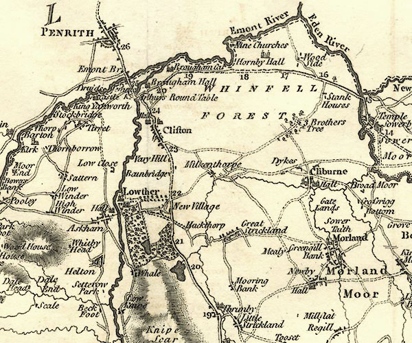 CY24NY52.jpg "Emont Br" block/s, labelled in italic lowercase; house, or hamlet; also in Cumberland item:- JandMN : 129 Image © see bottom of page |
|||
|
|
||||
| evidence:- | road book:- Cary 1798 (2nd edn 1802) placename:- Emont Bridge |
|||
| source data:- | Road book, itineraries, Cary's New Itinerary, by John Cary, 181
Strand, London, 2nd edn 1802. goto source click to enlarge click to enlargeC38267.jpg page 267-268 "Emont Bridge" goto source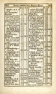 click to enlarge click to enlargeC38281.jpg page 281-282 "Emont Bridge" item:- JandMN : 228.1 Image © see bottom of page |
|||
|
|
||||
| evidence:- | old map:- Ford 1839 map placename:- Eamont Bridge |
|||
| source data:- | Map, uncoloured engraving, Map of the Lake District of
Cumberland, Westmoreland and Lancashire, scale about 3.5 miles
to 1 inch, published by Charles Thurnam, Carlisle, and by R
Groombridge, 5 Paternoster Row, London, 3rd edn 1843.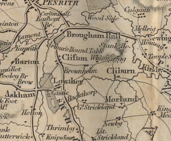 FD02NY52.jpg "Eamont Br." item:- JandMN : 100.1 Image © see bottom of page |
|||
|
|
||||
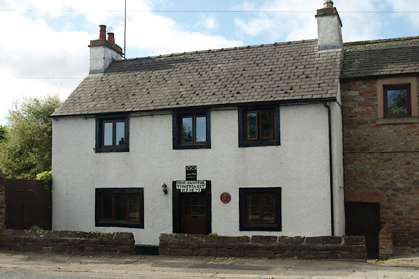
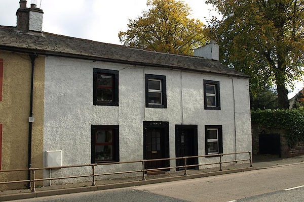
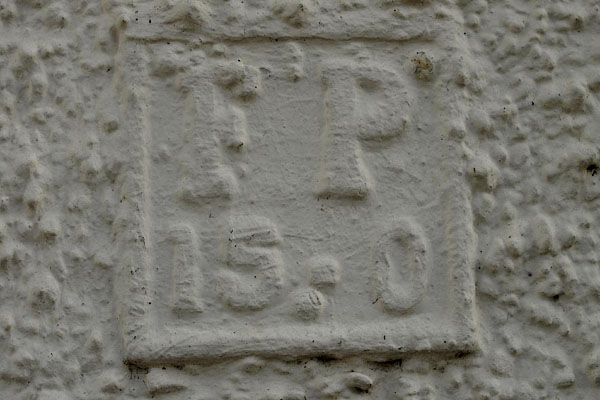
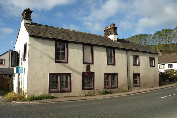
| evidence:- | old photograph:- Bell 1880s-1940s item:- date stone (1671) |
|||
| source data:- | Photograph, House at Eamont Bridge, date stone, Eamont Bridge, Westmorland, by Herbert
Bell, photographer, Ambleside, Westmorland, 1895.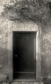 click to enlarge click to enlargeHB0064.jpg Vol.1 no.64 in an album, Examples of Early Domestic and Military Architecture in Westmorland, assembled 1910. ms at bottom:- "64. House at Eamont Bridge. Barton. W." item:- Armitt Library : 1958.3165.64 Image © see bottom of page |
|||
|
|
||||
| evidence:- | old map:- Burrow 1920s |
|||
| source data:- | Road book, On the Road, Dunlop Pictorial Road Plans, volume V,
strip maps with parts in Westmorland, Cumberland etc, irregular
scale about 1.5 miles to 1 inch, by E J Burrow and Co,
Cheltenham, Gloucestershire, 1920s.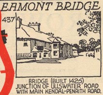 EJB3Vg20.jpg item:- private collection : 17 Image © see bottom of page |
|||
|
|
||||
| places:- |
|
|||
|
||||
|
||||
|
||||
|
||||
|
||||
|
||||
|
||||
|
||||
|
||||
|
||||
|
||||
|
||||
|
||||
|
||||
|
||||
|
||||
|
||||
|
||||
|
||||
|
||||
Lakes Guides menu.