Old Cumbria Gazetteer
 |
 |
|
||
| Crake, River | ||||
| runs into:- |  Leven Estuary Leven Estuary |
|||
|
|
||||
| civil parish:- | Lowick (formerly Lancashire) | |||
| civil parish:- | Blawith and Subberthwaite (formerly Lancashire) | |||
| civil parish:- | Colton (formerly Lancashire) | |||
| civil parish:- | Egton with Newland (formerly Lancashire) | |||
| county:- | Cumbria | |||
| locality type:- | river | |||
| 1Km square:- | SD2987 (etc) | |||
| 10Km square:- | SD28 | |||
| 10Km square:- | SD38 | |||
|
|
||||
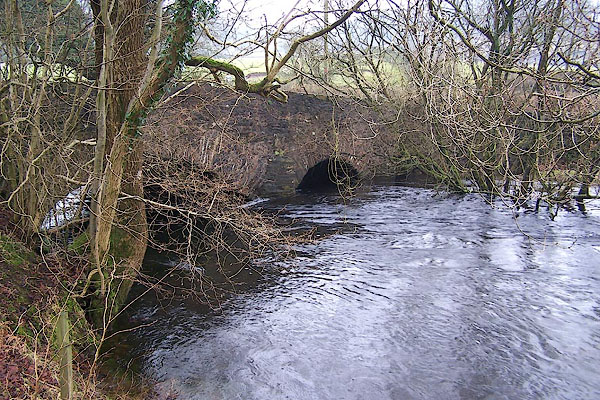
 BOK30.jpg Running higher than the fields. At Bouthey Bridge. (taken 11.1.2008) |
||||
|
|
||||
| evidence:- | old map:- OS County Series (Lan 11) |
|||
| source data:- | Maps, County Series maps of Great Britain, scales 6 and 25
inches to 1 mile, published by the Ordnance Survey, Southampton,
Hampshire, from about 1863 to 1948. "Ordinary Tides flow to this point" |
|||
|
|
||||
| evidence:- | old map:- OS County Series (Lan 11) |
|||
| source data:- | Maps, County Series maps of Great Britain, scales 6 and 25
inches to 1 mile, published by the Ordnance Survey, Southampton,
Hampshire, from about 1863 to 1948. "Spring Tides flow to this point" |
|||
|
|
||||
| evidence:- | old map:- Saxton 1579 |
|||
| source data:- | Map, hand coloured engraving, Westmorlandiae et Cumberlandiae Comitatus ie Westmorland
and Cumberland, scale about 5 miles to 1 inch, by Christopher Saxton, London, engraved
by Augustinus Ryther, 1576, published 1579-1645.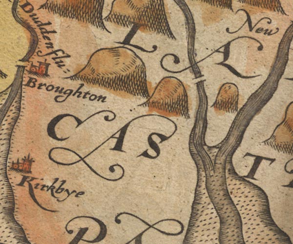 Sax9SD28.jpg item:- private collection : 2 Image © see bottom of page |
|||
|
|
||||
| evidence:- | old map:- Mercator 1595 (edn?) placename:- |
|||
| source data:- | Map, hand coloured engraving, Westmorlandia, Lancastria, Cestria
etc, ie Westmorland, Lancashire, Cheshire etc, scale about 10.5
miles to 1 inch, by Gerard Mercator, Duisberg, Germany, 1595,
edition 1613-16.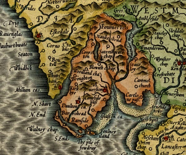 MER5LanA.jpg "" double line with stream lines; river, running into the sea item:- Armitt Library : 2008.14.3 Image © see bottom of page |
|||
|
|
||||
| evidence:- | old map:- Keer 1605 |
|||
| source data:- | Map, hand coloured engraving, Westmorland and Cumberland, scale
about 16 miles to 1 inch, probably by Pieter van den Keere, or
Peter Keer, about 1605 edition perhaps 1676. click to enlarge click to enlargeKER8.jpg "" double wiggly line, tapering to single; river item:- Dove Cottage : 2007.38.110 Image © see bottom of page |
|||
|
|
||||
| evidence:- | probably old map:- Speed 1611 (Cum/EW) |
|||
| source data:- | Map, hand coloured engraving, Kingdome of Great Britaine and
Ireland, scale about 36 miles to 1 inch, by John Speed, about
1610-11, published by Thomas Bassett, Fleet Street and Richard
Chiswell, St Paul's Churchyard, London, 1676? click to enlarge click to enlargeSPD6Cm.jpg item:- private collection : 85 Image © see bottom of page |
|||
|
|
||||
| evidence:- | old map:- Speed 1611 (Wmd) |
|||
| source data:- | Map, hand coloured engraving, The Countie Westmorland and
Kendale the Cheif Towne, scale about 2.5 miles to 1 inch, by
John Speed, 1610, published by George Humble, Popes Head Alley,
London, 1611-12.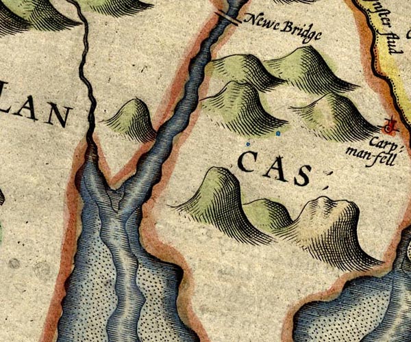 SP14SD38.jpg double line, into the Leven Estuary item:- Armitt Library : 2008.14.5 Image © see bottom of page |
|||
|
|
||||
| evidence:- | old map:- Jansson 1646 |
|||
| source data:- | Map, hand coloured engraving, Cumbria and Westmoria, ie
Cumberland and Westmorland, scale about 3.5 miles to 1 inch, by
John Jansson, Amsterdam, Netherlands, 1646.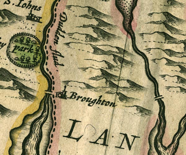 JAN3SD28.jpg Double wiggly line. item:- JandMN : 88 Image © see bottom of page |
|||
|
|
||||
| evidence:- | old map:- Sanson 1679 |
|||
| source data:- | Map, hand coloured engraving, Ancien Royaume de Northumberland
aujourdhuy Provinces de Nort, ie the Ancient Kingdom of
Northumberland or the Northern Provinces, scale about 9.5 miles
to 1 inch, by Nicholas Sanson, Paris, France, 1679. click to enlarge click to enlargeSAN2Cm.jpg tapering wiggly line; river item:- Dove Cottage : 2007.38.15 Image © see bottom of page |
|||
|
|
||||
| evidence:- | old map:- Seller 1694 (Wmd) |
|||
| source data:- | Map, hand coloured engraving, Westmorland, scale about 8 miles
to 1 inch, by John Seller, 1694. click to enlarge click to enlargeSEL7.jpg item:- Dove Cottage : 2007.38.87 Image © see bottom of page |
|||
|
|
||||
| evidence:- | old map:- Morden 1695 (Wmd) |
|||
| source data:- | Map, hand coloured engraving, Westmorland, scale about 2.5 miles to 1 inch, by Robert
Morden, published by Abel Swale, the Unicorn, St Paul's Churchyard, Awnsham, and John
Churchill, the Black Swan, Paternoster Row, London, 1695.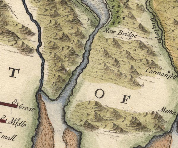 MD10SD38.jpg item:- JandMN : 24 Image © see bottom of page |
|||
|
|
||||
| evidence:- | old map:- Morden 1695 (Cmd) |
|||
| source data:- | Map, uncoloured engraving, Cumberland, scale about 4 miles to 1
inch, by Robert Morden, 1695, published by Abel Swale, the
Unicorn, St Paul's Churchyard, Awnsham, and John Churchill, the
Black Swan, Paternoster Row, London, 1695-1715.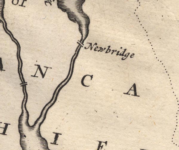 MD12SD38.jpg Double line from Coniston Water to the estuary. item:- JandMN : 90 Image © see bottom of page |
|||
|
|
||||
| evidence:- | old map:- Simpson 1746 map (Wmd) |
|||
| source data:- | Map, uncoloured engraving, Westmorland, scale about 8 miles to 1
inch, printed by R Walker, Fleet Lane, London, 1746.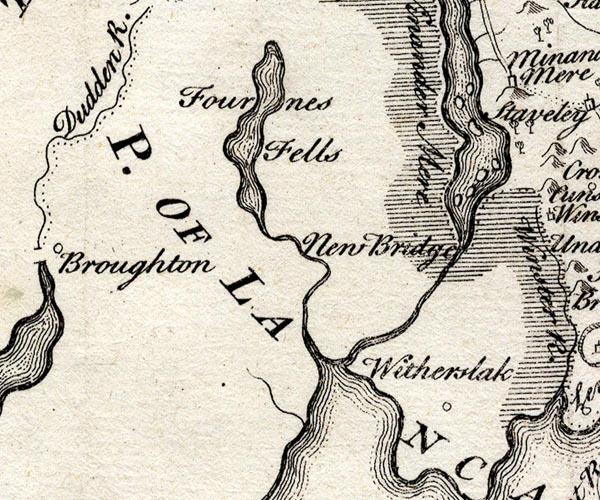 SMP2SDJ.jpg Wiggly line; from Coniston Water. item:- Dove Cottage : 2007.38.59 Image © see bottom of page |
|||
|
|
||||
| evidence:- | old map:- Bowen and Kitchin 1760 |
|||
| source data:- | Map, hand coloured engraving, A New Map of the Counties of
Cumberland and Westmoreland Divided into their Respective Wards,
scale about 4 miles to 1 inch, by Emanuel Bowen and Thomas
Kitchin et al, published by T Bowles, Robert Sayer, and John
Bowles, London, 1760.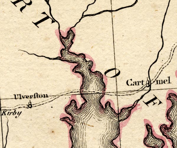 BO18SD27.jpg wiggly line, into the Leven Estuary item:- Armitt Library : 2008.14.10 Image © see bottom of page |
|||
|
|
||||
| evidence:- | old map:- Crosthwaite 1783-94 (Con) |
|||
| source data:- | Map, uncoloured engraving, An Accurate Map of Coniston Lake,
scale about 3 inches to 1 mile, by Peter Crosthwaite, Keswick,
Cumberland, 1788, version published 1809.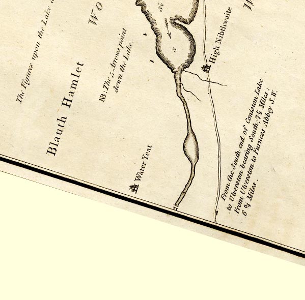 CTESD28Z.jpg lake draining Coniston Water item:- JandMN : 182.5 Image © see bottom of page |
|||
|
|
||||
| evidence:- | old map:- West 1784 map placename:- Crake River |
|||
| source data:- | Map, hand coloured engraving, A Map of the Lakes in Cumberland,
Westmorland and Lancashire, scale about 3.5 miles to 1 inch,
engraved by Paas, 53 Holborn, London, about 1784.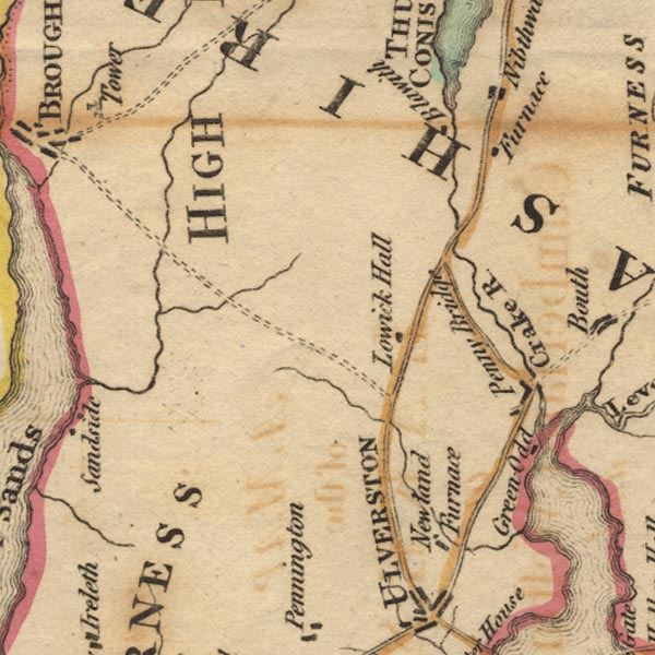 Ws02SD28.jpg item:- Armitt Library : A1221.1 Image © see bottom of page |
|||
|
|
||||
| evidence:- | road book:- Cary 1798 (2nd edn 1802) placename:- Crake, River |
|||
| source data:- | Road book, itineraries, Cary's New Itinerary, by John Cary, 181
Strand, London, 2nd edn 1802. goto source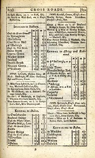 click to enlarge click to enlargeC38653.jpg page 653-654 "Cross the Crake River" item:- JandMN : 228.2 Image © see bottom of page |
|||
|
|
||||
| evidence:- | old map:- Skrine 1801 placename:- Crake River |
|||
| source data:- | Map, uncoloured engraving, rivers in Cumberland, Westmorland,
Lancashire and Cheshire, scale about 23 miles to 1 inch, by
Henry Skrine, published by P Elmsly, London, 1801.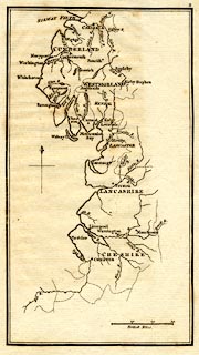 click to enlarge click to enlargeM076.jpg "Crake R." river item:- JandMN : 421 Image © see bottom of page |
|||
|
|
||||
| evidence:- | descriptive text:- Baker 1802 |
|||
| source data:- | Perspective road map with sections in Lancashire, Westmorland,
and Cumberland, by J Baker, London 1802. pp.25-26:- "... Cartmel ... between two bays of the sea, the one formed by the river Kenken, the other by the conflux of some smaller streams, there falling from the great Westmorland and Cumberland fells into the Irish sea. ..." |
|||
|
|
||||
| evidence:- | old map:- Cooke 1802 |
|||
| source data:- | Map, Lancashire, scale about 18 miles to 1 inch, by George
Cooke, 1802, bound in Gray's New Book of Roads, 1824, published
by Sherwood, Jones and Co, Paternoster Road, London, 1824.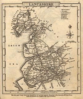 click to enlarge click to enlargeGRA1La.jpg tapering wiggly line; river item:- Hampshire Museums : FA2000.62.6 Image © see bottom of page |
|||
|
|
||||
| evidence:- | old map:- Laurie and Whittle 1806 placename:- Crake River |
|||
| source data:- | Road map, Completion of the Roads to the Lakes, scale about 10
miles to 1 inch, by Nathaniel Coltman? 1806, published by Robert
H Laurie, 53 Fleet Street, London, 1834. click to enlarge click to enlargeLw18.jpg "Crake R." river item:- private collection : 18.18 Image © see bottom of page |
|||
|
|
||||
| evidence:- | old print:- Wilkinson 1810 (plate 3) item:- boat; sailing boat |
|||
| source data:- | Print, uncoloured soft ground etching, Penny Bridge, between Ulverstone and Coniston;
with the Tide in, Cumberland, by Joseph Wilkinson, engraved by William Frederick Wells,
published by R Ackermann, Repository of Arts, 101 Strand, London, 1810.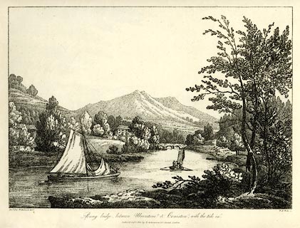 click to enlarge click to enlargeWKN103.jpg Plate 3 in Select Views in Cumberland, Westmoreland, and Lancashire. printed at bottom left, right, centre:- "Revd. Jos: Wilkenson delt. / W. F. Wells sc. / Penny bridge, between Ulverstone &Coniston; with the tide in. / Publish'd Sepr. 1. 1810. by R. Ackermann. 101. Strand. London." item:- Fell and Rock Climbing Club : MN4.3 Image © see bottom of page |
|||
|
|
||||
| evidence:- | old map:- Otley 1818 placename:- Crake River |
|||
| source data:- | Map, uncoloured engraving, The District of the Lakes,
Cumberland, Westmorland, and Lancashire, scale about 4 miles to
1 inch, by Jonathan Otley, 1818, engraved by J and G Menzies,
Edinburgh, Scotland, published by Jonathan Otley, Keswick,
Cumberland, et al, 1833.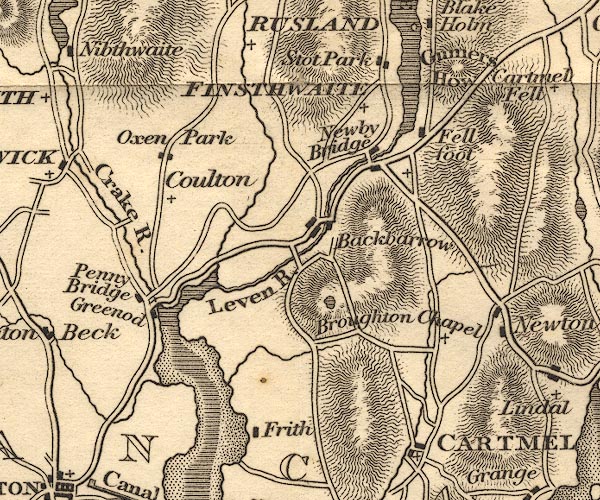 OT02SD38.jpg "Crake R." item:- JandMN : 48.1 Image © see bottom of page |
|||
|
|
||||
| evidence:- | descriptive text:- Otley 1823 (5th edn 1834) |
|||
| source data:- | Guide book, A Concise Description of the English Lakes, the
mountains in their vicinity, and the roads by which they may be
visited, with remarks on the mineralogy and geology of the
district, by Jonathan Otley, published by the author, Keswick,
Cumberland now Cumbria, by J Richardson, London, and by Arthur
Foster, Kirkby Lonsdale, Cumbria, 1823; published 1823-49,
latterly as the Descriptive Guide to the English Lakes. goto source Page 41:- "... the Leven, ... joins the Crake from Coniston upon the sands below Penny Bridge." |
|||
|
|
||||
| evidence:- | old map:- Perrot 1823 |
|||
| source data:- | Map, hand coloured engraving, Cumberland and Westmoreland ie
Westmorland, scale about 38 miles to 1 inch, by Aristide Michel
Perrot, engraved by Migneret, 1823, published by Etienne Ledoux,
9 Rue Guenegaud, Paris, France, 1824-48. click to enlarge click to enlargePER2.jpg tapering wiggly line item:- Dove Cottage : 2007.38.45 Image © see bottom of page |
|||
|
|
||||
| evidence:- | old map:- Ford 1839 map placename:- Crake River |
|||
| source data:- | Map, uncoloured engraving, Map of the Lake District of
Cumberland, Westmoreland and Lancashire, scale about 3.5 miles
to 1 inch, published by Charles Thurnam, Carlisle, and by R
Groombridge, 5 Paternoster Row, London, 3rd edn 1843.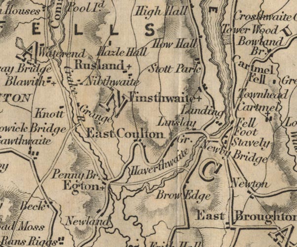 FD02SD38.jpg "Crake R." item:- JandMN : 100.1 Image © see bottom of page |
|||
|
|
||||
| evidence:- | old map:- Garnett 1850s-60s H placename:- Crake, River |
|||
| source data:- | Map of the English Lakes, in Cumberland, Westmorland and
Lancashire, scale about 3.5 miles to 1 inch, published by John
Garnett, Windermere, Westmorland, 1850s-60s.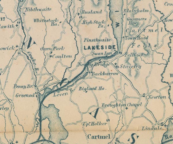 GAR2SD38.jpg "Crake R." wiggly line, river item:- JandMN : 82.1 Image © see bottom of page |
|||
|
|
||||
| evidence:- | old map:- Postlethwaite 1877 (3rd edn 1913) placename:- Crake, River |
|||
| source data:- | Map, uncoloured engraving, Map of the Lake District Mining Field, Westmorland, Cumberland,
Lancashire, scale about 5 miles to 1 inch, by John Postlethwaite, published by W H
Moss and Sons, 13 Lowther Street, Whitehaven, Cumberland, 1877 edn 1913.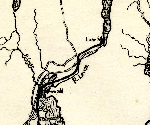 PST2SD38.jpg "Crake" wiggly line, running into Leven Estuary item:- JandMN : 162.2 Image © see bottom of page |
|||
|
|
||||
| hearsay:- |
The valley is described in Viking times in Collingwod's book 'Thorstein of the Mere'. |
|||
| Collingwood, W G: : Thorstein of the Mere |
||||
|
|
||||
| places:- |
|
|||
|
||||
|
||||
|
||||
Lakes Guides menu.