 Old Cumbria Gazetteer
 |
 |
|
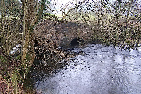
| Bouthrey Bridge, Colton | ||
| Bouthrey Bridge | ||
| site name:- | Crake, River | |
| civil parish:- | Colton (formerly Lancashire) | |
| civil parish:- | Blawith and Subberthwaite (formerly Lancashire) | |
| county:- | Cumbria | |
| locality type:- | bridge | |
| coordinates:- | SD29128896 | |
| 1Km square:- | SD2988 | |
| 10Km square:- | SD28 | |
|
|
||
 BOK27.jpg (taken 11.1.2008) 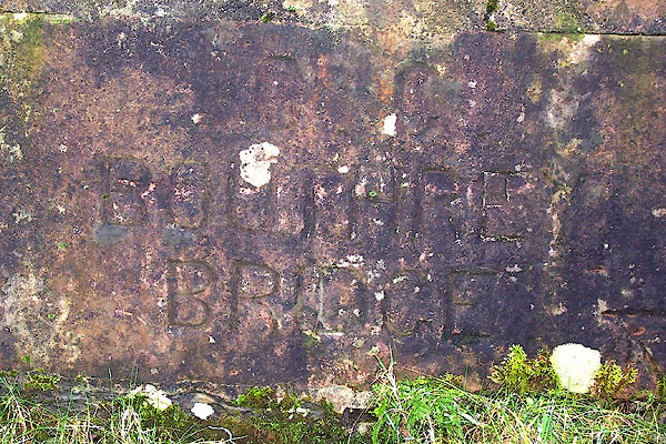 BOK29.jpg Inscribed stone:- "C C / BOUTHRE[Y] / BRIDGE" (taken 11.1.2008) |
||
|
|
||
| evidence:- | old map:- OS County Series (Lan 7 7) placename:- Bouthray Bridge |
|
| source data:- | Maps, County Series maps of Great Britain, scales 6 and 25
inches to 1 mile, published by the Ordnance Survey, Southampton,
Hampshire, from about 1863 to 1948. |
|
|
|
||
| evidence:- | old map:- Ford 1839 map placename:- Bowdray Bridge |
|
| source data:- | Map, uncoloured engraving, Map of the Lake District of
Cumberland, Westmoreland and Lancashire, scale about 3.5 miles
to 1 inch, published by Charles Thurnam, Carlisle, and by R
Groombridge, 5 Paternoster Row, London, 3rd edn 1843.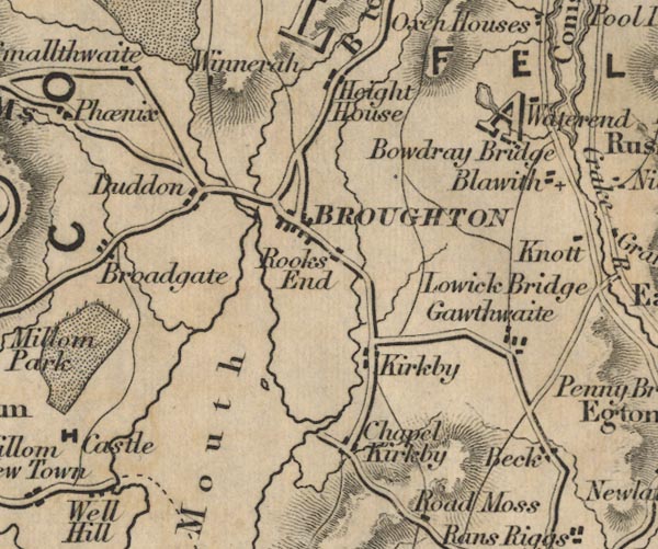 FD02SD28.jpg "Bowdray Bridge" item:- JandMN : 100.1 Image © see bottom of page |
|
|
|
||
| evidence:- | database:- Listed Buildings 2010 placename:- Bouthray Bridge |
|
| source data:- | courtesy of English Heritage "BOUTHRAY BRIDGE (THAT PART IN BLAWITH) / / / BLAWITH AND SUBBERTHWAITE / SOUTH LAKELAND / CUMBRIA / II / 76710 / SD2912688980" |
|
| source data:- | courtesy of English Heritage "BOUTHRAY BRIDGE (THAT PART IN COLTON) / / / COLTON / SOUTH LAKELAND / CUMBRIA / II / 421457 / SD2912788980" |
|
| source data:- | courtesy of English Heritage "Bridge. Date uncertain, probably C18. Stone rubble. 2 segmental arches, that to east wider. Central pier on concrete base, with cutwater to north elevation. Plain parapet, with stone inscribed: "CC/BOUTHRAY BRIDGE". Bridge has been widened (straight joint to soffits of arches). Part of this bridge is in Colton CP." |
|
|
|
||
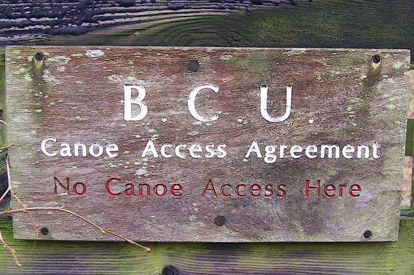 BOK28.jpg Access notice:- "B.C.U. / Canoe Access Agreement / No canoe access here" (taken 11.1.2008) |
||
|
|
||
 Lakes Guides menu.