Old Cumbria Gazetteer
 |
 |
|
||
| included in:- |
 road, Carlisle to Tynemouth road, Carlisle to Alston road, Carlisle to Tynemouth road, Carlisle to Alston |
|||
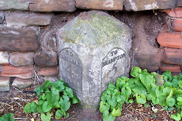
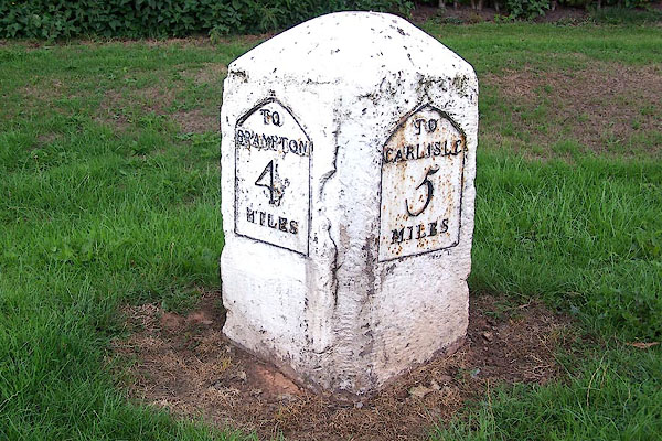
| road, Carlisle to Brampton S | ||||
| A69 | ||||
| civil parish:- | Carlisle (formerly Cumberland) | |||
| civil parish:- | Wetheral (formerly Cumberland) | |||
| civil parish:- | Hayton (formerly Cumberland) | |||
| civil parish:- | Brampton (formerly Cumberland) | |||
| county:- | Cumbria | |||
| locality type:- | road route | |||
| 10Km square:- | NY35 | |||
| 10Km square:- | NY45 | |||
| 10Km square:- | NY55 | |||
| 10Km square:- | NY56 | |||
| SummaryText:- | via Warwick Bridge, Southerly route | |||
|
|
||||
| evidence:- | old map:- Ogilby 1675 |
|||
| source data:- | Road strip map, uncoloured engraving, the Road from Tinmouth ...
to Carlisle, scale about 1 inch to 1 mile, by John Ogilby,
London, 1675.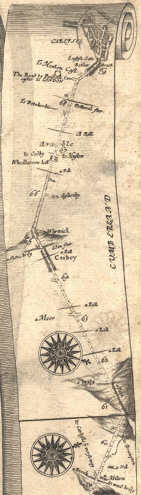 OG86BtoC.jpg item:- JandMN : 73 Image © see bottom of page |
|||
|
|
||||
| evidence:- | old map:- Bowen 1720 (plate 232) |
|||
| source data:- | Road strip map, road map, pl.232, part of The Road from Tinmouth
to Carlisle, scale about 2 miles to 1 inch, with sections in
Northumberland and Cumberland, published by Emanuel Bowen, St
Katherines, London, 1720.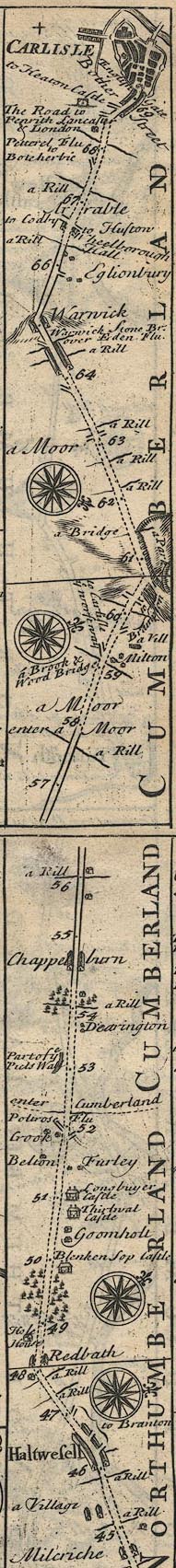 B232HtoC.jpg item:- JandMN : 65.232 Image © see bottom of page |
|||
|
|
||||
| evidence:- | old map:- Bowen and Kitchin 1760 |
|||
| source data:- | Map, hand coloured engraving, A New Map of the Counties of
Cumberland and Westmoreland Divided into their Respective Wards,
scale about 4 miles to 1 inch, by Emanuel Bowen and Thomas
Kitchin et al, published by T Bowles, Robert Sayer, and John
Bowles, London, 1760.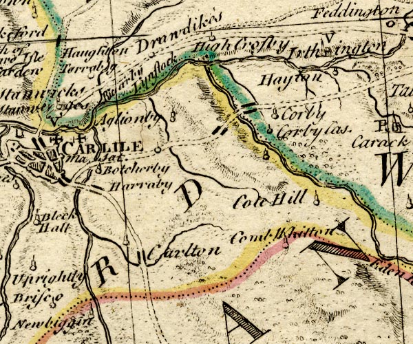 BO18NY45.jpg north and south, both double line, dotted 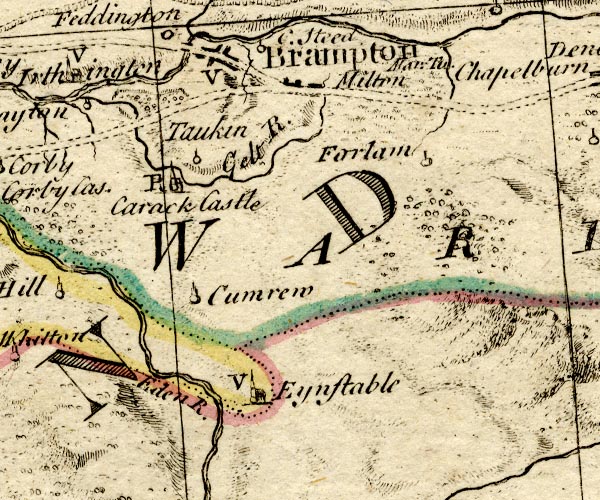 BO18NY55.jpg north and south, both double line, dotted item:- Armitt Library : 2008.14.10 Image © see bottom of page |
|||
|
|
||||
| evidence:- | old map:- Kitchin 1767 (plate 97) |
|||
| source data:- | Road strip map, uncoloured engraving, The Road from Tinmouth to
Carlisle, in Kitchin's Post Chaise Companion, by Thomas Kitchin,
published by Robert Sayer, 53 Fleet Street, John Bowles,
Cornhill, and Carington Bowles, St Paul's Church Yard, London,
1767.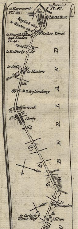 K097BtoC.jpg item:- Hampshire Museums : FA1999.138.97 Image © see bottom of page |
|||
|
|
||||
| evidence:- | gradient diagram:- Gall and Inglis 1890s-1900s (Roads) |
|||
| source data:- | Contour Road Book of England, Northern Division, by Harry R G Inglis, published by
Gall and Inglis, 25 Paternoster Square, London and Edinburgh, 1898.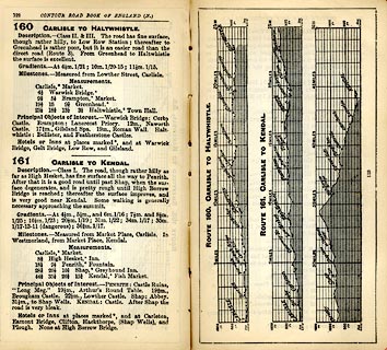 click to enlarge click to enlargeIG5160.jpg Itinerary, with gradient diagram, route 160, Carlisle to Haltwhistle, and route 161, Carlisle to Kendal, Westmorland, Cumberland and Northumberland, 1898. item:- JandMN : 763.8 Image © see bottom of page |
|||
|
|
||||
| evidence:- | old map:- Bell 1892 |
|||
| source data:- | Map, colour lithograph, Road Map of Cumberland, by George Joseph
Bell, scale about 2.5 miles to 1 inch, printed by Charles
Thurnam and Sons, Carlisle, Cumberland, 1892.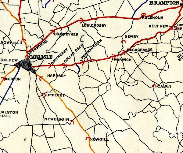 BEL9NY45.jpg 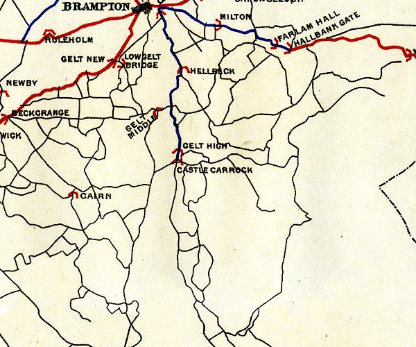 BEL9NY55.jpg 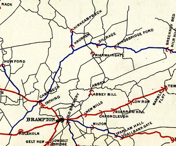 BEL9NY56.jpg red - disturnpiked 'main road' under section 13 of the Highways Act 1878 Road map of Cumberland showing County Bridges item:- Carlisle Library : Map 38 Images © Carlisle Library |
|||
|
|
||||
| evidence:- | old strip map:- CTC 1911 (Roads) |
|||
| source data:- | Page 90 of Cyclists' Touring Club British Road Book new series vol.6, edited by F
B Sandford, published by Thomas Nelson and Sons, London etc, 1911.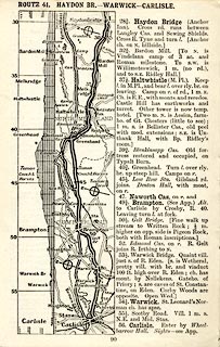 click to enlarge click to enlargeCTC290.jpg Strip road map, route 41, Haydon Bridge Warwick Carlisle, part of Newcastle to Carlisle, scale roughly 5 miles to 1 inch.. Together with an itinerary and gradient diagram. item:- JandMN : 491.90 Image © see bottom of page |
|||
|
|
||||
 Act of Parliament Act of Parliament |
||||
|
|
||||
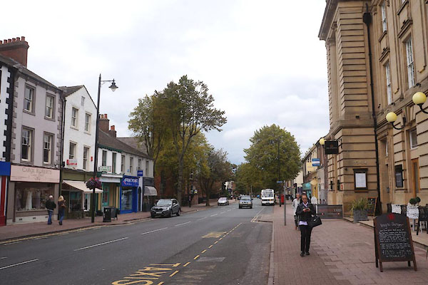
| places:- | Carlisle Warwick Bridge Brampton |
|||
|
|
||||
| places:- |
|
|||
|
||||
|
||||
|
||||
|
||||
|
||||
|
||||
|
||||
|
||||
|
||||
Lakes Guides menu.