 Old Cumbria Gazetteer
 |
 |
|
| milestone, Hayton (3) | ||
| site name:- | road, Carlisle to Brampton S | |
| locality:- | Corby Hill | |
| civil parish:- | Hayton (formerly Cumberland) | |
| county:- | Cumbria | |
| locality type:- | milestone | |
| coordinates:- | NY47865702 | |
| 1Km square:- | NY4757 | |
| 10Km square:- | NY45 | |
|
|
||
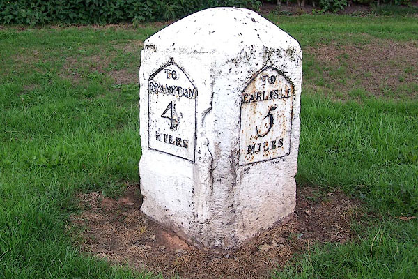 BMM87.jpg Stone with cast iron plates:- "TO / BRAMPTON / 4 / MILES" "TO / CARLISLE / 5 / MILES" (taken 11.8.2006) |
||
|
|
||
| evidence:- | old map:- OS County Series (Cmd 24 3) |
|
| source data:- | Maps, County Series maps of Great Britain, scales 6 and 25
inches to 1 mile, published by the Ordnance Survey, Southampton,
Hampshire, from about 1863 to 1948. "M.S. BRAMPTON .. 4 CARLISLE .. 5" |
|
|
|
||
| evidence:- | database:- Listed Buildings 2010 |
|
| source data:- | courtesy of English Heritage "MILESTONE AT NGR 47860 57020 / / A 69 / HAYTON / CARLISLE / CUMBRIA / II / 78031 / NY4786657029" |
|
| source data:- | courtesy of English Heritage "Milestone. 1830 for the Carlisle-Brampton Turnpike. Red sandstone, cast iron plates. Squared stone with chamfered top, set at angle to road to give 2 faces in direction of traffic. Cast plates set into each face, that pointing east inscribed TO CARLISLE 5 MILES and west TO BRAMPTON 4 MILES. Whitewashed with lettering picked out in black. May have been moved from its original position to allow for road widening." |
|
|
|
||
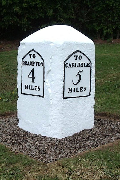 CEL88.jpg Cast iron plates on stone:- "TO / BRAMPTON / 4 / MILES" "TO / CARLISLE / 5 / MILES" (taken 14.6.2013) courtesy of Terry Moore Image © Terry Moore |
||
|
|
||
 Lakes Guides menu.