 Old Cumbria Gazetteer
 |
 |
|
|
| track, Sadgill to Gatescarth | |||
| Sadgill to Gatescarth | |||
| Gatescarth to Sadgill | |||
| civil parish:- | Longsleddale (formerly Westmorland) | ||
| county:- | Westmorland | ||
| locality type:- | track route (ex road) | ||
| locality type:- | byway | ||
| locality type:- | drove road (ex) | ||
| 10Km square:- | NY40 | ||
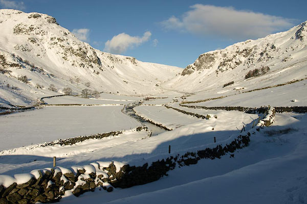
| SummaryText:- | Track from the road end at Sadgill Bridge to the parish boundary in Gatescarth Pass. | ||
|
|
|||
 BTU93.jpg (taken 5.12.2010) 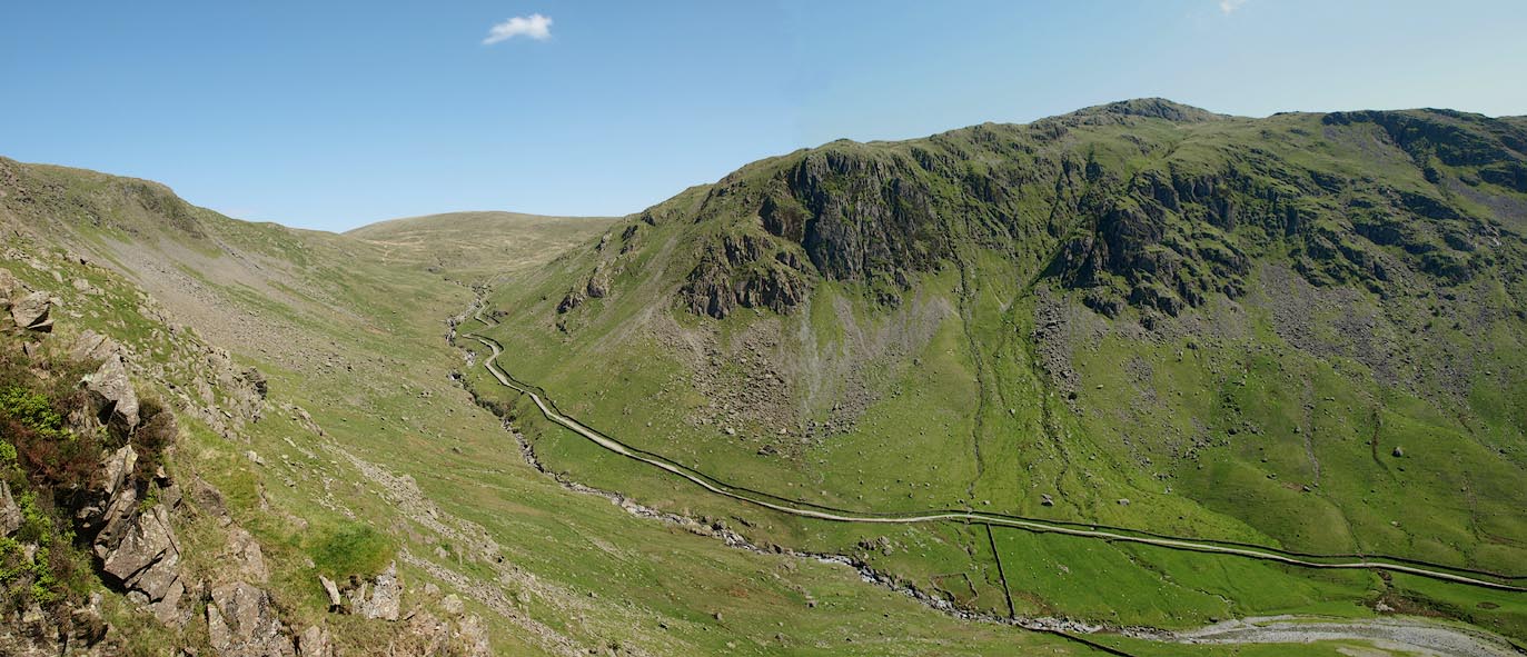 Click to enlarge BQR81.jpg (taken 31.5.2009) |
|||
|
|
|||
| evidence:- | old map:- OS County Series (Wmd 27 2) |
||
| source data:- | Maps, County Series maps of Great Britain, scales 6 and 25
inches to 1 mile, published by the Ordnance Survey, Southampton,
Hampshire, from about 1863 to 1948. OS County Series (Wmd 27 3) OS County Series (Wmd 27 7) Bench marks and spot heights are shown along the track. |
||
|
|
|||
 Sadgill to Wrengill, photo record of walk Sadgill to Wrengill, photo record of walk |
|||
|
|
|||
| Wrengill to Gatescarth, photo record of walk |
|||
|
|
|||
| Gatescarth to Wrengill, photo record of walk |
|||
|
|
|||
| Wrengill to Sadgill, photo record of walk |
|||
|
|
|||
| evidence:- | old map:- Jefferys 1770 (Wmd) |
||
| source data:- | Map, 4 sheets, The County of Westmoreland, scale 1 inch to 1
mile, surveyed 1768, and engraved and published by Thomas
Jefferys, London, 1770.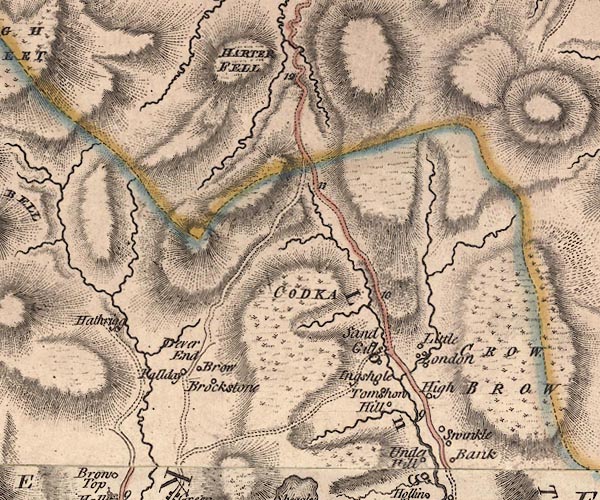 J5NY40NE.jpg double line; road, with mile numbers item:- National Library of Scotland : EME.s.47 Image © National Library of Scotland |
||
|
|
|||
| evidence:- | descriptive text:- West 1778 (11th edn 1821) |
||
| source data:- | Guide book, A Guide to the Lakes, by Thomas West, published by
William Pennington, Kendal, Cumbria once Westmorland, and in
London, 1778 to 1821. goto source goto sourcePage 166:- "... [from Hawesater] ... On the summit of the mountain you soon come in sight of Long-Sleddale, Lancaster-sands, &c. and in the course of your descent, you will presently be accompanied by a cataract on the right. The road traverses the mountain as on the other side, but is much better made, and wider, on account of the slate taken from the sides of these mountains and carried to Kendal, &c. The water-falls on the right are extremely curious. You enter Long-Sleddale between two shattered rocky mountains. That on the left, Crowbarrow, is not less terrible to look up at, when under it, than any rock in Barrowside or Borrowdale, and it has covered a much larger space with ruins. Here is every possible variety of water falls and cataracts; the most remarkable of which is on the left. Over a most tremendous wall of rock, a mountain torrent, in one broken sheet, leaps headlong one hundred yards and more. The whole vale is narrow; the hills rise swift on each hand; their brows are wooded; their feet covered with grass, or cultivated, and their summits broken. ..." |
||
|
|
|||
| evidence:- | old text:- Prior 1865 |
||
| source data:- | Guide book, Ascents and Passes in the Lake District of England,
by Herman Prior, published by John Garnett, Windermere,
Westmorland, and by Simpkin, Marshall and Co, London, 1865. Page 7:- "... from the bridge, the road follows the stream along the flat of the upper valley, and to the summit of the first ascent above it. The road is a good cart-road, and the stream which, as you begin to ascend, flows in a deep channel between rocks, is kept on the left throughout. At the top of the ascent, just opposite a pretty waterfall, you reach a quarry with some deserted huts; and here the stream forks, the left-hand bending away to Harter Fell, the mountains which form the left wall of Sleddale. The road passes through the quarries, crosses the right fork of the stream by a bridge, and then bends to the left, rounding under a low grass hillock on that side, and keeping the stream just crossed close on its right. On rounding the hillock you see a sheep-pen at no great distance, just short of which, the road separates into three, the centre track re-crossing the stream, and then following it along the boggy upper valley in front of you. The Mardale and Hawes-Water track turns to the left, passing between the sheep-pen on the right, and a rocky knoll on the left, on rounding which, you have above you the grassy slopes of the northern side of Harter Fell, with the road zigzaging up them, but with a general direction to the right. It is well marked to the summit:- two turns to some large quarries on the left, one just beyond the rocky knoll, and the other" Page 8:- "about half way up the ascent (crossing a small rill of water), will of course be avoided. On reaching the top of the zigzag, the path continues still slightly ascending, bending rather to the left, towards Harter Fell, and passing a slope of boggy ground on its right, until it reaches the summit level. The is Gatescarth Pass. Here it turns to the right, to a little stony hillock which it crosses, and then continues bearing right, to the edge of a hollow leading down into Mardale." "..." Page 50:- "... keeping up on the right, under the slopes of Harter Fell, soon reaches the summit-level. Here it bends slightly to the left, and then right again, so as to round the shoulder of Harter Fell. It then descends, at first gradually, and afterwards, on reaching the edge of the boggy basin, you have been skirting, in deep zigzags. Soon after commencing these, you see below you a sheep-pen by the side of a stream, on the left of a round-headed hillock of some height. The road descends to this sheep-pen without difficulty; some turns to the right, leading to the Harter Fell quarries, will, of course, be disregarded. On reaching the hillock, you wind under it, and soon after cross a stream by a small bridge. Just beyond this is an abandoned quarry, with a hut; passing which the track descends steeply by the side of the stream, keeping it on the right-hand throughout the descent, as well as along the flat of the Sleddale valley below. About three-quarters of a mile down this, a bridge is reached, opposite the first houses." "..." |
||
|
|
|||
| evidence:- | old map:- OS 1881-82 New Series (outline edition) |
||
| source data:- | Map, engraving, area north of Kendal, Westmorland, New Series
one inch map, outline edition, sheet 39, scale 1 inch to 1 mile,
published by the Ordnance Survey, Southampton, Hampshire,
1881-82.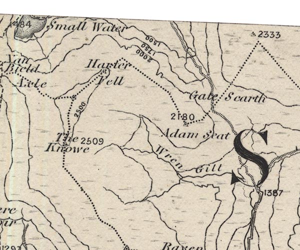 O21NY40U.jpg 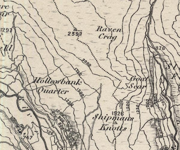 O21NY40T.jpg 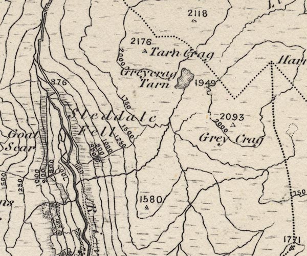 O21NY40Y.jpg item:- JandMN : 61 Image © see bottom of page |
||
|
|
|||
| evidence:- | old postcard:- |
||
| source data:- | Postcard, sepia coloured photograph of Buckbarrow taken from the track above Sadgill
Bridge, Longsleddale, Westmorland, about 1900s.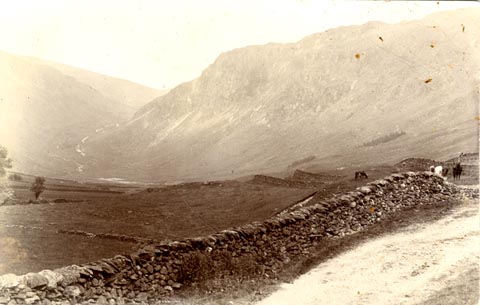 click to enlarge click to enlargePH0158.jpg item:- private collection : 346 Image © see bottom of page |
||
|
|
|||
| evidence:- | old postcard:- |
||
| source data:- | Postcard, sepia toned photograph of people beside track just above Sadgill Bridge,Longsleddale,
Westmorland 1920s-30s?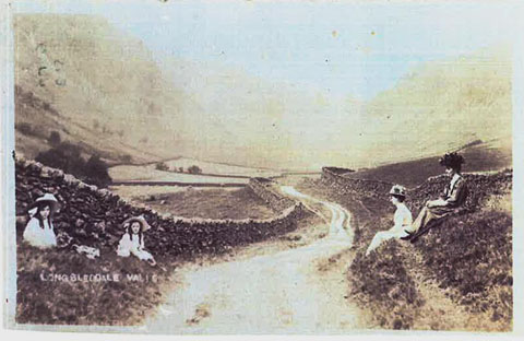 click to enlarge click to enlargePH0038.jpg item:- private collection : 140 Image © see bottom of page |
||
|
|
|||
| Longsleddale volcanic rocks |
|||
|
|
|||
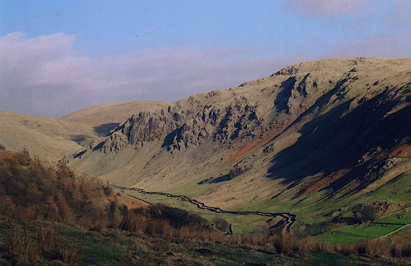 BIK13.jpg From Cocklaw Fell:- (taken 15.2.2004) 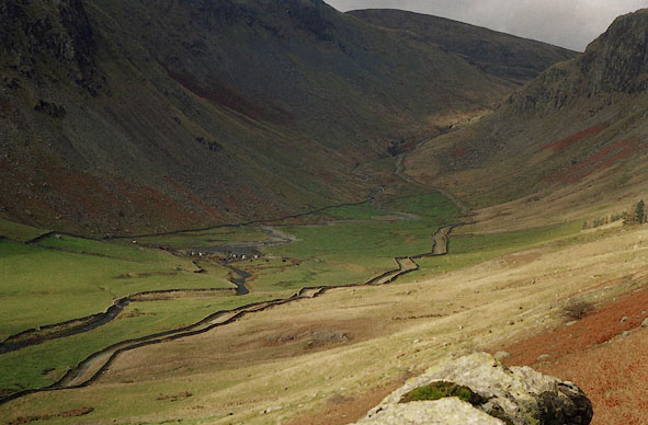 BHU24.jpg From Great Howe, (taken 11.2003) 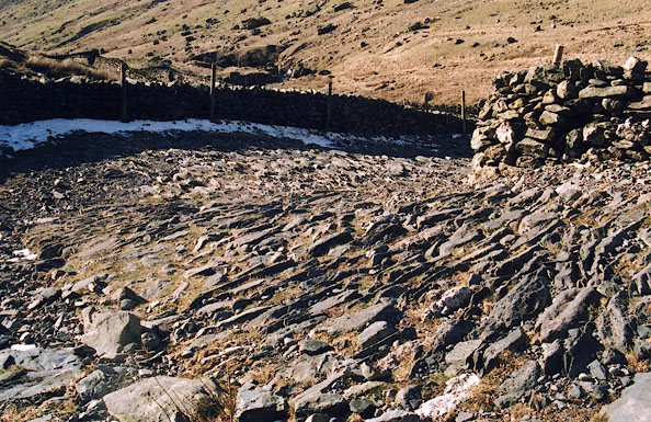 BIM11.jpg made up section on rise to Brownhowe Bottom; known as Blackknot Turns. It was said to have been needed for lorries coming from Wrengill Quarry. (taken 1.3.2004) |
|||
|
|
|||
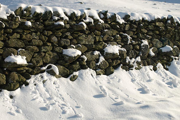 BTU94.jpg Stone wall by track; snow. (taken 5.12.2010)  BTU96.jpg Boots and crampons in the snow. (taken 5.12.2010)  BTU97.jpg Boots and crampons in the snow. (taken 5.12.2010) |
|||
|
|
|||
| places:- | Sadgill, Longsleddale bridge, Galeforth Gill Wrengill Quarry, Longsleddale Gatescarth Pass, Longsleddale |
||
|
|
|||
Lakes Guides menu.