 |
 |
   |
|
|
|
Sadgill |
| locality:- |
Longsleddale |
| civil parish:- |
Longsleddale (formerly Westmorland) |
| county:- |
Cumbria |
| locality type:- |
locality |
| coordinates:- |
NY48260570 |
| 1Km square:- |
NY4805 |
| 10Km square:- |
NY40 |
|
|
|
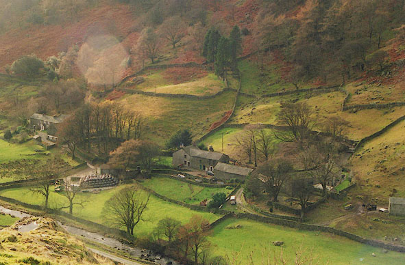
BHU25.jpg Low Sadgill beyond the trees on the left, Middle Sadgill in the middle, and High Sadgill
hid in trees to the right.
(taken 11.2003)
|
|
|
| evidence:- |
old map:- OS County Series (Wmd 27 6)
placename:- Sadgill
|
| source data:- |
Maps, County Series maps of Great Britain, scales 6 and 25
inches to 1 mile, published by the Ordnance Survey, Southampton,
Hampshire, from about 1863 to 1948.
OS County Series (Wmd 27 7)
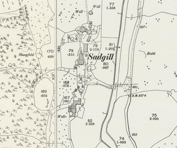
C5E001.jpg
"Sadgill"
|
|
|
| evidence:- |
old photograph:-
|
| source data:- |
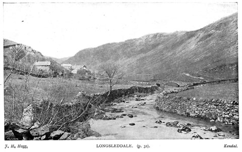
River Sprint and Sadgill Bridge by J H Hogg, Kendal, 1900s.
 click to enlarge click to enlarge
BII37.jpg
in guide book, Kendal Illustrated, published by T Wilson, Kendal,
Westmorland, 1900s. "LONGSLEDDALE"
item:- private collection : 58
Image © see bottom of page
|
|
|
| evidence:- |
census returns:-
placename:- Low Sadgill
placename:- Sadghyll
placename:- Middle Sad Ghyll
|
|
|
| evidence:- |
old map:- Jefferys 1770 (Wmd)
placename:- Sand Gills
|
| source data:- |
Map, 4 sheets, The County of Westmoreland, scale 1 inch to 1
mile, surveyed 1768, and engraved and published by Thomas
Jefferys, London, 1770.
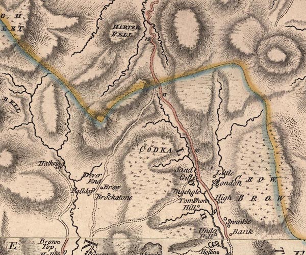
J5NY40NE.jpg
"Sand Gills"
circle, labelled in italic lowercase text; settlement, farm, house, or hamlet?
item:- National Library of Scotland : EME.s.47
Image © National Library of Scotland |
|
|
| evidence:- |
old map:- Cary 1789 (edn 1805)
placename:- Sand Gills
|
| source data:- |
Map, uncoloured engraving, Westmoreland, scale about 2.5 miles
to 1 inch, by John Cary, London, 1789; edition 1805.
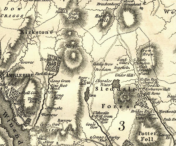
CY24NY40.jpg
"Sand Gills"
block/s, labelled in italic lowercase; house, or hamlet
item:- JandMN : 129
Image © see bottom of page
|
|
|
| evidence:- |
old map:- Otley 1818
|
| source data:- |
Map, uncoloured engraving, The District of the Lakes,
Cumberland, Westmorland, and Lancashire, scale about 4 miles to
1 inch, by Jonathan Otley, 1818, engraved by J and G Menzies,
Edinburgh, Scotland, published by Jonathan Otley, Keswick,
Cumberland, et al, 1833.
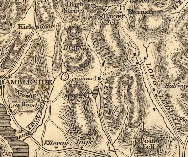
OT02NY40.jpg
item:- JandMN : 48.1
Image © see bottom of page
|
|
|
| evidence:- |
old map:- Hodgson 1828
placename:- Sad Gill
|
| source data:- |
Map, hand coloured engraving, 4 sheets mounted together on linen and rolled, Plan
of the County of Westmorland, scale about 1.25 inches to 1 mile, by Thomas Hodgson,
engraved by W R Gardner, Harpur Street, London, published by Thomas Hodgson, Lancaster,
and perhaps by C Smith, 172 Strand, London,1828.
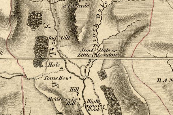
HDG6lsl3.jpg
map courtesy of Mark Cropper
"Sad Gill"
item:- private collection : 371
Image © see bottom of page
|
|
|
| evidence:- |
old map:- Kendal Corn Rent Act 1836
placename:- Sad Gill
|
| source data:- |
Tithe map, Plan of part of the Township of Longsleddale, Westmorland, made regarding
the Kendal Corn Rent Act, ie a tithe award map, scale about 20 inches to 1 mile, Kendal,
Westmorland, 1836.
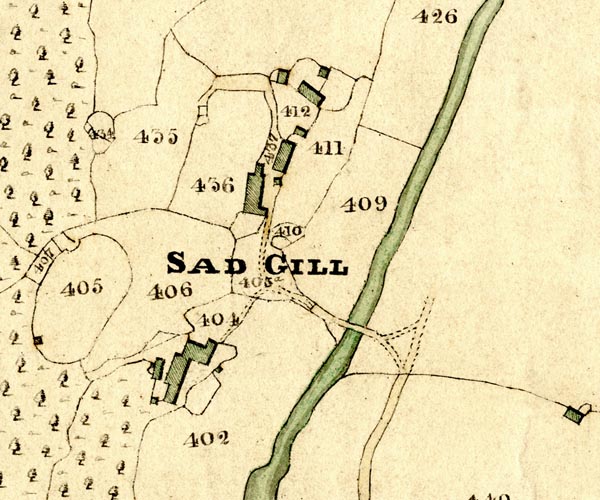
KCR201.jpg
courtesy of Mark Cropper
Plan of part of the Township of Longsleddale, Westmorland, made regarding the Kendal
Corn Rent Act, ie a tithe award map, scale about 20 inches to 1 mile, Kendal, Westmorland,
1836. "SAD GILL"
item:- private collection : 370
Image © see bottom of page
|
|
|
|
 Kendal Corn Rent Act 1836 Kendal Corn Rent Act 1836 |
|
|
| evidence:- |
old text:- Prior 1865
|
| source data:- |
Guide book, Ascents and Passes in the Lake District of England,
by Herman Prior, published by John Garnett, Windermere,
Westmorland, and by Simpkin, Marshall and Co, London, 1865.
Page 7, on the Stile End path:- "... going through the upper of these two gates; and then continuing without difficulty,
with a wall on its right throughout, to the houses in the village. Opposite to these,
a bridge is seen, on crossing which you are then in the main road up the valley. ..."
|
|
|
| evidence:- |
descriptive text:- Bulmer 1880s (1st edn 1885/Wmd)
|
| source data:- |
Series of books, each the History, Topography, and Directory of
a county in the NW, mostly by T F Bulmer, published by T Bulmer
and Co, Manchester, Lancashire, 1880s; 2nd editions 1900s-10s.
"The township [Longsleddale] has no village of its own name; but there are two hamlets,
Stockdale and Sadgill, the former containing two and the latter three houses."
|
|
|
| evidence:- |
old map:- OS 1881-82 New Series (outline edition)
placename:- Sadgill
|
| source data:- |
Map, engraving, area north of Kendal, Westmorland, New Series
one inch map, outline edition, sheet 39, scale 1 inch to 1 mile,
published by the Ordnance Survey, Southampton, Hampshire,
1881-82.
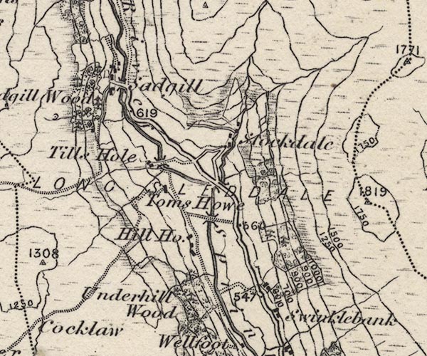
O21NY40X.jpg
"Sadgill"
item:- JandMN : 61
Image © see bottom of page
|
|
|
| evidence:- |
old photograph:- Kendal Corn Rent Act 1836
|
| source data:- |
Photograph, sepia toned print, Longsleddale Nutting Party 1894,
Sadgill, Longsleddale, Westmorland, 1894.
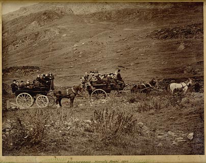 click to enlarge click to enlarge
PH0050.jpg
1894, charabanc "LONGSLEDDALE NUTTING PARTY 1894"
courtesy of Ruth Fishwick
item:- private collection : 199
Image © see bottom of page
|
|
|
| evidence:- |
old print:- Watson 1894
|
| source data:- |
View of upper Longsleddale including Sadgill, Goat Scar and Buckbarrow, in The Annals
of a Quiet Valley, by A Country Parson edited by John Watson, published by J M Dent
and Co, London, 1894.
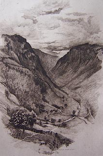 click to enlarge click to enlarge
WT1E01.jpg
"BERTHA NEWCOMBE"
item:- Kendal Library : 5
Image © see bottom of page
|
|
|
| evidence:- |
descriptive text:- Wilson 1912
|
| source data:- |
Guide book, Longsleddale, by F M Wilson, published by T Wilson,
Kendal, Westmorland, 1912.
WILSON1.txt
"The parish has no village of its own name, but there are two hamlets, Stockdale and
Sadgill; the former containing two, and the latter three houses."
"At Sadgill you will hear the mournful sound of the water as it dashes over the waterfall
and among the rocks; ..."
The waterfall referred to is not Sadgill Force which is the one you can hear; though
Sadgill Force does make a low moan.
|
|
|
| evidence:- |
old postcard:-
|
| source data:- |
Postcard, black and white, cattle on the grassing by the hoghouse above Sadgill, Longsleddale,
Westmorland, 1920s - 1930s.
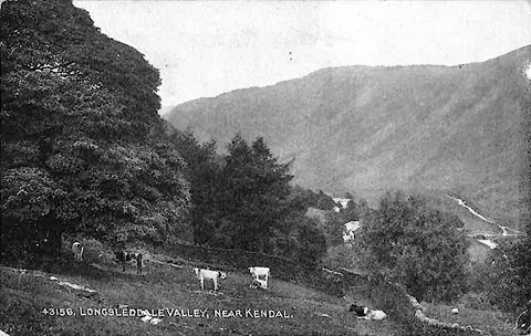 click to enlarge click to enlarge
PH0043.jpg
"4315[8], LONGSLEDDALE VALLEY, NEAR KENDAL"
courtesy of Michael Wooldridge
item:- private collection : 145
Image © see bottom of page
|
|
|
| evidence:- |
textbook:- EPNS Westmorland 1967
placename:- Satgill
placename:- Sategille
placename:- Sapgill
placename:- Saggill
|
| source data:- |
Book, The Place Names of Westmorland, two volumes, by A H Smith,
published for the English Place Name Society by Cambridge
University Press, Cambridgeshire, 1967
|
|
|
|
 directory entries directory entries |
|
|
|
 fungi fungi |
|
|
|
 hounds hounds |
|
|
|
 old parish registers (formerly ) old parish registers (formerly ) |
|
|
| evidence:- |
map:- OS Six Inch (1956)
placename:- Sadgill
|
| source data:- |
Map series, various editions with the national grid, scale about
6 inches to 1 mile, published by the Ordnance Survey,
Southampton, Hampshire, scale 1 to 10560 from 1950s to 1960s,
then 1 to 10000 from 1960s to 2000s, superseded by print on
demand from digital data.
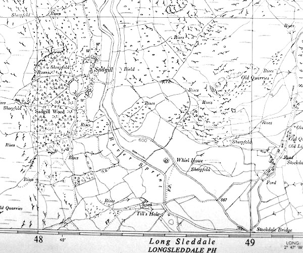
SINY4805.jpg
"Sadgill"
several buildings drawn, not labelled.
|
|
|
| evidence:- |
shepherds guide:- Robinson, Dent and Vickers 1885
placename:- Sad Gill
|
| source data:- |
Book, Shepherds' Guide,
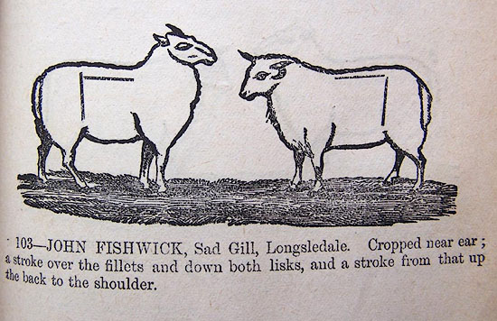
RDVp195b.jpg
"103 - JOHN FISHWICK, Sad Gill, Longsleddale. Cropped near ear, a stroke over the fillets
and down both lisks, and a stroke from that up the back to the shoulder."
item:- Kendal Library : 41
Image © see bottom of page
|
|
|
| evidence:- |
shepherds guide:- Hodgson 1849
|
| source data:- |
Book, Shepherd's Guide, or a Delineation of the Wool and Ear
Marks of the Different Stocks of Sheep, Lancashire, Cumberland,
and Westmorland, by William Hodgson, Normoss, Corney,
Cumberland, 1849.
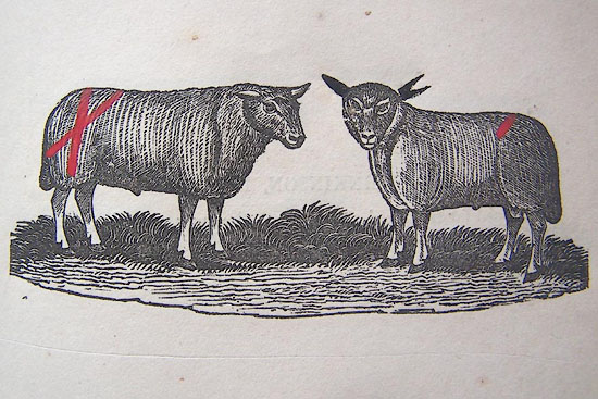
HG2p597a.jpg
"GEORGE HUDSON, Sad Gill."
"Forked near ear, a red stroke from the fillets to the far side of the tail, and a
stroke from the near hock bone over and across the other and down the buttock, TH
on the far horn."
item:- Kendal Library : 39
Image © see bottom of page
|
|
|
| evidence:- |
shepherds guide:- Hodgson 1849
|
| source data:- |
Book, Shepherd's Guide, or a Delineation of the Wool and Ear
Marks of the Different Stocks of Sheep, Lancashire, Cumberland,
and Westmorland, by William Hodgson, Normoss, Corney,
Cumberland, 1849.
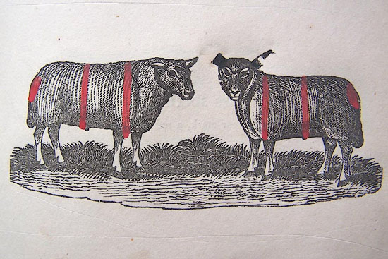
HG2p597b.jpg
"GEORGE HUDSON, Sad Gill."
"Under key bitted near ear, cropped far, a red stroke over and down both shoulders,
and one over the back and down both sides, and a pop at the tail head."
item:- Kendal Library : 39
Image © see bottom of page
|
|
|
| evidence:- |
shepherds guide:- Hodgson 1849
|
| source data:- |
Book, Shepherd's Guide, or a Delineation of the Wool and Ear
Marks of the Different Stocks of Sheep, Lancashire, Cumberland,
and Westmorland, by William Hodgson, Normoss, Corney,
Cumberland, 1849.
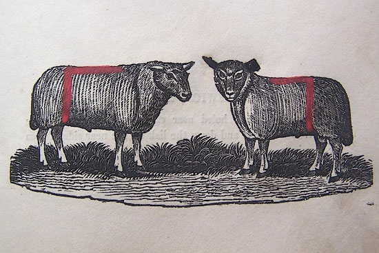
HG2p591c.jpg
"BENJAMIN MARTIN, Sad Gill."
"Cropped near ear, a stroke over the fillets and down both lisk[s], and a stroke from
that up the back to the shoulders."
item:- Kendal Library : 39
Image © see bottom of page
|
|
|
| evidence:- |
shepherds guide:- Walker 1817
placename:- Sadgill
|
| source data:- |
Shepherds guide, The Shepherd's Guides or a Delineation of the
Wool and Ear Marks on the Different Stocks of Sheep ..., in
Westmorland, by Joseph Walker, printed by W Stephen, Penrith,
Cumberland, 1817.
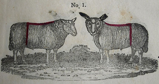
WK13L01.jpg
courtesy of George Akrigg
"No.1 - JAMES MATTINSON, Sadgill:"
"Cropped near ear, a red mark on the back and down both lisks, IM on the horn, and
a figure."
item:- private collection : 91
Image © see bottom of page
|
|
|
| evidence:- |
shepherds guide:- Walker 1817
placename:- Sadgill
|
| source data:- |
Shepherds guide, The Shepherd's Guides or a Delineation of the
Wool and Ear Marks on the Different Stocks of Sheep ..., in
Westmorland, by Joseph Walker, printed by W Stephen, Penrith,
Cumberland, 1817.
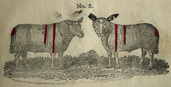
WK13L02.jpg
courtesy of George Akrigg
"No 2 - THOMAS WALKER, Sadgill:"
"Cropped far ear, and under key bitted near, a red mark over both shoulders, and another
over behind the shoulders, a pop on the tail head, and TW on the horns."
item:- private collection : 91
Image © see bottom of page
|
|
|
notes:-
|
The shepherds guides do not always distinguish the various Sadgill farms, and sometimes
just refer to 'Sadgill'.
|
|
|
| evidence:- |
old newspaper:- Z8900705.txt
placename:-
item:- placename, Sadgill
|
| source data:- |
Z8900705.txt
Westmorland Gazette
Transcription from the Westmorland Gazette 5 July 1890
page 6:- "... Sadgill is plainly indicated by the mournful sound of the water as it dashes over
the waterfall, and among the rocks underneath Buckbarrow. One authority states that
the river Sprint rises in Sadgill, but its course may be traced to Harter Fell."
|
|
|
|
 mountain biking mountain biking |
|
|
|
 rain storm 20151205 rain storm 20151205 |
|
|
|
 snow December 2010 snow December 2010 |
|
|
hearsay:-
|
|
|
"... Five miles from the Dun Bull Sad Gill is reached. Why "Sad?" Possibly because
it is the furthest limit of any attempt at cultivation, if one excepts a couple of
fir plantings on the slopes of Buckbarrow; or perhaps the name is derived from the
Anglo-Saxon "Sad," meaning "heavy" or "sodden." Otherwise it is a comfortable looking
hamlet of not more than four or five houses, if as many, ..."
|
|
Barber, John B &Atkinson, George: 1931: Lakeland Passes
|
|
|
|
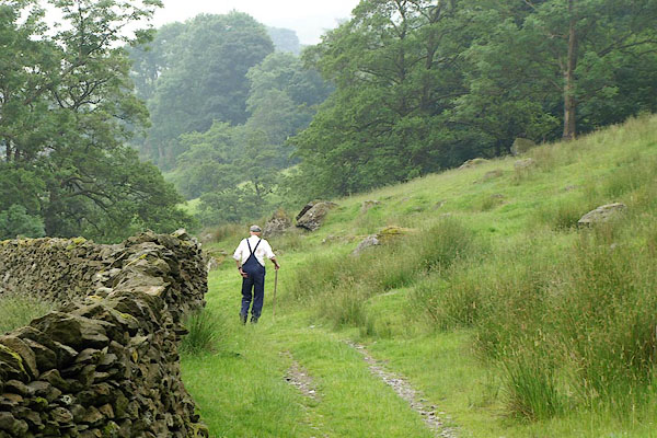
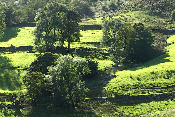
BQY25.jpg Path from Tills Hole to Low Sadgill.
(taken 1.7.2009)
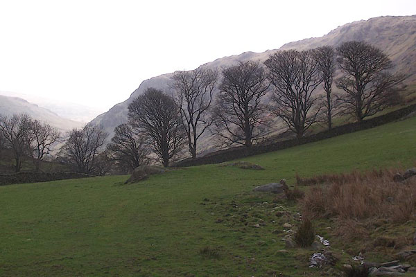
BXG70.jpg Trees in Old Close.
(taken 2.9.2012)
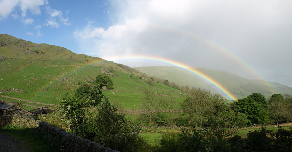
Click to enlarge
BQO42.jpg Rainbow.
(taken 26.5.2009)
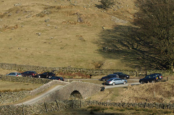
BLV76.jpg Windbreak, east of the bridge, Sadgill.
(taken 13.4.2006)
BSF91.jpg Cars parked at the road end.
(taken 7.3.2010)
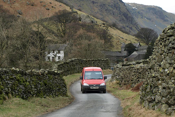
BSD08.jpg Postman, on his way out.
(taken 8.2.2010)
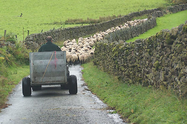
BJW30.jpg Sheep on the road
(taken 29.9.2005)
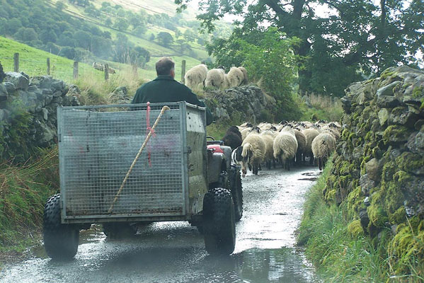
BJW31.jpg Sheep on the road
(taken 29.9.2005)
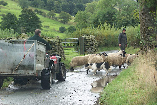
BJW32.jpg Sheep changing field
(taken 29.9.2005)
|
|
|
fiction:-
|
Called High Close in
|
|
Ward, Humphrey, Mrs: 1888: Robert Elsmere
|
|
|
story:-
|
At the edge of Sadgill Wood, above Middle Sadgill, there is said to be an ash tree
with a horizontal bough, on which can be seen the groove of the rope where the last
sheep stealer was hanged in the valley.
|
|
|
| see:- |
 High Sadgill, Longsleddale High Sadgill, Longsleddale |
|
|
| see:- |
 Middle Sadgill, Longsleddale Middle Sadgill, Longsleddale |
|
|
| see:- |
 Low Sadgill, Longsleddale Low Sadgill, Longsleddale |
|
|


 click to enlarge


 Kendal Corn Rent Act 1836
 click to enlarge
 click to enlarge
 click to enlarge
 directory entries
 fungi
fungi hounds
 old parish registers (formerly )


 mountain biking
 rain storm 20151205
 snow December 2010


 High Sadgill, Longsleddale
 Middle Sadgill, Longsleddale
 Low Sadgill, Longsleddale