 Old Cumbria Gazetteer
 |
 |
|
| roman fort, Burwens | ||
| Bravoniacum | ||
| locality:- | Burwens | |
| locality:- | Kirkby Thore | |
| civil parish:- | Kirkby Thore (formerly Westmorland) | |
| county:- | Cumbria | |
| locality type:- | roman fort | |
| coordinates:- | NY63802560 | |
| 1Km square:- | NY6325 | |
| 10Km square:- | NY62 | |
|
|
||
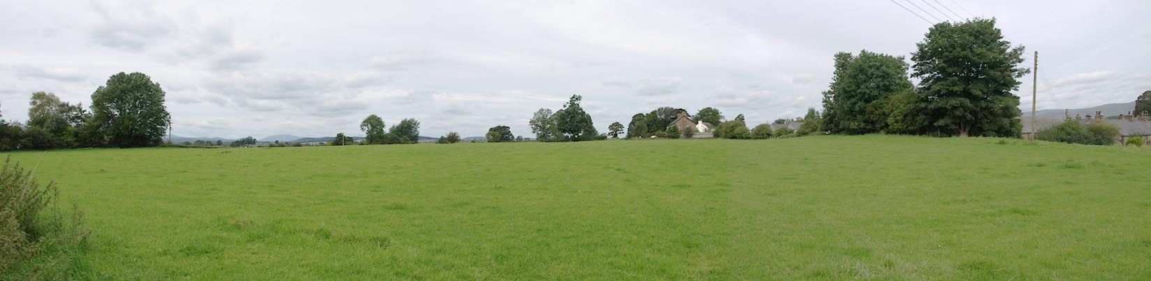 Click to enlarge BXF17.jpg Not a lot to see. (taken 31.8.2012) 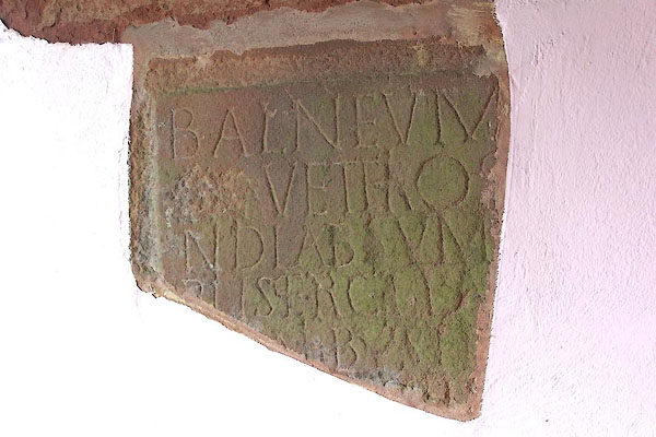 BMD43.jpg Inscribed stone in the porch of St Cuthbert's Church, Cliburn, believed to be from this roman fort:- "BALNEVM / [ ]VET[R]O / ND LABSVM / [V]SERC[ ] / [ ]B[ ]" about the building of a new bath house? |
||
|
|
||
| evidence:- | old map:- OS County Series (Wmd 9 1) placename:- Burwens |
|
| source data:- | Maps, County Series maps of Great Britain, scales 6 and 25
inches to 1 mile, published by the Ordnance Survey, Southampton,
Hampshire, from about 1863 to 1948. |
|
|
|
||
| evidence:- | old map:- Speed 1611 (Wmd) placename:- Callagum |
|
| source data:- | Map, hand coloured engraving, The Countie Westmorland and
Kendale the Cheif Towne, scale about 2.5 miles to 1 inch, by
John Speed, 1610, published by George Humble, Popes Head Alley,
London, 1611-12.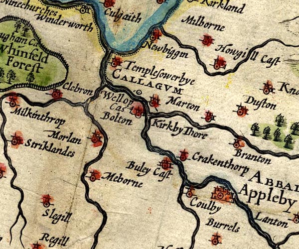 SP14NY62.jpg "CALLAGUM / Wellop Cas" circle item:- Armitt Library : 2008.14.5 Image © see bottom of page |
|
|
|
||
| evidence:- | old map:- Morden 1695 (Wmd) placename:- Gallatum |
|
| source data:- | Map, hand coloured engraving, Westmorland, scale about 2.5 miles to 1 inch, by Robert
Morden, published by Abel Swale, the Unicorn, St Paul's Churchyard, Awnsham, and John
Churchill, the Black Swan, Paternoster Row, London, 1695.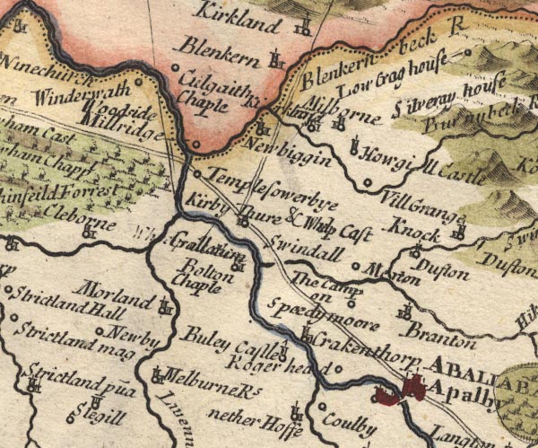 MD10NY62.jpg "Kirby Thure &Whelp Cast / Galla[tum]" Circle, building and tower; the roman name is engraved over a poorly erased label for Whelp Castle. item:- JandMN : 24 Image © see bottom of page |
|
|
|
||
| evidence:- | descriptive text:- Simpson 1746 placename:- Whelp Castle placename:- Gallatum |
|
| source data:- | Atlas, three volumes of maps and descriptive text published as
'The Agreeable Historian, or the Compleat English Traveller
...', by Samuel Simpson, 1746. goto source goto sourcePage 1025:- "..." "Gallatum is supposed to be Whelp Castle, near Kirkby Thore, where are the Ruins of an old Town, and very considerable Remains of Antiquity." |
|
|
|
||
| evidence:- | old text:- Pennant 1773 placename:- Whelp's Castle placename:- Brovonacae placename:- Burwens item:- High Burwens; roman coin; coin, roman; roman altar; altar, roman; roman inscription; inscription, roman |
|
| source data:- | Book, A Tour from Downing to Alston Moor, 1773, by Thomas
Pennant, published by Edward Harding, 98 Pall Mall, London, 1801. goto source Pennant's Tour 1773, page 150 "A place of still greater antiquity was till of late years discoverable in its neighbourhood, the Roman Brovonacae, which retains its sound in Burwens, the present name of its site. Whelp's-castle was another appellation, which was derived from the first Lord of this manor, Whelp, who lived in the reign of King Stephen, or that of Henry II. It remained in his posterity some centuries: in the time of Henry VI.John Wharton, supposed to have been a cadet of" goto sourcePennant's Tour 1773, page 151 "Wharton-hall possessed it; and it lately remained in his descendants, two Ladies, co-heiresses of the place." "It chiefly stood near the rill Troutbeck, near the Eden; as appears from the foundations disturbed by the plough. A square inclosure, called High Burwens, containing about eight score yards in diameter, says Doctor Burn, was its area; but the extent of the outward works reached beyond the Roman way or high street of Kirkby-Thore, most of which, as well as the manor-house, was built out of the ancient ruins. in most parts, traces of it may be seen in vaults, conduits, pavements both flagged and tiled, foundations of walls, brick and stone; and coins, urns, altars, and other antiquities are frequently found. An altar is preserved in the walls of the old school-house at Appleby, dedicated to Belatucader, or Mars:" ""DEO BELATVCAD "RO. LIB. VOTV "M FECIT. "IOLVS."" |
|
|
|
||
| evidence:- | old text:- Camden 1789 (Gough Additions) placename:- Brovonacae item:- roman inscription; inscription, roman; roman altar; altar, roman |
|
| source data:- | Book, Britannia, or A Chorographical Description of the Flourishing Kingdoms of England,
Scotland, and Ireland, by William Camden, 1586, translated from the 1607 Latin edition
by Richard Gough, published London, 1789. goto source Page 158:- "..." "Mr. Ward places BROVONACAE at Kirby Thor, Brugh being ten miles from thence as Verterae is from Brovonacae. The altar mentioned by Mr. Camden is now worked up in the end of the old school house at Appleby, and under a modern inscription H. M. EST GALLAGI, Hoc monumentum est Gallagi, probably by Mr. Bainbridge before-mentioned. Mr. Machel in Phil. Trans. No.158, describes a patera found here inscribed... TIAN IMP.... Coins, urns, and other antiquities have also been found here. In 1753 was found in a stone wall of a field near the parsonage house the upper half of an altar, inscribed:" "IOVI SERAPI L[ ]ALE[ ]NVS [ ] FALF" "Another beginning ANTONIA. There are like wise other Roman letters and sculptures, upon several of the door lintels, in the same town, which Mr. Horsley has omitted." "The manor house, as well as most of the town of Kirkby Thor, have been built out of the remains of Whelp castle, of which there are now scarce any remains. The main body of it stood in a place called the Burwens, on a rising ground at the bank of the rivulet called Troutbeck, not far from the river Eden." goto sourcePage 159:- "The square inclosure, called the High Burwens, seems to have been the area of it, containing eight score yards in diameter, now ploughed and cultivated, and the outer buildings to have run along the said rivulet, at least as far as to the fulling mill, or further beyond the Roman way, and so up the west side of the high street, about 160 yards, and thence again in a strait line to the west angle of the said area. In all these places have been found conduits under ground, vaults, pavements, tiles, and slates with iron nails in them, foundations of walls both of brick and stone, coins, altars, urns, and other earthen vessels, Mr. Machel found 1687 among the foundations a wall made up of four others of hewn stone, each two foot four inches thick: in another part an altar inscribed FORTVNAE SERVATRICI: also some leaden pipes, and a drain through the wall above-mentioned, and divers arched vaults underground flagged with stone or paved with bricks about 10 inches square and two thick, and some a foot square, and two inches and an half thick. At the lower end of the town he found an antient well by the side of the Roman road from Appleby to Carlisle: in it were several urns and fine earthen vessels, the head of a spear, sandals of leather stuck full of nails. A few years ago the horn of a moose deer was found about four feet under ground by the washing away of the bank near the conflux of the Troutbeck and Eden." "It is not worth mentioning that Dr. Gale in his notes on Nennius, p.133, fancied he found Whallop castle in the Catguoloph of an old fragment of that writer in the Cottonian library near Marchontiby, which Mr. Camden heard of, but which seems now equally unknown." |
|
|
|
||
| evidence:- | old text:- Camden 1789 placename:- Whellep Castle placename:- Gallatum placename:- Gallagum item:- roman inscription; inscription, roman; roman coin; coin, roman |
|
| source data:- | Book, Britannia, or A Chorographical Description of the Flourishing Kingdoms of England,
Scotland, and Ireland, by William Camden, 1586, translated from the 1607 Latin edition
by Richard Gough, published London, 1789. goto source Page 148:- "..." "... Kirkby Thore, below which are to be seen considerable ruins of an antient town, and Roman coins are frequently dug up, and not long ago this inscription:" "DEO BELATVCAD- RO LIB VOTV M FECIT IOLVS." "Age has almost obliterated its name, it being now called Whellep castle. If the prince of antiquity would allow me I should say it was the GALLAGUM of Ptolemy, and GALLATUM of Antoninus, agreeable to the distance of miles, and not contradicted by the name. The British term gall at the beginning of a word was changed by the Saxons into Wall, as GALENA into Wallingford, and Gall-Sever, Severus' Wall, &c. It was certainly considerable when the pitched road called Maidenway ran strait from hence to Caer Vorran by the Picts' wall, where moorish mountains rear their heads for nearly 20 miles. On this way I should conclude the stations and mansions recited by Antoninus in his IXth British iter lay if nobody had pointed out the places. Nor is this to be wondered at when they have been for so many ages the food of time." |
|
|
|
||
| evidence:- | old map:- Ford 1839 map placename:- Gallatum |
|
| source data:- | Map, uncoloured engraving, Map of the Lake District of
Cumberland, Westmoreland and Lancashire, scale about 3.5 miles
to 1 inch, published by Charles Thurnam, Carlisle, and by R
Groombridge, 5 Paternoster Row, London, 3rd edn 1843.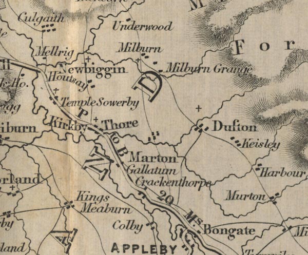 FD02NY62.jpg "Gallatum" item:- JandMN : 100.1 Image © see bottom of page |
|
|
|
||
| evidence:- | text:- Rivet and Smith 1979 placename:- Bravoniacum placename:- Brovonacis placename:- Braboniaco placename:- Barboniaco placename:- Ravonia |
|
| source data:- | ||
|
|
||
| evidence:- | old map:- Horsley 1732 placename:- Brovonacae placename:- Kirkby Thorn |
|
| source data:- | Map, uncoloured engraving, Britannia Antiqua, roman Britain,
scale about 50 miles to 1 inch, by John Horsley, perhaps 1732,
edition published about 1869?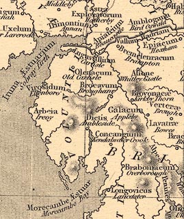 click to enlarge click to enlargeHOR1Cm.jpg "Brovonacae / Kirkby Thorn" item:- JandMN : 429 Image © see bottom of page |
|
|
|
||
Lakes Guides menu.