Old Cumbria Gazetteer
 |
 |
|
||
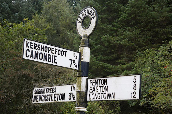
| Kershopefoot, Nicholforest | ||||
| Kershopefoot | ||||
| civil parish:- | Nicholforest (formerly Cumberland) | |||
| county:- | Cumbria | |||
| locality type:- | locality | |||
| locality type:- | buildings | |||
| coordinates:- | NY47658286 (etc) | |||
| 1Km square:- | NY4782 | |||
| 10Km square:- | NY48 | |||
|
|
||||
| evidence:- | old map:- OS County Series (Cmd 3 2) placename:- Kershopefoot |
|||
| source data:- | Maps, County Series maps of Great Britain, scales 6 and 25
inches to 1 mile, published by the Ordnance Survey, Southampton,
Hampshire, from about 1863 to 1948. |
|||
|
|
||||
| evidence:- | old map:- Saxton 1579 placename:- Kirsop Foote |
|||
| source data:- | Map, hand coloured engraving, Westmorlandiae et Cumberlandiae Comitatus ie Westmorland
and Cumberland, scale about 5 miles to 1 inch, by Christopher Saxton, London, engraved
by Augustinus Ryther, 1576, published 1579-1645.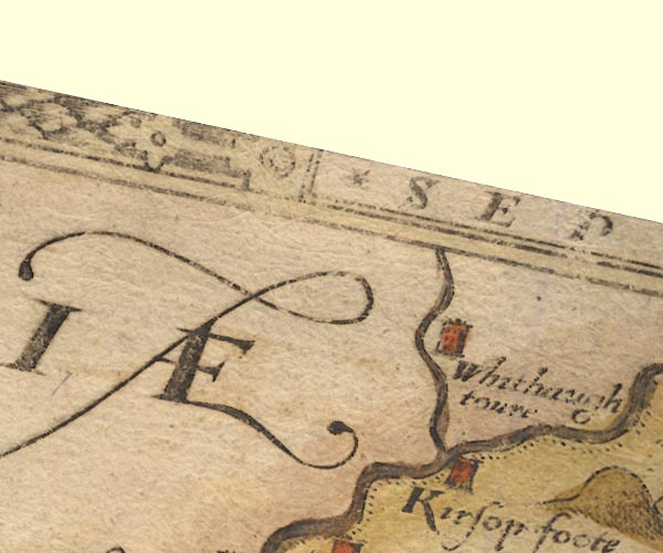 Sax9NY48.jpg Tower, symbol for a house, hall, tower, etc. "Kirsop foote" item:- private collection : 2 Image © see bottom of page |
|||
|
|
||||
| evidence:- | old map:- Burghley 1590 (facsimile) placename:- Kirsopfoote |
|||
| source data:- | Facsimile map, A Platt of the Opposete Border of Scotland to ye West Marches of England,
parts of Cumberland and Scotland including the Debateable Land, from a manuscript
drawn for William Cecil, Lord Burghley, about 1590, published by R B Armstrong, 1897. courtesy of the National Library of Scotland 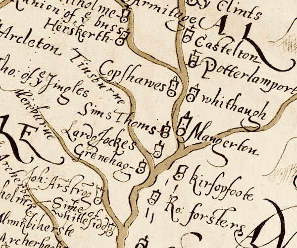 M048NY48.jpg "kirsopfoote" circle, tower item:- National Library of Scotland : MS6113 f.267 Image © National Library of Scotland |
|||
|
|
||||
| evidence:- | old map:- Mercator 1595 (edn?) placename:- Kirsop Foote |
|||
| source data:- | Map, hand coloured engraving, Northumbria, Cumberlandia, et
Dunelmensis Episcopatus, ie Northumberland, Cumberland and
Durham etc, scale about 6.5 miles to 1 inch, by Gerard Mercator,
Duisberg, Germany, about 1595. MER8CumA.jpg "Kirsop foote" circle, building and tower item:- JandMN : 169 Image © see bottom of page |
|||
|
|
||||
| evidence:- | old map:- Keer 1605 placename:- Kitsop Foote |
|||
| source data:- | Map, hand coloured engraving, Westmorland and Cumberland, scale
about 16 miles to 1 inch, probably by Pieter van den Keere, or
Peter Keer, about 1605 edition perhaps 1676. click to enlarge click to enlargeKER8.jpg "Kitsop foote" dot, circle and tower; village item:- Dove Cottage : 2007.38.110 Image © see bottom of page |
|||
|
|
||||
| evidence:- | old map:- Speed 1611 (Cmd) placename:- Kirksop Foot |
|||
| source data:- | Map, hand coloured engraving, Cumberland and the Ancient Citie
Carlile Described, scale about 4 miles to 1 inch, by John Speed,
1610, published by J Sudbury and George Humble, Popes Head
Alley, London, 1611-12.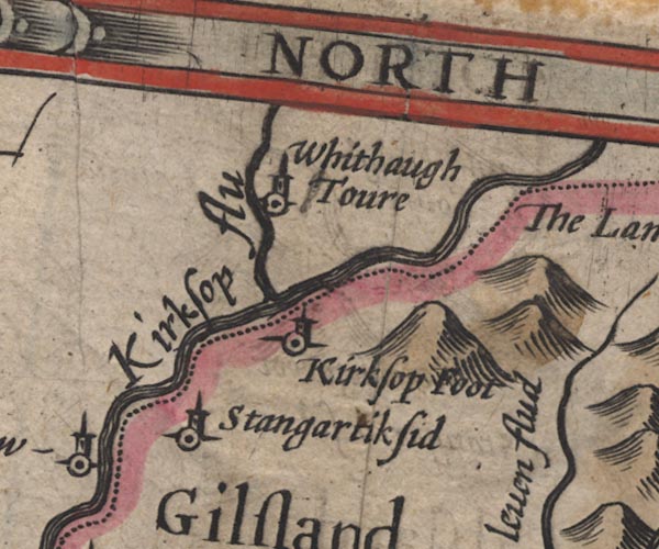 SP11NY48.jpg "Kirksop foot" circle, tower item:- private collection : 16 Image © see bottom of page |
|||
|
|
||||
| evidence:- | probably old map:- Jenner 1643 placename:- Kirksop |
|||
| source data:- | Tables of distances with a maps, Westmerland, scale about 16
miles to 1 inch, and Cumberland, scale about 21 miles to 1 inch,
published by Thomas Jenner, London, 1643; published 1643-80. JEN4Sq.jpg "Kirksop" circle |
|||
|
|
||||
| evidence:- | old map:- Jansson 1646 placename:- Kirksop Foodt |
|||
| source data:- | Map, hand coloured engraving, Cumbria and Westmoria, ie
Cumberland and Westmorland, scale about 3.5 miles to 1 inch, by
John Jansson, Amsterdam, Netherlands, 1646.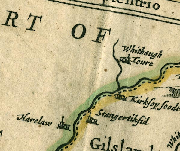 JAN3NY48.jpg "Kirksop foodt" Buildings and tower. item:- JandMN : 88 Image © see bottom of page |
|||
|
|
||||
| evidence:- | old map:- Morden 1695 (Cmd) placename:- Kirksop Foot |
|||
| source data:- | Map, uncoloured engraving, Cumberland, scale about 4 miles to 1
inch, by Robert Morden, 1695, published by Abel Swale, the
Unicorn, St Paul's Churchyard, Awnsham, and John Churchill, the
Black Swan, Paternoster Row, London, 1695-1715.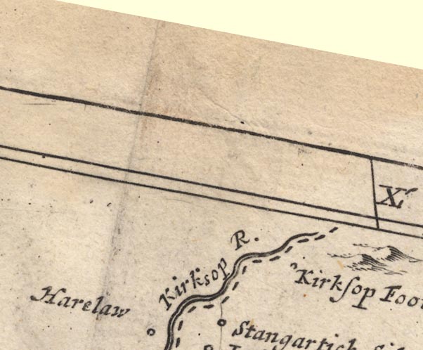 MD12NY48.jpg "Kirksop Foot" Circle. item:- JandMN : 90 Image © see bottom of page |
|||
|
|
||||
| evidence:- | old map:- Bowen and Kitchin 1760 placename:- Kirksop Foot |
|||
| source data:- | Map, hand coloured engraving, A New Map of the Counties of
Cumberland and Westmoreland Divided into their Respective Wards,
scale about 4 miles to 1 inch, by Emanuel Bowen and Thomas
Kitchin et al, published by T Bowles, Robert Sayer, and John
Bowles, London, 1760. BO18NY57.jpg "Kirksop Foot" circle and line item:- Armitt Library : 2008.14.10 Image © see bottom of page |
|||
|
|
||||
| evidence:- | old map:- Donald 1774 (Cmd) placename:- Kershope Foot |
|||
| source data:- | Map, hand coloured engraving, 3x2 sheets, The County of Cumberland, scale about 1
inch to 1 mile, by Thomas Donald, engraved and published by Joseph Hodskinson, 29
Arundel Street, Strand, London, 1774.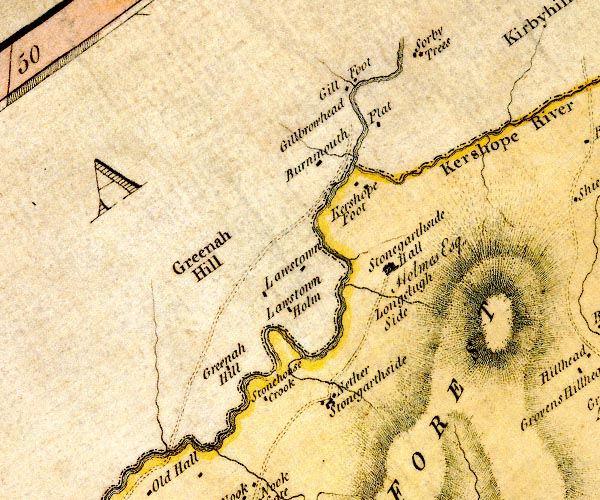 D4NY48SE.jpg "Kershope Foot" block or blocks, labelled in lowercase; a hamlet or just a house item:- Carlisle Library : Map 2 Image © Carlisle Library |
|||
|
|
||||
| hearsay:- |
Just across the boundary was the Truce Stone, also known as the Tourney Stone or Laird
Jock's Stone in a field called the Tourneyholm. It marked where the border reiver
Wee Jock Elliot fought Lord Bothwell, one of the scottish march wardens. The english
and scottish wardens met here on truce days to sort disputes and exchange prisoners.
Some disputes ere settled by single combat. |
|||
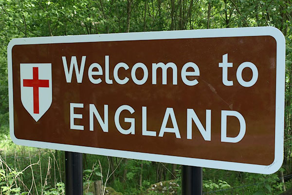
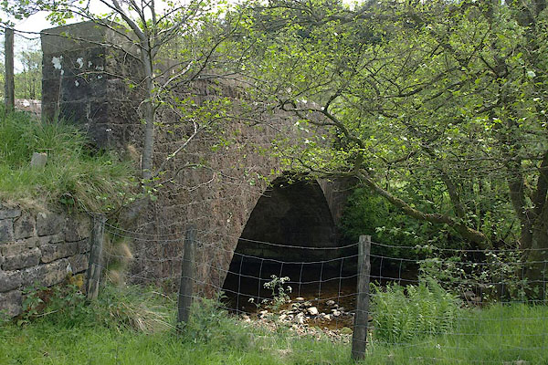
| The Liddel Water and the Kershope Burn, which enters the Liddel at kershopefoot, are
the boundary between England and Scotland. |
||||
|
|
||||
| places:- |
|
|||
|
||||
|
||||
|
||||
|
||||
|
||||
|
||||
|
||||
|
||||
|
||||
|
||||
|
||||
|
||||
|
||||
|
||||
|
||||
 Lakes Guides menu.