Old Cumbria Gazetteer
 |
 |
|
||
| Grange, Borrowdale | ||||
| Grange | ||||
| Grange-in-Borrowdale | ||||
| locality:- | Borrowdale | |||
| civil parish:- | Borrowdale (formerly Cumberland) | |||
| county:- | Cumbria | |||
| locality type:- | locality | |||
| locality type:- | buildings | |||
| coordinates:- | NY25281749 (etc) | |||
| 1Km square:- | NY2517 | |||
| 10Km square:- | NY21 | |||
|
|
||||
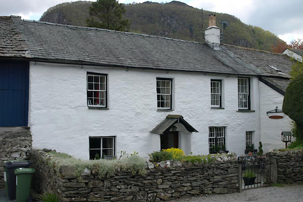
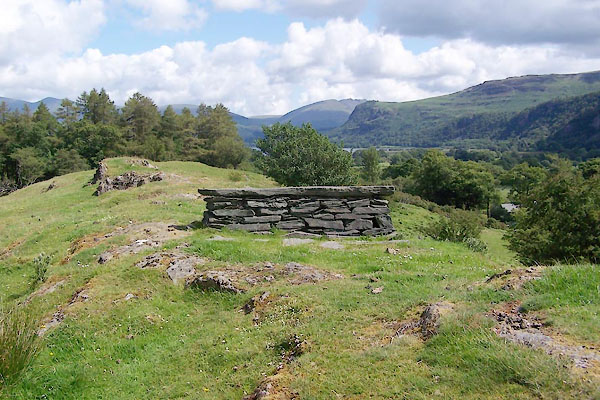
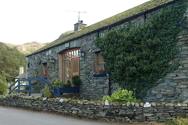
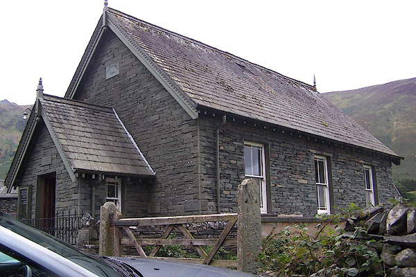
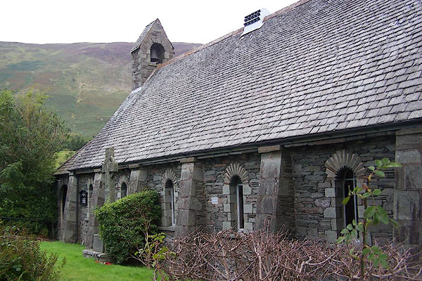
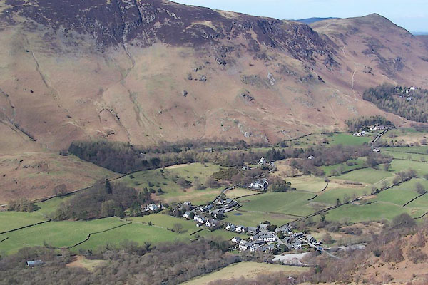 BSM47.jpg (taken 12.4.2010) 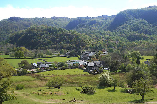 CGA72.jpg From Peace How. (taken 7.5.2017) |
||||
|
|
||||
| evidence:- | old map:- OS County Series (Cmd 70 2) placename:- Grange |
|||
| source data:- | Maps, County Series maps of Great Britain, scales 6 and 25
inches to 1 mile, published by the Ordnance Survey, Southampton,
Hampshire, from about 1863 to 1948. |
|||
|
|
||||
| evidence:- | old map:- Saxton 1579 placename:- Grange, The |
|||
| source data:- | Map, hand coloured engraving, Westmorlandiae et Cumberlandiae Comitatus ie Westmorland
and Cumberland, scale about 5 miles to 1 inch, by Christopher Saxton, London, engraved
by Augustinus Ryther, 1576, published 1579-1645.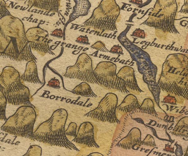 Sax9NY21.jpg Building, symbol for a hamlet, which may or may not have a nucleus. "The grange" item:- private collection : 2 Image © see bottom of page |
|||
|
|
||||
| evidence:- | old map:- Mercator 1595 (edn?) placename:- Grange, The |
|||
| source data:- | Map, hand coloured engraving, Northumbria, Cumberlandia, et
Dunelmensis Episcopatus, ie Northumberland, Cumberland and
Durham etc, scale about 6.5 miles to 1 inch, by Gerard Mercator,
Duisberg, Germany, about 1595.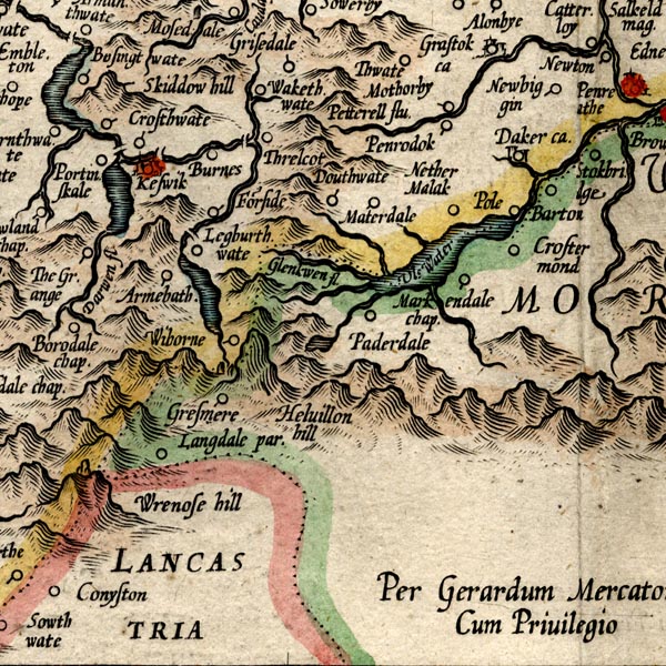 MER8CumF.jpg "The Grange" circle item:- JandMN : 169 Image © see bottom of page |
|||
|
|
||||
| evidence:- | old map:- Speed 1611 (Cmd) placename:- Grange, The |
|||
| source data:- | Map, hand coloured engraving, Cumberland and the Ancient Citie
Carlile Described, scale about 4 miles to 1 inch, by John Speed,
1610, published by J Sudbury and George Humble, Popes Head
Alley, London, 1611-12.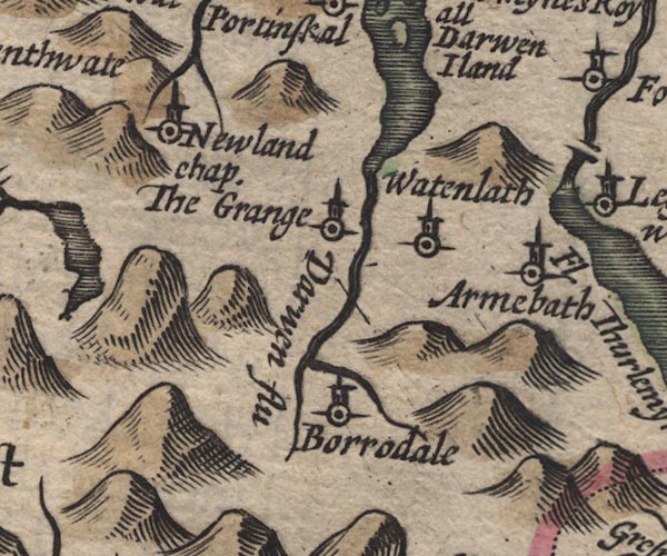 SP11NY21.jpg "The Grange" circle, tower item:- private collection : 16 Image © see bottom of page |
|||
|
|
||||
| evidence:- | old map:- Jansson 1646 placename:- Grange, The |
|||
| source data:- | Map, hand coloured engraving, Cumbria and Westmoria, ie
Cumberland and Westmorland, scale about 3.5 miles to 1 inch, by
John Jansson, Amsterdam, Netherlands, 1646.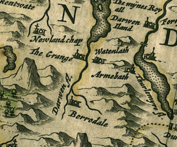 JAN3NY21.jpg "The Grange" Buildings and tower. item:- JandMN : 88 Image © see bottom of page |
|||
|
|
||||
| evidence:- | old map:- Morden 1695 (Cmd) placename:- Grange |
|||
| source data:- | Map, uncoloured engraving, Cumberland, scale about 4 miles to 1
inch, by Robert Morden, 1695, published by Abel Swale, the
Unicorn, St Paul's Churchyard, Awnsham, and John Churchill, the
Black Swan, Paternoster Row, London, 1695-1715.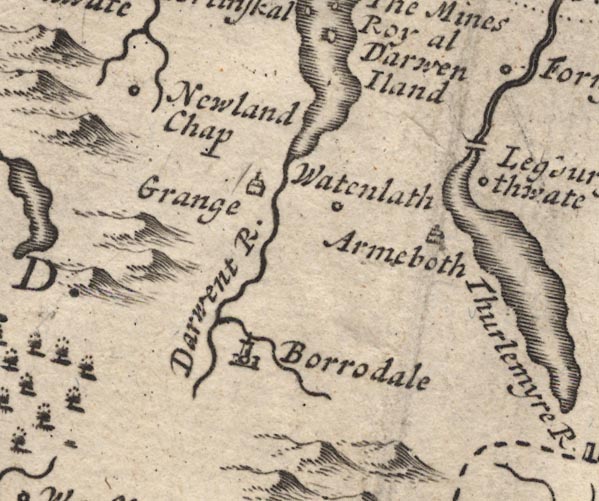 MD12NY21.jpg "Grange" Drawing of a house. item:- JandMN : 90 Image © see bottom of page |
|||
|
|
||||
| evidence:- | old text:- Gents Mag |
|||
| source data:- | Magazine, The Gentleman's Magazine or Monthly Intelligencer or
Historical Chronicle, published by Edward Cave under the
pseudonym Sylvanus Urban, and by other publishers, London,
monthly from 1731 to 1922. goto source goto sourceGentleman's Magazine 1751 p.52 "... At the head of Keswic lake, the Darwent is contracted to a narrow river, and runs between two precipices, covered with wood to the top, the perpendicular height of which is 800 yards. On approaching this place we imagined it to be our ne plus ultra, but our guide soon convinced us that we were mistaken. On the West side of the Darwent in this Herculean streight, and directly under one of these stupendous precipices lies the village of Grange. ..." |
|||
|
|
||||
| evidence:- | old map:- Gents Mag 1751 placename:- Grange |
|||
| source data:- | Map, uncoloured engraving, Map of the Black Lead Mines in
Cumberland, and area, scale about 2 miles to 1 inch, by George
Smith, published in the Gentleman's Magazine, 1751. GM1310.jpg "Grange" circle; village item:- JandMN : 114 Image © see bottom of page |
|||
|
|
||||
| evidence:- | old map:- Bowen and Kitchin 1760 placename:- Grange, The |
|||
| source data:- | Map, hand coloured engraving, A New Map of the Counties of
Cumberland and Westmoreland Divided into their Respective Wards,
scale about 4 miles to 1 inch, by Emanuel Bowen and Thomas
Kitchin et al, published by T Bowles, Robert Sayer, and John
Bowles, London, 1760. BO18NY11.jpg "The Grange" no symbol item:- Armitt Library : 2008.14.10 Image © see bottom of page |
|||
|
|
||||
| evidence:- | old map:- Donald 1774 (Cmd) placename:- Grange |
|||
| source data:- | Map, hand coloured engraving, 3x2 sheets, The County of Cumberland, scale about 1
inch to 1 mile, by Thomas Donald, engraved and published by Joseph Hodskinson, 29
Arundel Street, Strand, London, 1774. D4NY21NW.jpg "Grange" house item:- Carlisle Library : Map 2 Image © Carlisle Library |
|||
|
|
||||
| evidence:- | descriptive text:- West 1778 (11th edn 1821) item:- tithe; salt; grain |
|||
| source data:- | Guide book, A Guide to the Lakes, by Thomas West, published by
William Pennington, Kendal, Cumbria once Westmorland, and in
London, 1778 to 1821. goto source Page 93:- "... The village of Grange is under it [Castle Crag], celebrated as well for its hospitality to Mr. Gray, as for its sweet romantic site. And to affirm that all that Mr. Gray says of the young farmer at Grange, is strictly applicable to the inhabitants of these mountainous regions in general, is but common justice done to the memory of repeated favours." "- Hail sacred flood! / May still thy hospitable swains be blest / In rural innocence; thy mountains still / Teem with the fleecy race; thy tuneful woods / For ever flourish: and thy vales look gay. // Armstrong on Health." goto sourcePage 94:- "... The Grange was the place where they [monks of Furness] laid up their grain and their tithe, and also the salt they made at the salt spring, of which works there are still some vestiges remaining, below Grange. ..." goto sourceAddendum; Mr Gray's Journal, 1769 Page 204:- "..." "... Here we met a civil young farmer overseeing his reapers (for it is now oat harvest) who conducted us to a neat white house in the village of Grange, which is built on a rising ground in the midst of a valley; round it the mountains" goto sourcePage 205:- "form an awful amphitheatre, and through it obliquely runs the Derwent, clear as glass, and showing under its bridge every trout that passes. Beside the village rises a round eminence of a rock covered entirely in old trees, and over that more proudly towers Castle-cragg, ... ..." "For me , I went no farther than the farmer's (better than four miles from Keswick) at Grange; his mother and he brought us butter that Siserah would have jumped at, though not in a lordly dish, bowls of milk, thin oaten cakes, and ale, and we had carried a cold tongue thither with us. Our farmer was himself the man that last year plundered the eagles' eyrie: ..." |
|||
|
|
||||
| evidence:- | old map:- Crosthwaite 1783-94 (Der) placename:- Grange |
|||
| source data:- | Map, uncoloured engraving, An Accurate Map of the Matchless Lake
of Derwent, ie Derwent Water, scale about 3 inches to 1 mile, by
Peter Crosthwaite, Keswick, Cumberland, 1783, version published
1800.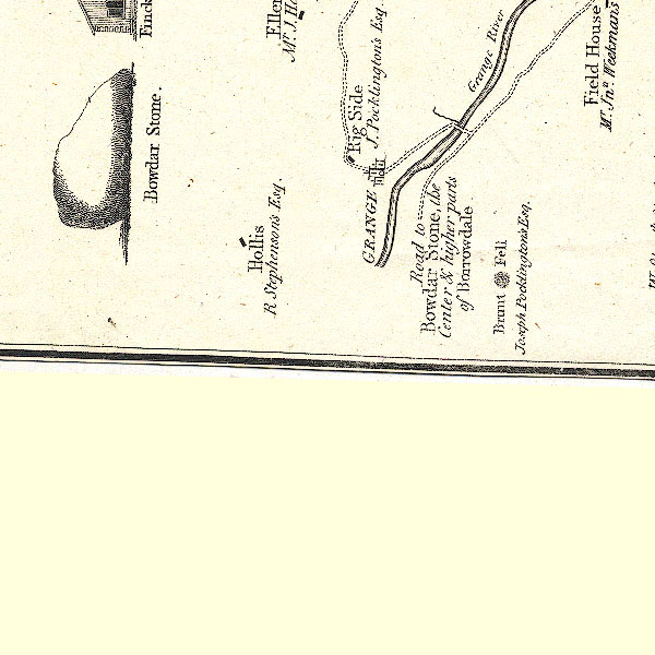 CT2NY21M.jpg "GRANGE" item:- Armitt Library : 1959.191.3 Image © see bottom of page |
|||
|
|
||||
| evidence:- | old map:- West 1784 map placename:- Grange |
|||
| source data:- | Map, hand coloured engraving, A Map of the Lakes in Cumberland,
Westmorland and Lancashire, scale about 3.5 miles to 1 inch,
engraved by Paas, 53 Holborn, London, about 1784.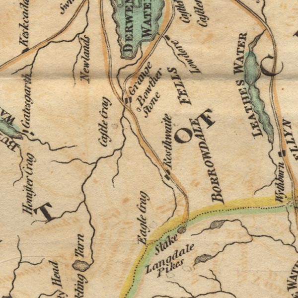 Ws02NY21.jpg item:- Armitt Library : A1221.1 Image © see bottom of page |
|||
|
|
||||
| evidence:- | old text:- Clarke 1787 placename:- Grainge |
|||
| source data:- | Guide book, A Survey of the Lakes of Cumberland, Westmorland,
and Lancashire, written and published by James Clarke, Penrith,
Cumberland, and in London etc, 1787; published 1787-93. goto source Page 82:- "..." "We next arrive at Grainge, a pretty well-built village. Mr Gray speaks with raptures of this little place, and after describing his hospitable and kingly feast that was given him, says "And she brought me butter on a lordly dish, which Sisera himself would have envied me the eating."" "Behind the house of Mr Ab. Banks is a delightful view; for here the river runs close to your feet, and the different objects are disposed in an extremely beautiful and picturesque manner." |
|||
|
|
||||
| evidence:- | old map:- Clarke 1787 map (Der) placename:- Grainge |
|||
| source data:- | Map, uncoloured engraving, Map of Derwentwater and its Environs,
scale about 13 ins to 1 mile, by James Clarke, engraved by S J
Neele, published by James Clarke, Penrith, Cumberland and in
London etc, 1787.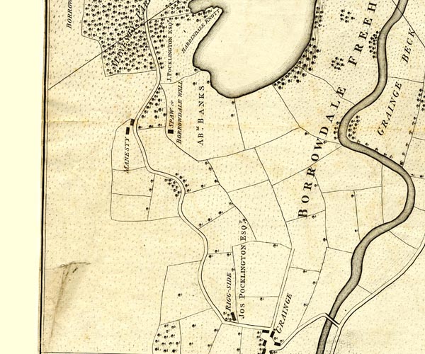 CL152518.jpg "GRAINGE" scatter of buildings item:- private collection : 169 Image © see bottom of page |
|||
|
|
||||
| evidence:- | old map:- Cooke 1802 placename:- Grange |
|||
| source data:- | Map, The Lakes, Westmorland and Cumberland, scale about 8.5
miles to 1 inch, engravedby Neele and Son, published by
Sherwood, Jones and Co, Paternoster Road, London, 1824. click to enlarge click to enlargeGRA1Lk.jpg "Grange" blocks, italic lowercase text, village, hamlet, locality item:- Hampshire Museums : FA2000.62.5 Image © see bottom of page |
|||
|
|
||||
| evidence:- | old text:- Gents Mag placename:- Grange, The item:- tithes |
|||
| source data:- | Magazine, The Gentleman's Magazine or Monthly Intelligencer or
Historical Chronicle, published by Edward Cave under the
pseudonym Sylvanus Urban, and by other publishers, London,
monthly from 1731 to 1922. goto source Gentleman's Magazine 1805 p.1123 "..." "The Grange is a small village in the mouth of Borradaile, once used as the repository of their tithe-grain by the Monks of Furness. A little stone bridge thrown across the river here is nearly gone to decay: here we saw the farm house, whither Mr. Gray fled for shelter from the inhospitable frowns of Borradaile. ..." |
|||
|
|
||||
| evidence:- | old print:- Green 1810 (plate 39) placename:- Grange |
|||
| source data:- | Print, soft ground etching, Grange in Borrowdale, Cumberland, by William Green, Ambleside,
Westmorland, 1808.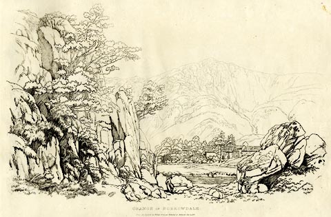 click to enlarge click to enlargeGN1239.jpg Plate 39 in Sixty Studies from Nature, 1810. printed at top right:- "39" printed at bottom:- "GRANGE IN BORROWDALE. / Drawn and Engraved by William Green and Published at Ambleside, June 24, 1808." watermark:- "J WHATMAN / 1813" item:- Armitt Library : A6641.39 Image © see bottom of page |
|||
|
|
||||
| evidence:- | old print with text:- Farington 1816 placename:- Grange, The |
|||
| source data:- | Print, uncoloured engraving and descriptive text, The Grange in Borrowdale, Cumberland,
drawn by Joseph Farington, engraved by J Scott, published by T Cadell and W Davies,
Strand, London, 1815.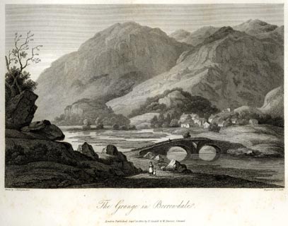 click to enlarge click to enlargeFA0407.jpg printed, bottom left, right, centre "Drawn by J. Farington R.A. / Engraved by J. Scott. / Grange in Borrowdale. / London Published Septr. 15, 1815, by T. Cadell &W. Davies, Strand." Descriptive text:- "THE GRANGE IN BORROWDALE." "THE Village of Grange consists of a few houses, or rather cottages, situated on the west side of the river Derwent, about a mile above its entrance into the Lake. This village is a mile distant from the Waterfall of Lowdore, and about five miles from Keswick. In this spot is formed, by the impending mountains, what Mr. Gray calls the Gorge, or narrow pass of Borrowdale. The cottages, built apparently without mortar, have been erected so long ago that the stones have acquired the same weather-worn colour, as those which lie on the mountain-side behind them. A few pines rise over them; the mountains appear to meet a little way on, and form an amphitheatre; and where they meet, their base is richly clothed with coppice-wood and young trees. The river Derwent, clear, shallow, and melodious, washes the stone bank on which the greater number of the pines grow, and forms the fore-ground, with an old bridge of two arches, as rude in construction as the cottages. A small insulated rock, called Castlet Crag, nearly covered with trees, is a marked feature in this scene. Concealed from the sight of it by the precipice on the fore-ground, stands Castle Crag, which is delineated in the following engraving. The dale, secluding itself beyond this hill, continues to exhibit, for a few miles, the wildest and most romantic scenes, forming a striking contrast to the open display of magnificence which characterises the vale of Keswick. The Derwent affords easy passage to boats from the Lake, part of the way to the bridge; but there is seldom water sufficient for the boats to proceed to that point. The course of the river is winding, and the water is so beautifully clear, that the bed of the river may be distinctly seen at a great depth. Borrowdale abounds in valuable mines, from some of which are obtained the finest wadd, or black lead, to be found in England. Iron, slate, and free-stone of various kinds, are also the treasures of these mountains." item:- Armitt Library : A6666.7 Image © see bottom of page |
|||
|
|
||||
| evidence:- | old map:- Otley 1818 placename:- Grange |
|||
| source data:- | Map, uncoloured engraving, The District of the Lakes,
Cumberland, Westmorland, and Lancashire, scale about 4 miles to
1 inch, by Jonathan Otley, 1818, engraved by J and G Menzies,
Edinburgh, Scotland, published by Jonathan Otley, Keswick,
Cumberland, et al, 1833. OT02NY21.jpg item:- JandMN : 48.1 Image © see bottom of page |
|||
|
|
||||
| evidence:- | descriptive text:- Ford 1839 (3rd edn 1843) placename:- Grange |
|||
| source data:- | Guide book, A Description of Scenery in the Lake District, by
Rev William Ford, published by Charles Thurnam, Carlisle, by W
Edwards, 12 Ave Maria Lane, Charles Tilt, Fleet Street, William
Smith, 113 Fleet Street, London, by Currie and Bowman,
Newcastle, by Bancks and Co, Manchester, by Oliver and Boyd,
Edinburgh, and by Sinclair, Dumfries, 1839. goto source Page 56:- "... Further on is a scene greatly and deservedly admired, we mean the bridge and village of Grange, planted on the west banks of the Derwent; the sweetly-wooded Holme Crag and other knolls swell above the houses, over which masses of rock and precipitous crags sublimely tower. ..." goto sourcePage 166:- "..." "Grange is a small village, at the entrance of the narrow pass which leads into Borrodale." "Manesty.- Near this place is a medicinal spring; and the retrospective view over its woods into Borrodale, is magnificent, especially if seen under the influence of a setting sun." |
|||
|
|
||||
| evidence:- | old map:- Ford 1839 map placename:- Grange |
|||
| source data:- | Map, uncoloured engraving, Map of the Lake District of
Cumberland, Westmoreland and Lancashire, scale about 3.5 miles
to 1 inch, published by Charles Thurnam, Carlisle, and by R
Groombridge, 5 Paternoster Row, London, 3rd edn 1843. FD02NY21.jpg "Grange" item:- JandMN : 100.1 Image © see bottom of page |
|||
|
|
||||
| evidence:- | old drawing:- Aspland 1840s-60s placename:- Grange |
|||
| source data:- | Drawing, pencil, Grange, Borrowdale, Cumberland, by Theophilus Lindsey Aspland, 1857.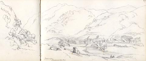 click to enlarge click to enlargeAS0533.jpg "Grange / Borrowdale" page number "27" item:- Armitt Library : 1958.389.33 Image © see bottom of page |
|||
|
|
||||
| evidence:- | old drawing:- Aspland 1840s-60s placename:- Grange |
|||
| source data:- | Drawing, pencil, Grange, Borrowdale, Cumberland, by Theophilus Lindsey Aspland, 1857.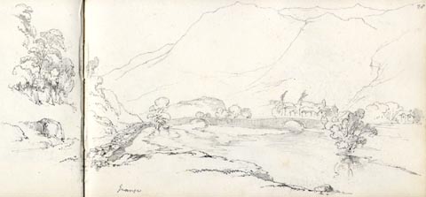 click to enlarge click to enlargeAS0535.jpg "Grange" page number "28" item:- Armitt Library : 1958.389.35 Image © see bottom of page |
|||
|
|
||||
| evidence:- | old map:- Garnett 1850s-60s H placename:- Grange |
|||
| source data:- | Map of the English Lakes, in Cumberland, Westmorland and
Lancashire, scale about 3.5 miles to 1 inch, published by John
Garnett, Windermere, Westmorland, 1850s-60s. GAR2NY21.jpg "Grange" blocks, settlement item:- JandMN : 82.1 Image © see bottom of page |
|||
|
|
||||
| evidence:- | old text:- Martineau 1855 item:- drawing |
|||
| source data:- | Guide book, A Complete Guide to the English Lakes, by Harriet
Martineau, published by John Garnett, Windermere, Westmorland,
and by Whittaker and Co, London, 1855; published 1855-76. goto source Page 81:- "... A mile further lies Grange, at the entrance of the dale, with its undulating bridges crossing the windings of the river. When the Abbots of Furness owned the whole of Borrowdale, a few monks were placed at its entrance, to receive and guard the crops; and this place was their granary. It is now a picturesque hamlet, which must be familiar to all who haunt exhibitions of pictures. Nobody who carries a pencil can help sitting down on the grass to sketch it. ..." |
|||
|
|
||||
| evidence:- | descriptive text:- placename:- Grange item:- development |
|||
| source data:- | Waugh, Edwin: 1882: Rambles in the Lake Country "It matters little where you build a house in Grange, it is sure to have a pleasant
outlook, and is never in the way of its neighbour; for the land over which the dwellings
are so picturesquely dribbled, is all fertile dingles, and knolls, and nest-like nooks
mixed with bloomy orcahrds, flower gardens and scattered tufts of wood; amd there
are several mansions thereabout, whose green shades and ornamental grounds give a
park-like tone to the skirts of the village." |
|||
|
|
||||
| evidence:- | old map:- Postlethwaite 1877 (3rd edn 1913) placename:- Grange |
|||
| source data:- | Map, uncoloured engraving, Map of the Lake District Mining Field, Westmorland, Cumberland,
Lancashire, scale about 5 miles to 1 inch, by John Postlethwaite, published by W H
Moss and Sons, 13 Lowther Street, Whitehaven, Cumberland, 1877 edn 1913.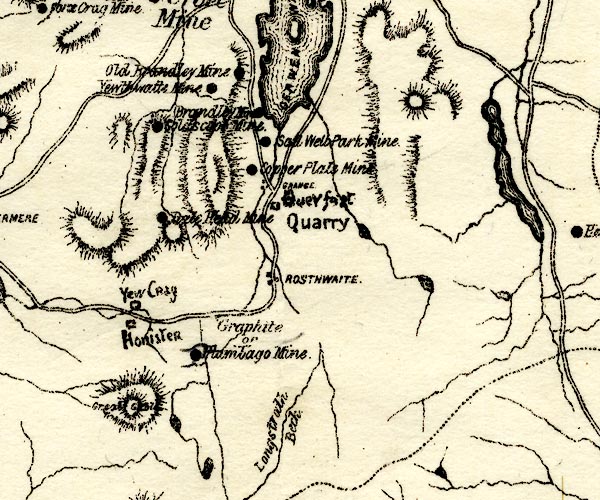 PST2NY21.jpg "GRANGE" dots, roads item:- JandMN : 162.2 Image © see bottom of page |
|||
|
|
||||
| evidence:- | outline view:- Red Guide 1892 |
|||
| source data:- | Print, engraving, pair of outline views, Mountains as seen from Castlehead, Keswick,
and Mountains as seen from the West Side of Grange in Borrowdale looking west, published
by Ward, Lock and Co, Warwick House, Salisbury Square, London, etc, 1892.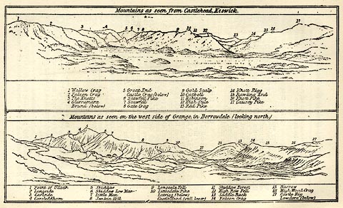 click to enlarge click to enlargeRG0103.jpg "1 Point of Ullock 2 Langside 3 Carlside 4 Carsledam 5 Skiddaw 6 Skiddaw Low Man 7 Little Man 8 Jenkin Hill 9 Lonscale Fell 10 Littledale Pike / Latrigg (below) / Castle Head (still lower) 11 Skiddaw Forest 12 High Row Fell 13 Saddle Back &14 Falcon Crag 15 Barrow 16 High Wood Crag 16 Castle Rigg / Lowdore (below)" On p.150 in the Red Guide guide book, Guide to the English Lakes. item:- JandMN : 102.4 Image © see bottom of page |
|||
|
|
||||
| evidence:- | old painting:- item:- stepping stones |
|||
| source data:- | Painting, oil painting, Borrowdale, by Samuel Bough, 1846.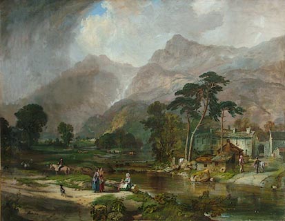 click to enlarge click to enlargePR0868.jpg Borrowdale 1846 oil on canvas by Sam Bough. View of Grange village in Borrowdale, the Lake District. It shows the Lakeland valley in summer with clouds gathered over the fells which rise beyond the valley. On the right stands a small stone mill, partially obscured by a stand of tall trees; two men stand conversing on the path which fords the river crossing composition diagonally from lower right corner. In the foreground two women pause in a patch of sunlight to talk to a third woman seated on a log beside the river. To their left a man on horseback turns in his saddle to regard them. To extreme left, a small flock of sheep are accompanied by a sheepdog; in middle distance a herd of cattle stand in the river beyond. Bough has dramatically altered the appearance of the valley by exaggerating the size of the fells in this painting which resemble the Scottish highlands and show a considerable amount of artistic licence. Bough would have sketched this view of Grange on the spot on his occasional visits to the Lake District, completing the finished oil painting back in his studio. signed &dated at bottom centre:- "Sam Bough 1846" item:- Tullie House Museum : 1917.89.1 Image © Tullie House Museum |
|||
|
|
||||
| evidence:- | old print:- Rose 1832-35 (vol.1 no.71) placename:- Grange |
|||
| source data:- | Print, uncoloured engraving, Castle Crag, Borrowdale, from the Village of Grange,
Cumberland, drawn by Thomas Allom, engraved by J C Bentley, published by Fisher, Son
and Co, London, 1832-35.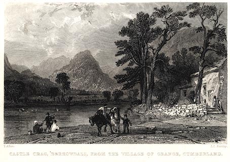 click to enlarge click to enlargePR0026.jpg vol.1 pl.71 in the set of prints, Westmorland, Cumberland, Durham and Northumberland Illustrated. printed at bottom left, right, centre:- "T. Allom. / J. C. Bentley. / CASTLE CRAG, BORROWDALE, FROM THE VILLAGE OF GRANGE, CUMBERLAND." item:- Dove Cottage : 2008.107.26 Image © see bottom of page |
|||
|
|
||||
| evidence:- | old print:- |
|||
| source data:- | Print, uncoloured engraving, Grange Bridge, Entrance to Borrowdale, Cumberland, published
1830s-40s?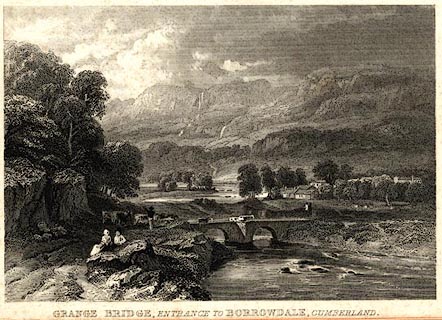 click to enlarge click to enlargePR0576.jpg printed at bottom:- "GRANGE BRIDGE, ENTRANCE TO BORROWDALE, CUMBERLAND" item:- Dove Cottage : 2008.107.524 Image © see bottom of page |
|||
|
|
||||
| evidence:- | old print with text:- Farington 1789 (plate 2) placename:- Grange, The |
|||
| source data:- | Print, engraving, The Grange in Borrowdale, painted by Joseph Farington, engraved
by W Byrne and T Medland, published by W Byrne, 79 Titchfield Street, London, 1784.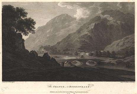 click to enlarge click to enlargeBMZ90.jpg Grange Bridge over the River Derwent, Grange village and Low Scawdel and High Scawdel in the background? Plate 2 from Views of the Lakes, &c, in Cumberland and Westmorland, published 1789; with descriptive text:- "THE GRANGE IN BORROWDALE." "CONSISTS of a few Houses standing on the West Side of the River Derwent, about a Mile above its Entrance into the Lake. This Village is a Mile distant from the waterfall of Lowdore, and about five from Keswick. In this spot is formed by the impending Mountains what Mr. Gray calls 'THE GORGE OF BORROWDALE.' ..." item:- Dove Cottage : Lowther.54 Image © see bottom of page |
|||
|
|
||||
| evidence:- | old print:- |
|||
| source data:- | Print, coloured, John Ruskin in Lakeland, Grange, Borrowdale, Cumberland, by Joseph
W Simpson, 1938 with text by T Gray on reverse.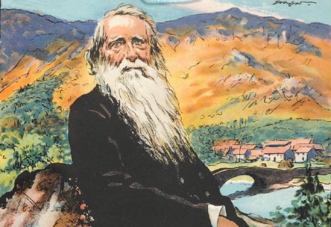 click to enlarge click to enlargePR1418.jpg John Ruskin seated on rock in foreground. Grange village Borrowdale in background. signed at top right on print:- "Simpson" 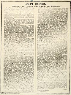 click to enlarge click to enlargePR1419.jpg text by T Gray about John Ruskin in Lakeland on reverse of coloured print by Joseph W Simpson, 1938. item:- Tullie House Museum : 2009.210.3 Images © Tullie House Museum |
|||
|
|
||||
| hearsay:- |
There is said to be a seat by the road at the turning to Grange, with the inscription:- |
|||
| "Here traveller rest and feel the potent charm Of fell and valley, bridge and clustered farm, Make them thine own, no absence shall destroy The hamlet's peace, the ancient river's joy. H.D.R." |
||||
|
|
||||
| hearsay:- |
A grange was a farming outstation belonging to an abbey; this Grange belonged to Furness
Abbey from the early 13th century. |
|||
|
|
||||
| places:- |
|
|||
|
||||
|
||||
|
||||
|
||||
|
||||
|
||||
|
||||
|
||||
|
||||
|
||||
|
||||
|
||||
|
||||
|
||||
|
||||
|
||||
|
||||
|
||||
|
||||
|
||||
|
||||
|
||||
|
||||
|
||||
|
||||
|
||||
|
||||
|
||||
|
||||
Lakes Guides menu.