 Jansson 1646 NY00


|

|
|
|
gazetteer links places may or may not be labelled on the map |
||

|
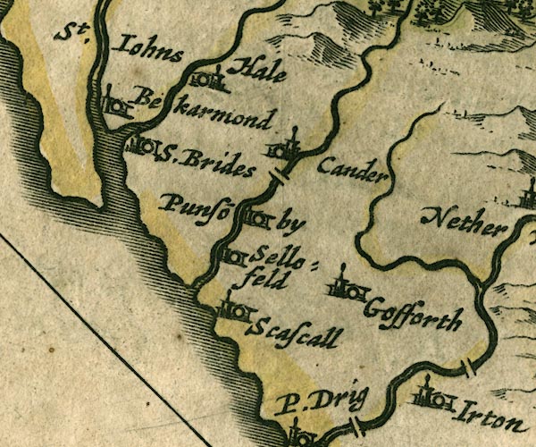
-- Bleng, River |
|
|
|
-- Calder Bridge |
|
|
|
-- Calder Bridge -- "Cander" |
|
|
|
-- Calder, River |
|
|
|
-- Ehen, River |
|
|
|
-- Gosforth -- "Gosforth" |
|
|
|
-- Haile -- "Hale" |
|
|
|
-- Irton Hall -- "Irton" |
|
|
|
-- Kirk Beck |
|
|
|
-- Ponsonby -- "Punso~by" |
|
|
|
-- Seascale Hall -- "Scascall" |
|
|
|
-- Sellafield (?) -- "Sellofeld" |
|
|
|
-- St Bridget's Church -- "S.Brides" |
|
|
|
-- St John's Church -- "St. Iohns Bekarmond" |
|
|
civil parishes The area roughly includes parts of parishes:- Drigg and Carleton Irton with Santon Seascale Ponsonby Gosforth Haile St Bridget Beckermet Lowside Quarter Ennerdale and Kinniside Egremont St John Beckermet |
||
|
|
||
|
|
Lakes Guides menu. | |