 Old Cumbria Gazetteer
 |
 |
|
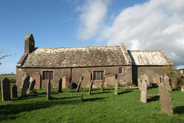
| St Bridget, Beckermet | ||
| St Bridget's Church | ||
| Beckermet Church | ||
| locality:- | Beckermet | |
| civil parish:- | St Bridget Beckermet (formerly Cumberland) | |
| county:- | Cumbria | |
| locality type:- | church | |
| locality type:- | runic inscription | |
| coordinates:- | NY01500607 | |
| 1Km square:- | NY0106 | |
| 10Km square:- | NY00 | |
| SummaryText:- | Called the Low Church because it is downstream. | |
|
|
||
 BVM14.jpg (taken 7.10.2011) 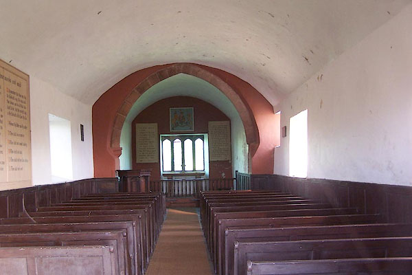 BMW13.jpg The acoustic's are said to be wonderful. (taken 13.10.2006) |
||
|
|
||
| evidence:- | old map:- OS County Series (Cmd 77 4) placename:- St Bridget's Church |
|
| source data:- | Maps, County Series maps of Great Britain, scales 6 and 25
inches to 1 mile, published by the Ordnance Survey, Southampton,
Hampshire, from about 1863 to 1948. |
|
|
|
||
| evidence:- | old map:- Saxton 1579 placename:- St Brides |
|
| source data:- | Map, hand coloured engraving, Westmorlandiae et Cumberlandiae Comitatus ie Westmorland
and Cumberland, scale about 5 miles to 1 inch, by Christopher Saxton, London, engraved
by Augustinus Ryther, 1576, published 1579-1645.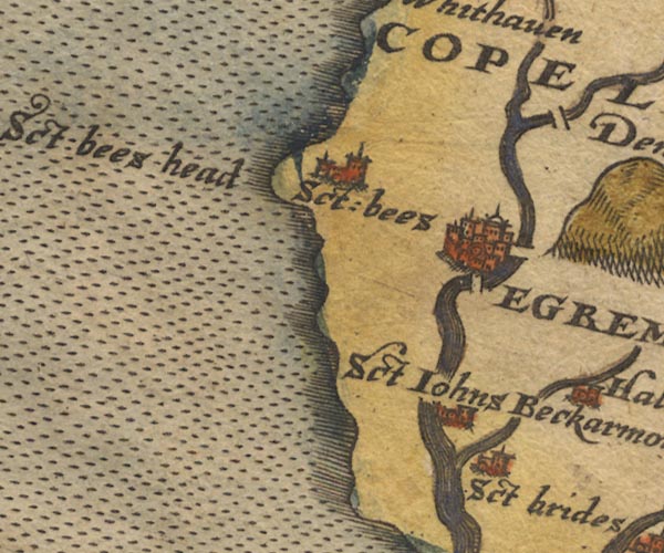 Sax9NX91.jpg Church, symbol for a parish or village, with a parish church. "St brides" item:- private collection : 2 Image © see bottom of page |
|
|
|
||
| evidence:- | old map:- Mercator 1595 (edn?) placename:- St Brides |
|
| source data:- | Map, hand coloured engraving, Northumbria, Cumberlandia, et
Dunelmensis Episcopatus, ie Northumberland, Cumberland and
Durham etc, scale about 6.5 miles to 1 inch, by Gerard Mercator,
Duisberg, Germany, about 1595. MER8CumE.jpg "St. Brides" circle item:- JandMN : 169 Image © see bottom of page |
|
|
|
||
| evidence:- | old map:- Speed 1611 (Cmd) placename:- St Bride's |
|
| source data:- | Map, hand coloured engraving, Cumberland and the Ancient Citie
Carlile Described, scale about 4 miles to 1 inch, by John Speed,
1610, published by J Sudbury and George Humble, Popes Head
Alley, London, 1611-12.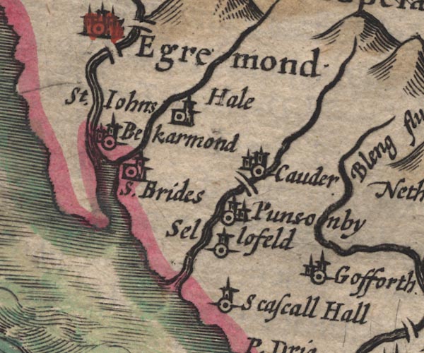 SP11NY00.jpg "S. Brides" circle, building, tower item:- private collection : 16 Image © see bottom of page |
|
|
|
||
| evidence:- | perhaps old map:- Jenner 1643 placename:- St Brides |
|
| source data:- | Tables of distances with a maps, Westmerland, scale about 16
miles to 1 inch, and Cumberland, scale about 21 miles to 1 inch,
published by Thomas Jenner, London, 1643; published 1643-80. JEN4Sq.jpg "S Brides" dot, circle, red tint |
|
|
|
||
| evidence:- | old map:- Jansson 1646 placename:- St Brides |
|
| source data:- | Map, hand coloured engraving, Cumbria and Westmoria, ie
Cumberland and Westmorland, scale about 3.5 miles to 1 inch, by
John Jansson, Amsterdam, Netherlands, 1646.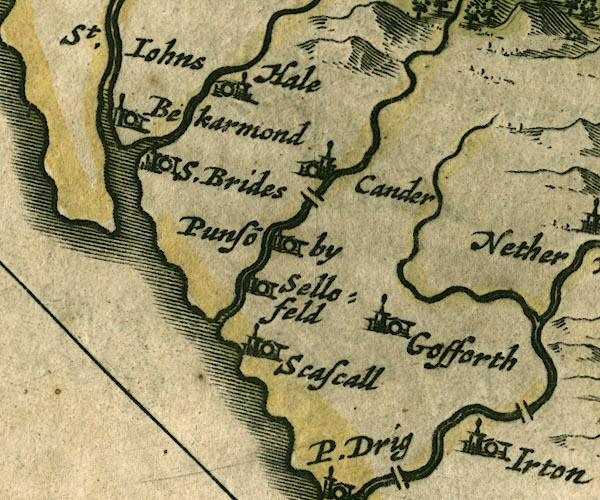 JAN3NY00.jpg "S.Brides" Buildings and tower. item:- JandMN : 88 Image © see bottom of page |
|
|
|
||
| evidence:- | old map:- Seller 1694 (Cmd) placename:- St Bride |
|
| source data:- | Map, uncoloured engraving, Cumberland, scale about 12 miles to 1
inch, by John Seller, 1694. click to enlarge click to enlargeSEL9.jpg "St. Bride" circle, italic lowercase text; settlement or house item:- Dove Cottage : 2007.38.89 Image © see bottom of page |
|
|
|
||
| evidence:- | old map:- Morden 1695 (Cmd) placename:- St Brides |
|
| source data:- | Map, uncoloured engraving, Cumberland, scale about 4 miles to 1
inch, by Robert Morden, 1695, published by Abel Swale, the
Unicorn, St Paul's Churchyard, Awnsham, and John Churchill, the
Black Swan, Paternoster Row, London, 1695-1715.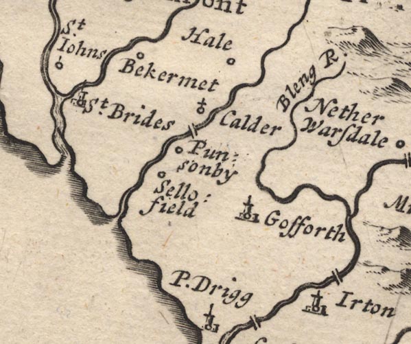 MD12NY00.jpg "St. Brides" Circle, building and tower. item:- JandMN : 90 Image © see bottom of page |
|
|
|
||
| evidence:- | old map:- Bowen and Kitchin 1760 placename:- St Brides |
|
| source data:- | Map, hand coloured engraving, A New Map of the Counties of
Cumberland and Westmoreland Divided into their Respective Wards,
scale about 4 miles to 1 inch, by Emanuel Bowen and Thomas
Kitchin et al, published by T Bowles, Robert Sayer, and John
Bowles, London, 1760.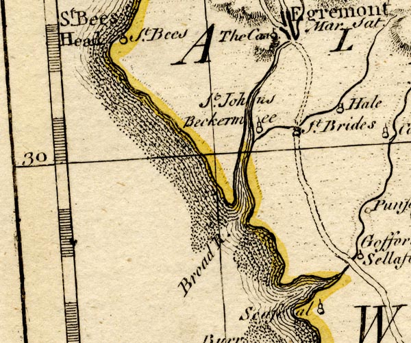 BO18NX90.jpg "St. Brides" circle, tower? item:- Armitt Library : 2008.14.10 Image © see bottom of page |
|
|
|
||
| evidence:- | old map:- Donald 1774 (Cmd) placename:- St Bridgets |
|
| source data:- | Map, hand coloured engraving, 3x2 sheets, The County of Cumberland, scale about 1
inch to 1 mile, by Thomas Donald, engraved and published by Joseph Hodskinson, 29
Arundel Street, Strand, London, 1774. D4NY00NW.jpg "St. Bridgets" church item:- Carlisle Library : Map 2 Image © Carlisle Library |
|
|
|
||
| evidence:- | old map:- Ford 1839 map placename:- St Bridgets |
|
| source data:- | Map, uncoloured engraving, Map of the Lake District of
Cumberland, Westmoreland and Lancashire, scale about 3.5 miles
to 1 inch, published by Charles Thurnam, Carlisle, and by R
Groombridge, 5 Paternoster Row, London, 3rd edn 1843.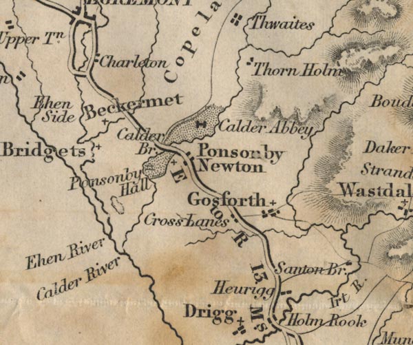 FD02NY00.jpg "St. Bridgets" item:- JandMN : 100.1 Image © see bottom of page |
|
|
|
||
| evidence:- | old text:- Gents Mag |
|
| source data:- | Magazine, The Gentleman's Magazine or Monthly Intelligencer or
Historical Chronicle, published by Edward Cave under the
pseudonym Sylvanus Urban, and by other publishers, London,
monthly from 1731 to 1922. goto source goto sourceGentleman's Magazine 1861 part 2 p.530 "..." "Mr. L. [Longstaffe] also exhibited careful rubbings of the cross in Beckermont churchyard, Cumberland. They were made by the Rev. Frederic Addison, of Cleator, who has no theory on the subject, but who is decidedly of opinion that the inscription remains to be read, and that the versions of Haigh and Maughan cannot be supported. Mr. Haigh's drawing was compared, and the members confessed themselves unable to trace or consider possible some of the principal features therein delineated. The identification of Piegbalech, the burial place of Tuda, bishop of Lindisfarne, with Beckermont, cannot therfore be accepted without better evidence of the stone being his monument." "..." |
|
|
|
||
| evidence:- | old map:- Nurse 1918 |
|
| source data:- | Map, The Diocese of Carlisle, Cumberland, Westmorland, and
Lancashire North of the Sands, scale about 4 miles to 1 inch, by
Rev Euston J Nurse, published by Charles Thurnam and Sons, 11
English Street, Carlisle, Cumberland, 2nd edn 1939.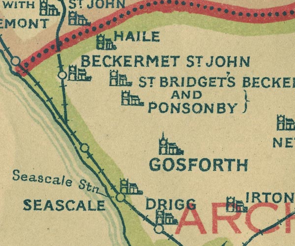 NUR1NY00.jpg "ST. BRIDGET'S BECKERMET AND PONSONBY" item:- JandMN : 27 Image © see bottom of page |
|
|
|
||
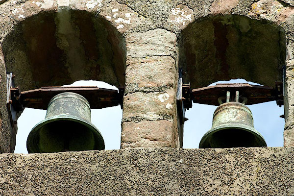 BQW99.jpg The two bells. The treble bell is inscribed:- "IHESS [ decoration] ZyX / [inverted T]" and the tenor:- "MARIA [decoration] ZyX / [inverted T]" The bells are a pair, similar to pairs at Loweswater and at Whicham, dating from the early 15th century. The bellfounder is not known. (taken 25.6.2009) |
||
|
|
||
| evidence:- | old print:- Calverley 1899 item:- cross; beacon; Tuda, Bishop; Arlec, Queen; Athfeschar; macCairbre, John |
|
| source data:- | In the churchyard:-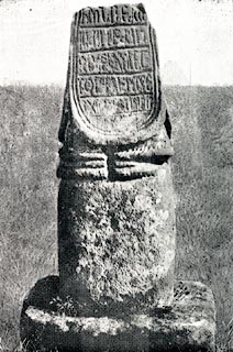 click to enlarge click to enlargeCV1014.jpg Photograph by W L Fletcher. 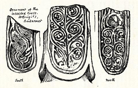 click to enlarge click to enlargeCV1015.jpg Sketch by W G Collingwood The incomplete insciption has been read in several ways. As English in roman characters:- "Here enclosed / Tuda bishop: / the plague-destruction before, / the reward of Paradise after." and:- "Here beacons / two set up / queen Arlec / for her son Athfeschar. / Pray for our / souls." and:- "O, thou loved / Offspring Edith, / Little maid, in / slumber waned. / Years XII. Pray ye for her soul. / Year MCIII." and as irish miniscule:- 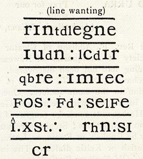 click to enlarge click to enlargeCV1016.jpg "[this cross was] / made for / John mac Cair- / bre gone to / rest in the keeping / of Christ. Be gracious / to him, O Christ!" In the churchyard:- 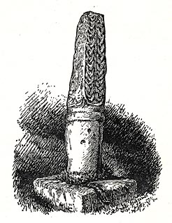 click to enlarge click to enlargeCV1017.jpg Sketch by W G Collingwood. item:- JandMN : 190 Image © see bottom of page |
|
|
|
||
| evidence:- | old drawing:- placename:- St Brigit's Church item:- cross |
|
| source data:- | Drawing, Ornament of the Inscribed Cross, at St Bridget's Church, Beckermet, Cumberland,
by William Gershom Collingwood, 1899.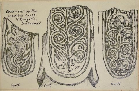 click to enlarge click to enlargePR0836.jpg Sketch of the south, east and north faces of a headless cross shaft with carved spiral decoration. Drawn to illustrate Notes on the Early Sculptured Crosses, Shrines and Monuments in the Present Diocese of Carlisle, by Rev William Slater Calverley, published by T Wilson, Kendal 1899; opposite p.29. inscribed at top left:- "Ornament of the inscribed cross, St Brigit's, Beckermet" item:- Tullie House Museum : 1902.18.25 Image © Tullie House Museum |
|
|
|
||
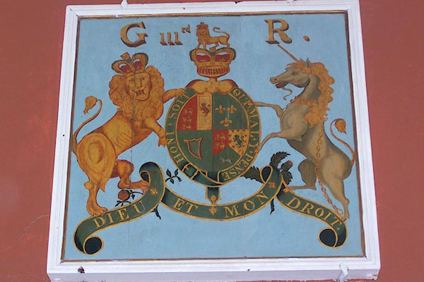 BMW14.jpg Coat of arms, George III. (taken 13.10.2006) 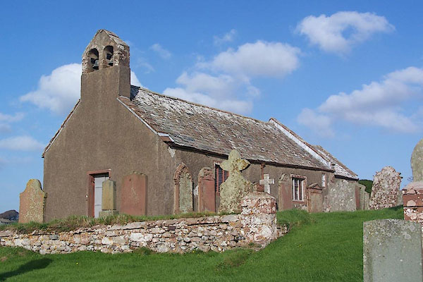 BMW12.jpg (taken 13.10.2006) 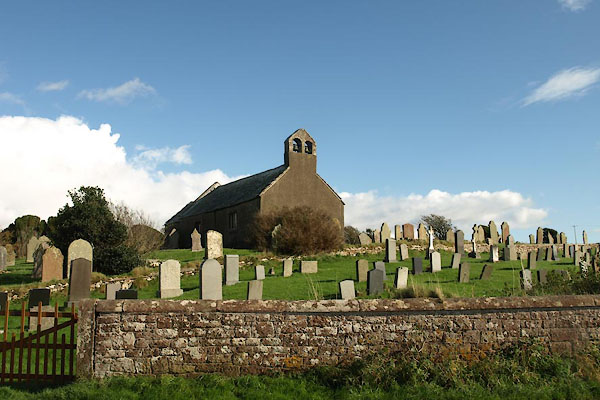 BVM13.jpg (taken 7.10.2011) |
||
|
|
||
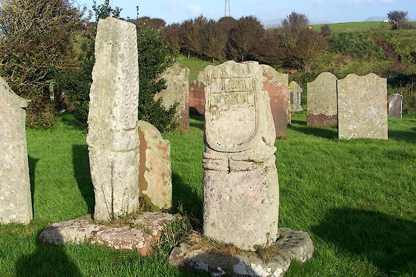 BMW15.jpg Old crosses in the churchyard. (taken 13.10.2006) 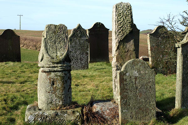 BOS32.jpg (taken 27.2.2008) 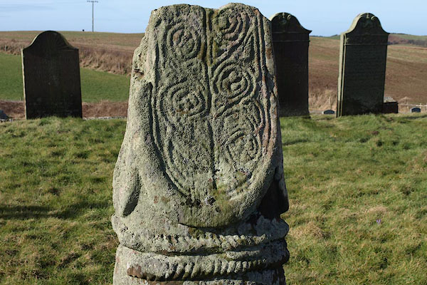 BOS33.jpg (taken 27.2.2008)  BOS34.jpg (taken 27.2.2008) 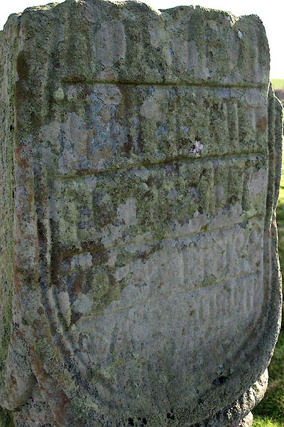 BOS35.jpg Panel of runes. (taken 27.2.2008) |
||
|
|
||
| notes:- |
It is possible that there was a small nunnery on this site in the 7th century. Nothing
is known of the building of the present church. |
|
| : : church leaflet |
||
|
|
||
Lakes Guides menu.