 Garnett 1850s-60s NY01


|

|
|
|
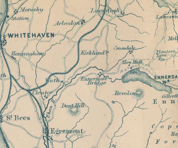
gazetteer links places may or may not be labelled on the map |
||

|
-- Arlecdon -- "Arlecdon" |
|
|
|
-- Cleator -- "Cleator" |
|
|
|
-- Croasdale -- "Crossdale" |
|
|
|
-- Dent -- "Dent Hill" |
|
|
|
-- Dub Beck |
|
|
|
-- Egremont -- "Egremont" |
|
|
|
-- Ehen, River -- "Ehen R." |
|
|
|
-- Ennerdale Bridge -- "Ennerdale Bridge" |
|
|
|
-- Ennerdale Water -- "ENNERDALE WR." |
|
|
|
-- How Hall Farm -- "How Hall" |
|
|
|
-- Kirkland -- "Kirkland" |
|
|
|
-- Red Moss |
|
|
|
-- Revelin Crag -- "Revelin" |
|
|
|
-- Egremont to Cockermouth |
|
|
|
-- Wath -- "Wath" |
|
|
|
-- Whitehaven, Cleator and Egremont Railway |
|
|
civil parishes The area roughly includes parts of parishes:- Haile St John Beckermet Ennerdale and Kinniside Cleator Moor Arlecdon and Frizington St Bees Egremont Whitehaven Weddicar Moresby St Bridget Beckermet Lowside Quarter Lamplugh |
||
|
|
||
|
|
Lakes Guides menu. | |