 Ford 1839 map NY00


|

|
|
|
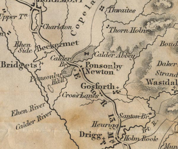
gazetteer links places may or may not be labelled on the map |
||

|
-- Beckermet -- "Beckermet" |
|
|
|
-- Calder Abbey -- "Calder Abbey" |
|
|
|
-- Calder Bridge -- "Calder Bridge" |
|
|
|
-- Calder, River -- "Calder River" -- "Calder
R." -- "Calder R." |
|
|
|
-- Carleton -- "Charleton" |
|
|
|
-- Cross Lanes -- "Cross Lands" |
|
|
|
-- Ehen, River -- "Ehen River" |
|
|
|
-- Ehenside -- "Ehen Side" |
|
|
|
-- Gosforth -- "Gosforth" |
|
|
|
-- Hewrigg Farm -- "Heurigg" |
|
|
|
-- Irt, River -- "Irt R." |
|
|
|
-- Ponsonby Old Hall -- "Ponsonby Hall" |
|
|
|
-- Ponsonby -- "Ponsonby Newton" |
|
|
|
-- Ravenglass to Egremont -- "E to R 13 Ms." |
|
|
|
-- Sellafield Tarn |
|
|
|
-- St Bridget's Church -- "St. Bridgets" |
|
|
|
-- Thornholme -- "Thorn Holm" |
|
|
civil parishes The area roughly includes parts of parishes:- Drigg and Carleton Irton with Santon Seascale Ponsonby Gosforth Haile St Bridget Beckermet Lowside Quarter Ennerdale and Kinniside Egremont St John Beckermet |
||
|
|
||
|
|
Lakes Guides menu. | |