 West 1784 map SD29


|

|
|
|
gazetteer links places may or may not be labelled on the map |
||

|
-- Bleng, River |
|
|
|
-- Church Beck |
|
|
|
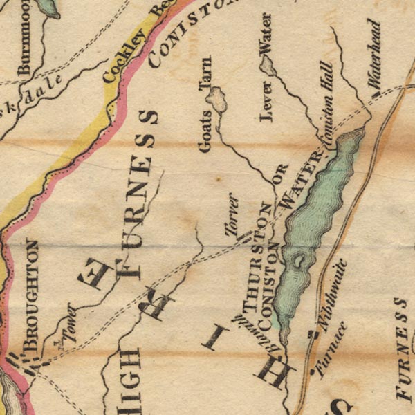
-- Coniston Hall |
|
|
|
-- Coniston Water -- "THURSTON OR CONISTON WATER" |
|
|
|
-- Duddon, River |
|
|
|
-- Goat's Water |
|
|
|
-- High Nibthwaite |
|
|
|
-- Kirkby Pool |
|
|
|
-- Levers Water |
|
|
|
-- Mite, River |
|
|
|
-- Peel Island |
|
|
|
-- Torver |
|
|
civil parishes The area roughly includes parts of parishes:- Blawith and Subberthwaite Torver Coniston Kirkby Ireleth Dunnerdale-with-Seathwaite Ulpha Colton Broughton West Eskdale |
||
|
|
||
|
|
Lakes Guides menu. | |